Map size in jpg-format: 1.01131MiB
Click to open in high resolution (open in new tab).
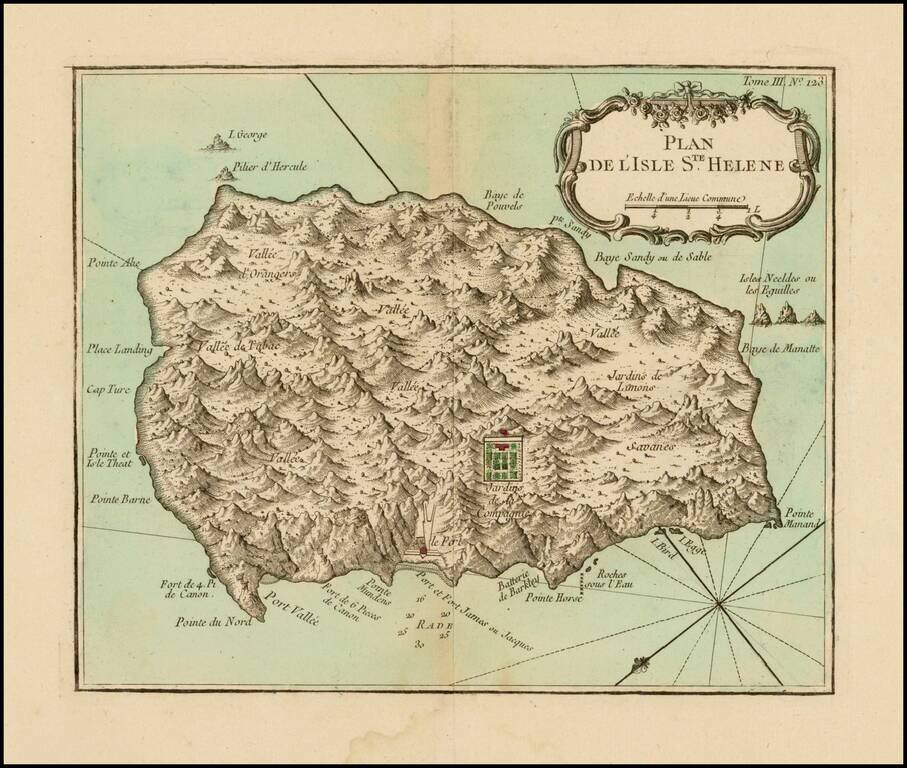
Fine early map of the St. Helene.
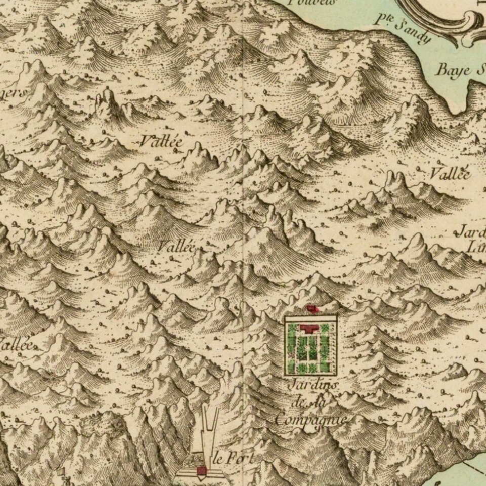
Bellin's map Plan de l'Isle Ste Helene is largely is derived from the maps of Seller and Moll. The outline of the island essentially is that portrayed by Seller, with, for example, the very pronounced 'finger' of Pointe du Nord (Sugerlofe Point of Seller and Moll). Interior features of the island, such as Vallée de Tabac, Vallée d'Orangers, and Jardins de Limons are taken directly from Seller and Moll, as are most of the coastal names.
Some corruption of place names has crept in, however, Man and Horse Point has become Pointe Manand. Bellin does add some new touches, indicating the location of the Company Gardens in the interior of the island and giving some information on the strength of fortifications; six cannon at Rupert's Fort and four cannon at what is the Northern or North Point (Sugerloaf Point) of Seller and Moll. Bellin also indicates some water depths in the Roads.
Description taken from www.bweaver.nom.sh/maps/bellin1.htm
Jacques-Nicolas Bellin (1703-1772) was among the most important mapmakers of the eighteenth century. In 1721, at age 18, he was appointed hydrographer (chief cartographer) to the French Navy. In August 1741, he became the first Ingénieur de la Marine of the Depot des cartes et plans de la Marine (the French Hydrographic Office) and was named Official Hydrographer of the French King.
During his term as Official Hydrographer, the Depot was the single most active center for the production of sea charts and maps, including a large folio format sea-chart of France, the Neptune Francois. He also produced a number of sea-atlases of the world, e.g., the Atlas Maritime and the Hydrographie Francaise. These gained fame, distinction, and respect all over Europe and were republished throughout the 18th and even in the succeeding century.
Bellin also came out with smaller format maps such as the 1764 Petit Atlas Maritime, containing 580 finely detailed charts. He also contributed many of the maps for Bellin and contributed a number of maps to the 15-volume Histoire Generale des Voyages of Antoine François Prévost or simply known l'Abbe Prevost.
Bellin set a very high standard of workmanship and accuracy, thus gaining for France a leading role in European cartography and geography. Many of his maps were copied by other mapmakers of Europe.
If you are a student, write to us in telegram: @antiquemaps and indicate what material you need and for what work you need a map in high detail. We are ready to provide material on special terms. For students only!

![[Ascension Island] The True Description of the Island of Ascention lyeing under 8 degrees on ye South syde of ye Equinoctiall lyne.](/map/small/69468.jpg)