Map size in jpg-format: 359634B
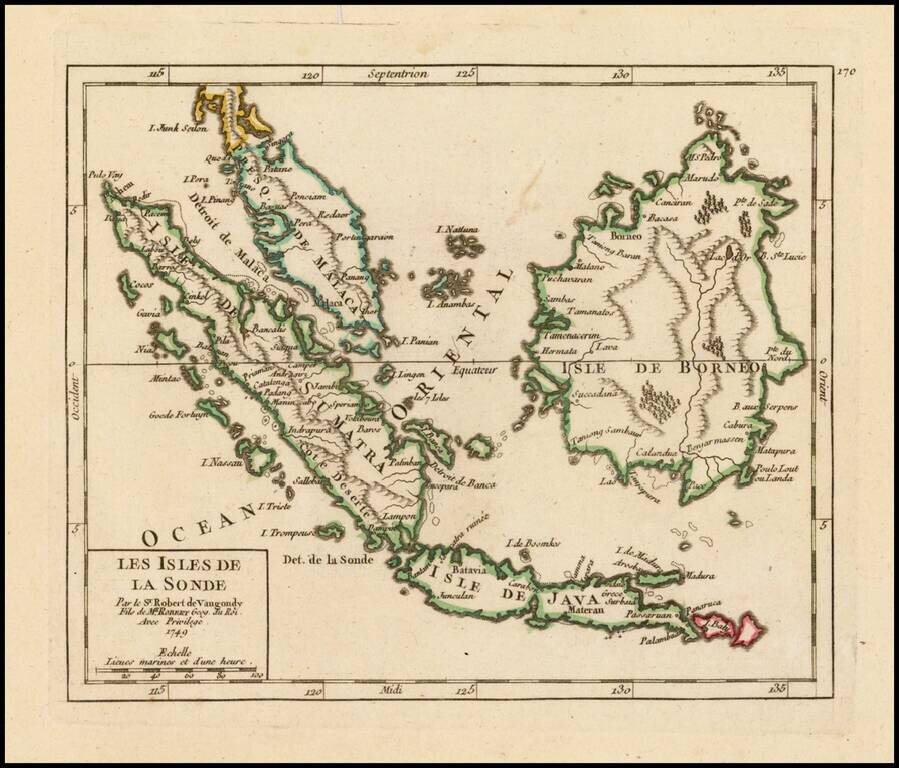
Attractive map of the Straits of Singapore, Sumatra, Java, Malaca, Borneo and neighboring islands, showing towns, harbours, bays, and other details.
The map appeared in De Vaugondy's Atlas Portatif.
Gilles Robert de Vaugondy (1688-1766) was the head of a leading family of geographers in eighteenth century France. Gilles got his start when he jointly inherited the shop of Pierre-Moullart Sanson, grandson of the famous geographer Nicholas Sanson. The inheritance included the business, its stock of plates, and a roller press. In 1760 Gilles became geographer to King Louis XV. His son, Didier Robert de Vaugondy (ca. 1723-1786), was also a geographer and the two worked together. They were known for their exactitude and depth of research. In 1757, they produced the Atlas Universel, considered an authority for many years.
If you are a student, write to us in telegram: @antiquemaps and indicate what material you need and for what work you need a map in high detail. We are ready to provide material on special terms. For students only!
![[Signed Political Satire Artwork] Vietnam ... Vietnam ... Vietnam ...](/map/small/68726.jpg)
![[Martin Behaim Globe / Book] Pars Globi terrestris Ao. 1492 a Martino Behaim Equite Lusitano Norimbergae confecti Delineavit Christoph. Theoph de Murr 1778 (bound with:) Diplomatische Geschichte des Portugesischen berühmten Ritters Martin Behaims](/map/small/68828.jpg)
![Il Disegno Della Terza Parte Dell' Asia [Gastaldi's Wall Map of SE Asia with extra panels!]](/map/small/30554hbp.jpg)