Map size in jpg-format: 26.695MiB
Click to open in high resolution (open in new tab).
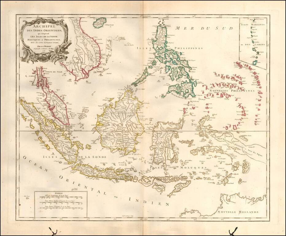
Striking and highly detailed map of the region from Sumatra and Malacca and Southern China to the Philippines, New Guinea and Northern Australia, centered on Borneo.
Includes a large inset of the Marianas. Wonderful early detail, derived from the Neptune Orientale, published by the French Hydrographical Department in the mid 18th Century.
Large Decorative Cartouche.
If you are a student, write to us in telegram: @antiquemaps and indicate what material you need and for what work you need a map in high detail. We are ready to provide material on special terms. For students only!
![[Signed Political Satire Artwork] Vietnam ... Vietnam ... Vietnam ...](/map/small/68726.jpg)
![[Martin Behaim Globe / Book] Pars Globi terrestris Ao. 1492 a Martino Behaim Equite Lusitano Norimbergae confecti Delineavit Christoph. Theoph de Murr 1778 (bound with:) Diplomatische Geschichte des Portugesischen berühmten Ritters Martin Behaims](/map/small/68828.jpg)
![Il Disegno Della Terza Parte Dell' Asia [Gastaldi's Wall Map of SE Asia with extra panels!]](/map/small/30554hbp.jpg)