Map size in jpg-format: 514996B
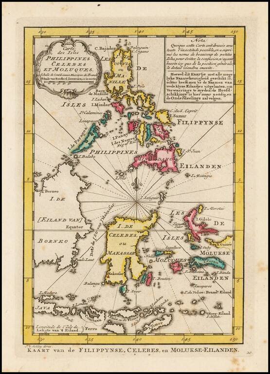
Detailed map of the Philippines and islands to the south, including the Moluques, part of the New Guinea, Gilolo, Timor and parts of Borneo and Java.
From a Dutch edition of Bellin's Atlas.
Jakob van der Schley was a skilled draftsman and engraver who operated out of Amsterdam and had strong ties with the Hague. He was trained by Bernard Picart and his style resembles that of the elder man. Van der Schely was known for intricately engraved portraits and frontispieces. He signed most of the plates used in the Hague edition of the Abbe Prevost's Histoire generale des voyages.
If you are a student, write to us in telegram: @antiquemaps and indicate what material you need and for what work you need a map in high detail. We are ready to provide material on special terms. For students only!
![[Signed Political Satire Artwork] Vietnam ... Vietnam ... Vietnam ...](/map/small/68726.jpg)
![[Martin Behaim Globe / Book] Pars Globi terrestris Ao. 1492 a Martino Behaim Equite Lusitano Norimbergae confecti Delineavit Christoph. Theoph de Murr 1778 (bound with:) Diplomatische Geschichte des Portugesischen berühmten Ritters Martin Behaims](/map/small/68828.jpg)
![Il Disegno Della Terza Parte Dell' Asia [Gastaldi's Wall Map of SE Asia with extra panels!]](/map/small/30554hbp.jpg)