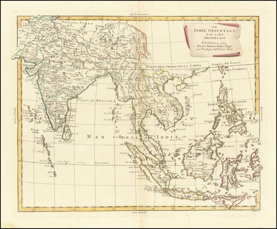
Early edition of Zatta's map of the Philippines, Indian and Southeast Asia. Striking regional map of Southeast Asia, extending from the Philippines and Moluccas to India and the Maldives, and north to Tibet. Decorative scroll title cartouche. This...
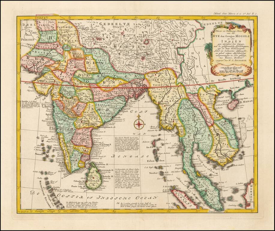
Rare Dutch edition of Bowen's map of India and Southeast Asia. All nomenclature has been changed and includes extensive annotations in Dutch. The map extends from the Straits of Malaca and Indo China in the east to India and the Maldives.
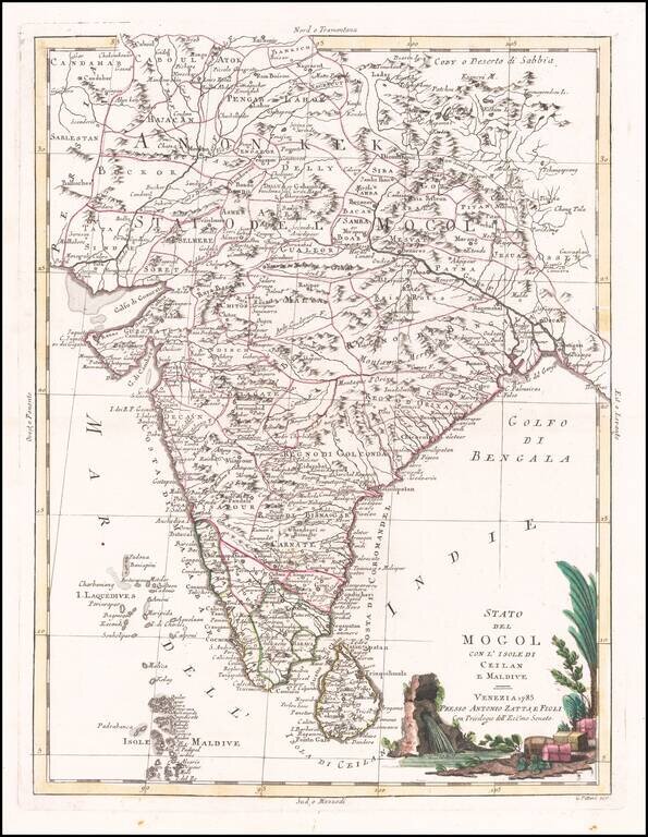
18th Century Antique Map of India Terrific map of India and Ceylon, along with the Maldive Islands. Includes a large decorative title cartouche. The map was issued in Zatta's Atlante Novissimo a monumental 4 volume work and is one of the last great...
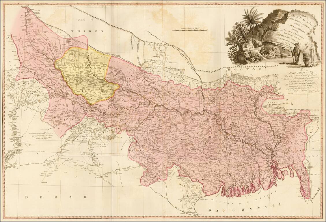
Detailed map of the Upper Indian provinces, extending to Tibet in the North and the Bay of Bengal in the South. Th map was drawn by James Rennell F.R.S., Surveyor General of India, and engraved from the original drawing in the Possession of the East...
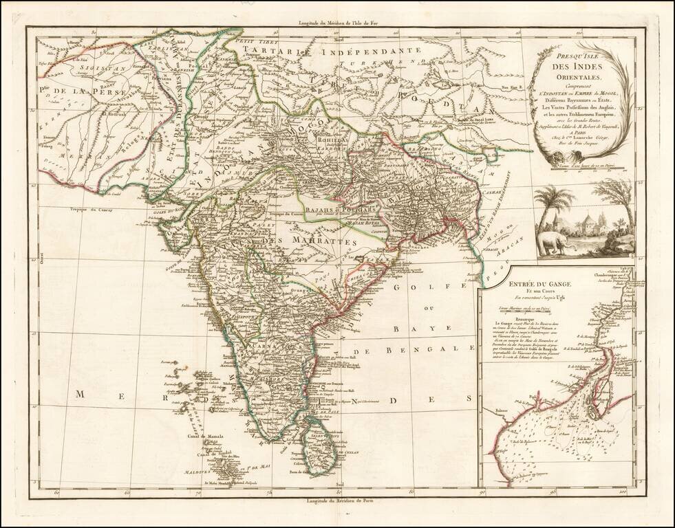
An Early Colonial Map of India Detailed map of India with inset map of the mouth of the river Ganges, detailing the States of India, Colonial holdings of the British and other European powers and the major roads through India. The map identifies...
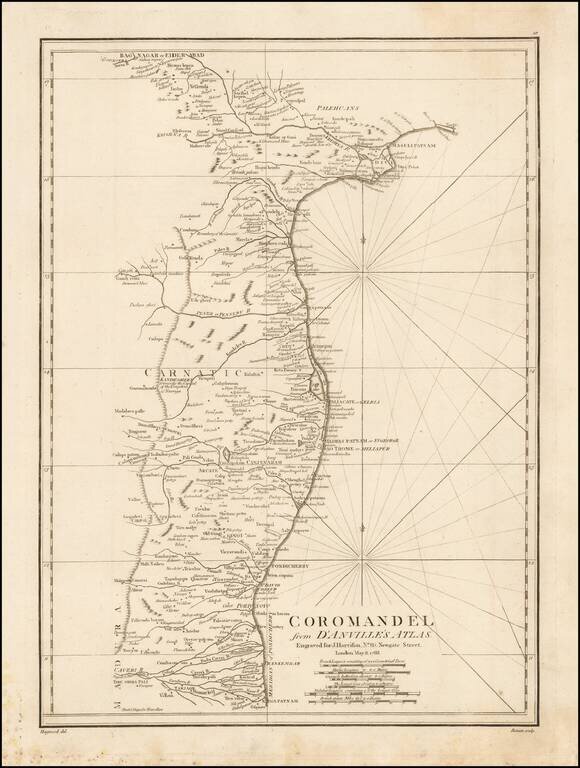
Fine regional map of India showing the Coromandel Coast. This map covers the southeastern coast of India from Nagapattinam (Nega-Patnam) north as far as Narsapur and inland as far as Tiruchirappalli and Hyderabad. Harrison derived this map from the...
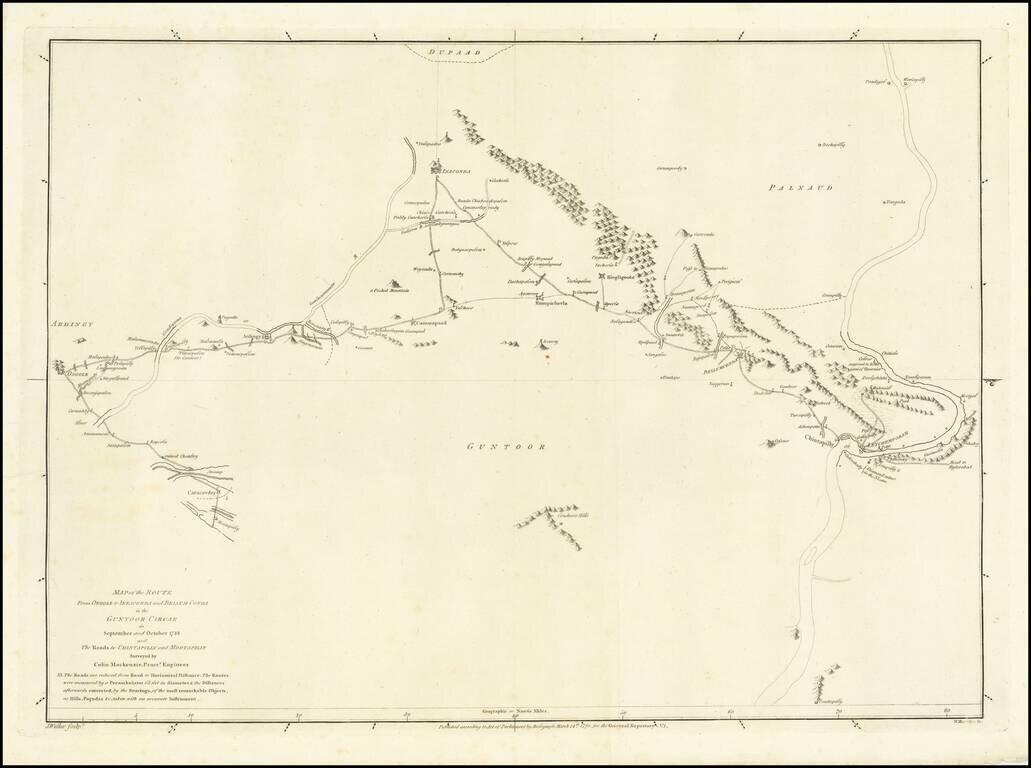
![[Andhra Pradesh] Map of the Roads From Nellore to the Passes of Rampore and Samisserum and to Ongole by Caolin Mackenzie, Practr. Engineer 1788 . . .](/map/small/62194.jpg)
Scarce road showing roads in the modern region of Andhra Pradesh, India, which appeared in the Oriental Repertory No. 1, published in 1791. The Oriental Repertory was a publication of the East India Company, detailing its activities and information in...
Scarce road showing roads in the modern region of Andhra Pradesh, India, which appeared in the Oriental Repertory No. 1, published in 1791. The Oriental Repertory was a publication of the East India Company, detailing its activities and information in...
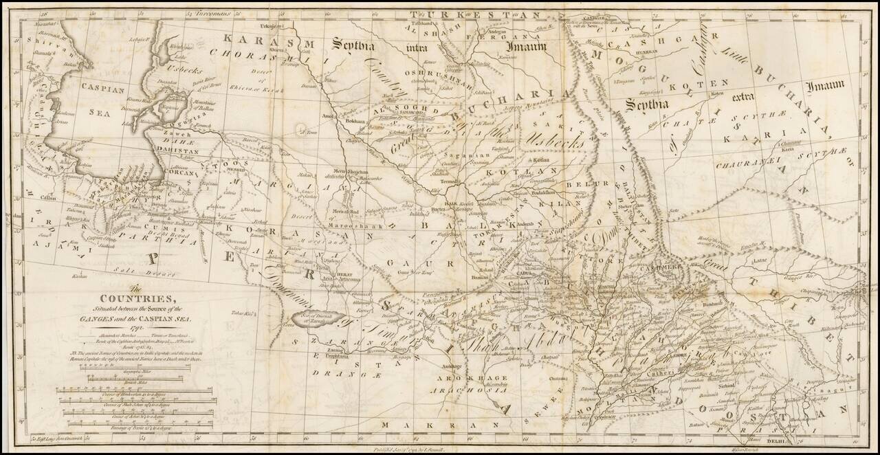
Interesting overview of the region east of the Caspian Sea to Bukara and Tibet, published by Rennell. Shows a wealth of cities, towns, tribes, river systems and general topography. Notably the ancient place names are shown in Italic Capitals while...
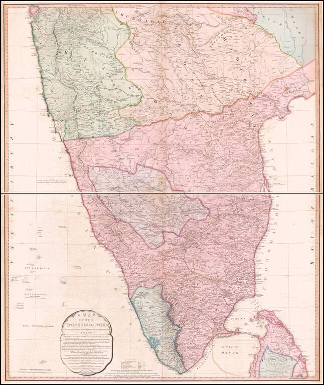
Striking Map of British India This highly detailed two-page map depicts the southern portion of India as it was known at the turn of the nineteenth century. It includes thorough information about the extent of British rule in India at the time. The...
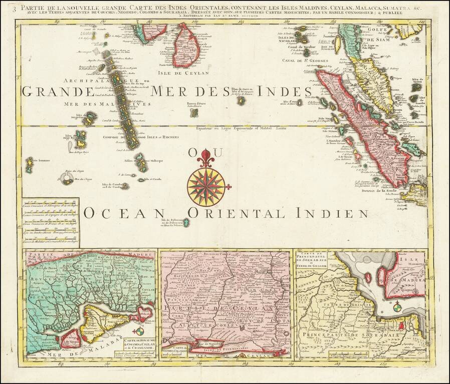
Finely detailed regional map depicting Singapore, Ceylon, the Maldive Islands, Sumatra, Southern Malaysia, etc. Remarkably detailed this map is highly decorative as well.
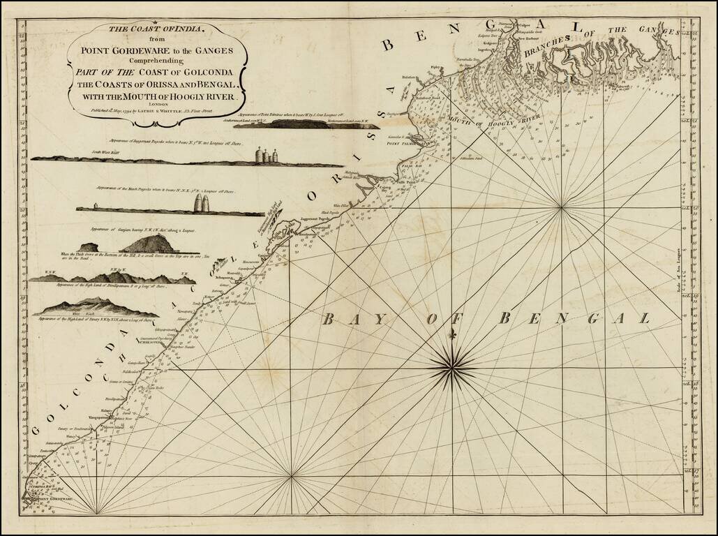
Detailed sea chart of the coast of India, from the mouths of the Ganges Rivers in the northeast to Point Gordeware in the south west. Includes numerous sailing channels and soundings, along with smaller islands and several profile views. One of the...
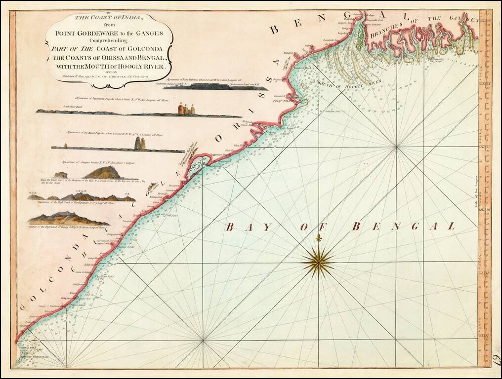
Detailed sea chart of the coast of India, from the mouths of the Ganges Rivers in the northeast to Point Gordeware in the south west. Includes numerous sailing channels and soundings, along with smaller islands and several profile views. One of the...
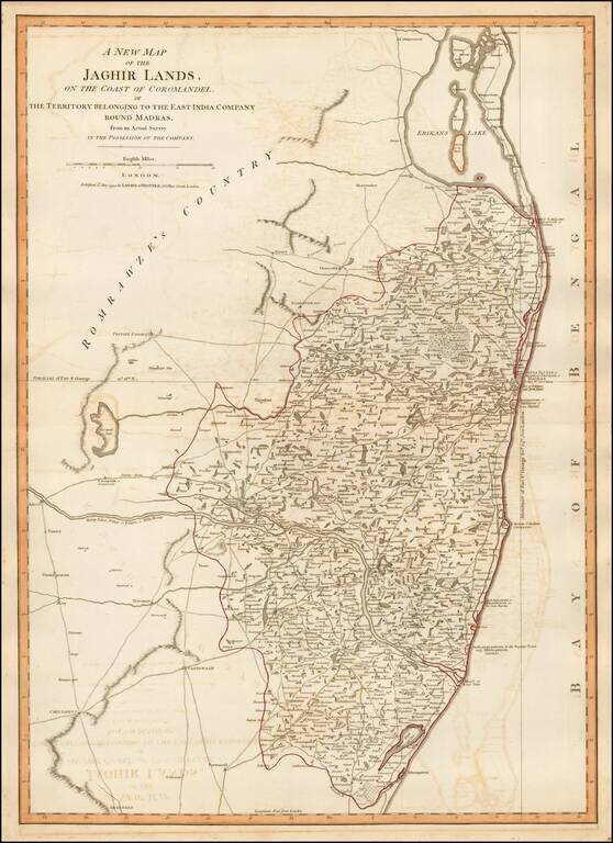
Detailed map of the coastal region of India centered on Madras and Fort St. George (Chennai), extending north to Erikans Lake (Pulicat Lake) and south to Cheeyer Tank and Allumparva (Cheyyur), one of a series of maps of India prepared by James Rennell...
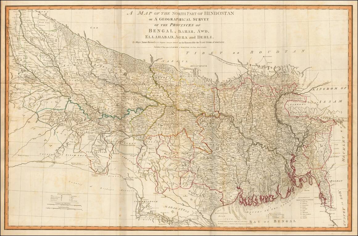
Fine example of James Rennell's highly detailed map of northern India, based upon his survey work while Surveyor General of the East Indian Company. The map is exceptionally detailed and includes roads, towns, mountains, rivers and a host of other...
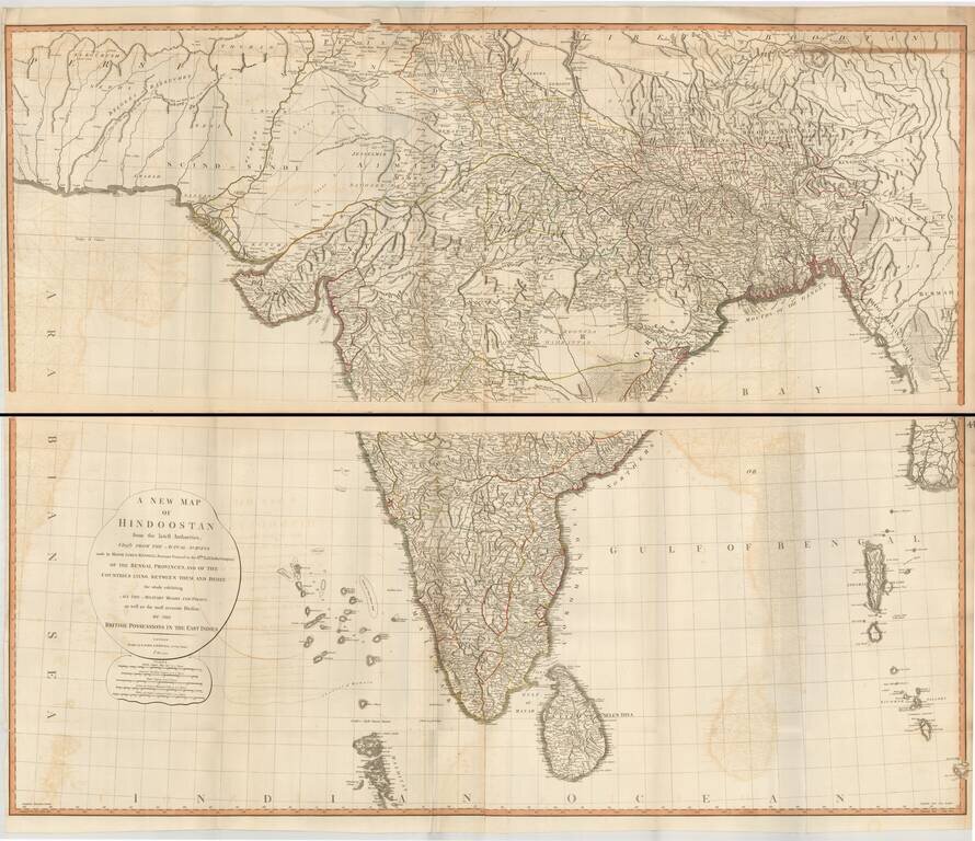
Superb large format map of India and Sri Lanka, based on the surveys of James Rennell, and published by Laurie & Whittle. The map is exceptionally detailed and includes roads, towns, mountains, rivers and a host of other details. It was one of the...