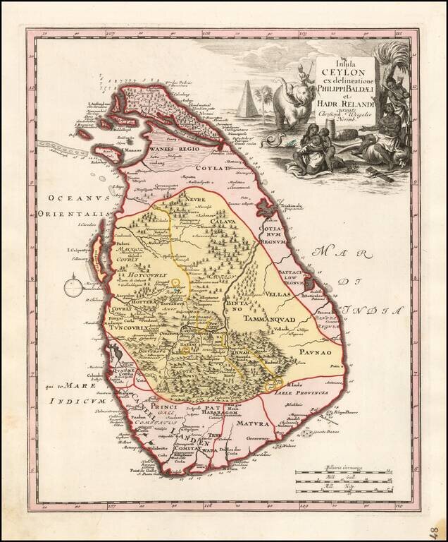
Rare modern map of Sri Lanka (Ceylon), published by Weigel in Nuremberg. The map credits Philips Baelde and Adrian Reland. Philips Baelde or Father Philippus Baldaeus was a Dutch minister. He went to Jaffna during the Dutch period in Ceylon with an...
![[Dutch Forts -- Jakarta, Amboine, Ternate, Solor, Banda] Vue et Description de Quelques-Uns des Principaux Forts des Hollandois dans les Indes](/map/small/43122.jpg)
Interesting sheet with seven detailed views illustrating the most important Dutch trading outposts and fortified colonial possessions in the East Indies The sheet includes 4 harbor views Batavia (Jakarta), Amboina, Ternate, and Solor, and 3 fort...
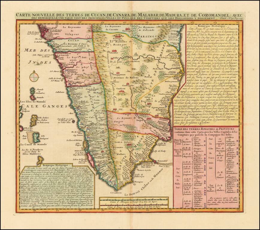
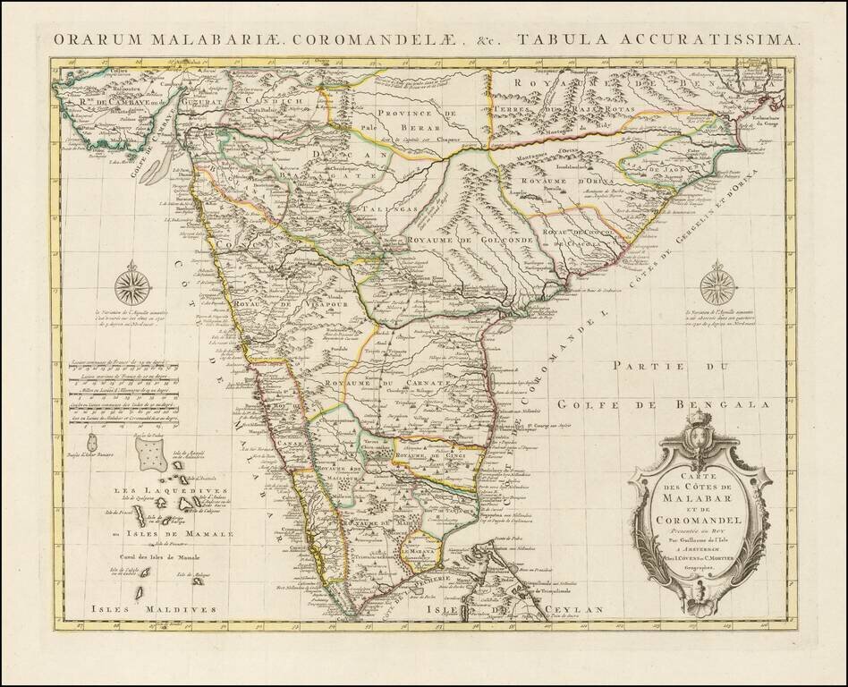
India south of Goa, from Chatelain's monumental Atlas Historique, published in Amsterdam. The map includes three text boxes giving particulars of the region and its divisions. Interior details include the Western Ghats and wild animals among the...
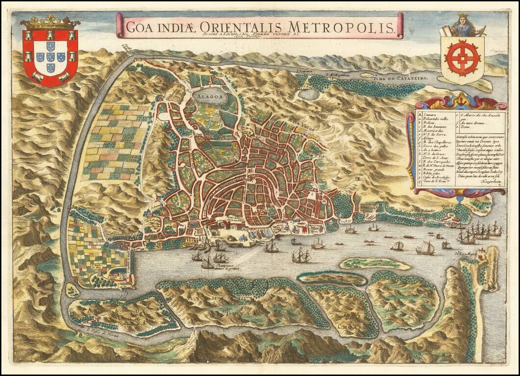
An Early View of Goa Decorative and detailed birds-eye view of the city and harbor of Goa. The map is based upon an earlier map by Jan Huygen van Linschoten. Linschoten served 6 years as the bookkeeper for the Archbishop of Goa (1583-89). While in...
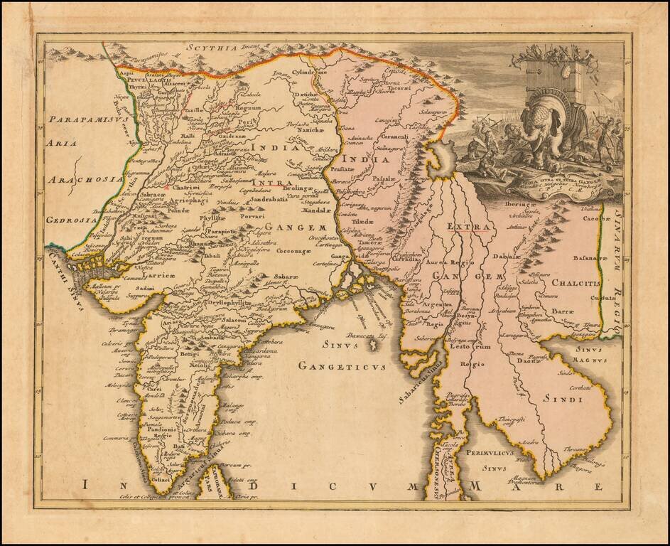
Decorative map of ancient India, from Weigel's Descriptio Orbis Antiqui.
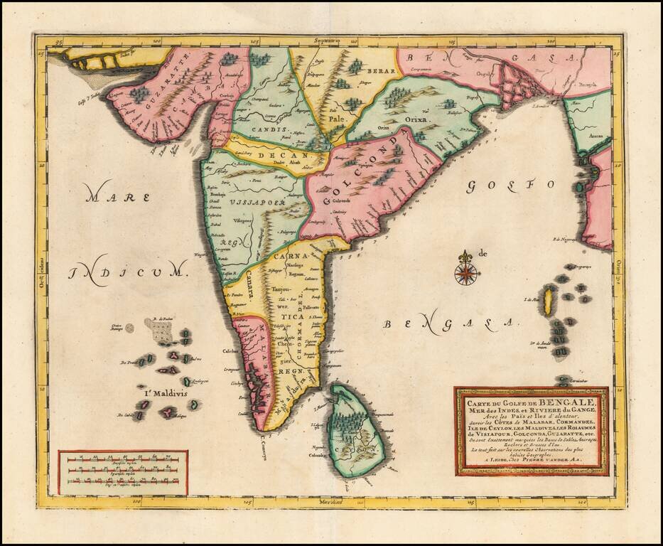
Detailed map of the southern part of India, Sri Lanka and the Maldives, published by Vander Aa in Leiden. The map provides a highly detailed treatment of the region, including topographical details.
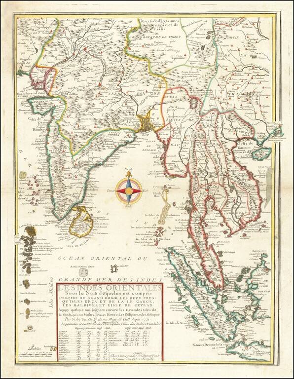
Second edition of De Fer's rare map of the region extending from Hong Kong and Macao in the east to the Indus River and Maldives in the west, bearing the imprint of his son-in-law and successor, Guillaume Danet. This fascinating map includes...
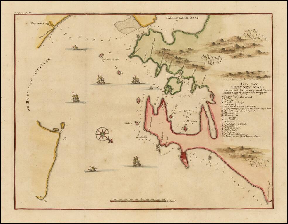
One of the earliest printed maps of Trincomalee Bay, from Valentyn's Oud en Nieuw Oost-Indien. Finely detailed map of the Trincomalee Bay in Sri Lanka. Valentijn was born in 1666 in Dordrecht, Holland, but spent significant time in the tropics,...
Fine early view of Colombo, Sri Lanka, including a number of buildings along the coast and the Indian Ocean teeming with vessels. Francois Valentijn Francois Valentijn was born in 1666 in Dordrecht, Holland, but spent significant time in the tropics,...
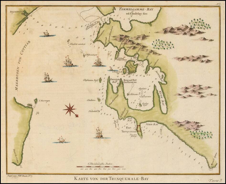
Fine early view of Trincomallee Bay, Sri Lanka, with soundings, compass rose and other details. The map is oriented with Southwest at the top. Francois Valentijn Francois Valentijn was born in 1666 in Dordrecht, Holland, but spent significant time in...
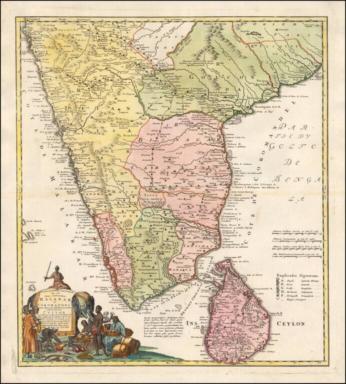
Finely Detailed Map of Southern India Emphasizing Trade Finely engraved map of the southern part of India, first issued in 1723 by acclaimed French mapmaker Guillaume De L’Isle. It focuses on trade routes within India, as well as the Coromandel and...
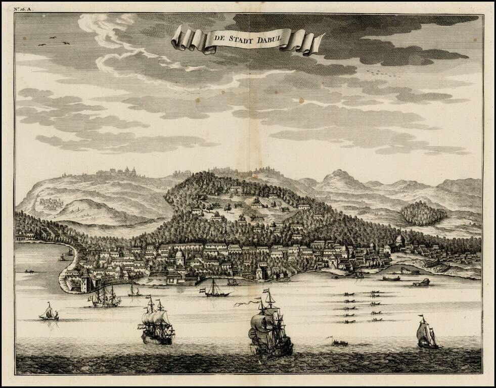
Nice bird's eye-view of the Town of Dabul , from Francois Valentyn's Oud en Nieuw Oost Indien, part V : Beschryving van Coromandel, Pegu, Arrakan, Bengale, Mocha, Persien, Malakka, Sumatra, Ceylon. Francois Valentijn (1666-1727) was a minister,...
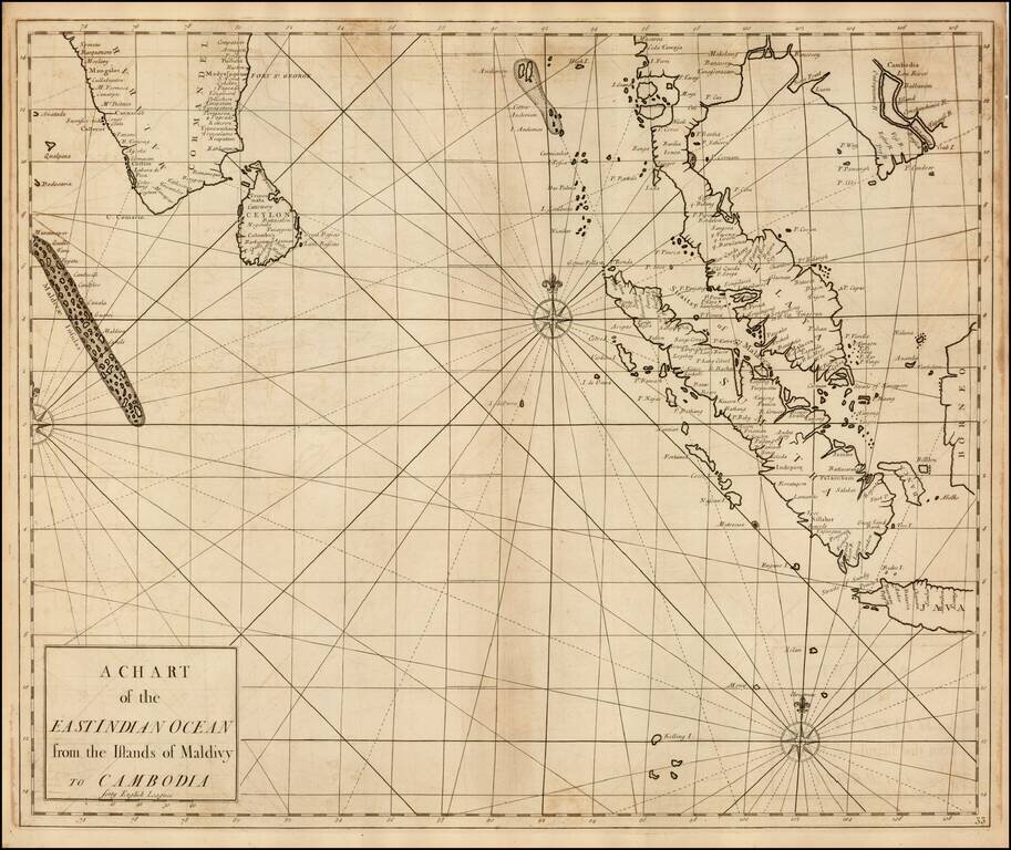
Fine Chart of the Indian Ocean in an Influential Atlas Scarce sea chart of the Straits of Singapore, the Malay Peninsula, Sumatra, the southern part of India and the Maldives, from the Atlas Maritimus & Commercialis, published in London in 1728....
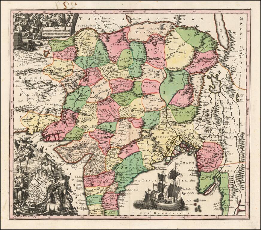
Detailed map of India, extending from the Ganges to Eastern Persia and North to the Mont de Caucause (Himalayas). Colored by provinces. Includes 2 large decorative vignettes and a sailing ship.
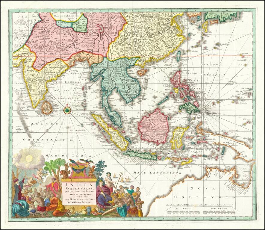
Antique Map of Southeast Asia, Indian Ocean and Australia A nice example of Seutter's scarce map of the East Indies and part of Australia, from the Atlas Novus. The map extends from Japan and Persia in the North, to the Maldives and Australia and the...
Homann's Map of India Large and attractive map of Sri Lanka and the southern part of the Indian Peninsula, with an elaborate cartouche showing an elephant and elaborately clothed indigenous people. The map includes towns, roads, rivers, mountains,...