logo

1792. The Countries, Situated between the Source of the Ganges and the Caspian Sea. 1792

  • The Countries, Situated between the Source of the Ganges and the Caspian Sea.  1792

The Countries, Situated between the Source of the Ganges and the Caspian Sea. 1792 information:

Year of creation: 
Resolution size (pixels): 
 4196x2170 px
Disk Size: 
 1.70389MiB
Number of pages: 
 1
Place: 
 London
Author: 

Print information. Print size (Width x height in inches):
Printing at 72 dpi 
  58.28 х 30.14
Printing at 150 dpi 
 27.97 х 14.47
Printing at 300 dpi 
 13.99 х 7.23

An example of detailing the file of this map of in a printable high-resolution:

Click to open in high resolution (open in new tab).
Attention! this is just the central piece (central area 960x960 px) of the map file!
This is an example, so that you can see and study the level of detail of a given map. The entire Map will be fully available after payment!

The Countries, Situated between the Source of the Ganges and the Caspian Sea.  1792

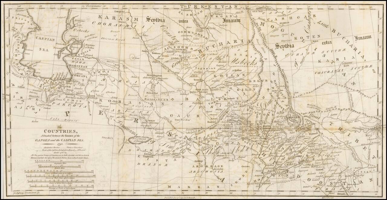
Interesting overview of the region east of the Caspian Sea to Bukara and Tibet, published by Rennell.

Shows a wealth of cities, towns, tribes, river systems and general topography. Notably the ancient place names are shown in Italic Capitals while modern names are in Roman Capitals, making it a useful reference for the time.

The map identifies the routes of:

  • Alexander's Marches
  • Tamerlane
  • The Castillian Ambassdors, AD 140-145)
  • Forsters Route 1783, 1784


Special conditions for students!

If you are a student, write to us in telegram: @antiquemaps and indicate what material you need and for what work you need a map in high detail. We are ready to provide material on special terms. For students only!

Item information:

Year of creation:
Size:
4196x2170 px
Disk:
1.70389MiB
Number of pages:
1
Place:
London
Author:
John Rennell.
$14.99

Related item