Map size in jpg-format: 33.4056MiB
Click to open in high resolution (open in new tab).
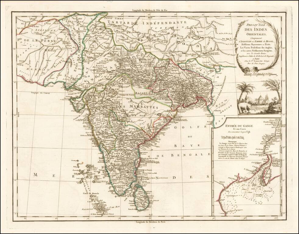
An Early Colonial Map of India
Detailed map of India with inset map of the mouth of the river Ganges, detailing the States of India, Colonial holdings of the British and other European powers and the major roads through India.
The map identifies Delhi (or Jehan Abad), Agra (or Ekbar Abad), Bombay, Goa, Calcutta, Pondicherry, and countless other major and minor cities.
An inset in the lower right details the mouths and the course of the River Ganga or Ganges from Hooghly, south part Calcutta into the Bay of Bengal.
Includes illustration of an elephant, trees and church below.
With decorative scene with an elephant underneath the title cartouche.
If you are a student, write to us in telegram: @antiquemaps and indicate what material you need and for what work you need a map in high detail. We are ready to provide material on special terms. For students only!

![Il Disegno Della Terza Parte Dell' Asia [Gastaldi's Wall Map of SE Asia with extra panels!]](/map/small/30554hbp.jpg)
