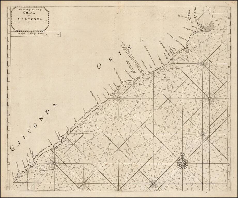
Scarce engraved sea chart of the coast of India, northeast from Vizagapatam (Visigapatam on the map). The map includes details along the coast that suggest the firsthand surveying that went into its production. Soundings are given from harbor to...
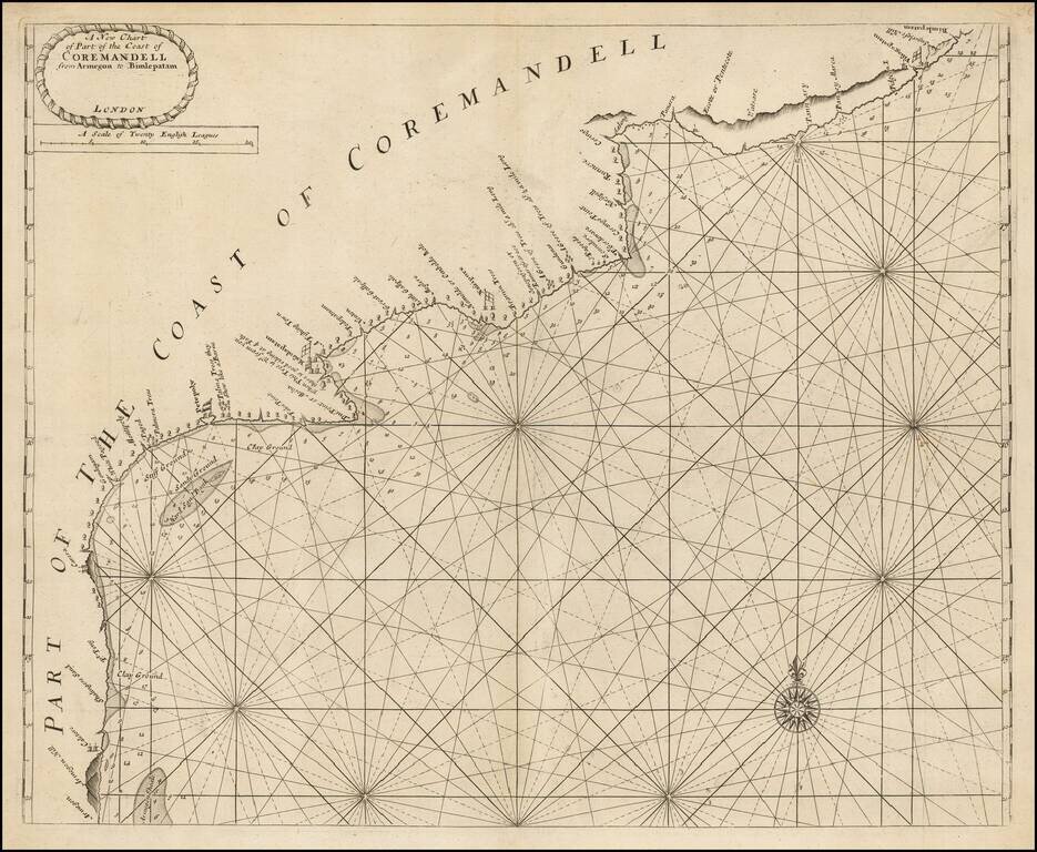
Scarce engraved sea chart of the Coromandel coast in southeast India covering the state of Andhra Pradesh from Bheemunipatnam (Bimlepatnam) near Visakhapatnam to Armegon. The map includes details along the coast that suggest the firsthand surveying...
Proof State of the Grierson Map of Southeast Asia. Very rare, circa 1735 pirated edition of Herman Moll's map of the same title, published by George Grierson in Dublin This is the first large scale map of Southeast Asia published in Ireland. The...
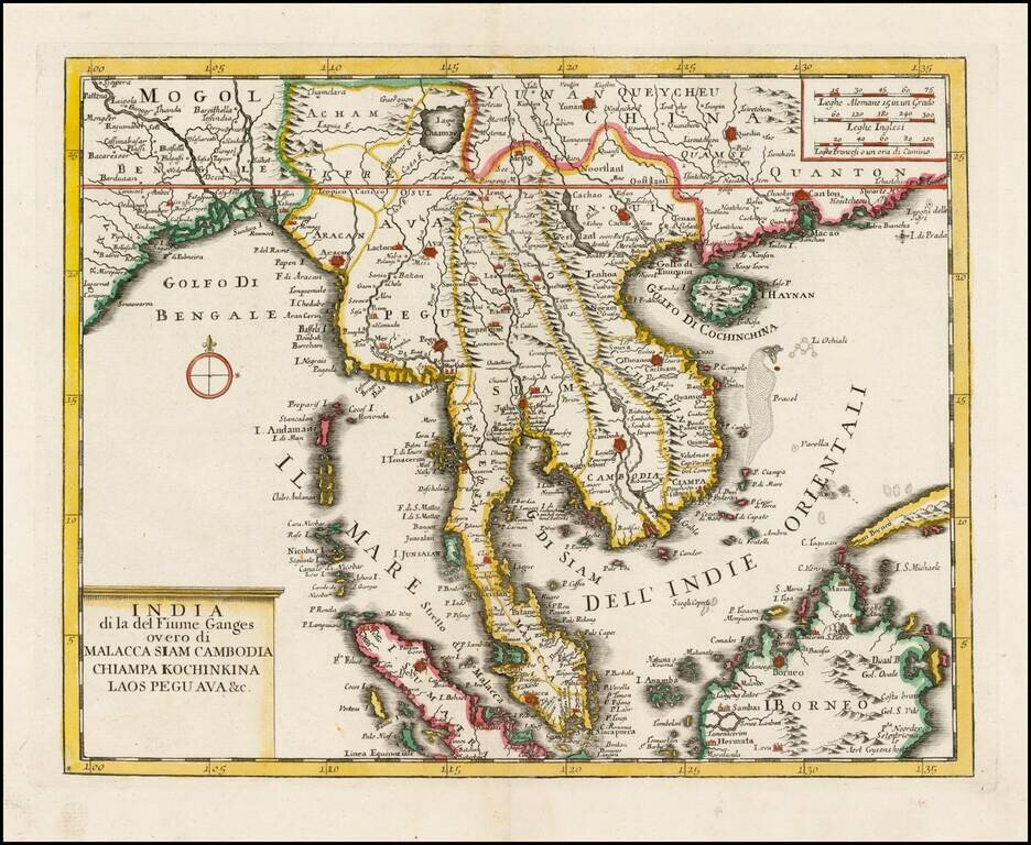
Scarce map of Southeast Asia and India, extending from the Gulf of Bengal to Canton province, from the Italian edition of Thomas Salmon's , Modern History: or, the present state of all Nations. . . entitled Lo Stato Presente... published in Venice,...
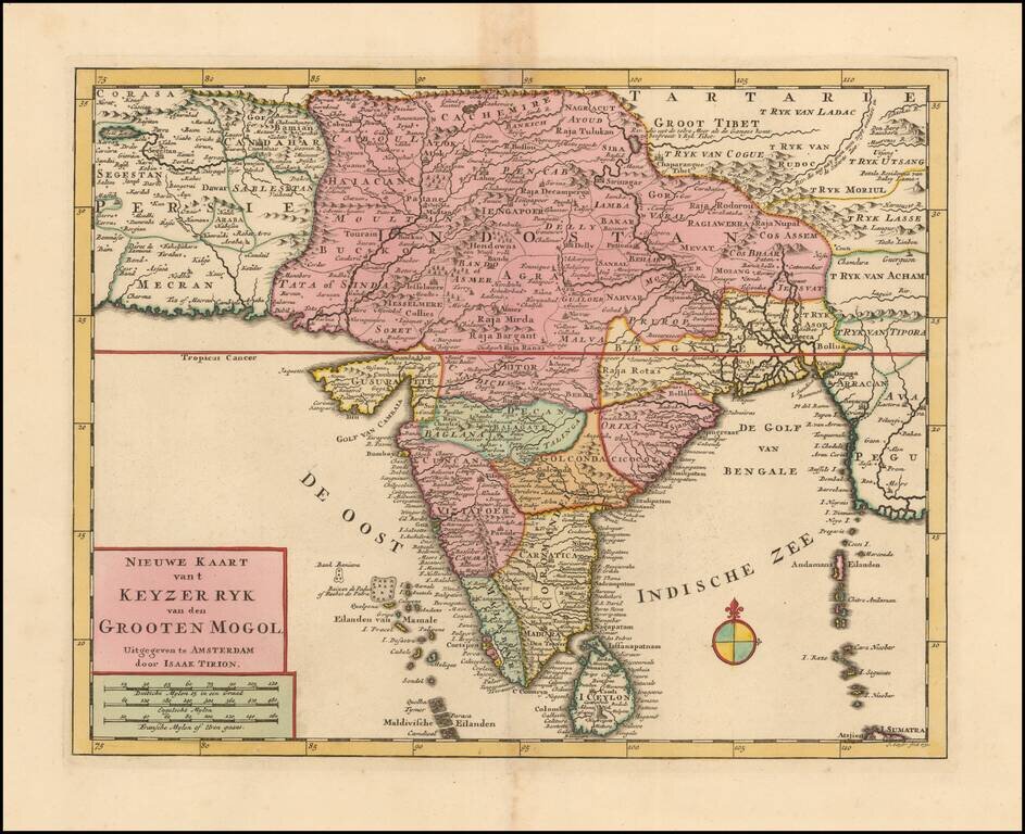
Highly detailed map of India, extending to Tibet, published by Isaak Tirion in Amsterdam. The map extends from the Candahar region and Lake Zara to Tibet, and south to Ceylon.
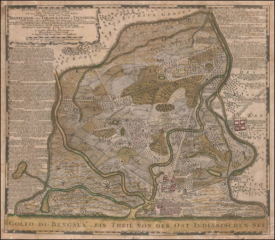
Scarce plan city of Tranquebar, primary factory for the Danish East India Company in the Madras Province. The Danish East India Company established a trading fort at Tranquebar around 1620. After years of sporadic and poor trading, Tranquebar became...
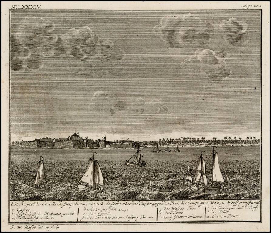
Birdseye view of the Dutch Fort at Jaffnapatnam, from Johann Wolfgang Heydt's Allerneuster Geographisch- und topographischer Schau-Platz von Africa und Ost-Indien. The view depicts Jaffnapatnam the fort on the coast of Sri Lanka. This Portuguese built...
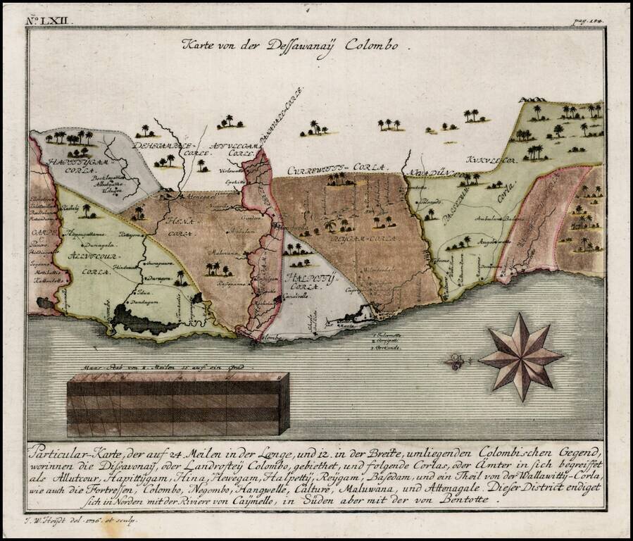
Detailed map of the Colombo region of Sri Lanka, from Heydt's Allerneuester Geographisch- und Topographischer Schau-Platz von Africa und Ost-Indie.
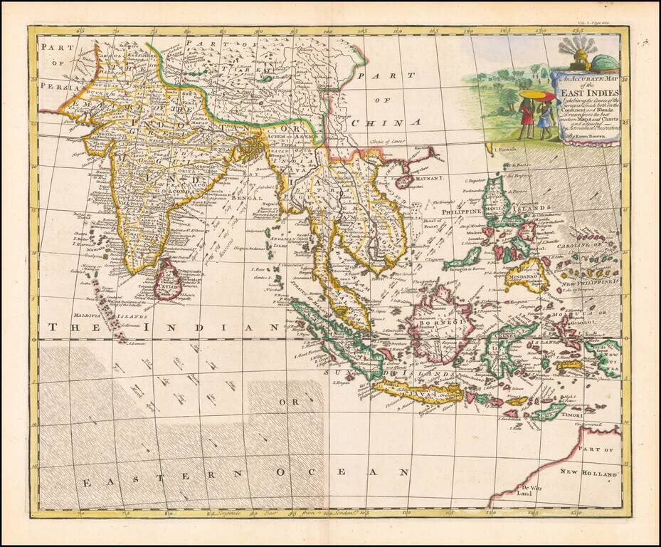
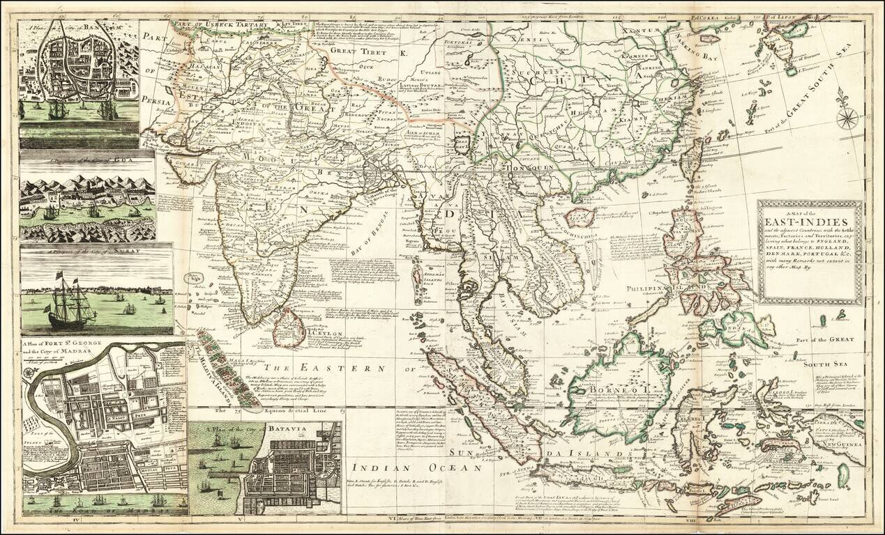
A decorative and highly detailed map, extending from Australia, the Philippines and the Carolines in the east to India, the Maldives and Afghanistan in the west. Includes information regarding the course of the flow of the Ocean in the Indian Ocean...
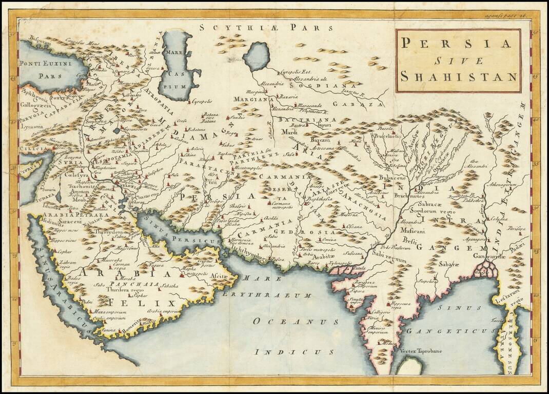
Terrific map of the Persian Empire, with ancient place names. The map appeared in an early edition of Cellarius' Notitia Orbis Antiqui, Sive Geographia Plenior...et Novis Tabulis Geographicis, which was published in London, Amsterdam and other places...
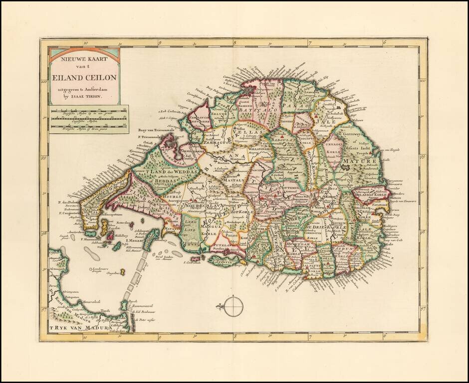
Striking example of Issak Tirion's map of Sri Lanka. Excellent and highly detailed map for the period.
![[Fort Gingee & The Great Mountain of Gingee]](/map/small/58792.jpg)
Detailed plan of "The Great Mountain of Gingee" and the small fort atop it, published by Thomas Kitchin. The explanatory note continues that 10 men were sufficient to defend the fort against assaults. The key locates a total of 12 places on the map....
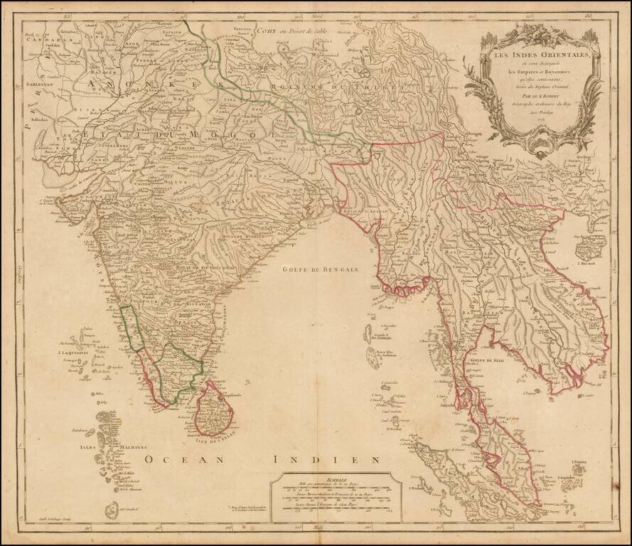
Nice example of Robert De Vaugondy's map of India & Southeast Asia, from his Atlas Universel. Publisher's outline hand-color.
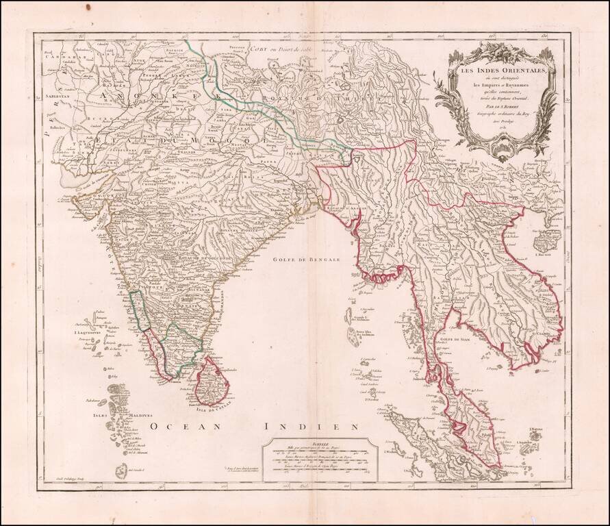
Interesting regional map extending from India, the Ganges and the Maldive Islands to Hai-nan, Cochinchina, the Straits of Malacca and Sumatra, from DeVaugondy's Atlas Universel. Includes islands, towns, mountains, rivers, lakes and a host of other...
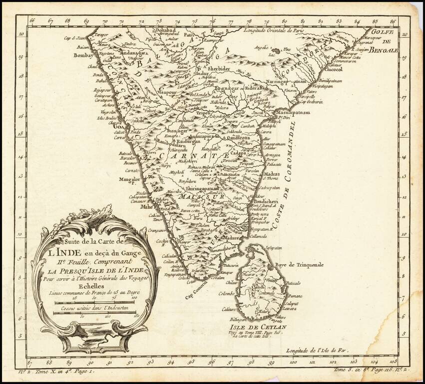
Interesting regional map of Southern India and Ceylon (Sri Lanka). A wonderfully detailed map. Includes a large decorative title cartouche. One of the maps produced by Nichlas Bellin for Prevost d'Exiles influential travel book, L'Histoire Generale...
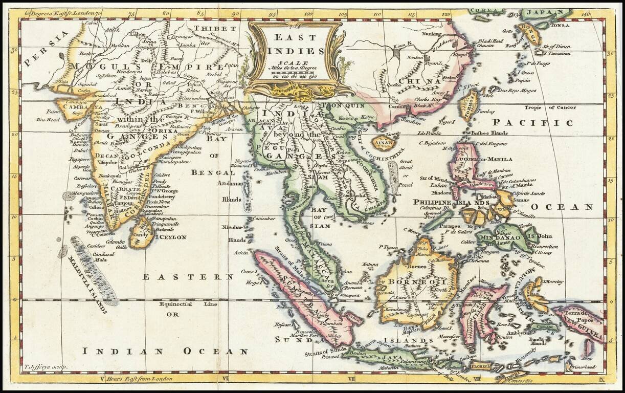
Excellent map of the region bounded by China in the northeast, the Timors and New Guinea in the Southeast, India, and the Maldives in the Southwest and Tibet and the Moguls Empire in the Northwest. Full of mid 18th Century regional names, and...