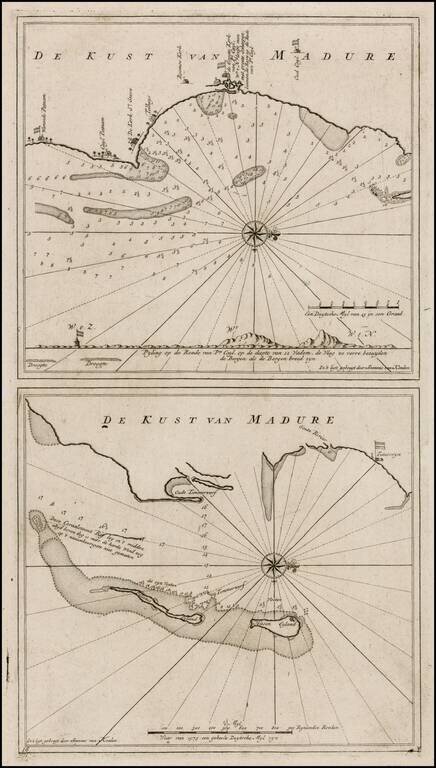
Nice example of this detailed pair of maps of the Madura Coast, from the Dutch East India' Company's Secret Atlas. The chart is oriented with west at the top and shows the areas around the Dutch trading houses ast Warande Patnam and de Groote Kerke...
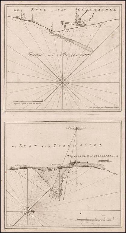
Nice example of this detailed pair of maps of the Coromandel Coast, from the Dutch East India Company's, Secret Atlas. The chart is oriented with west at the top and shows the areas around the Dutch trading houses, etc. The map includes a latitude...
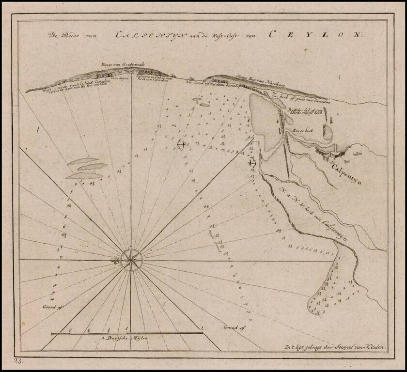
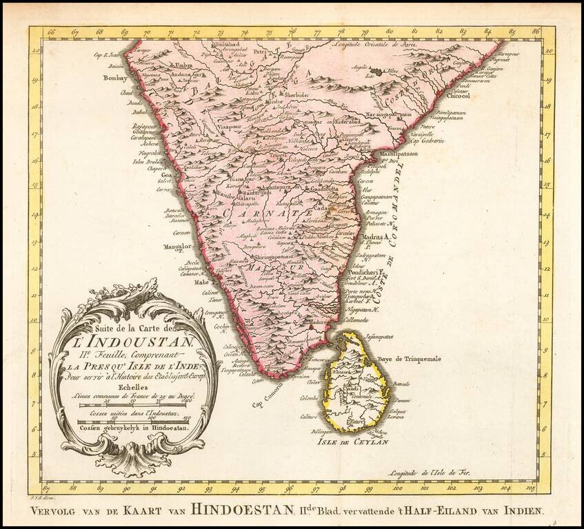
Nice example of this fine plan of the Sri Lankan Coastline, from the Dutch East India Company's Secret Atlas. The chart is oriented with east at the top and shows the areas around the Dutch trading houses, etc. The map includes a latitude scale,...
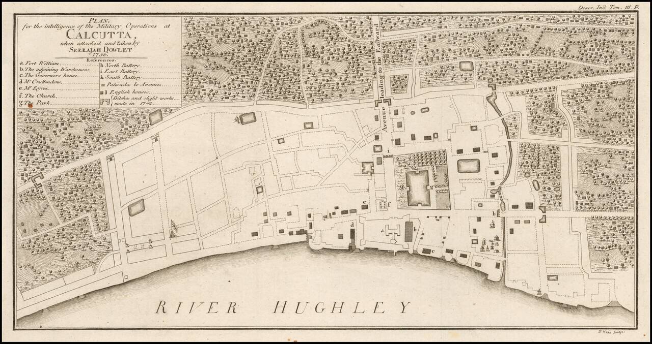
Fine contemporary map of Calcutta, illustrating the City at the time of the Siege of Calcutta. The map includes 14 points of interest relating to the Siege. The map is extremely rare -- this being the first example we have ever seen on the market....
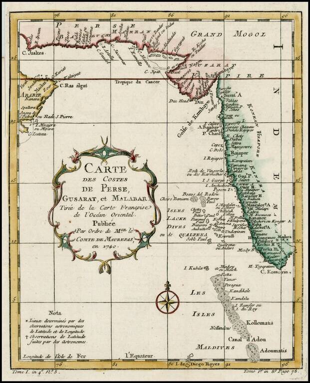
Detailed map of the region from the mouth of the Persian Gulf to the Maldives. Includes large decorative cartouche and compass rose.
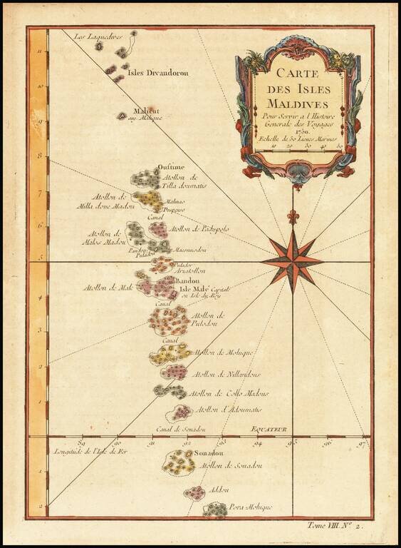
Detailed map of the Maldives, with rhumblines and a large compass rose. Includes a decorative title cartouche. One of the maps produced by Nichlas Bellin for Prevost d'Exiles influential travel book, L'Histoire Generale des Voyages.
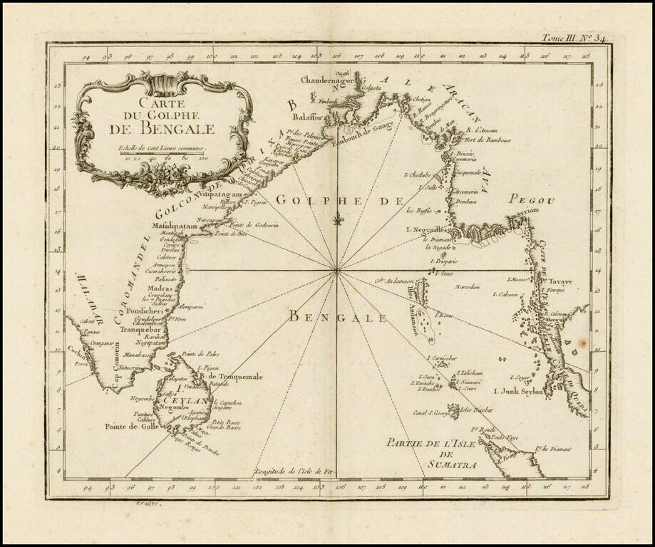
Scarce larger format edition of Bellin's detailed regional map of the Gulf of Bengal and the lower Ganges River. This larger format edition has a different cartouche and lacks the compass rose in the center.
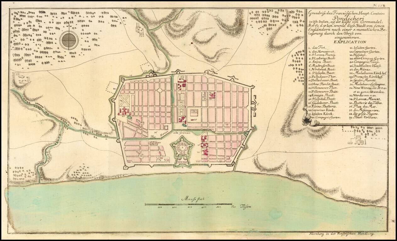
Puducherry at the time of its Capture by the English in 1761 Scarce early plan of the area around Puducherry, from Raspe's Schauplatz des Gegenwaertigen Kriegs... Shows fortifications, the Hospitals, Jesuit Church, Capuchine Church, English Church,...
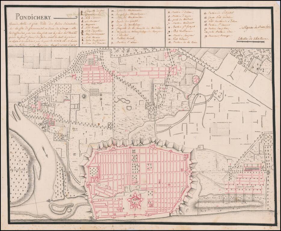
An Early Manuscript Map of Pondicherry Prior To Its Reconstruction After The Seven Years War Finely executed manuscript map of Pudicherry, India, prepared shortly after the French re-took the town after the end of the Seven Years War. Oriented with...
![[Tiruchirappalli] 1763 Plan de Trichenapaly](/map/small/58955.jpg)
Striking Plan of Tiruchirappalli, Drawn at the End of the Carnatic Wars Finely-executed manuscript plan of the city of Tiruchirappalli, here called Trichenapaly, on the south bank of the Kaveri River. The French plan, executed in 1763, was completed...
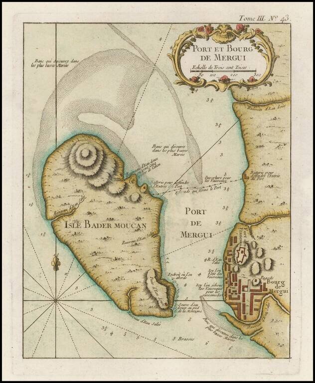
Finely engraved map of Pahtaw Pahtet - Myeik - Tanintharyi Region - Myanmar (Burma), from Jacques Nicolas Bellin's Le Petit Atlas Maritime Recueti de Cartes et Plans des Quatre Parlies du Monde en Cinq Volumes, first published in Paris in 1764....
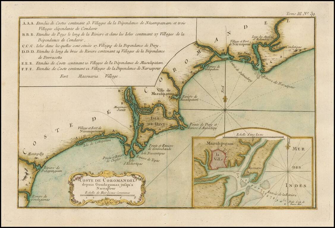
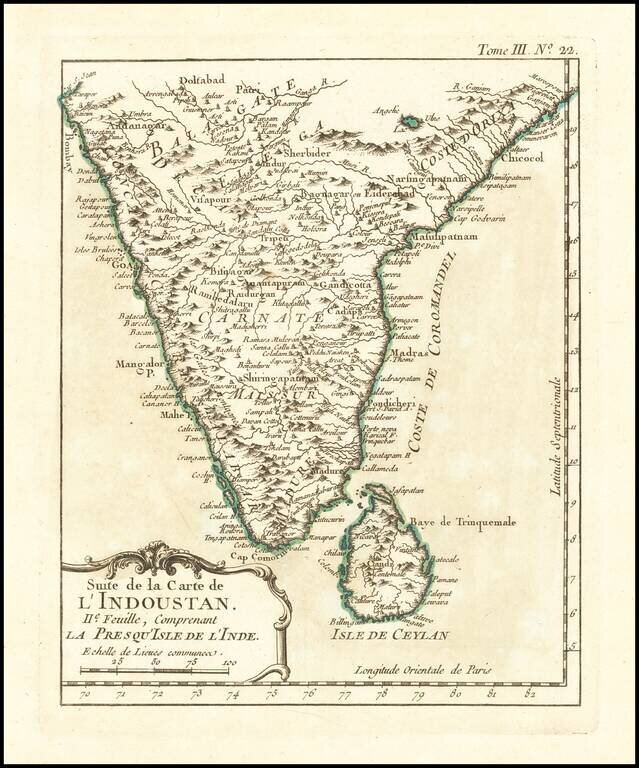
Finely engraved map of the Coromandel coast of India, from Jacques Nicolas Bellin's Le Petit Atlas Maritime Recueti de Cartes et Plans des Quatre Parlies du Monde en Cinq Volumes, first published in Paris in 1764. The focus is on the area around the...
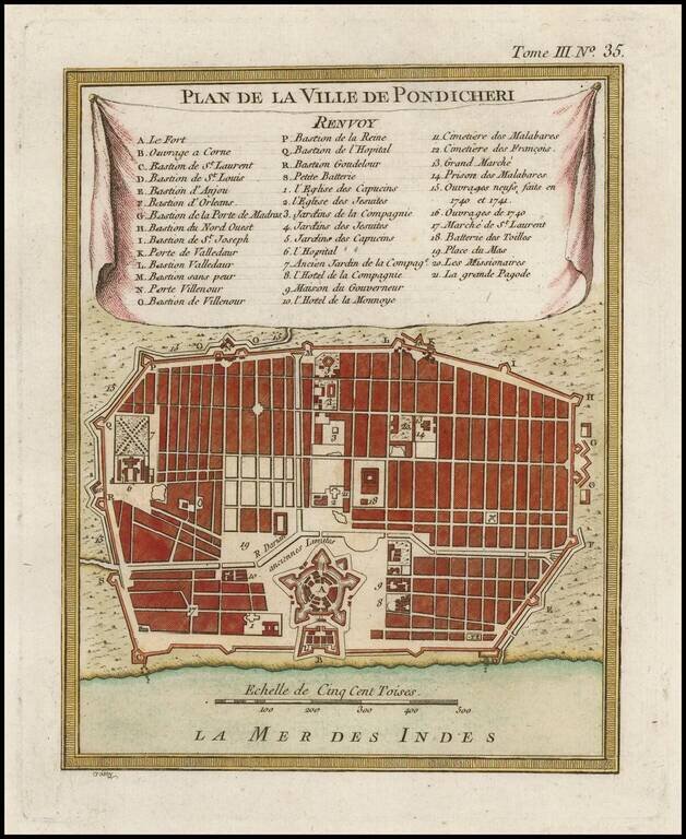
Finely engraved map of Puducherry (India), from Jacques Nicolas Bellin's Le Petit Atlas Maritime Recueti de Cartes et Plans des Quatre Parlies du Monde en Cinq Volumes, first published in Paris in 1764. Jacques Nicolas Bellin Jacques Nicolas Bellin...
Finely engraved map of India, from Jacques Nicolas Bellin's Le Petit Atlas Maritime Recueti de Cartes et Plans des Quatre Parlies du Monde en Cinq Volumes, first published in Paris in 1764. Jacques Nicolas Bellin Jacques Nicolas Bellin (1703-1772) is...
Finely engraved map of Afghanistan and Pakistan, from Jacques Nicolas Bellin's Le Petit Atlas Maritime Recueti de Cartes et Plans des Quatre Parlies du Monde en Cinq Volumes, first published in Paris in 1764. Jacques Nicolas Bellin Jacques Nicolas...
Finely engraved map of India, from Jacques Nicolas Bellin's Le Petit Atlas Maritime Recueti de Cartes et Plans des Quatre Parlies du Monde en Cinq Volumes, first published in Paris in 1764.