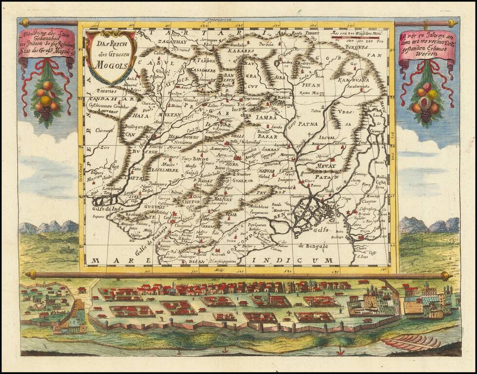
An impressive map of northern India and the surrounding region. The map is superimposed on a scene showing a small city, with a river through the foreground and mountains in the background. Text hangs from the map containing a brief description of the...
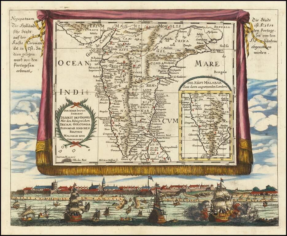
An attractive and rare antique map of southern India, super-imposed on a trompe l'oeil tapestry over a view of Negapatnam (Nagapattinam). The image also includes an inset map of the Malabar coast. The map alludes to the fact that Nageptnam had been a...
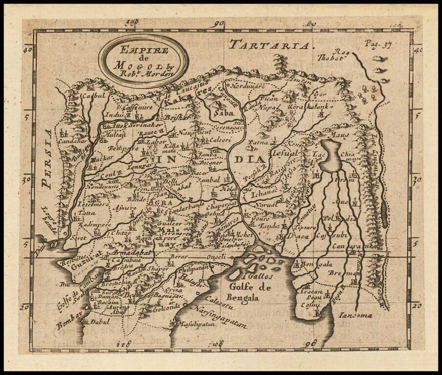
Rare English map, extending from the Gulf of Bengal to the Mecon River. Includes Cabul and Napal in the North and Bombay in the Southwest. One of the earliest obtainable English maps of the region.
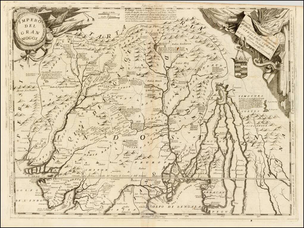
Striking example of Coronelli's map of Northern India, Bangladesh, Pakistan, Nepal, etc., and extending north to the Himalayas. Some of the more interesting early place names include Cabulistan, Kandauna, Harduari, Binsola, Burchar, Kachemire, Iamba,...
![[Persian Gulf, India, Pakistan, Iran]](/map/small/41337.jpg)
Striking example of a Coronelli Globe Gore Section, extending from the Persian Gulf to the Maldives and the west coast of India. The map appeared in Coronelli's Isolario.
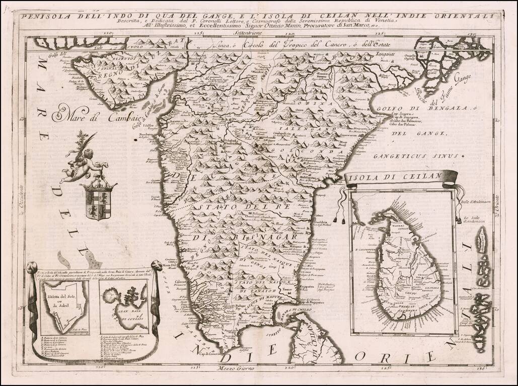
Striking example of Coronelli's detailed map of the Indian Peninsula, from Guzarate to the Ganges. Fine large format map, with detailed topographical features. The map shows India below the Tropic of Cancer, with an insets of Ceylon and Trincomalee.
![[Pakistan Afghanistan & Western India] Tab: IX Asia Continens Ariam, Paropanisum, Drangianam, Arachosiam, et Gedrosiam. . . .](/map/small/54110.jpg)
A striking Ptolemaic map of Central Asia, centered on the Indus River. The map extends from the Gujarat region in the east to west of Karchi, the north to the mountains. Mercator originally published this map in his 1578 edition of Ptolemy's...
An attractive map of the region bounded by northern India, Pakistan, Afghanistan and Bangladesh and extending inland up the Ganges and Indus Rivers to Tartary and the Himalayas, including Katmandu, Kabul and other legendary cities along the great...
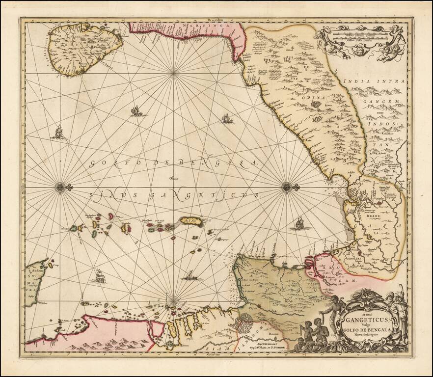
Valk and Schenk's edition of Jansson's engraved map of the Bay of Bengal from Ceylan (Sri Lanka) to Sumatra. This striking large format sea chart was originally published in a Jansson sea atlas. European and Oriental vessels are shown crossing the...
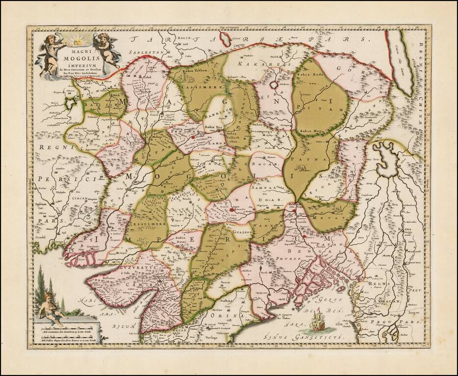
A highly attractive map embracing most of India, made during the height of the Mughal imperial expansion. The map encompasses most of India and Sri Lanka, showing cities, rivers, mountains, islands, political divisions, and more. An intriguing note...
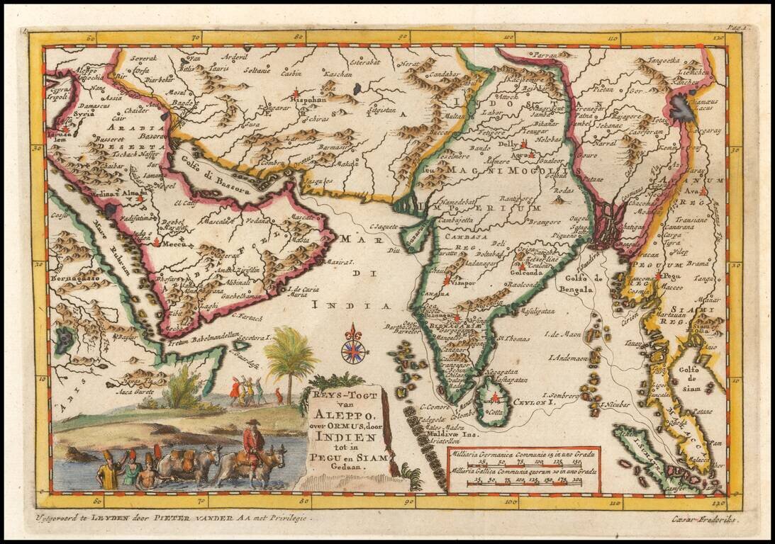
Detailed regional map of regions contiguous to the Indian Ocean, from the Red Sea, Persian Gulf and Saudi Arabia to the Gulf of Siam and Sumatra and extending North to Kandahar and the eastern Mediterranean. Caeser Frederiks traveled from Cyprus via...
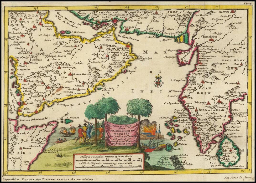
Fine image of the Arabian Peninsula and much of India, illustrating the third and final voyage of Vasco Da Gama, which result in his death and the ascendancy of Henrique de Menezes as Governor of India. Vasco da Gama was a Portuguese explorer and the...
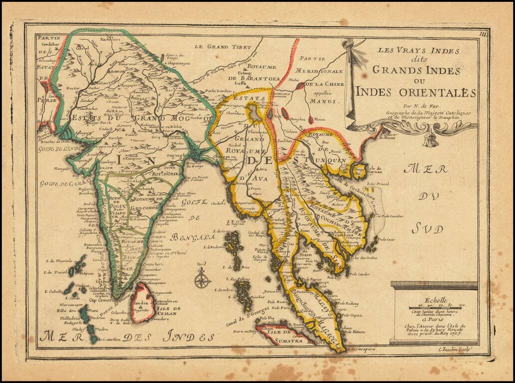
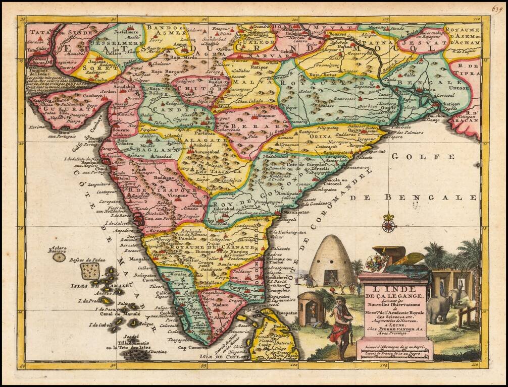
Striking map of India and the Malaysian Peninsula, showing excellent detail throughout. From De Fer's Atlas Curieux. Nice wide margins and decorative cartouche.
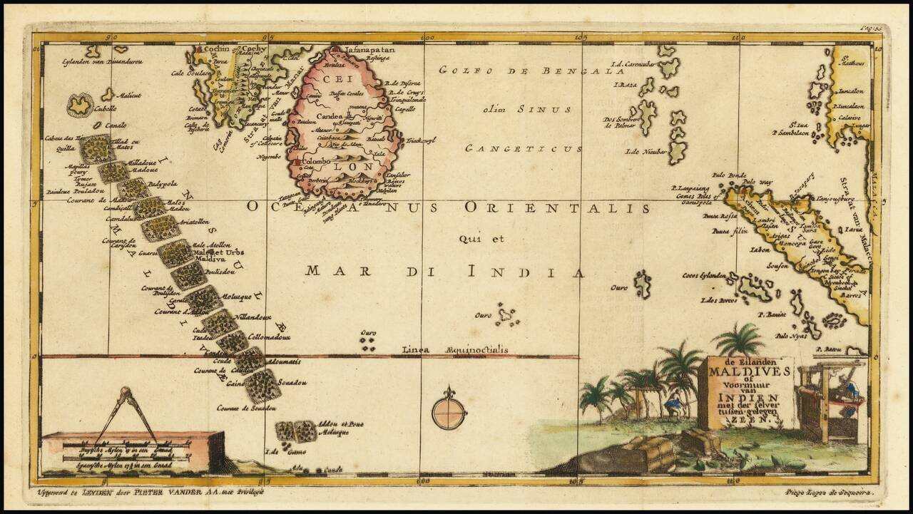
Interesting early map of the Maldives, Ceylon and parts of Malaysia and Sumatra, illustrating the travels of Diego Lopez de Sequeira. In the early 18th Century, Vander Aa reproduced a number of rare manuscript and printed accounts of 16th Century...
![Genealogie Des Empereurs Mogols Depuis Tamberlan ou Tamerlan . . . [maps of the Empire of the Grand Mogol, Kingdom of Kachemire and 3 indigenous views]](/map/small/43161.jpg)
Interesting pair of maps, Genealogical tree and 3 indigenous views of the Mogol Empire, from Chatelain's Atlas Historique. The upper maps show the Empire of the Great Mogol and the Kingdom of Kachimere. The center includes a tree showing the Mogol...
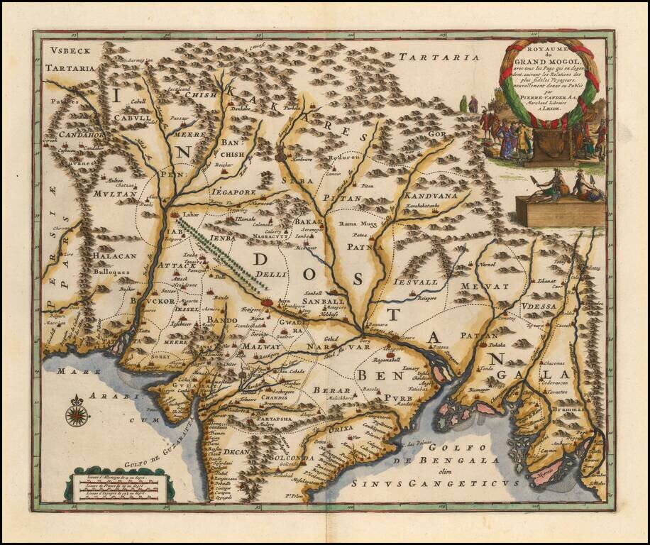
Scarce Dutch Edition of William Baffin's Map of India Fine dark impression of the Pierre Vander Aa edition of William Baffin's map of India, which is widely regarded as the first English map of India and the single most influential map of India...