![[Sri Lanka] Insula Zeilan olim Taprobana nunc incolis Tenarisim](/map/small/59295.jpg)
Decorative map of Sri Lanka, published in the later editions of Jansson's atlas. A striking image, with a decorative title cartouche and scale of miles held aloft by mer-cherubs.
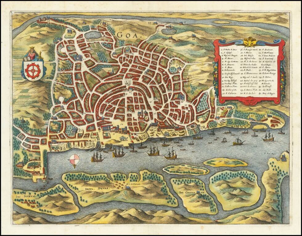
A detailed birdseye view plan of Goa, showing the various streets and buildings of the city, the city's riverine harbor, and the fields surrounding the city. Several decorative features are added. The view includes a key naming forty-three points of...
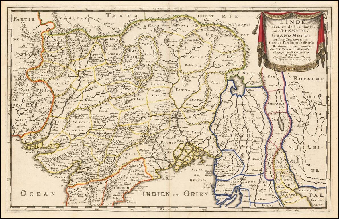
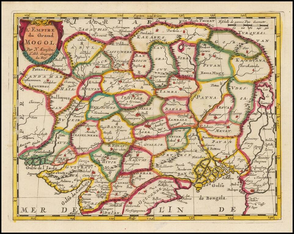
Fine Map of South Asia and the Mughal Empire by Renowned Mapmaker Sanson Detailed map showing a large swath of South Asia by the skilled mapmaker Nicolas Sanson. The map is centered on the portion of Asia north of the Indian subcontinent. It...
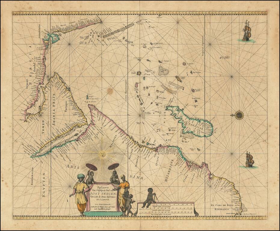
Charting the Western Indian Ocean Decorative sea chart of the Indian Ocean, orientated with the north to the left. The highly decorative chart shows the East African coast, Arabia, Madagascar and the islands of the Indian Ocean with the Seychelles...
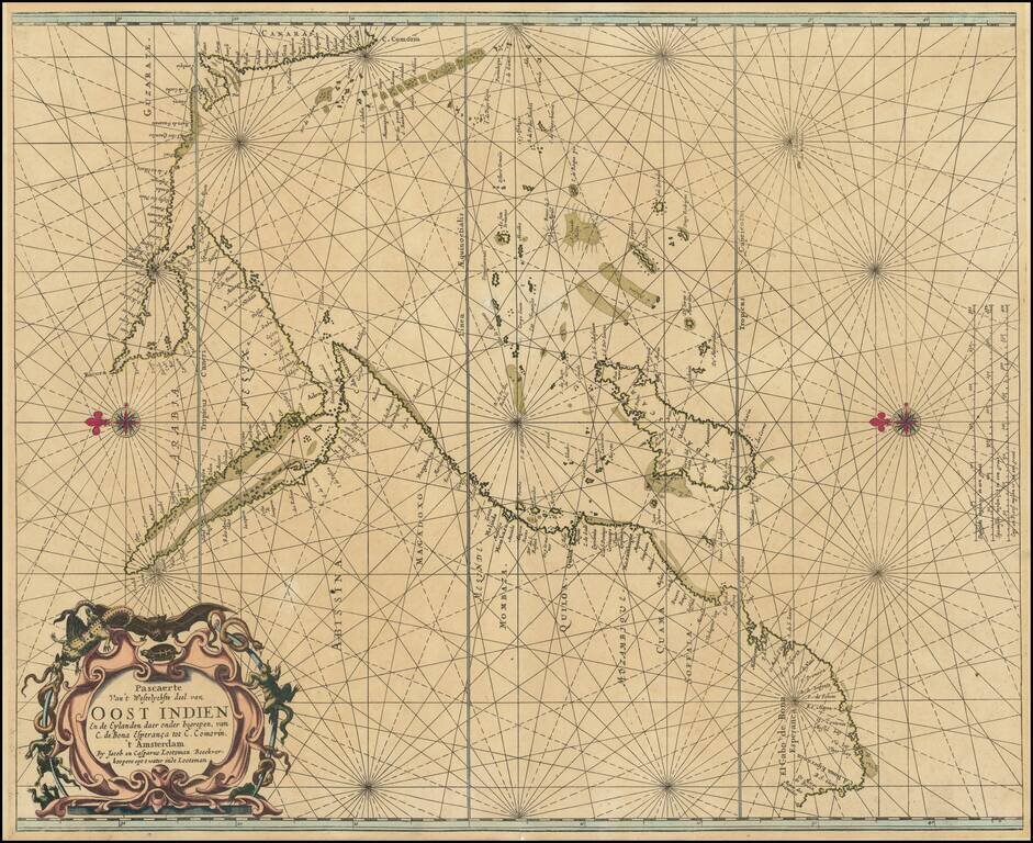
An Important Early Sea chart of the Western Indian Ocean Rare early sea chart of the East Coast of Africa, the Indian Ocean and the West Coast of India, by Jacob and Casper Lootsman, one of the first commercial publishers of Dutch sea charts. The...
![[Southeast Asia, Philippines & India] Nova Delineatio particularis Apostolicarum Peregrinationum noni Indiarum Apostoli in India Orientali](/map/small/51679.jpg)
Rare map of India, Southeast Asia and the Philippines, illustrating the travels of the earliest Jesuit Missionaries. The map includes a key locating the earliest Jesuit Missions in the region. The map was published to illustrate a book on the life of...
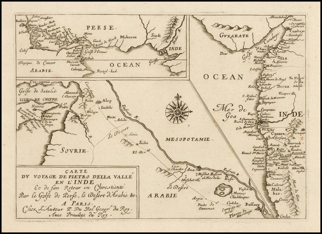
Rare Pierre Du Val antique engraved map featuring three small maps related to the travels of Italian writer Pietro della Valle's travel through the Middle East to the western coast of India in the early 17th century. Dell Valle's route is shown going...
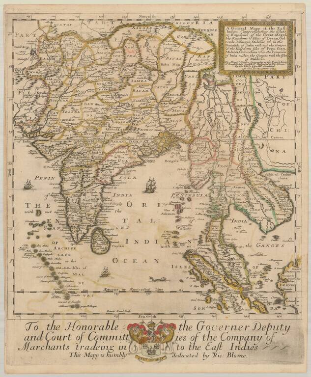
Old color example of the first state of Richard Blome's scarce map of India and Southeast Asia, the earliest folio sized map of the region to be engraved in England. While Speed's atlas was published prior to Blome, Speed's plates were engraved and...
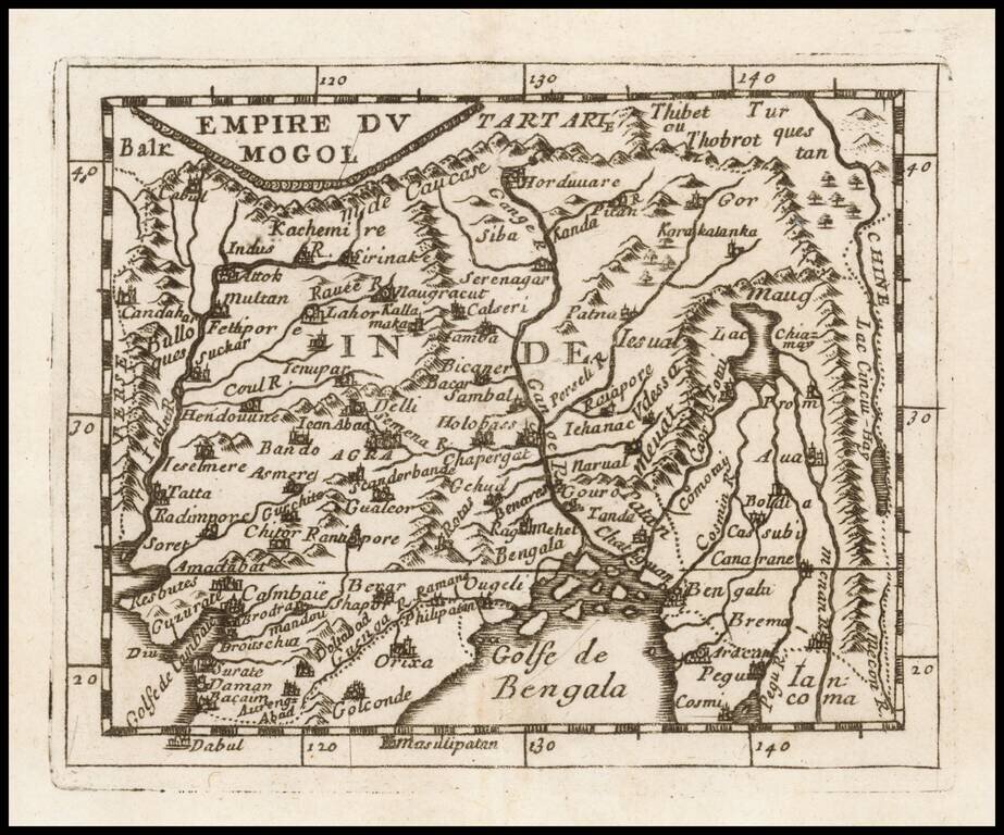
Detailed map of the Mogol Empire, centered on the Ganges River, published in Paris by Du Val. The map extends north to Tibet, west to the Indus River, south to the Bay of Bengal and east to the Mekong River.

Detailed map of the southern part of India and Sri Lanka, published in Paris by Du Val.
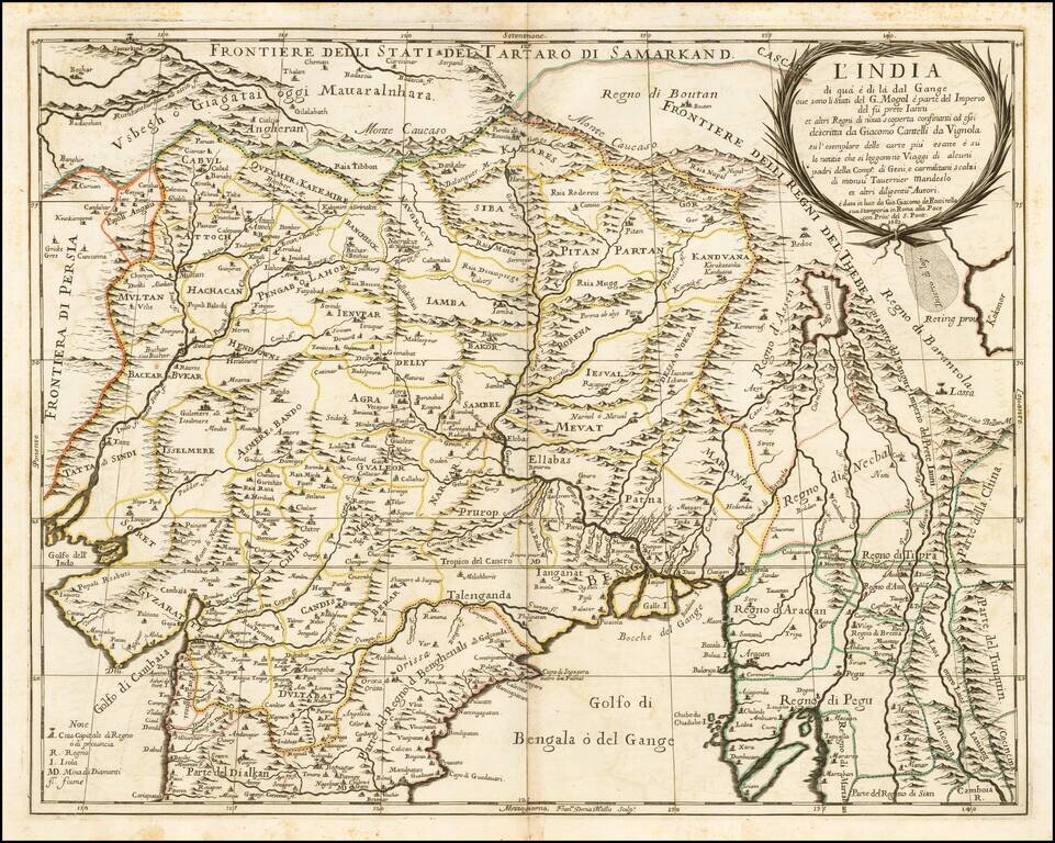
Nice example of the Cantelli-Rossi map of Northern India, Pakistan, Afghanistan and Tibet. The title carries a dedication to Jean-Baptiste Tavernier. Along the northern frontier, the map extends to Cabul, Samarkand, Nupal, Boutan and Lassa. The...
A detailed map of the Indian subcontinent and surrounding islands, also includes portions of Southeast and Central Asia. From Mallet's monumental Description de l' Univers, first published in Paris in 1683, perhaps the greatest work of its kind in the...
Fine old color example of this fine 17th Century map of India and Central Asia by Nicolas Sanson. The map extends from Persia in the West to Lake Chimay and the Bay of Bengal, with the Himalaya Mountains in the north.
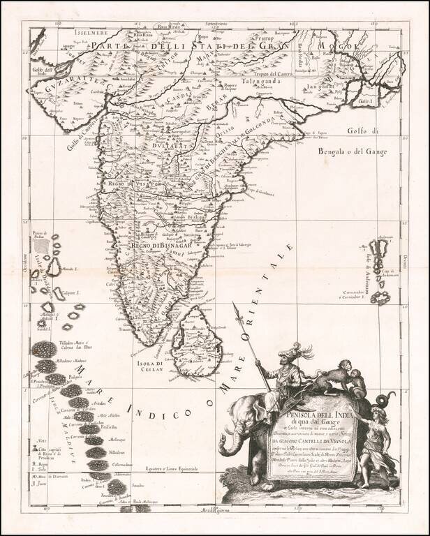
Scarce decorative map India, Ceylon, the Maldives and neighboring regions by Cantelli da Vignola and published in Rome by Rossi. The map provides one of the most detailed and up to date treatments of the region. Includes an ornate cartouche,...
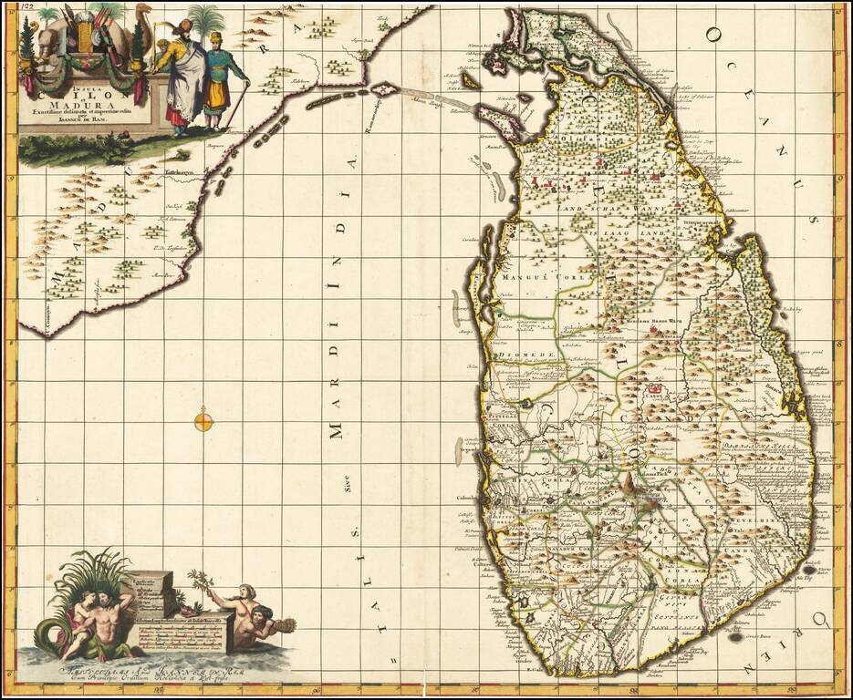
Fine Original Color Rare Johannes de Ram map of Ceilon, one of the most decorative large format maps of Ceilon of the period. The island is shown in remarkable detail, along with the contiguous coast of India. Two large allegorical cartouches. The...