![[Pakistan, Northwestern India] Tabula Asiae IX](/map/small/46402.jpg)
Fine unfolded example of Gastaldi's map of Northern India and Pakistan. Giacomo Gastaldi is considered as the foremost Italian cartographer of the 16th century along with Paolo Forlani. From Piedmont, Gastaldi established his reputation in Venice and...
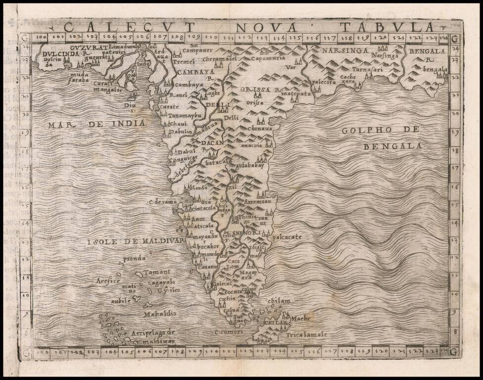
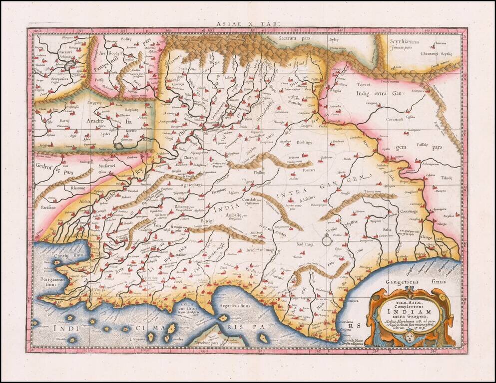
The First Modern Map of India Fine example of Gastaldi's modern map of the Southern Part of India, the first map to focus on India utilizing modern geographical information, rather than Ptolemy. Giacomo Gastaldi is considered as the foremost Italian...
![[India] and [Java Maior]](/map/small/59059.jpg)
Fascinating map of India and map of Java Maior, from Honter's 1561 De Cosmographiae Rudimentis. Honter's maps are based upon modern sources and are among the earliest modern printed maps of the regions shown.
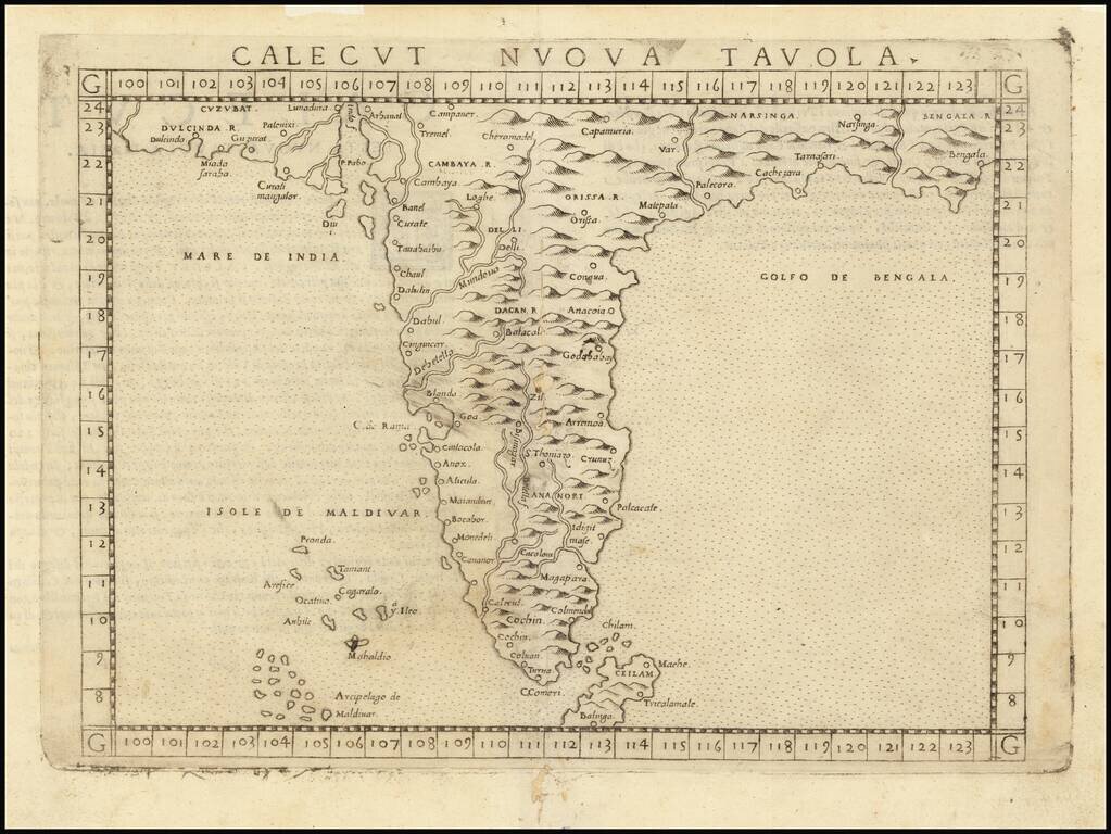
Fine dark impression of the first edition of Ruscelli's modern map of India, one of the earliest obtainable modern maps of the region. Ruscelli's Atlas is an expanded edition of Gastaldi's Atlas of 1548, which has been called the most comprehensive...
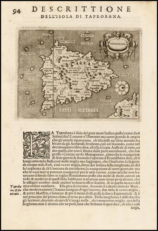
First edition of one of the earliest obtainable maps of Sri Lanka, which appeared in the first edition of Tomaso Porcacchi's L'Isole piu Famose del Mondo.
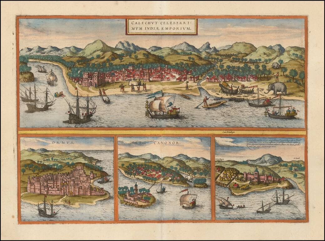
Striking group of 4 city views, illustrating a trip from Africa to the trading regions of East, from Braun & Hogenberg's Civitates Orbis Terrarum, the most famous and influential book of town plans published in the 16th Century. The top view shows...
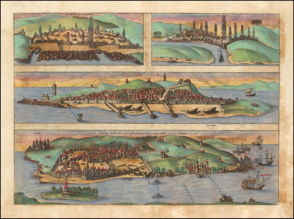
Nice old color example of Braun & Hogenberg's set of Casablanca (Anfa) - Azemmour (Azamor) - Diu - Old Goa (Velha Goa).
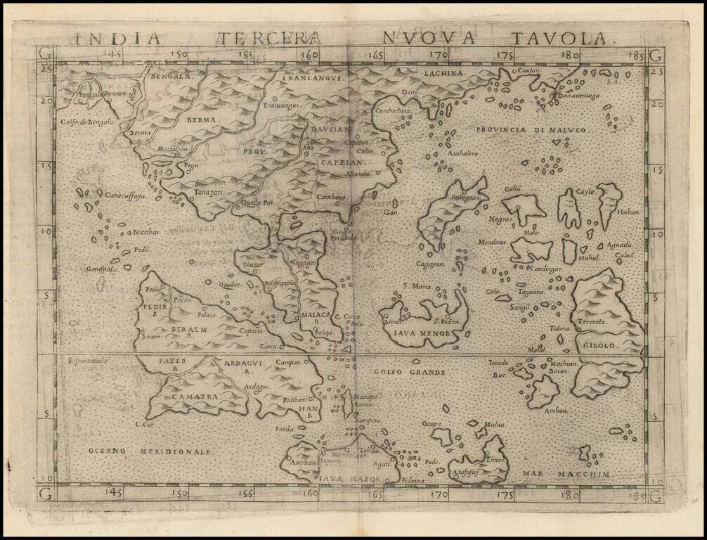
Girolamo Ruscelli's India Tercera Nuova Tavola is one of the earliest obtainable modern maps of Southeast Asia. The map is an enlarged version of Giacomo Gastaldi's miniature map of 1548, which was one of the earliest to introduce the Portuguese...
Nice example of Mercator's map of ancient Southeast Asia, first issued in the 1595 edition of Mercator's Geographia, based upon the works of Claudius Ptolemy. From Mercator's edition of Ptolemy's Geographia, first published in 1578 and republished in...
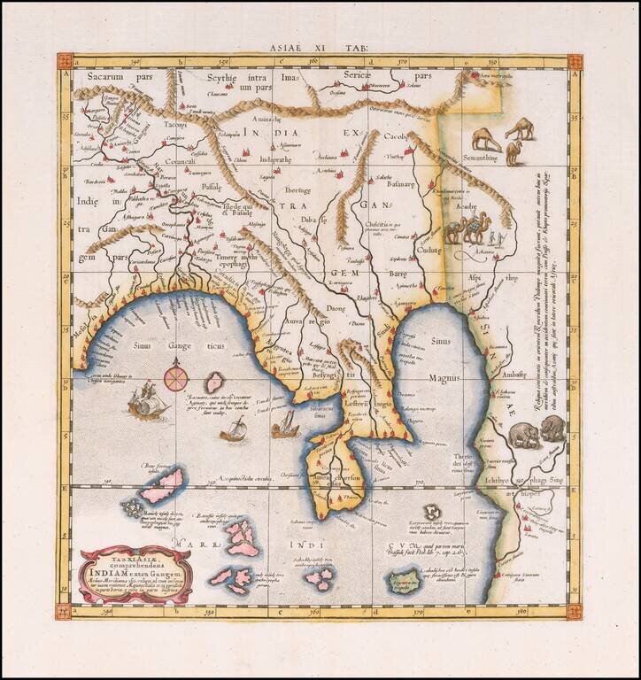
The Mercator-Ptolemy Map of India Colored example of Mercator's Ptolemaic map of much of India, first issued in the 1595 edition of Mercator's Geographia, based upon the works of Claudius Ptolemy. The present example is from the second set of plates,...
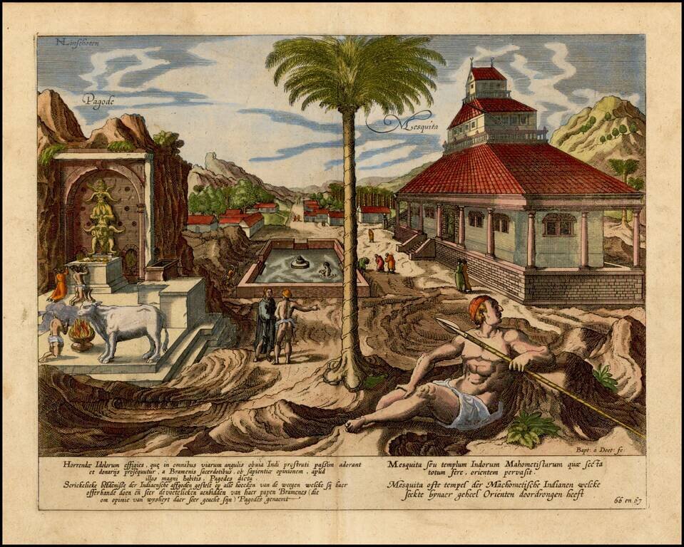
Scene of a Temple and Pagoda in India from Linschoten's epic work Itinerario, voyagie, ofte Ship-vaert (Amsterdam, 1596), inarguably the most influential book on Asia of its era. Jan Huygen van Linschoten (c.1563 -1611) was a larger than life figure...

Nice example of this early state of Barent Langenes's map of Burma, which first appeared in the 1598 edition of Langenes's Caert-Thresoor, published in Middelburg. The present map is one of the earliest obtainable maps to focus on Burma. Langenes's...
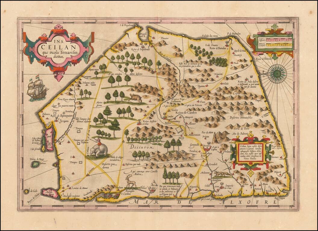
Finely colored example of Ceylon (Sri Lanka), from an early edition of the Mercator Hondius Atlas. The map is oriented with east at the top and includes elephants, gazelles and other animals, sailing ships, compass roses and 3 cartouches. The map...
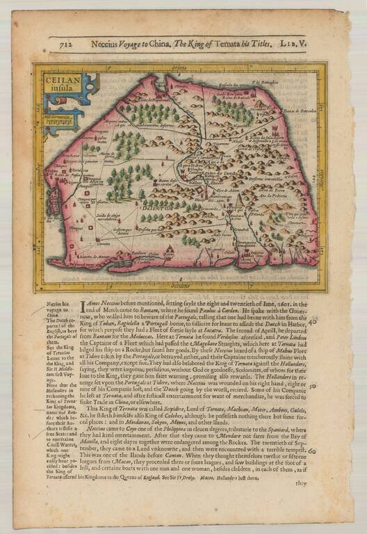
Striking early map of Ceylan with decorative cartouche. From the 1625-26 edition of Purchas His Pilgrims, one of the seminal early 17th Century English Language travel works. On a 13 x 9 inch sheet with English text, front and back.
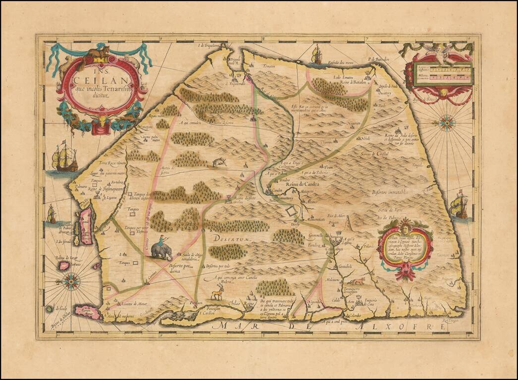
Nice example of Hondius's double-page engraved map of Ceylon (Sri Lanka), from the Mercator Hondius Atlas. The map is oriented with east at the top and includes elephants, gazelles and other animals, sailing ships, compass roses and 3 cartouches. A...
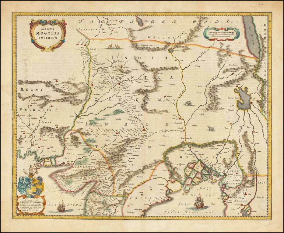
Old color example of Blaeu's map of India, based upon William Baffin's map of India, first published in about 1619. The map is bounded by Pakistan, Afghanistan and Bangladesh and extends inland up the Ganges and Indus Rivers to Tartary and the...