logo

1826. Die Rep: Colombia Departement 1. Orinoco. 2 Venezuela. 3 Maturin. 4. Zulia, 5. Boyaca

  • Die Rep: Colombia Departement 1. Orinoco. 2 Venezuela. 3 Maturin. 4. Zulia, 5. Boyaca

Die Rep: Colombia Departement 1. Orinoco. 2 Venezuela. 3 Maturin. 4. Zulia, 5. Boyaca information:

Year of creation: 
Resolution size (pixels): 
 2231x1733 px
Disk Size: 
 891394B
Number of pages: 
 1
Place: 
 Leipzig
Author: 

Print information. Print size (Width x height in inches):
Printing at 72 dpi 
  30.99 х 24.07
Printing at 150 dpi 
 14.87 х 11.55
Printing at 300 dpi 
 7.44 х 5.78

An example of detailing the file of this map of in a printable high-resolution:

Click to open in high resolution (open in new tab).
Attention! this is just the central piece (central area 960x960 px) of the map file!
This is an example, so that you can see and study the level of detail of a given map. The entire Map will be fully available after payment!

Die Rep: Colombia Departement 1. Orinoco. 2 Venezuela. 3 Maturin. 4. Zulia, 5. Boyaca

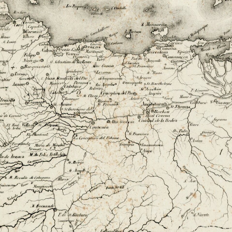
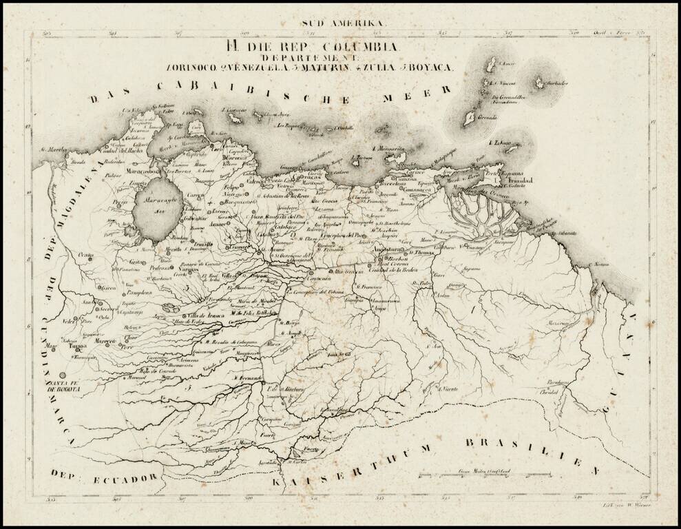
Rare map of the Republic of Colombia, divided into Departments, at a time when it included Venezuela.

On December 17, 1819 the Congress of Angostura declared Gran Colombia an independent country. After two more years of war, the country achieved independence from Spain in 1821 under the leadership of its most famous son, Simón Bolívar. Venezuela, along with the present-day countries of Colombia, Panama, and Ecuador, formed part of the Republic of Gran Colombia until 1830, when Venezuela separated and became a separate sovereign country.


Special conditions for students!

If you are a student, write to us in telegram: @antiquemaps and indicate what material you need and for what work you need a map in high detail. We are ready to provide material on special terms. For students only!

Item information:

Year of creation:
Size:
2231x1733 px
Disk:
891394B
Number of pages:
1
Place:
Leipzig
Author:
Schleiben.
$9.99

Related item