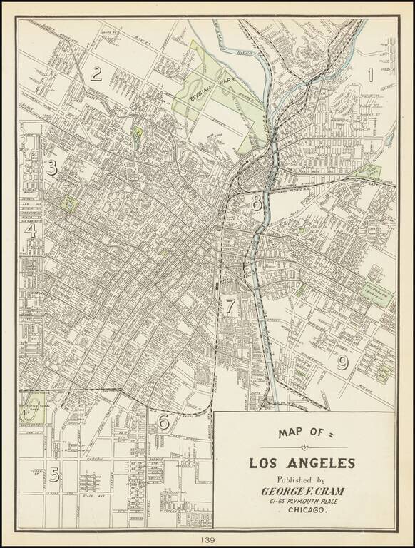
Scarce early Cram map of Los Angeles, one of the earliest obtainable separately issued maps of Los Angeles, most likely from the Atlas of the Pacific Coast. The city is shown at a much earlier stage in its development than Cram's later map of Los...
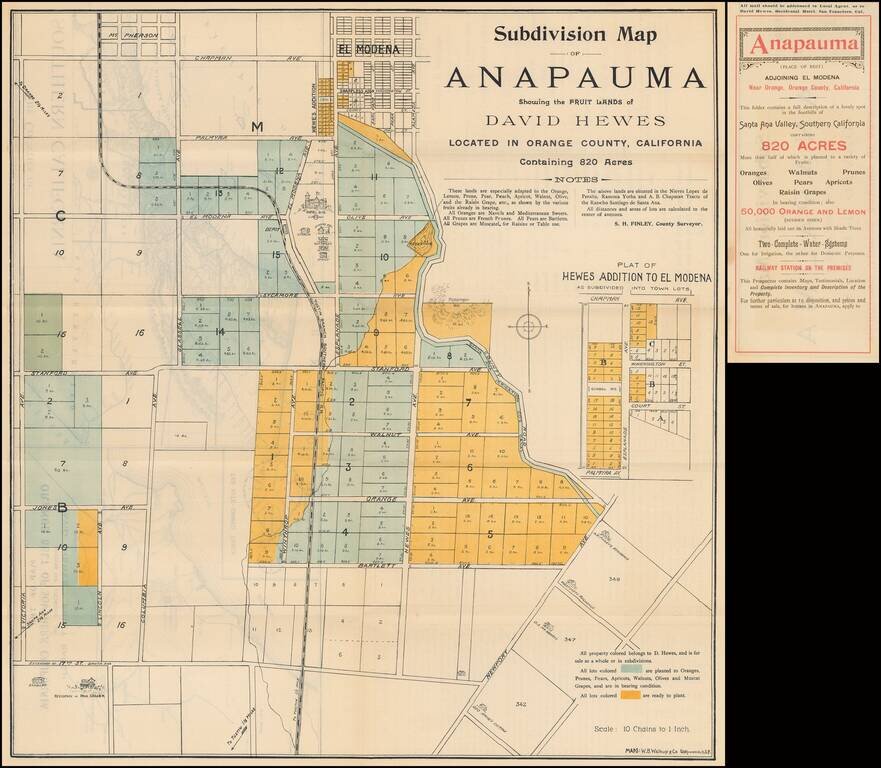
Fine example of the original subdivision promotional map for Anapauma, California, a short-lived real estate development in Southern California promoted by David Hewes, who is perhaps most famous for having been the creator of the "Golden Spike."...
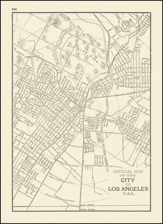
One of the Earliest Obtainable Separately Issued Maps of Los Angeles This is the rare Cram map of Los Angeles, showing the city roughly from Echo Park to Alameda. Detail is extensive on this street map, with many roads named in this region. To the...
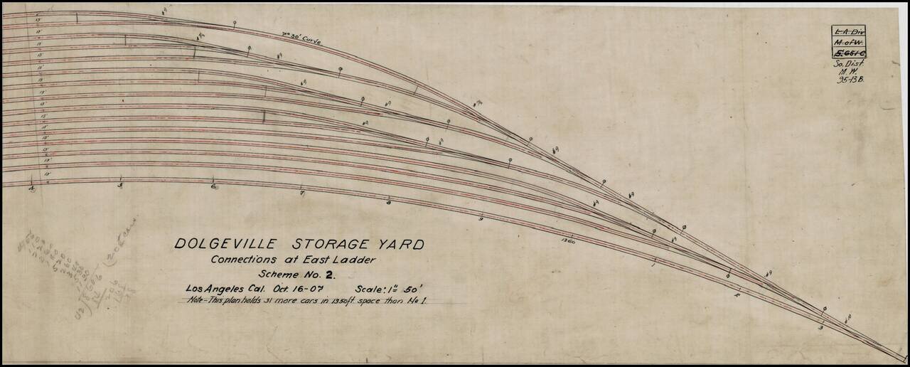
Manuscript plan for a proposed rail yard in Los Angeles, California, composed in 1907. The rail yard was probably located in the Dolgeville Subdivision of Alhambra, California. Dolgeville was named after the Alfred Dolge Manufacturing Company. This...
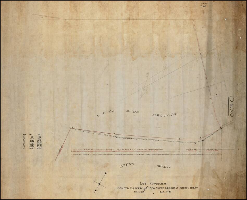
Southern Pacific Railroad Survey showing the boundary between the Stern Tract and the Southern Pacific Shop Ground, in Downtown Los Angeles. Includes the lines surveyed in August 1881, July 1899 and March 1891, the apparent basis for the dispute.
Detailed vintage map of San Pedro and western Long Beach, including the Port of Los Angeles terminals, published by the Automobile Club of Southern California. The map includes an inset of the area between Downtown Los Angeles and San Pedro, with...
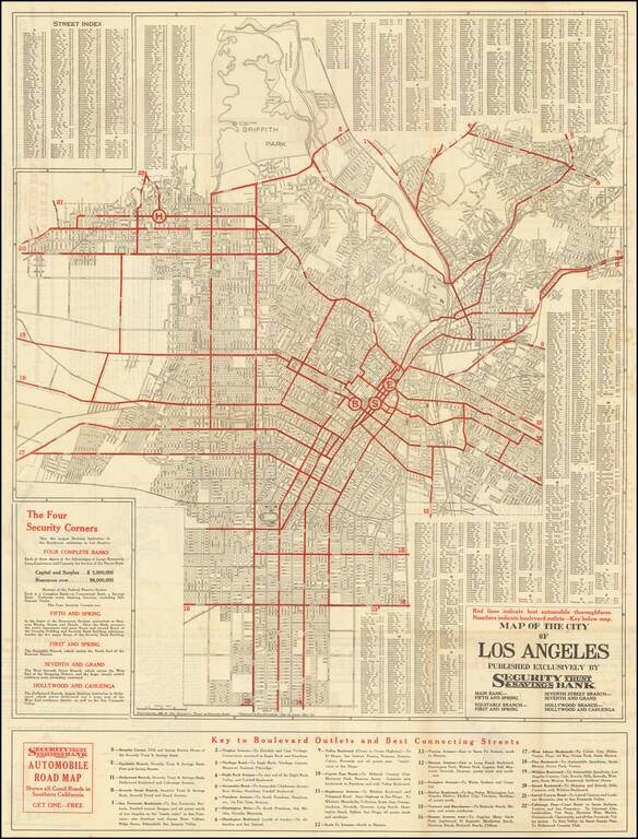
Detailed vintage street map of the City of Los Angeles, prepared by The Clason Map Company for the Security Trust & Savings Bank, and published in Los Angeles in 1921. The primary map covers the City of Los Angeles north of Manchester and the...
This is a fantastic pamphlet detailing Los Angeles during the 1920s. The booklet, replete with many photographs and descriptions, painting a marvelous picture of the region as it lay a century ago. This is the thirty-second edition of this work...
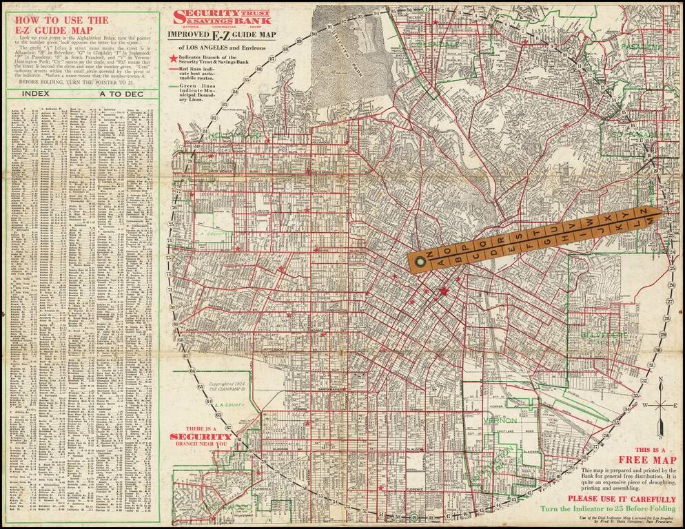
Rare folding map of Los Angeles and Vicinity, with riveted rotating pointer. Interesting promotional map for Security Trust & Savings Bank, with an Index and direction on how to use the map, which shows the locations of the bank's branches,...
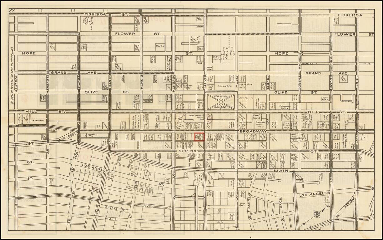
Detailed map of downtown Los Angeles in 1924, featuring building-level detail and an extensive enumeration of businesses in the area. The map is roughly bounded by Figueroa on the west, Wall Street on the east, First Street in the north, and Twelfth...
![[Catalina / Avalon] The Island for Rest and the Sport You Love Best](/map/small/70008.jpg)
Striking pictorial view of Avalon Bay, promoting the Wilmington Transportation Company's excursions to Catalina. The view provides a fine overview of the Avalon Area, including the residence of William Wrigley Jr. on the hillside at the left and the...
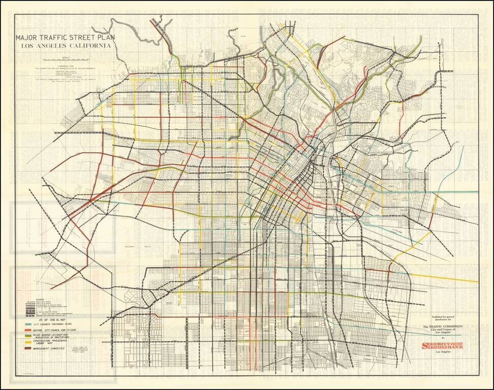
Early Los Angeles Transit Planning Rare separately issued folding map, showing the general plan for major streets prepared by the Los Angeles Traffic Commission, with one the commissioners including Frederick Law Olmsted, Harland Bartholomew, and...
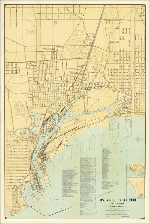
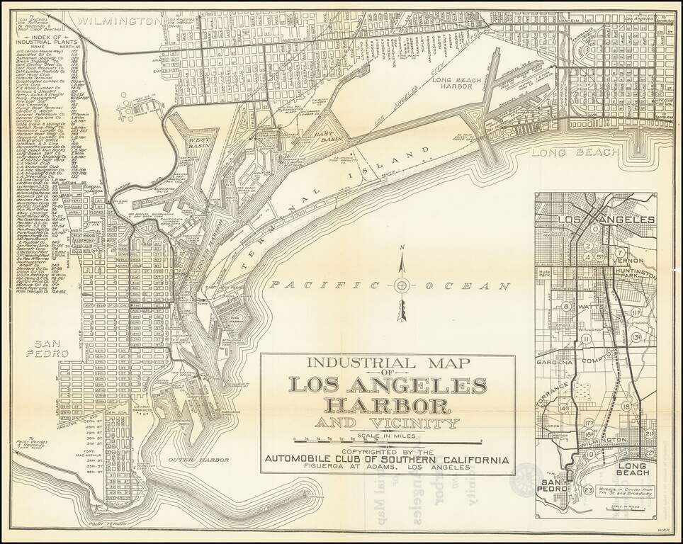
Highly detailed map of Los Angeles Harbor, first published by the Harbor Department in 1919 and periodically revised thereafter. The map includes a detailed plans for the Wilmington District, Long Beach and San Pedro District, along with excellent...
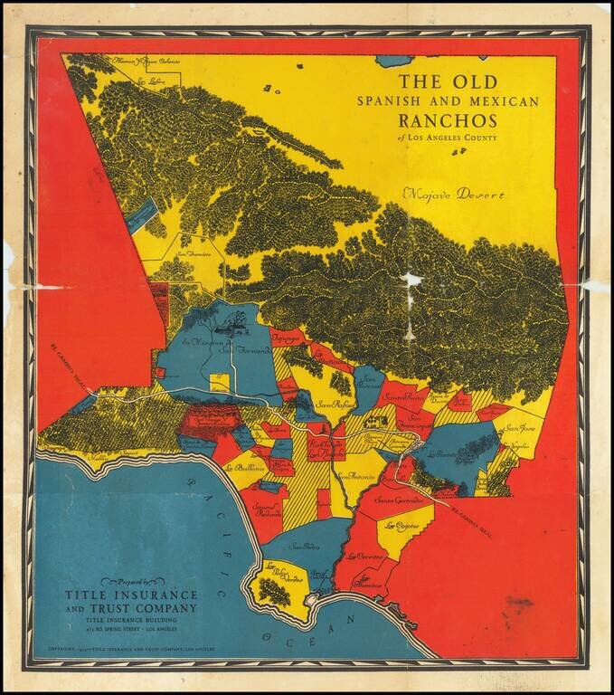
The Earliest of the Pictorial Maps of the Spanish & Mexican Ranchos Published for Title Insurance and Trust Company of Los Angeles Rare early Spanish & Mexican Ranchos map, prepared for the Title Insurance and Trust Company of Los Angeles....
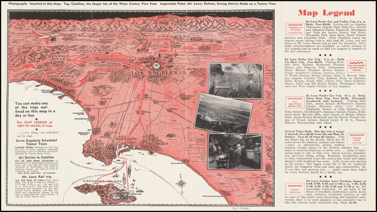
A pictorial map of Los Angeles from circa 1930 with photographs of Avalon, Mt. Lowe, and more. The map itself shows the area from Long Beach to the San Fernando Valley, and eastwards as far as Mt. Lowe and Monrovia. The image is drawn from a birdseye...
Interesting promotional map of the Eastern portion of Los Angeles County, likely published at about the time of the1932 Olympics. The map is centered on Pasadena and the the San Gabriel Valley, stretching north to Lancaster and south to Artesia and...