Map size in jpg-format: 30.3235MiB
Click to open in high resolution (open in new tab).
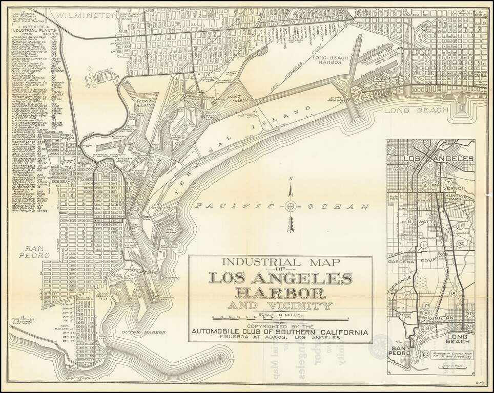
Detailed vintage map of San Pedro and western Long Beach, including the Port of Los Angeles terminals, published by the Automobile Club of Southern California.
The map includes an inset of the area between Downtown Los Angeles and San Pedro, with mileage for the routes indicated in circles along the way.
At the left is a key naming dozens of industrial plants in the area.
The map does not show the extension of the Fish Harbor sea wall that was underway in 1923, suggesting a date earlier than that.
If you are a student, write to us in telegram: @antiquemaps and indicate what material you need and for what work you need a map in high detail. We are ready to provide material on special terms. For students only!