Map size in jpg-format: 51.8654MiB
Click to open in high resolution (open in new tab).

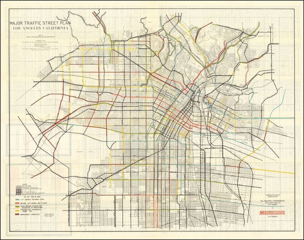
Early Los Angeles Transit Planning
Rare separately issued folding map, showing the general plan for major streets prepared by the Los Angeles Traffic Commission, with one the commissioners including Frederick Law Olmsted, Harland Bartholomew, and Charles Henry Cheney.
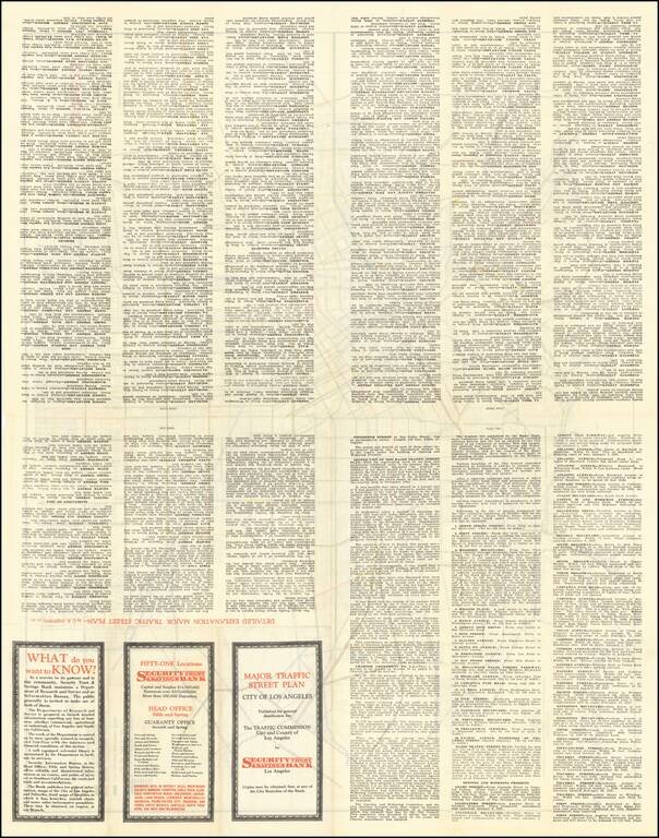
This highly detailed map shows the major planned roads for the City of Los Angeles in 1927. The Legend and color coding provide a detailed look at the status of major road construction, including roads then in engineering studies (blue), before the City Council (light red), approved and in court for acquisition of right of way by eminent domain (green), construction commenced (yellow) and finished (red). Extensive promotional and explanatory details on the verso, along with advertising for Security Bank.
If you are a student, write to us in telegram: @antiquemaps and indicate what material you need and for what work you need a map in high detail. We are ready to provide material on special terms. For students only!