Map size in jpg-format: 15.9388MiB
Click to open in high resolution (open in new tab).
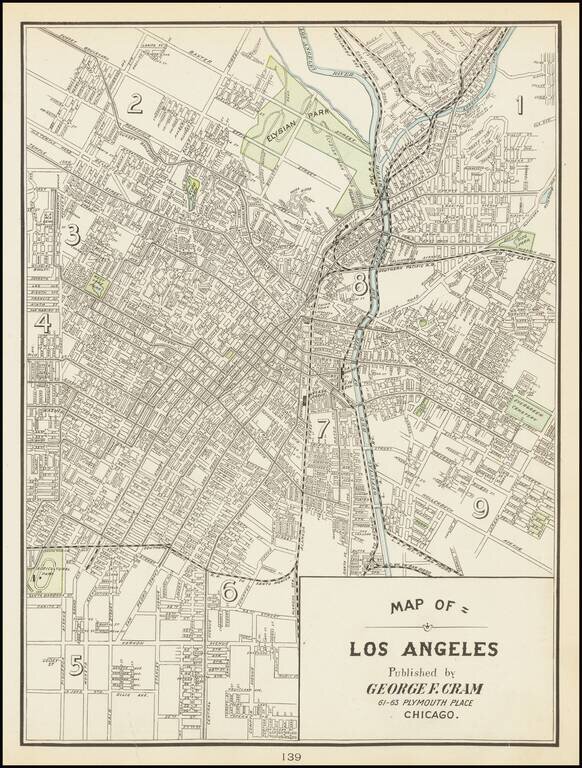
One of the Earliest Obtainable Separately Issued Maps of Los Angeles
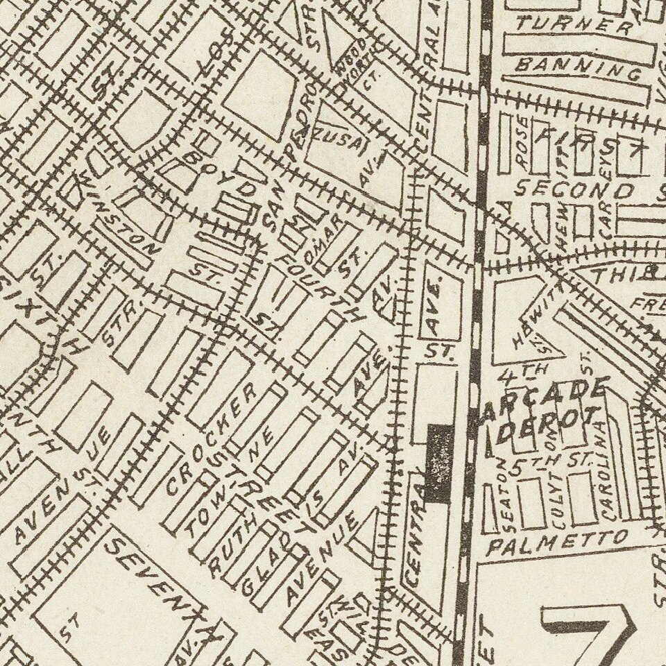
This is the rare Cram map of Los Angeles, showing the city roughly from Echo Park to Alameda. Detail is extensive on this street map, with many roads named in this region. To the north, densest development stops approximately at the Elysian Park, while in the south it stops at a small agricultural park with a track. This is, of course, the future location of the Coliseum, and the University of Southern California had already been founded.
Public transit lines, railways, the Los Angeles River, parks, cemeteries, and more are all visible on this extensive map. Detail is extensive, simple, and attractive.
The population of Los Angels was just over 100,000 at the time this map was made, having boomed since the completion of the railroads in the 1870s and 1880s. The 1892 petroleum boom further helped the city grow, and would soon lead to it being one of the biggest oil producers in the world. The city was rapidly outgrowing its water supply, which would soon lead to one of the most fascinating parts in the city's history, the water wars. Those who sought to "either bring the water to L.A. or bring L.A. to the water" would have used a map very similar to this one in planning their underhanded deeds. China Town can be found just next to the old Ferguson Alley.
George F. Cram (1842-1928), or George Franklin Cram, was an American mapmaker and businessman. During the Civil War, Cram served under General William Tecumseh Sherman and participated in his March to the Sea. His letters of that time are now important sources for historians of the Civil War. In 1867, Cram and his uncle, Rufus Blanchard, began the company known by their names in Evanston, Illinois.
Two years later, Cram became sole proprietor and the company was henceforth known as George F. Cram Co. Specializing in atlases, Cram was one of the first American companies to publish a world atlas. One of their most famous products was the Unrivaled Atlas of the World, in print from the 1880s to the 1950s.
Cram died in 1928, seven years after he had merged the business with that of a customer, E.A. Peterson. The new company still bore Cram’s name. Four years later, the Cram Company began to make globes, a branch of the business that would continue until 2012, when the company ceased to operate. For the final several decades of the company’s existence it was controlled by the Douthit family, who sold it just before the company was shuttered.
If you are a student, write to us in telegram: @antiquemaps and indicate what material you need and for what work you need a map in high detail. We are ready to provide material on special terms. For students only!