Map size in jpg-format: 20.3131MiB
Click to open in high resolution (open in new tab).
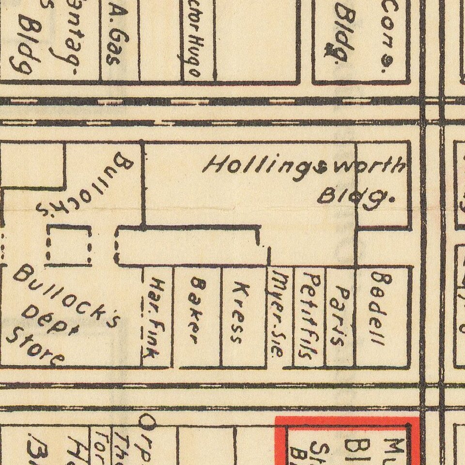
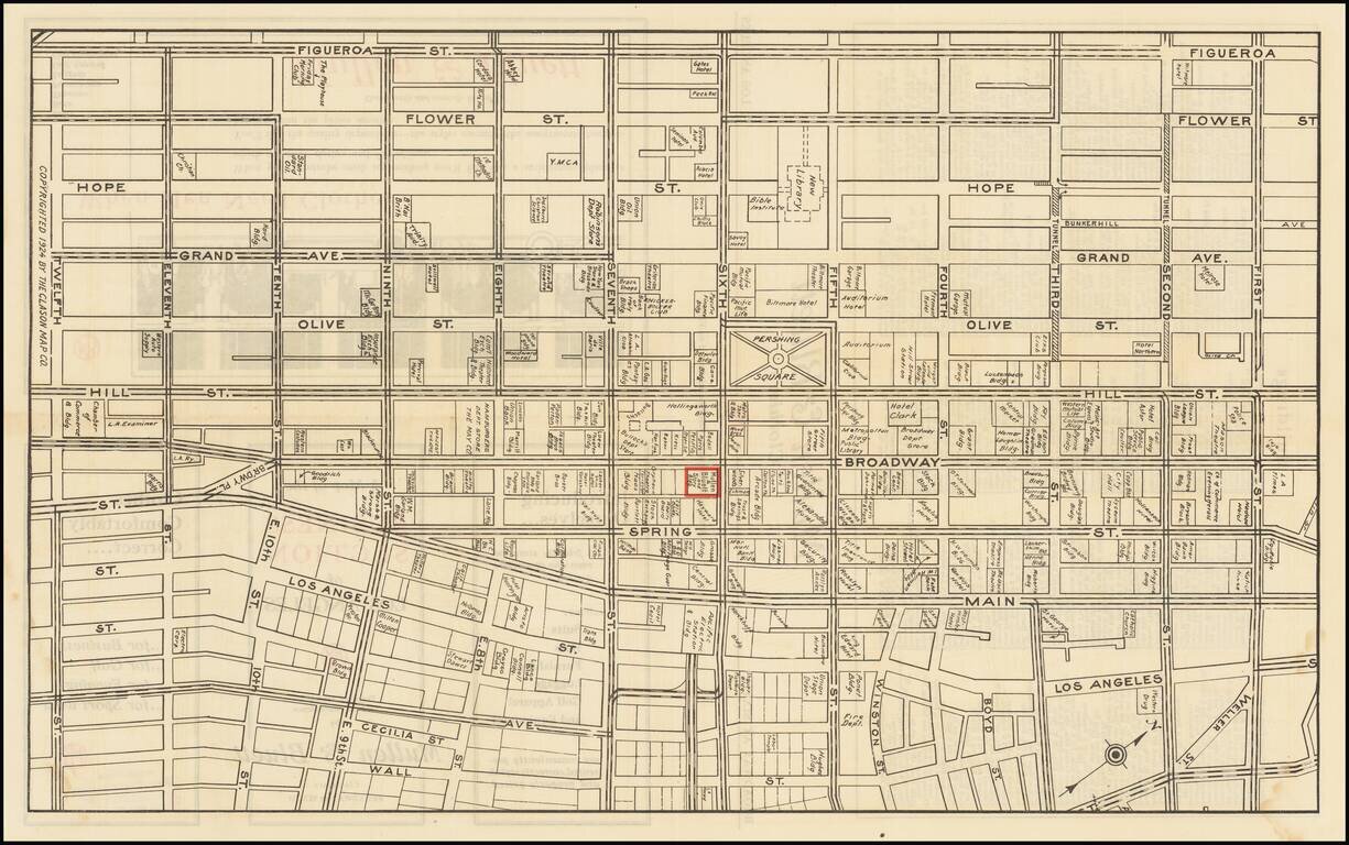
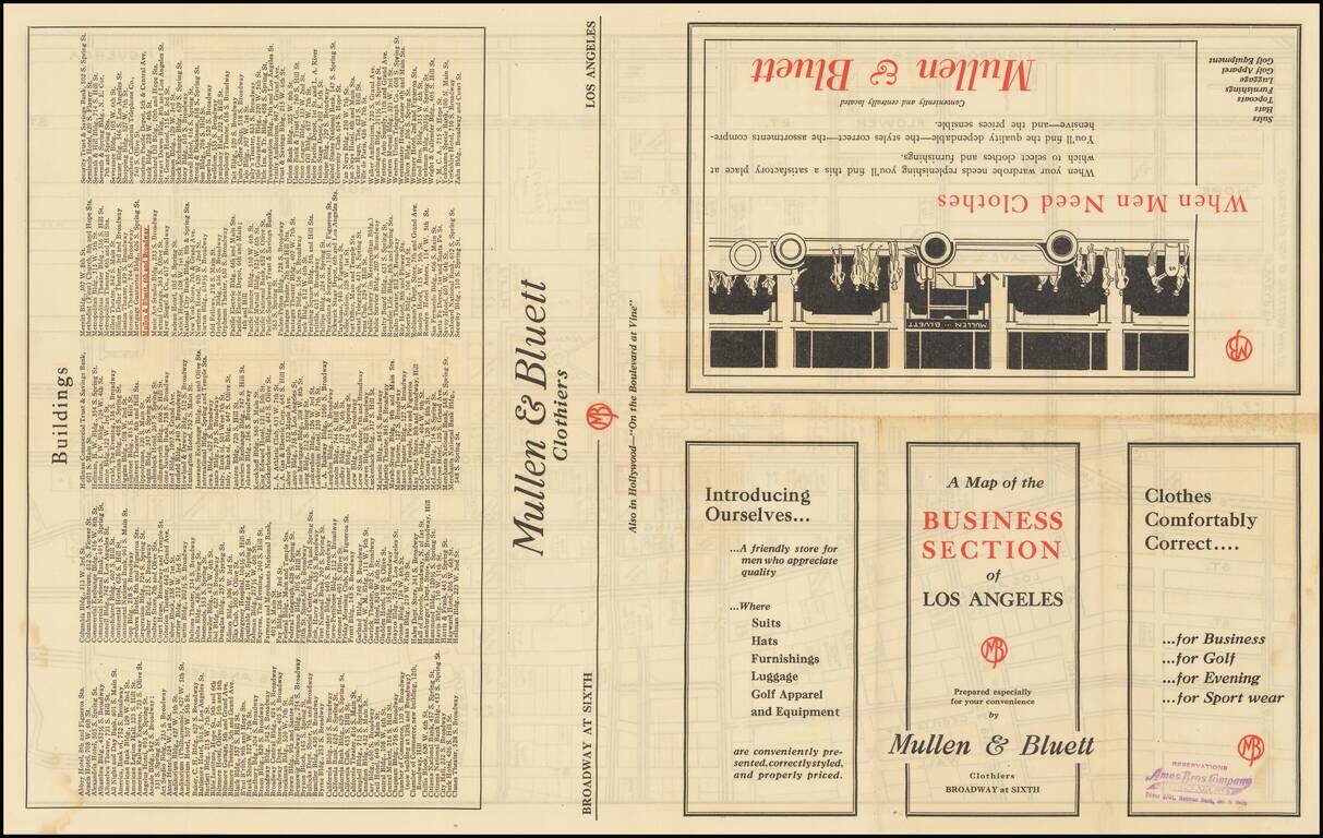
Detailed map of downtown Los Angeles in 1924, featuring building-level detail and an extensive enumeration of businesses in the area.
The map is roughly bounded by Figueroa on the west, Wall Street on the east, First Street in the north, and Twelfth in the south. Pershing Square is at the center of the map.
This example was issued as a promotion for Mullen & Bluett men's clothing department store, which is highlighted in red on the map. The only other example that we have seen (at the Los Angeles Public Library) was also made for Mullen & Bluett.
Interestingly, the map shows the footprint of the Los Angeles Central Library, which was built in 1926.
If you are a student, write to us in telegram: @antiquemaps and indicate what material you need and for what work you need a map in high detail. We are ready to provide material on special terms. For students only!