![[Europe, Mediterranean, Asia Minor and the Persian Empire]](/map/small/43558.jpg)
Fascinating early map of Europe, the Mediterranean, Asia Minor and part of Persia. The map utilizes a stippled style of oceans most commonly used at the end of the 16th Century by Dutch mapmakers, such as Jodocus Hondius. Unusual projection of the...

Striking map of the German Empire, including the Low Countries, Switzerland, Austria, and part of the Balkans prepared by Johan Baptiste Vrients for the very late editions of Ortelius' Theatrum Orbis Terrarum, the first modern atlas of the world. The...
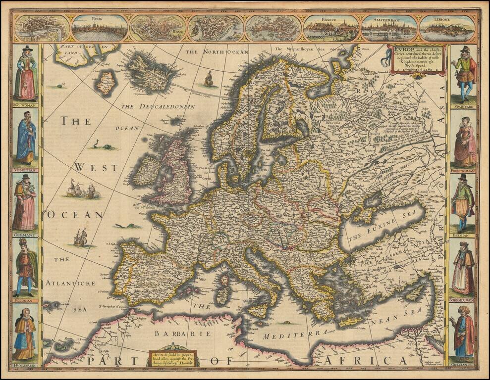
Speed’s Stylish, Striking Map of Europe Fine, decorative example of the 1626 George Humble edition of Speed's notable map of Europe. This map was featured in the first atlas of the world published by an Englishman, Prospect of the Most Famous Parts...

Decorative map of the region around Hirschfelt, along the Fuld River and environs. Nice full color.

Nice example of Blaeu's map of Rugia, including large decorative cartouche, compass rose, sailing ships, sea monster and 30 coats of arms.
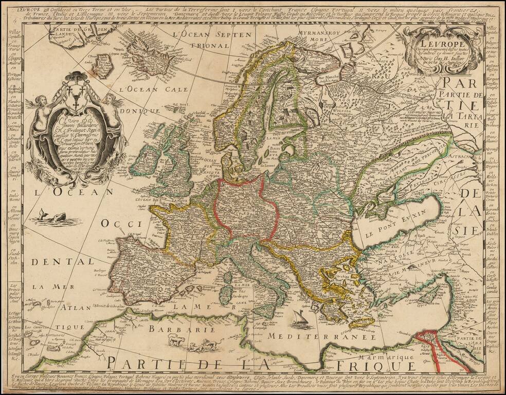
Rare map of Europe, one of the earliest maps to bear the imprint of Alexis Hubert Jaillot. The map also bears the name of Jaillot's predecessor, Nicolas Berey, in the dedicatory cartouche.


"A scientific and artistic document of the first order" -- One of the most important sea charts of the 17th century. Exceptionally rare Johannes Loots issue of Guillaume Blaeu's landmark sea chart of the Atlantic Ocean, America and Africa, printed on...
Superb Original Hand-Color Example. Striking large format map of Europe, by Jaillot, published in Amsterdam circa 1696 by Pierre Mortier. The map extends as far east as Ural Mountains and west to Iceland. Interestingly, the prime meridian is shown...

Handsome hand-colored map of Europe, based on the geography of the French master cartographer Nicolas Sanson. The map comes from the Atlas Contractus sive Mapparum Geographicarum Sansoniarum, a semi-stable composite atlas published by Valk &...

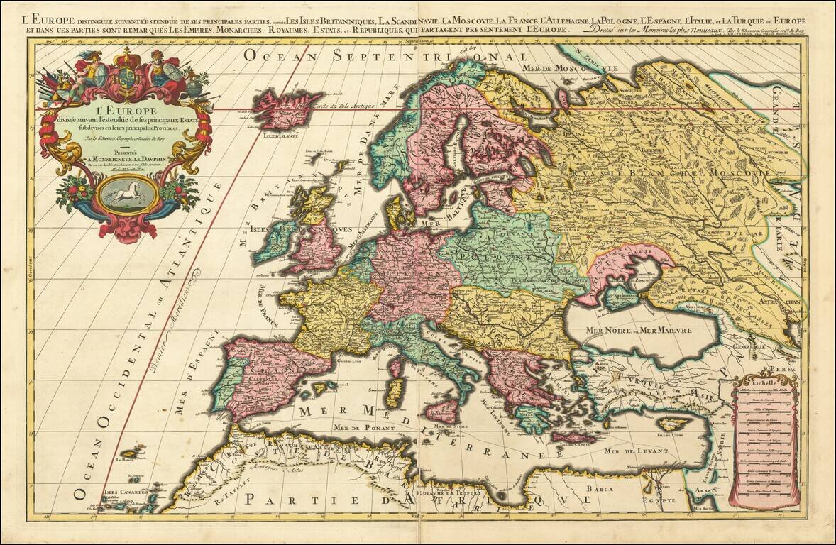
Prepared To Educate A Future King Decorative map of Europe at the beginning of the 18th Century. This map was part of an atlas dedicated to the Duke of Glocester, who was then attending school in Oxford.

Decorative map of the Black Sea Region, with a large decorative cartouche surmounted by the Russian Imperial Coat of Arms. The map extends north to Moscow and Smolensk from Constantinople in the south.

Decorative regional map of eastern Germany. Major cities include Leipzig and Halle.
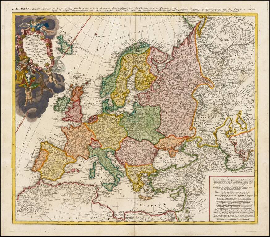
Decorative map of Europe, based upon Haase's stereographic horizontal projection, which was featured in his book on cartographic methodology. The map is hand colored by country, showing cities, towns, rivers, mtns, lakes, etc. Large decorative...

This is a scarce map encompassing Poland and parts of the grater Baltic Region, Russian, and Ukraine. The map extends from the Gulf of Riga to the Black Sea at the mouth of the Dniepr. The map includes an attractive cartouche. This is only the second...
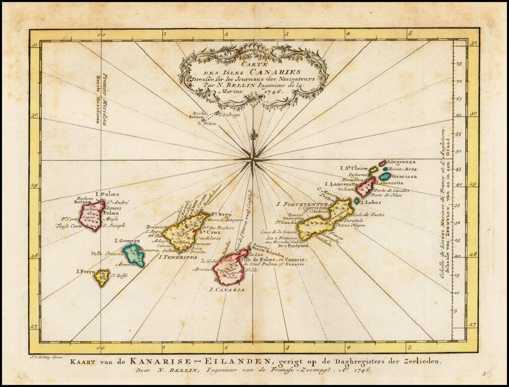
Detailed map of the Canary Islands, originally issued by Bellin and reissued in Dutch in 1770. Nice Cartouche and Compass Rose.