Map size in jpg-format: 3.35877MiB
Click to open in high resolution (open in new tab).
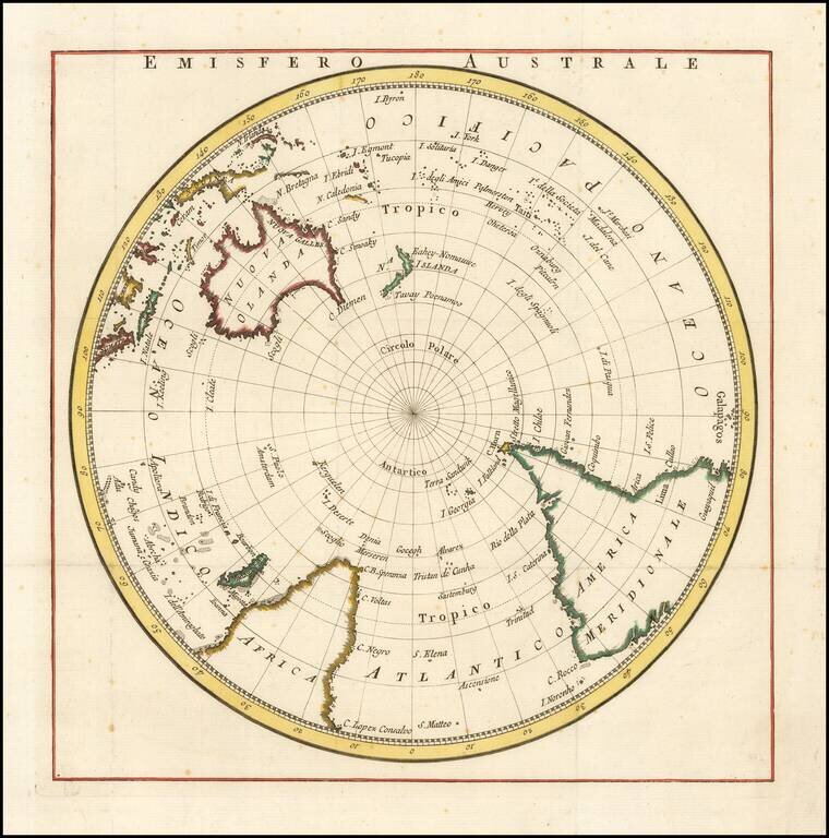
Rare map of the south polar regions, published in Italian,
The map shows the Southern Hemisphere prior to the first discoveries in Antarctica, but shortly after the Voyages of Captain James Cook established a more accurately known coastline for New Zealand.
We found one reference to the map, indicating that that the publisher is La Harpe, and that the work appeared in Compendio della Storia Generale de Viaggi, but have no other information.
If you are a student, write to us in telegram: @antiquemaps and indicate what material you need and for what work you need a map in high detail. We are ready to provide material on special terms. For students only!
![[Eastern Hemisphere Globe Gores] (Nova et integra universi Orbis descriptio)](/map/small/54480.jpg)

