Rare and antique old maps of the North America
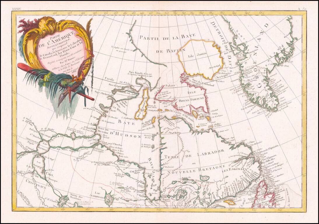
Detailed map of Canada and Hudson's Bay. Includes decorative cartouche and excellent detail throughout. Extends from Lake Winnipeg to the Eastern Seaboard.
![Plan De Louisbourg... [French & Indian War Battle Plan--Louisbourg]](/map/small/57192.jpg)
Rare French & Indian War Battle Plan, showing the fortifications and battles fought at Louisbourg. The key at the bottom of the battle plan explains the various places on the plan. The plans were issued in Les plans de la guerre de sept ans...
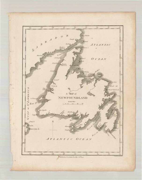
Scarce early map of Newfoundland, which first appeared in Samuel Morse's Universal Geography in 1794.
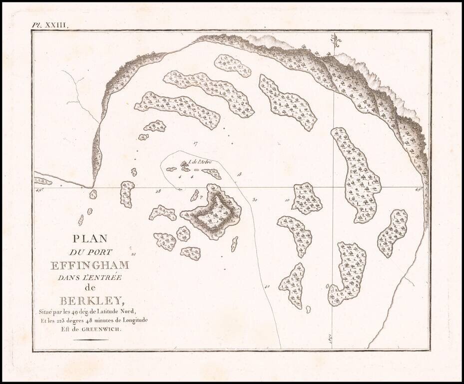
Detailed map of Port Effingham, likely on the present-day Effingham Island, previously known as Village Island in British Columbia, part of the Broken group of islands.
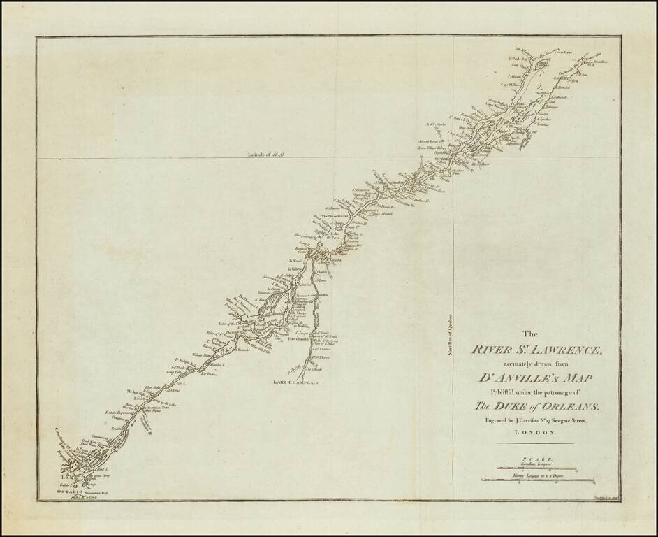
A rare English map of the St. Lawrence River, extending from Lake Ontario and Thousand Islands to just north of Quebec and Orleans Island. The chart shows channels, islands, shoals, waterfalls, rocks, and rapids in the river. Also shows towns, forts...
![[Vancouver Island] Carte Particuliere de la Cote du Nord-Ouest de l'Amerique reconnue par les Fregates Francaises la Boussole et l' Astrolabe en 1786 2e. Feuille.](/map/small/62141.jpg)
Vancouver Island Before Vancouver! Early sea chart of a portion of the west coast of Vancouver Island, centered on Nootka from the epic voyage of the Jean-François de Galaup, Comte de La Pérouse. This fine map embraces the western coast of...
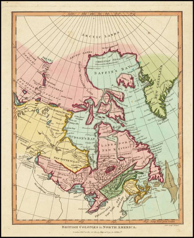
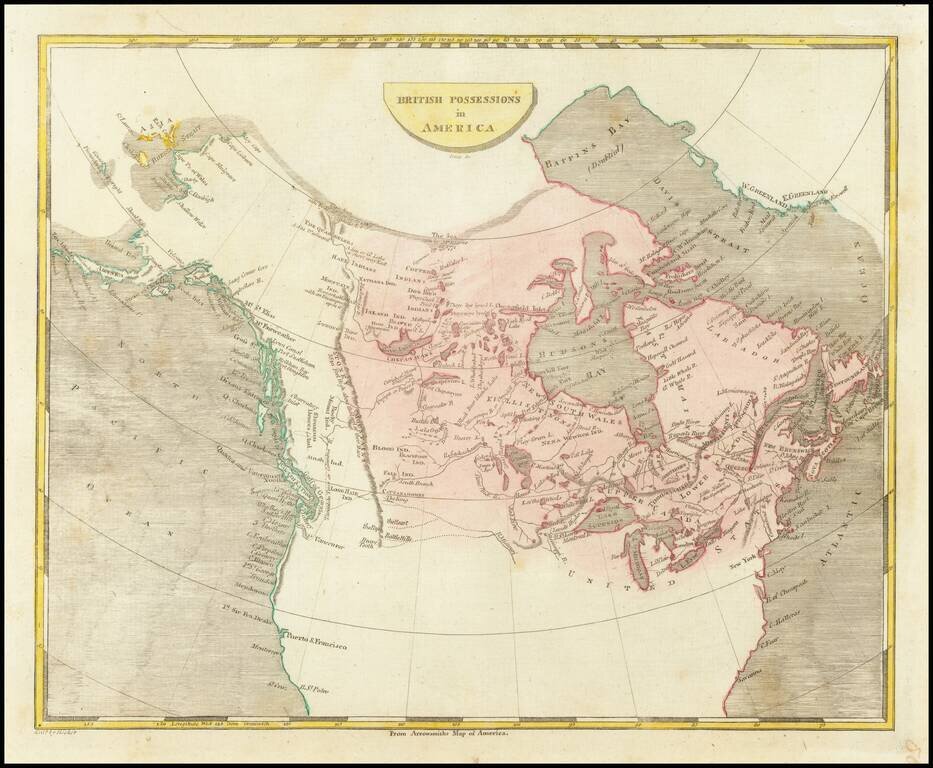
Includes a Reference to New Denmark. This map purports to show the extent of British colonial power in North America, which at present was limited to eastern Canada. The map extends from "New Greenland" to the upper Mississippi. Curious details and...
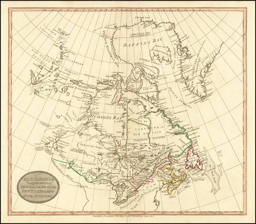
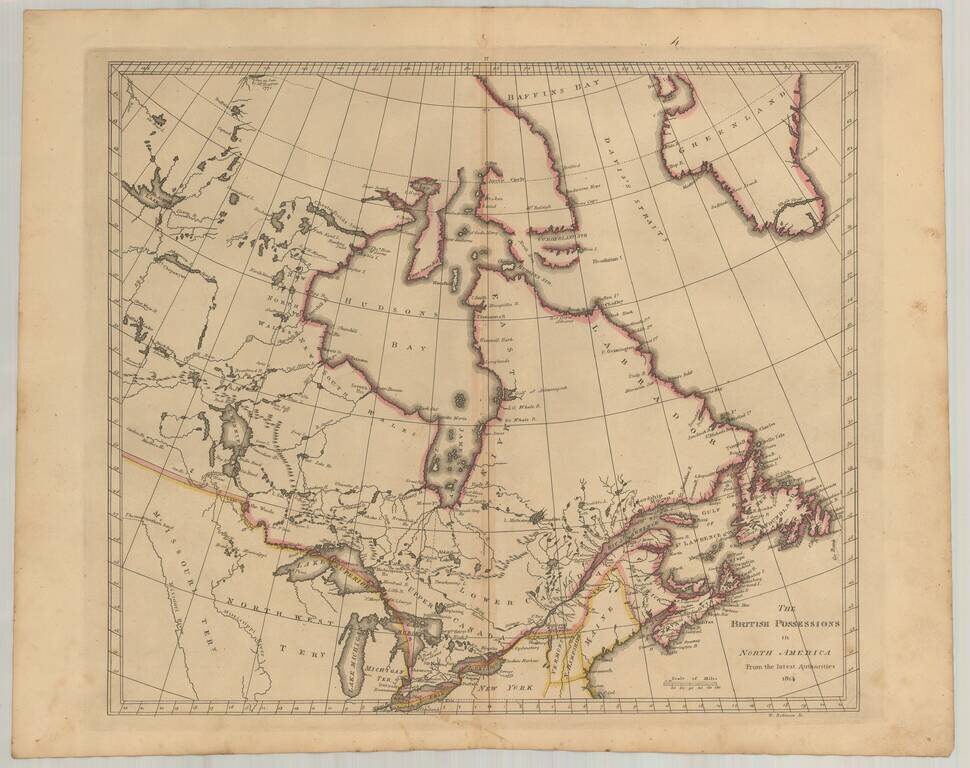
Rare Dublin edition of John Stockdale's map of British America. The map is centered on the Great Lakes and Hudsons Bay. The course of the Mississippi River is quite fascinating, and titled "Miiskoue-sipi or Red R." and a bit further south,...
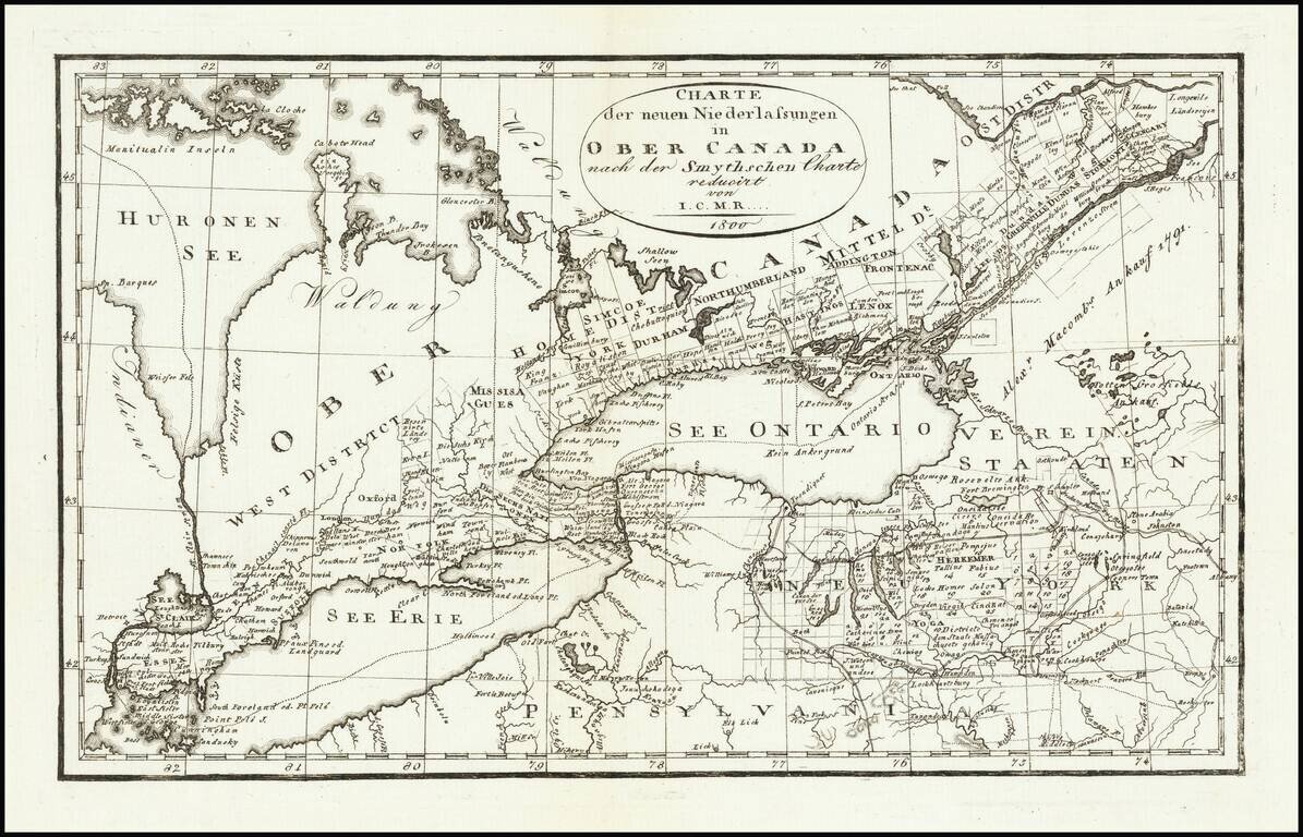
Rare Weimar edition of David William Smyth's map of Ontario. David William Smyth was the province's surveyor general of Canada, who produced A Map of the Province of Upper Canada, describing all the new settlements, townships &c. (London: William...
Scarce engraved map of Canada, published in Philadelphia in 1804. Shows a potential land bridge from Russia to Alaska. Speculates about the existence of the Northwest Passage.
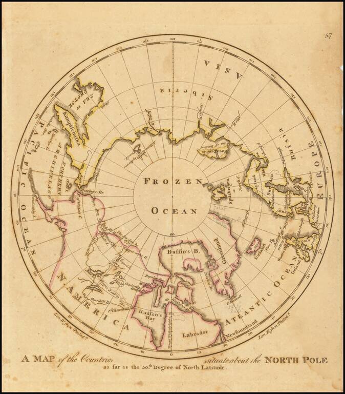
Early American map showing the extent of explorations in the North Pole, with emphasis on the efforts to find a Northwest passage and Hearne's and MacKenzies' routes.

Detailed plan of the Siege of Quebec, illustrating action during the early days of the Seven Years War (French & Indian War). This fascinating map embraces the environs of Quebec City and illustrates the British victory on the Plains of Abraham in...
Early American published map of Canada, New England, the Great Lakes and Old Northwest Territory, from a late edition of Carey's General Atlas. Extends North to Baffin's Bay and the Sea as Seen By Hearne in 1771, West to Slave Lake, Buffalo Lake, Ft....
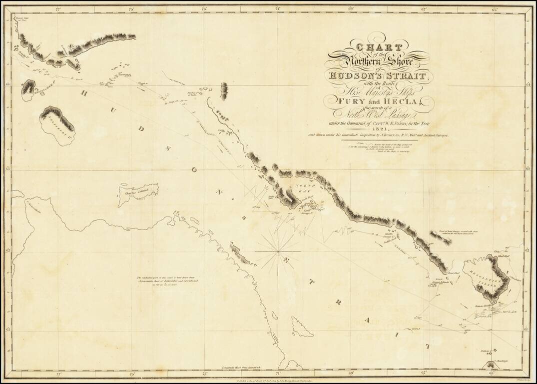
A nice example of Parry's map of Hudson's Strait, showing a portion of his expedtiion in search for the Northwest Passage. Shows Parry's tracts in marvelous detail, including a day by day account of his route and a number of annotations. After...
![Amer. Sep. No. 36 Partie Du Bas Canada [Gulf of St. Lawrence, Isle de Anticosti, District De Gaspe]](/map/small/14185.jpg)
Remarkably detailed map of the mouth of the St. Lawrence, District of Gaspe, Gulf of St. Lawrence Isle de Anticosti and west coast of Newfoundland. Includes coastal soundings. An amazing work and a must for regional collectors. Perhaps the most...
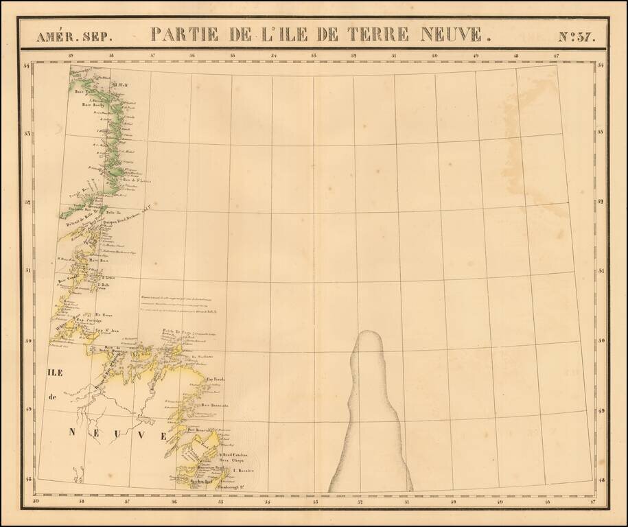
Large format map of Newfoundland, extending from Random Head and Flamborough Head to Wolf Island and Table Bay and centered on White Baie and Belle Ile. From Vandermaelen's remarkable 6 volume atlas, which if combined as globe gores forms an immense...