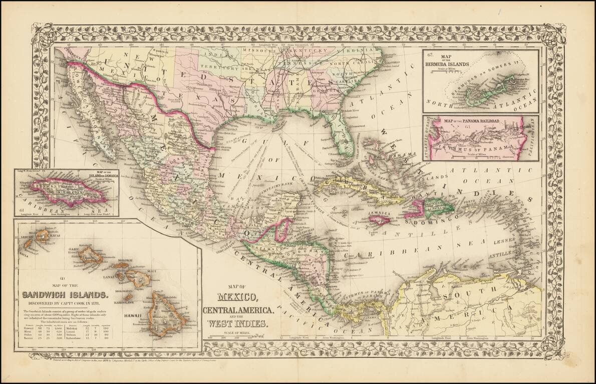
Rare and antique old maps of the North America
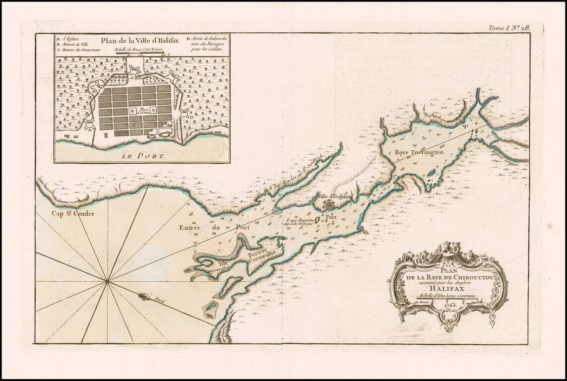
Halifax, Nova Scotia An excellent map of Chibouctou (Beford) Bay and environs, published by Nicolas Bellin in his Petit Atlas Maritime shortly after the conclusion of the Seven Years War. Includes a large plan of the town of Halifax.
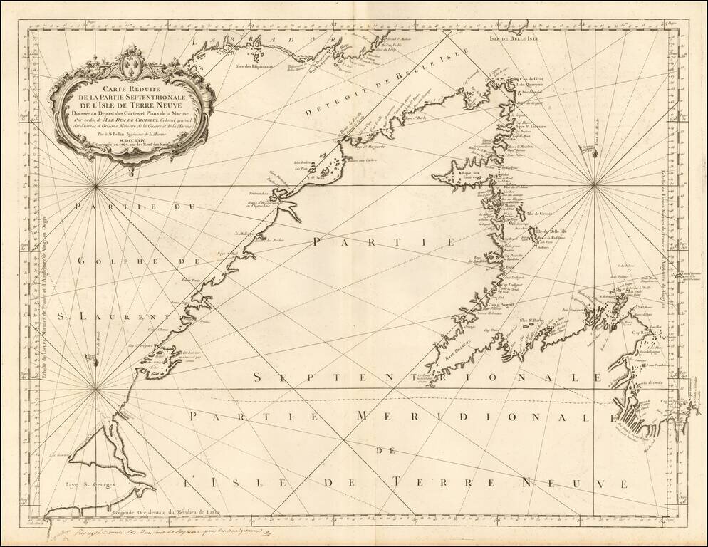
Detailed sea chart of northern part of Newfoundland and the mouth of the St. Lawrence River. The chart was produced by the Depot de la Marine toward the end of the Seven Years War (French & Indian War).
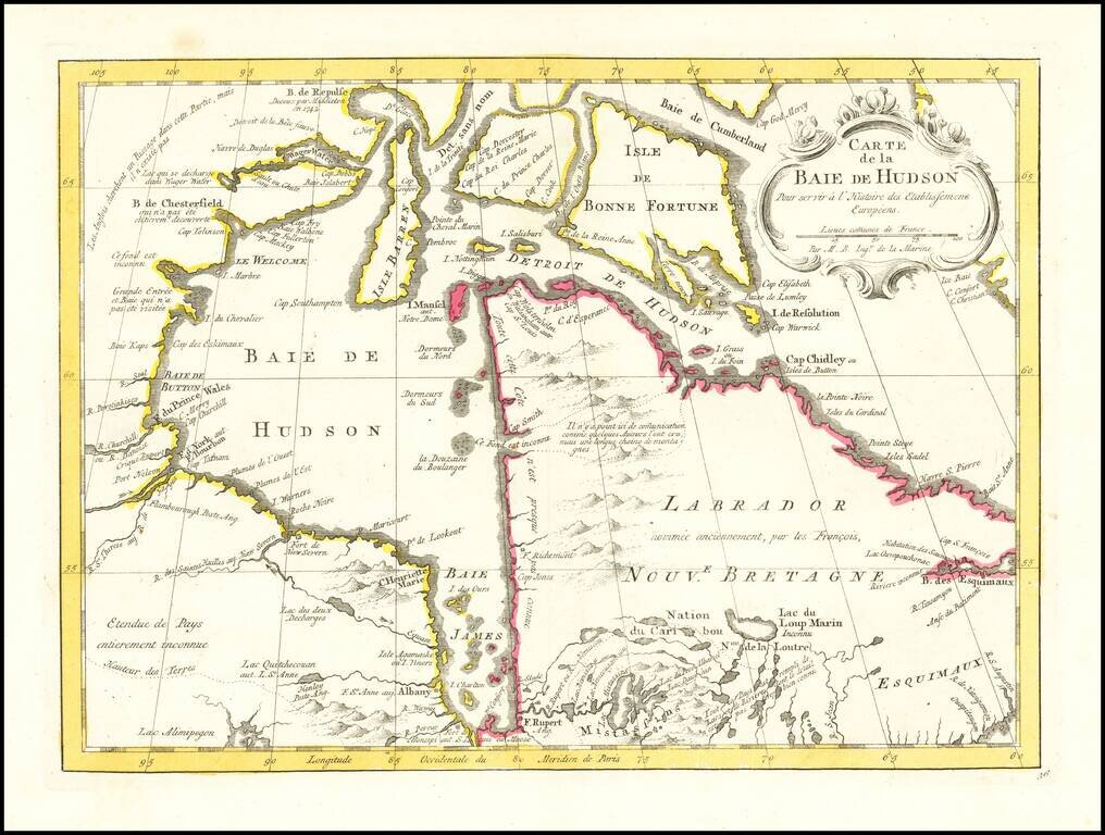
An excellent map of Hudson's Bay, Labrador, Hudson's Straits and neighboring regions from Bellin's Histoire General des Voyages. Includes numerous bays, islands, rivers, mountains and notes regarding explorations.
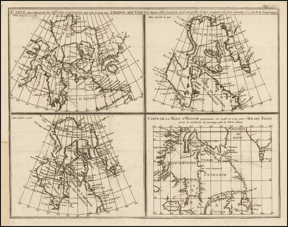
Marvelous set of four maps of the Hudson, Button and Baffin Bay regions, Davis Straits, and the Coast Labrador, as developed and explored between 1650 and 1750. This map was one of ten maps in Diderot's important 10 volume encyclopedia, one of the...
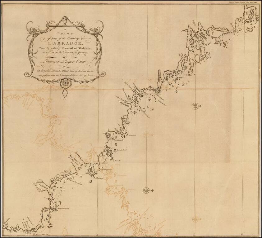
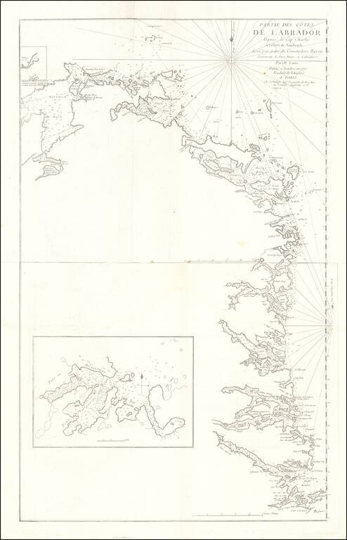
Fine map of the Coast of Labrador, showing the region explored by Roger Curtis, under instructions from Commodore Shuldham in 1773. Admiral Sir Roger Curtis, 1st Baronet, GCB (1746 - 1816) was an officer of the British Royal Navy, who saw action in...
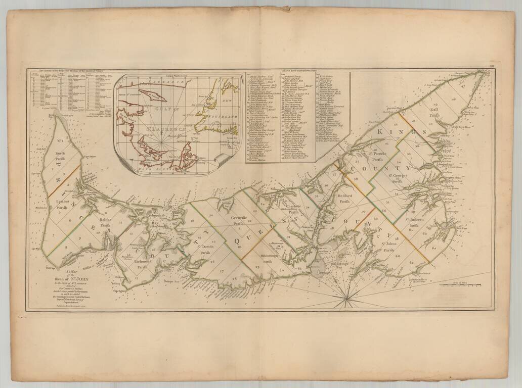
Important early map of St. Johns Island, published by Thomas Jefferys in the American Atlas. The map provides a finely detailed treatment of the island and environs, including a list of 67 lots and the proprietors of each lot, including Samuel Holland...
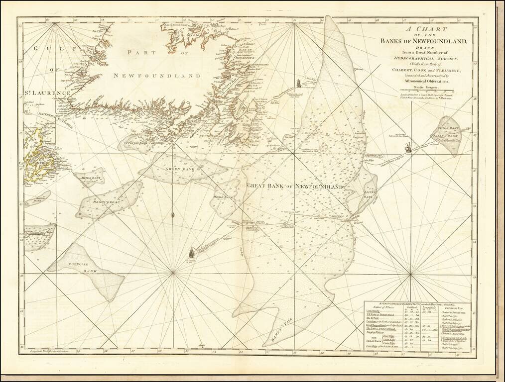
Detailed map of Newfoundland the Grand Banks, published in Jeffery's American Atlas. The map includes three ship illustrations representing the voyages of Chabert, Cook and Fleurieu, inset of astronomical observations on which the chart is based, as...
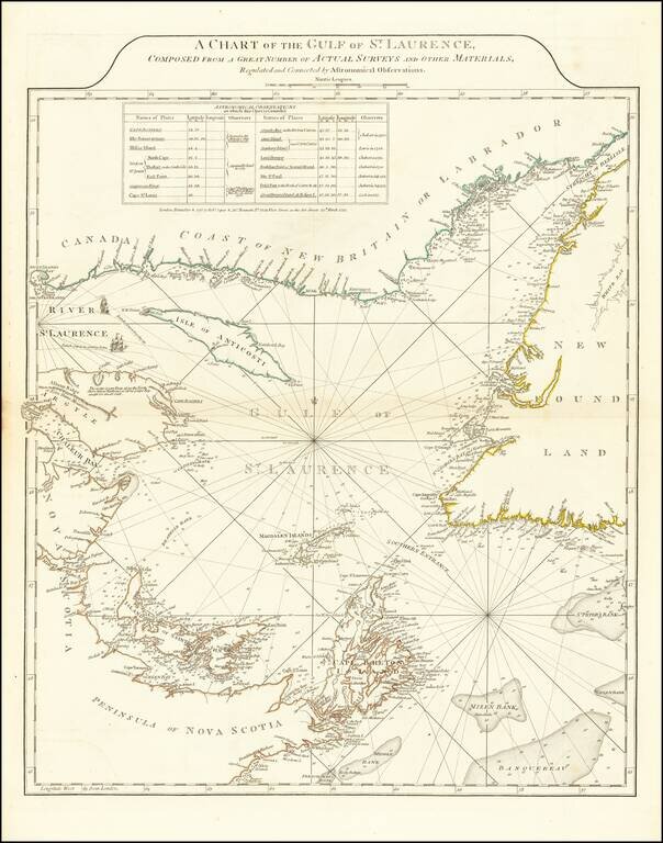
Fine example of Sayer and Bennett's chart of the Gulf of St. Laurence, based on the surveys by James Cook and Michael Lane. At the conclusion of the French and Indian War, the British needed accurate charts of the territories that had been awarded to...
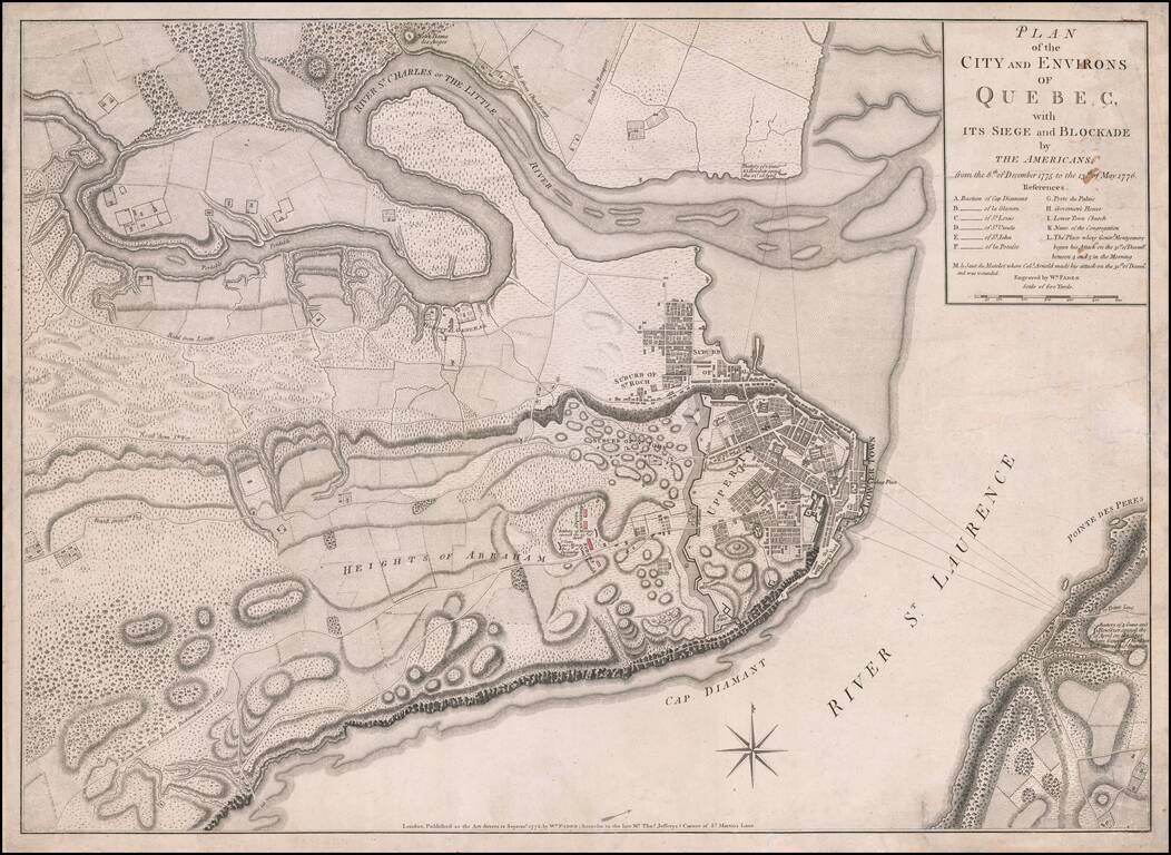
Fine, Detailed, Separately-Issued Plan of the Siege of Quebec (1775-6) Rare, separately-published plan of the Siege of Quebec, published by William Faden in London. The plan shows a pivotal early moment in the American Revolution and highlights the...
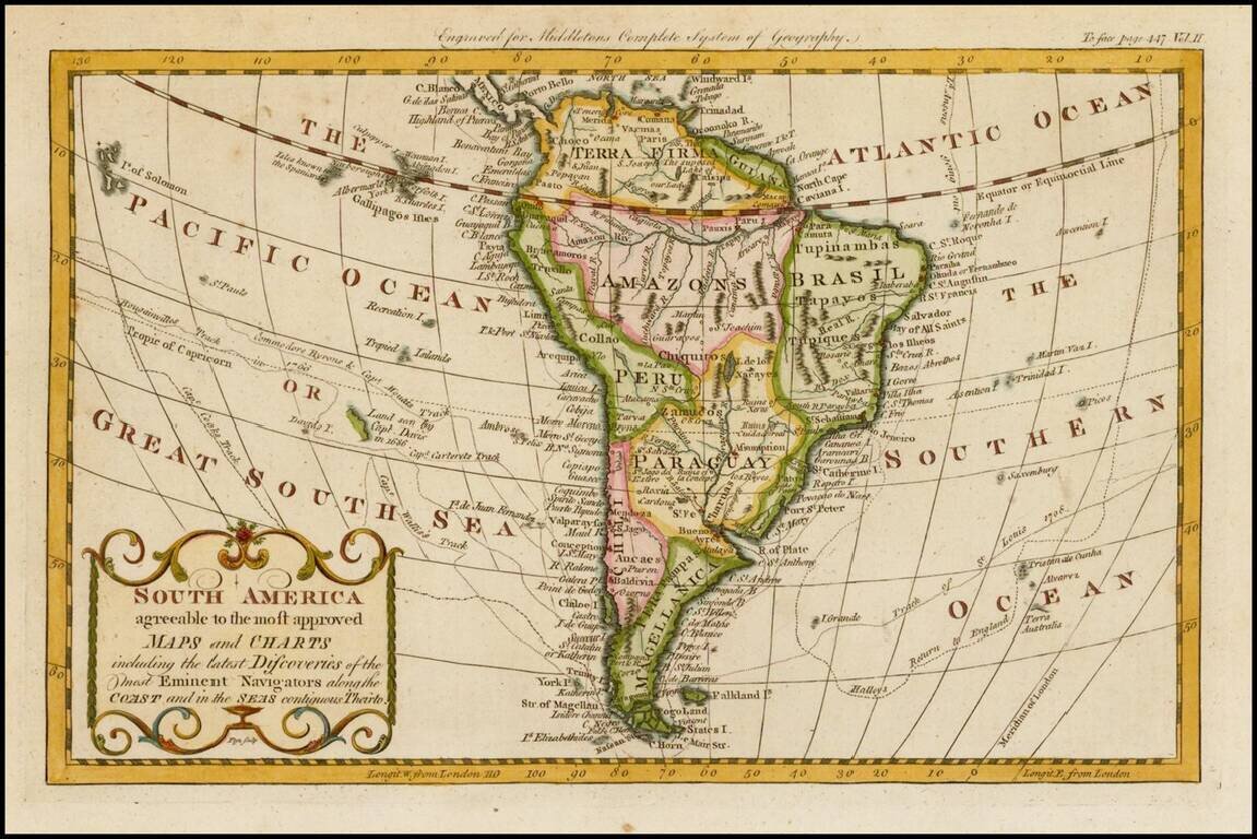
Detailed map of South America, published in London by Middleton. The map shows the exploration tracks of a number of major voyages of exploration, including: James Cook Sir Edmund Halley Philip Carteret Samuel Wallis John Byron Louis Antoine de...
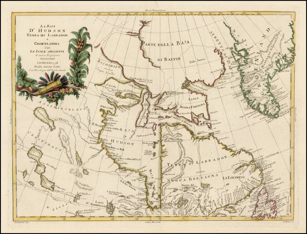
Striking map of Hudson Bay, Baffin Bay, part of Greenland, Labrador and Northern Canada. Marvelous detail on the islands and coastlines, known and unknown. Issued as part of Zatta's Atlante Novissimo, one of the last great decorative atlases.
Rare French edition Jefferey's 2-sheet map of part of Labrador, which appeared in Le Rouge's Pilot Americain Septentrionale. Includes extensive soundings, sailing directions, rhumb lines and many other fine details. The chart was included in Le...
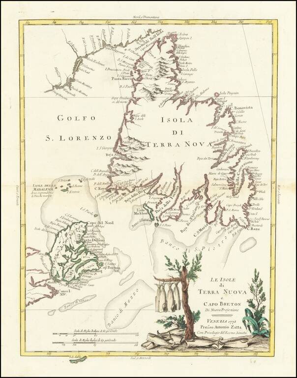
Gorgeous separate map of Newfoundland and Cape Breton Island, along with neighboring Islands, including St. Pierre Michelon. Antonio Zatta was a leading European cartographer and publisher, and his Atlante Novissimo was one of the most beautifully...
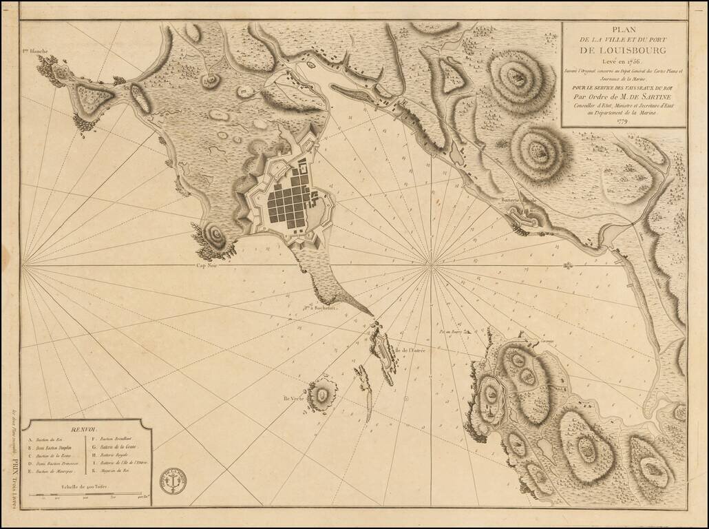
Plan of Louisbourg in 1779 Detailed plan of the town and port of Louisbourg, oriented with west at the top, made by order of the French Depot de la Marine, during the American Revolution. The plan was originally made 2 years prior to the Siege of...
![[East Coast of Prince Edward Island - Rollo Bay to Wood Islands]](/map/small/62849.jpg)
Rare chart of the East Coast of Prince Edward Island, centered on Cardigan Bay and Panmure Island. St. John's Island (Isle of St. John) was renamed Prince Edward Island in 1798, after Edward, Duke of Kent. This fine chart appeared in the Atlantic...
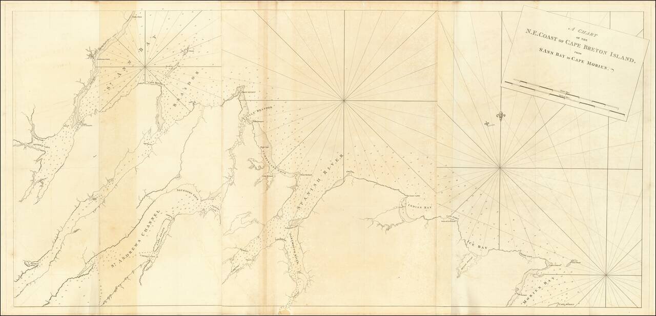
Rare chart of the North East Coast of Cape Breton, from Morien Bay to St Anne's Bay. This fine chart appeared in the Atlantic Neptune by Captain Joseph Frederick Wallet des Barres. The Atlantic Neptune was remarkable, multi-volume set of sea charts...