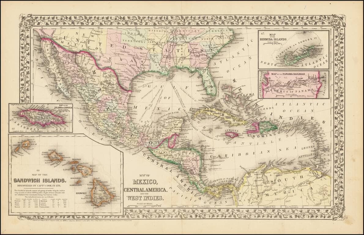
Rare and antique old maps of the North America
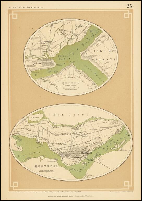
A rare map of Quebec and Montreal, from Rogers & Johnston's Atlas of the United States. The map shows the layout of the two cities including streets, neighborhoods, and other major features. Both cities are mapped on a large scale, showing towns...
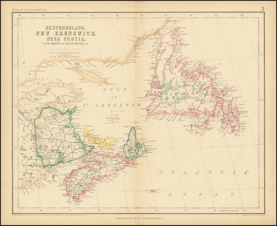
A rare antique map of eastern Canada from Rogers & Johnston's Atlas of the United States, one of the most attractive American atlases of the 19th century. This atlas was an unusual collaboration between an American, Englishman, and Scot. The map is...
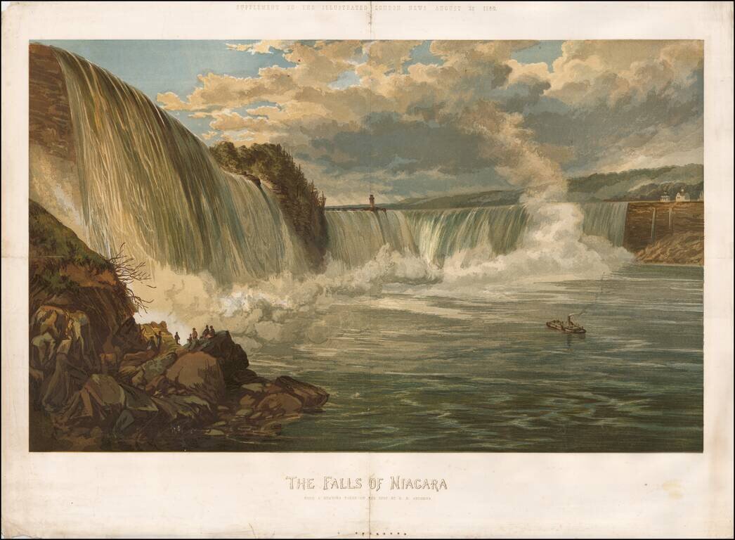
Rare color chromolithograph of Niagara Falls, with a small steamship in the center and several buildings visible at the top of the falls. The image was issued as a supplement to the Illustrated London News on August 25, 1860.
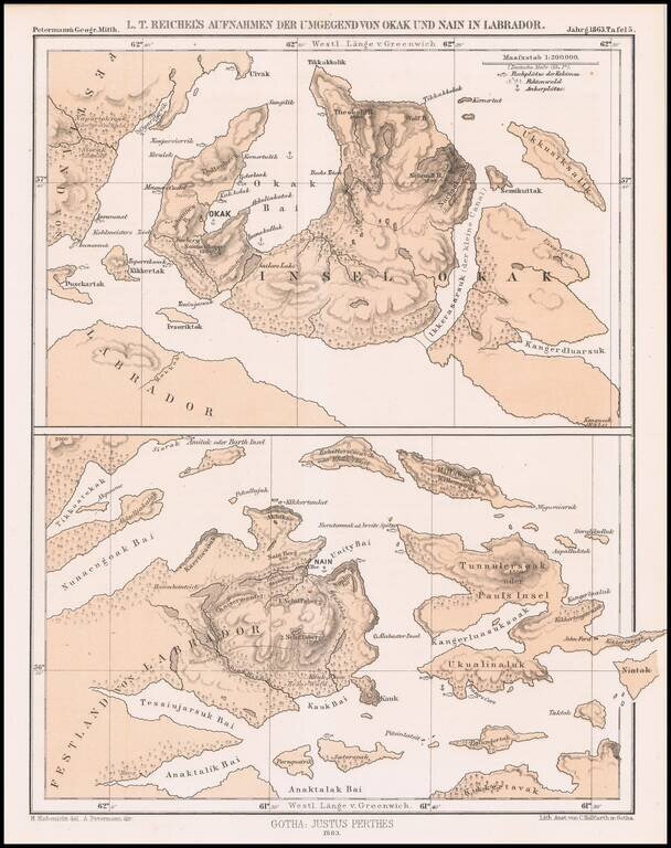
Detailed map of a portion of Labrador, published by Augustus Peterman. Includes Petermann's report on the region.
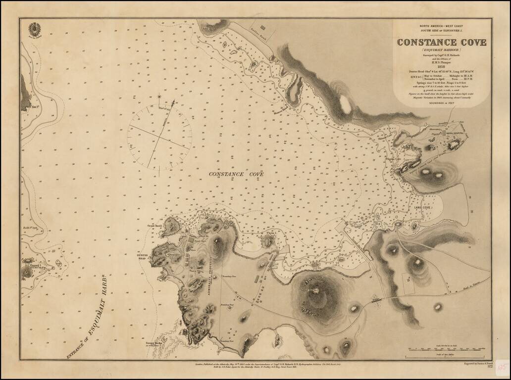
Surveyed For The New Headquarters of the British Navy's Pacific Fleet Rare British Admiralty Chart of Constance Cove, Esquimalt Harbour, home to the British Royal Navy's Pacific Fleet beginning in 1865 and thereafter the Canadian Royal Navy. This is...
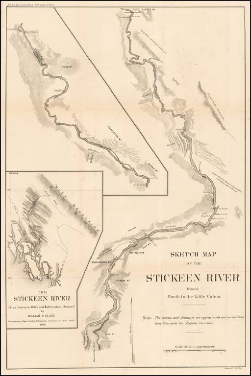
Finely detailed map of the Stikine River, based upon an expedition led by Mineralogist William Phipps Blake in 1863. The map was drawn to accompany the report of W.H. Seward, shortly after the acquisition of Alaska by the United States in 1867. The...
![[Vancouver] Fraser River and Burrard Inlet](/map/small/68029.jpg)
Attractive Chart Showing a Nascent City of Vancouver This is a navigational chart of the area around the Burrard Inlet on the Salish sea. The map extends inland along the Fraser River inland to Pitt Lake. Navigational detail on the map is extensive,...
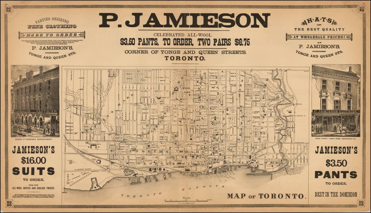
Rare double page map of Toronto, lithographed by Ralph Smith & Co. and published by Frederick B. Miles in Toronto. The map shows Toronto at a relatively early date. Streets are named, public squares, parks and buildings identified and wards...
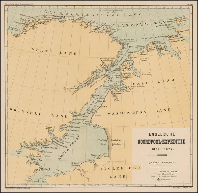
Detailed map illustrating the British Arctic Expedition of 1875-1876. The British Arctic Expedition of 1875-1876, led by Sir George Strong Nares, was sent by the British Admiralty to attempt to reach the North Pole via Smith Sound. Two ships, HMS...
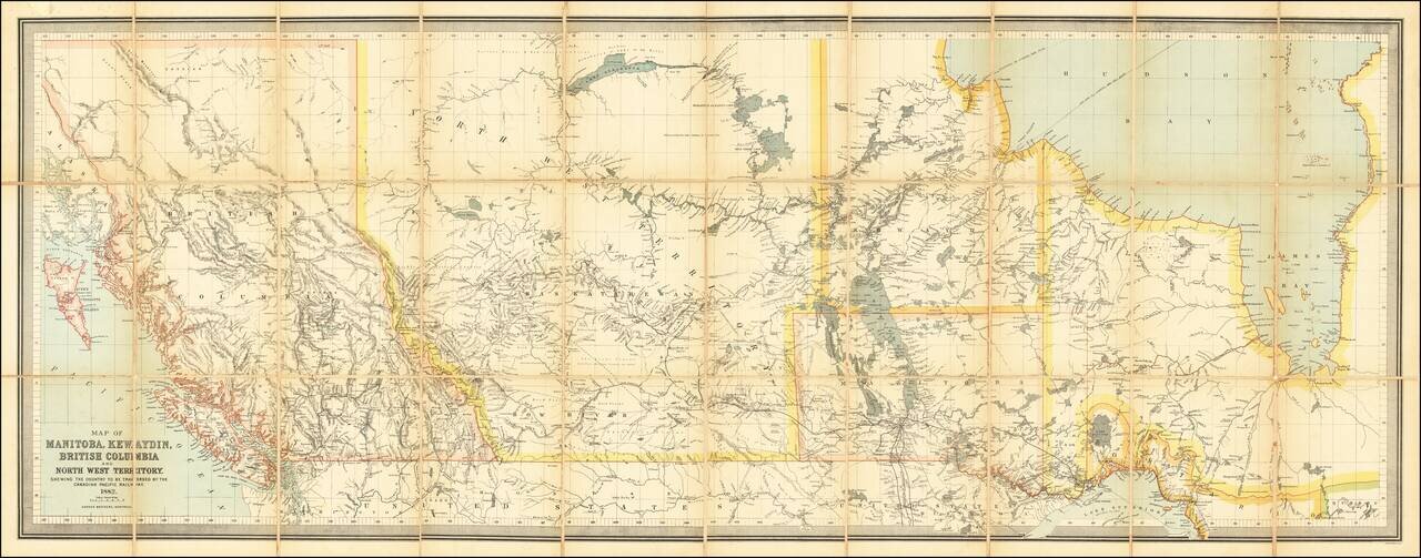
Impressive Canadian Railroad Map Showing the Proposed - But Never Realized - Province of Kewaydin. Color-lithographed antique folding map of Canada west of Ontario, published in Montreal in 1882 by the Dawson Brothers. The map features the Province...
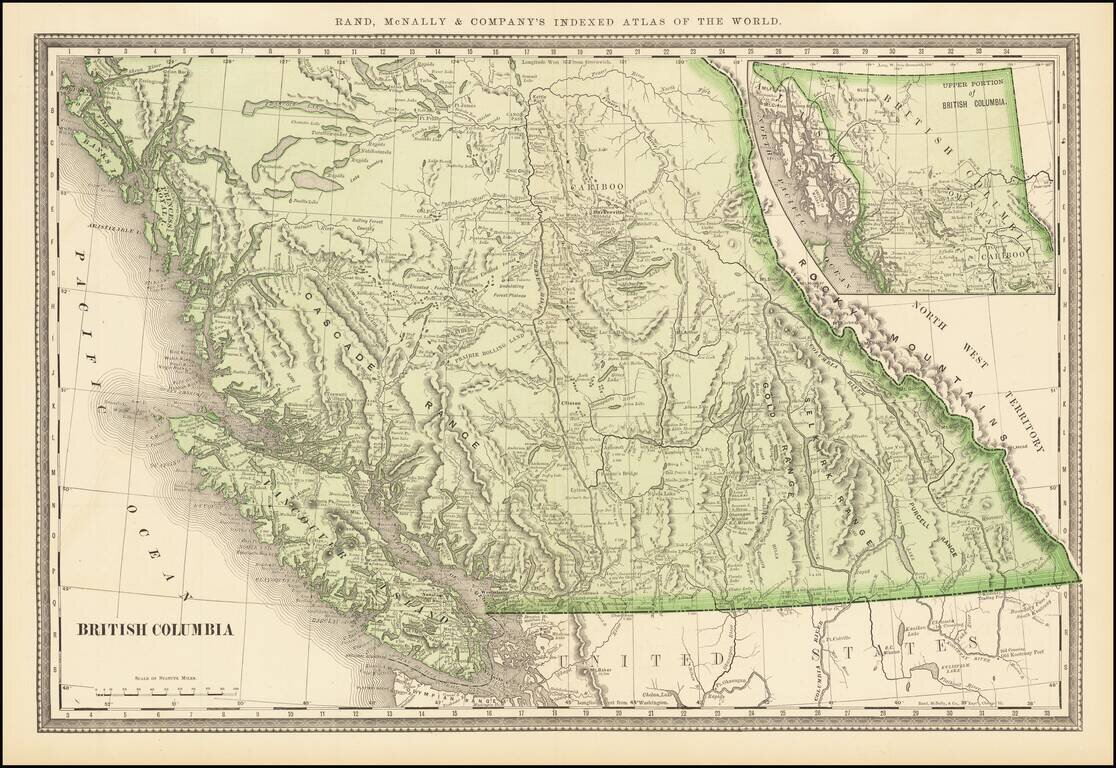
Highly detailed large format map of British Columbia from an early edition of Rand McNally's Indexed Atlas of the World. Exceptional detail. Includes towns, mountains, rivers, lakes, elevations, points, inlets, bays and many other details.
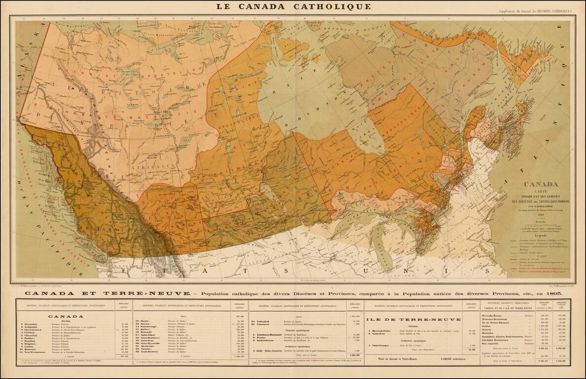
Rare separately issued map of Canada depicting the nature and organization of the Roman Catholic population, published as a supplement to the Journal les Missions Catholiques, in Paris. The map focuses on the various Roman Catholic Dioceses in Canada,...
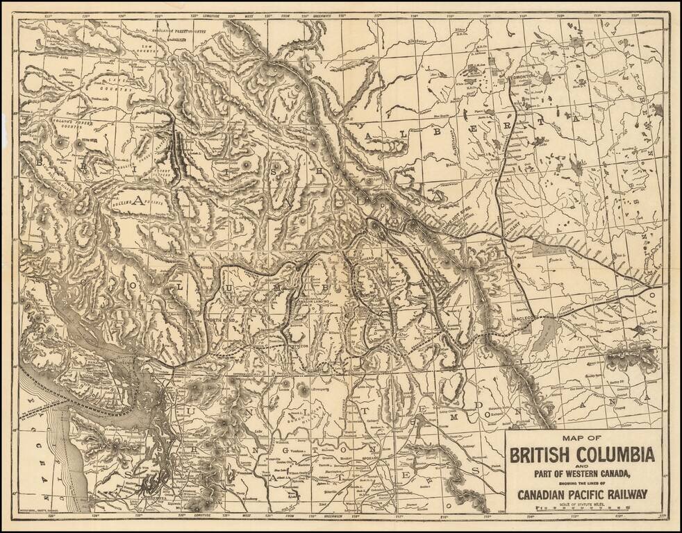
Rare map of the Canadian Pacific Railway, tracking the route of the lines between Medicine Hat and Dunimore to New Westminster and Vancouver. The map shows the region from Vancouver Island East to the Alberta-Saskatchewan border. Also includes some of...
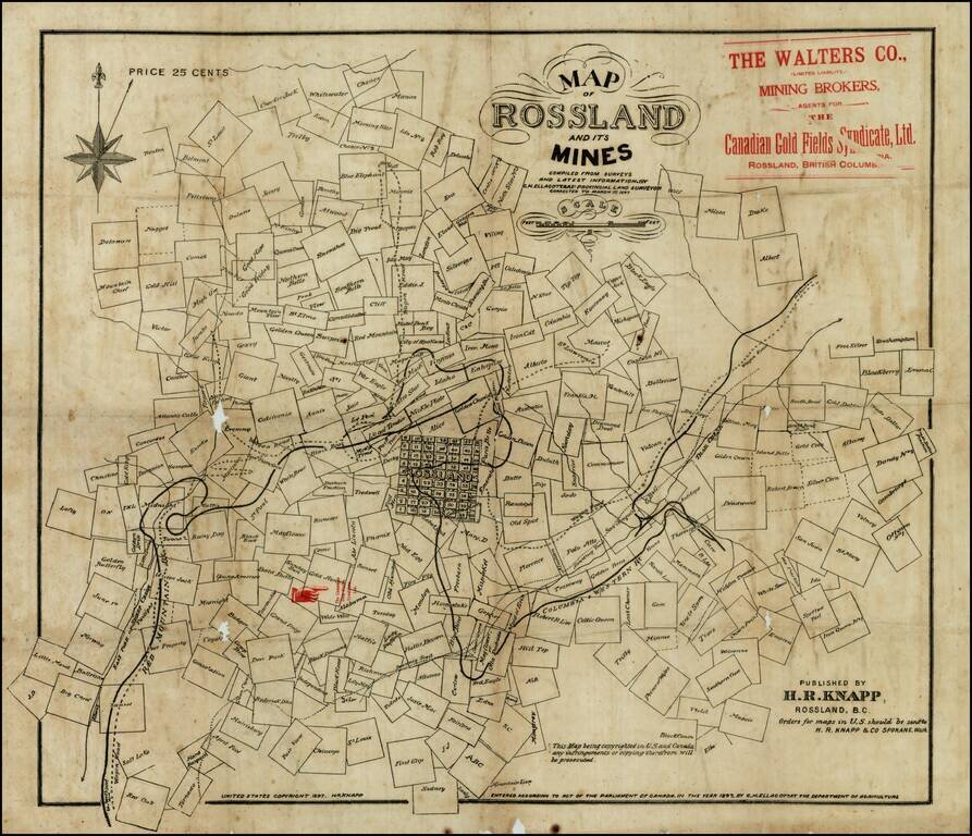
Rare early map of Rossland, British Columbia, in the Kootenay District, in the year of the great Rossland Gold Rush. The present map shows Rossland at the beginning of its boom period, during which time it would become one of the largest cities in...
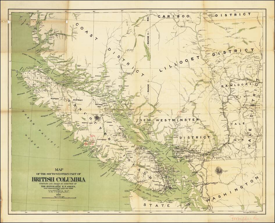
With Annotations By An Early Logging Concern? Important early Map of Southwestern British Columbia, published by the Department of Lands and Works. The map which depicts the relative locations of various Land Districts and Divisions in south-west...
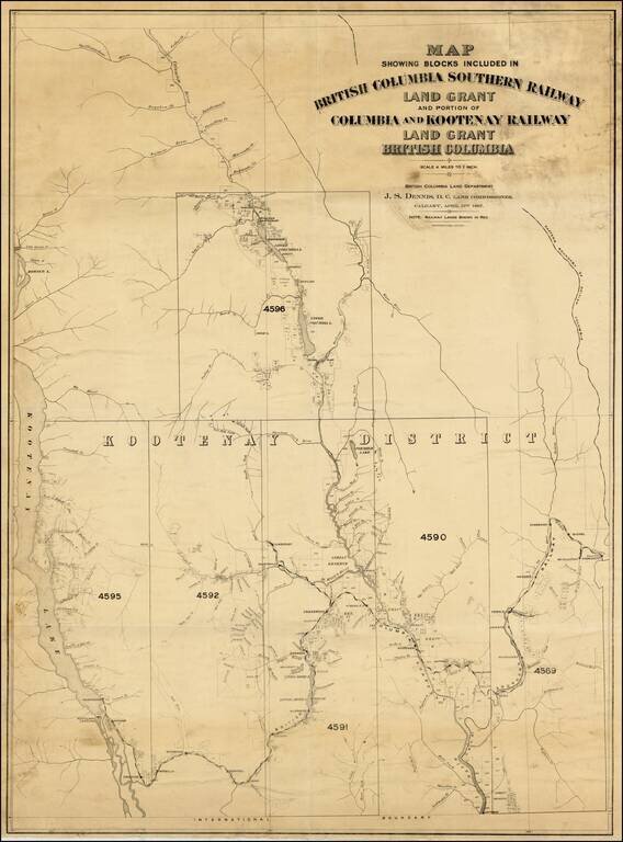
A very rare map with great importance to the historical development of the Kootenay Region of British Columbia. This map embraces the southeastern portion of British Columbia as far westward as Kootenay Lake, and charts the route of the British...