Rare and antique old maps of the North America
![[Encampment of De La Barre on Lac Frontenac]](/map/small/70174.jpg)
Important Early French Fur Trading Post. Interesting engraving depicting the Encampment of Joseph-Antoine le Fèbvre de La Barre. La Barre (1622-1688) was the Governor of New France from 1682 to 1685. Having replaced the frustrated Comte de...
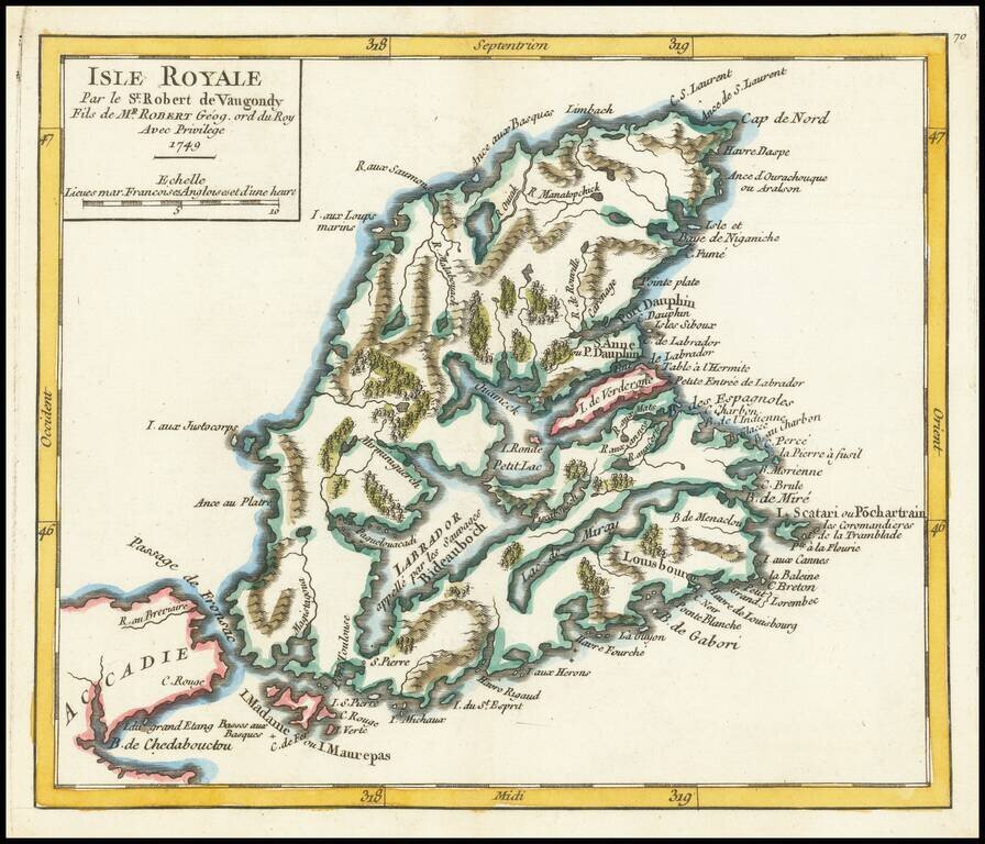
Detailed map of Isle Royale (Cape Breton Island) and contiguous regions, from De Vaugondy's Atlas Portatif.
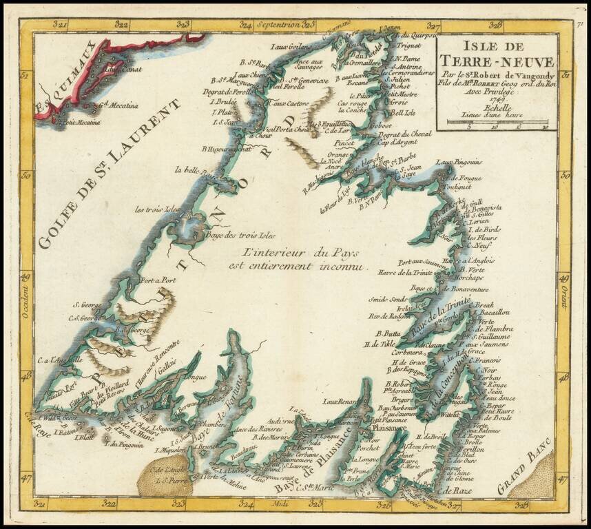
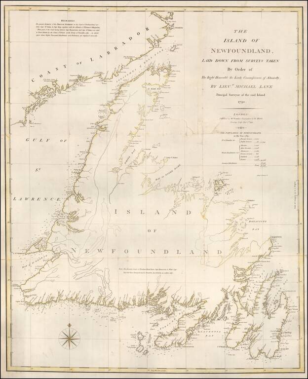
Detailed map of the island of Newfoundland, from De Vaugondy's Atlas Portatif.
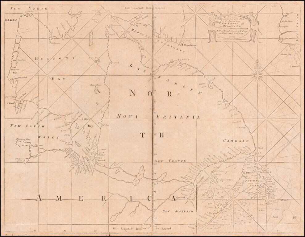
A Fine Mount & Page edition of John Thornton's important sea chart of Hudson's Bay and Eastern Canada. This fascinating sea chart embraces all of eastern Canada, from the southern part of Baffin Island down to include the Canadian Maritimes,...
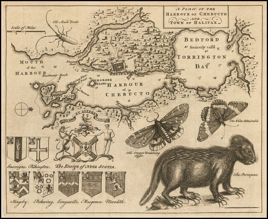
Popular engraved map of Halifax featuring a remarkable depiction of a porcupine in the lower right of the image. This map, which was published in the Gentleman's Magazine in 1750, has long been sought after by collectors for its curious natural...
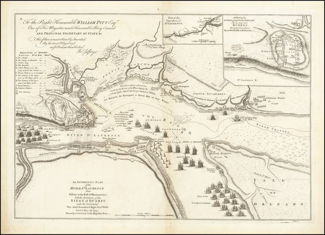
Battle Plan of the Siege of Quebec Striking example of the first State of Jefferys' map of the siege of Quebec of 1759, widely considered to be the most important single printed military map in Canadian history. Drawn by an officer of the Royal Navy,...
Rare separately issued chart of Newfoundland, published in London by William Faden in 1791. Faden's chart covers the entire island of Newfoundland along with a portion of the coast of Labrador bordering the Gulf of St. Lawrence. There is fine detail...
Rare Revolutionary War battle plan of Quebec City, from Charles Smith's Monthly Military Repository, the first map of Quebec printed in the United States. This rare engraving from Charles Smith's Monthly Military Repository is the first detailed plan...
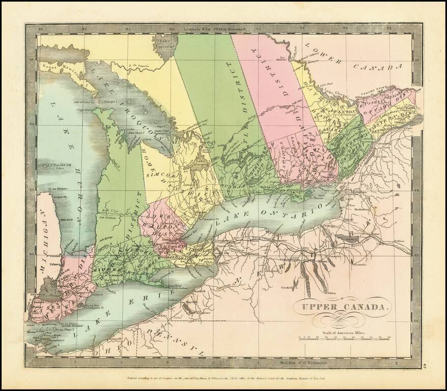
Interesting map of Upper Canada by David Burr, from his New Universal Atlas. Names Toronto on Lake Ontario, and, in the far west, Detroit. The internal districts are named and colored individually.
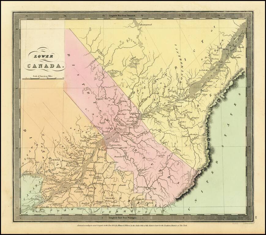
Interesting map of Lower Canada by David Burr, from his New Universal Atlas. The map is centered on the St. Lawrence River. The internal districts are named and colored individually.
Detailed map of Northeastern Canada, published by David Burr.
![[Newfoundland] Carta Esferica en dos hojas Del Banco y La Isla De Terranova con parte de la Costa de Labrador, Consruida en la Direccion de Hidrografia seun las ultimas publicadas por el Deposito hidrografico de Londres y presantada a S.S.M.M. por Don Ju](/map/small/42237sh.jpg)
Northern chart of this scarce Spanish Chart of Newfoundland and Labrador, published in Madrid.
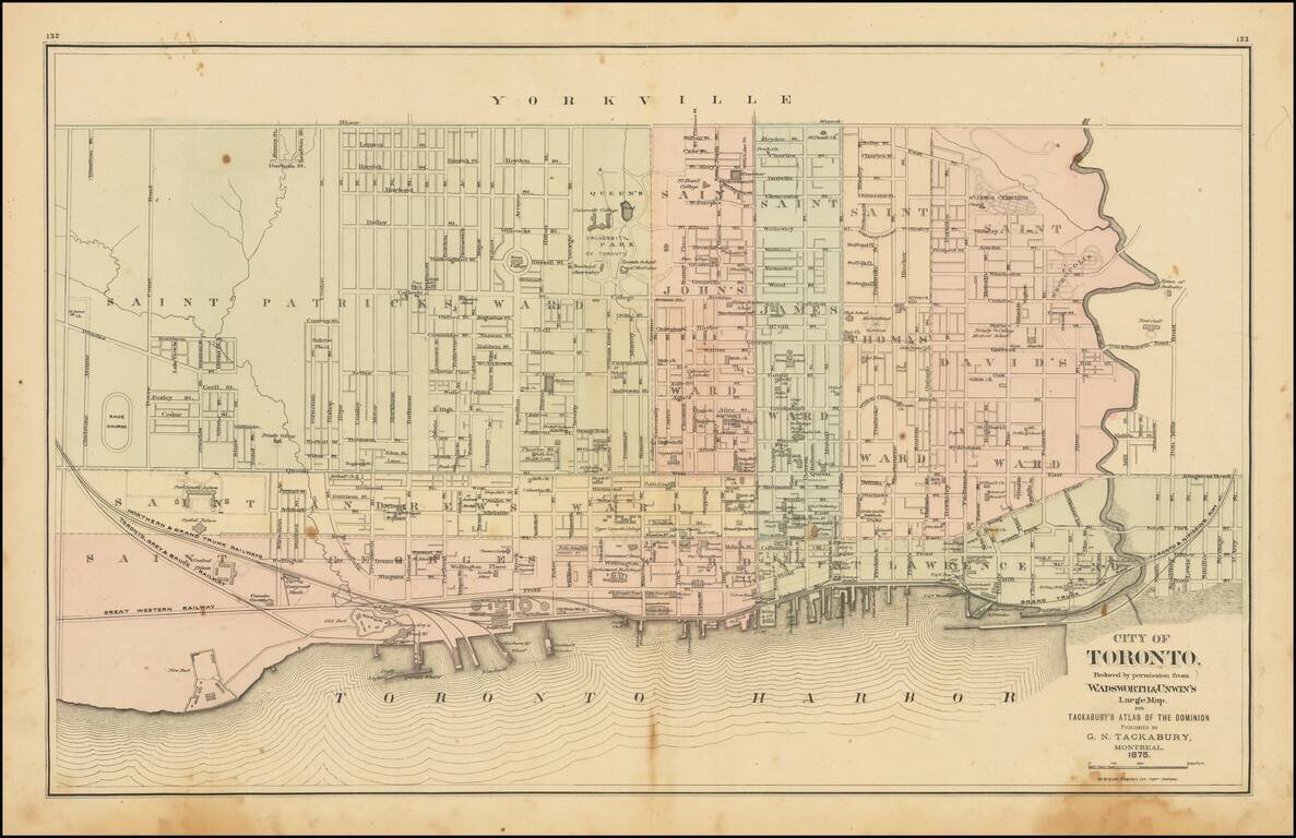
Detailed map of Toronto, colored by Wards, from Tackabury's Atlas of the Dominion. Locates a number wharfs, buildings, railroad lines and other details. Toronto was originally named York, changing its name in 1834. The map shows Toronto during a...
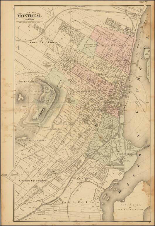
Scarce lithographed map of Montreal, probably from Tackabury's Atlas of the Dominion of Canada (1876). Hand-colored by wards. Many important public buildings are outlined and labeled. The topography of Mount Royal is rendered with hachuring.
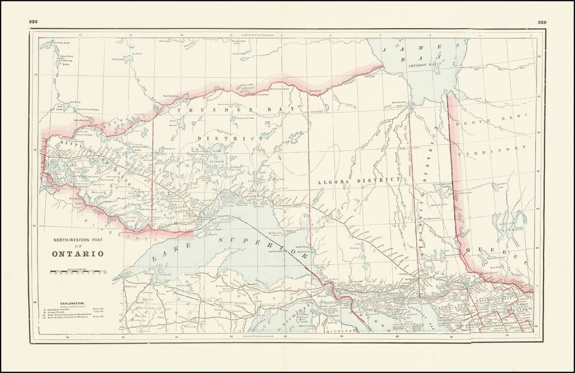
Detailed railroad map, showing counties, railroad lines, towns, rivers, township surveys, lakes, mountains, creeks, waterfalls, and a host of other information. Focuses on the northern Great Lakes, specifically Lake Superior, and shows Ontario north...
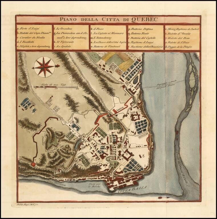
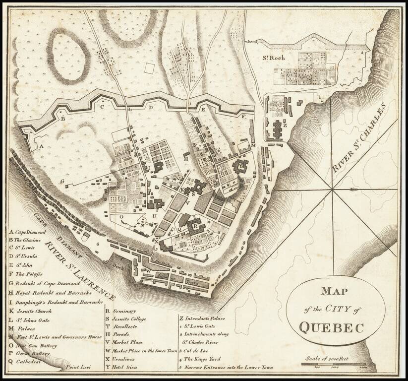
Finely colored plan of the town and fortifications of Quebec. The map illustrates the fortifications, as they existed during the French & Indian War.