Rare and antique old maps of the North America
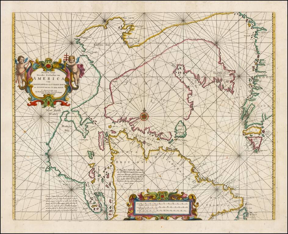
Fine example of Doncker's rare early map of the Northern part of America, including Hudson Bay, Davis Straits, Button Bay and the west coast of Greenland. Doncker's chart is one of the earliest obtainable charts to show this configuration and much of...
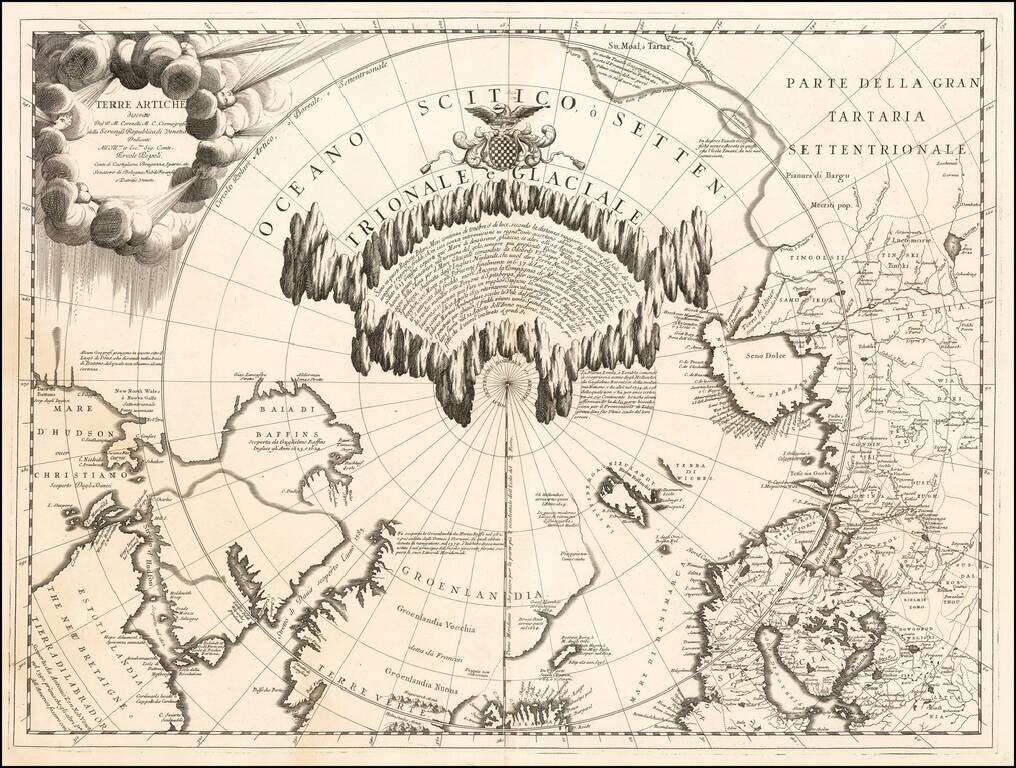
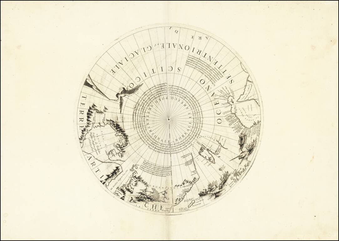
Fine example of Vincenzo Maria Coronelli's map of the North Polar Regions, published in Venice circa 1690. Coronelli's map provides a remarkable depiction of the Arctic Circle, North Pole, Greenland, and Baffin Bay, with parts of Canada, parts of...
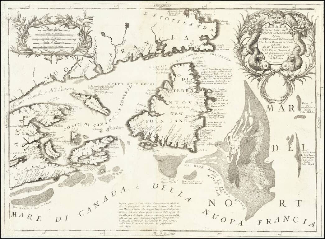
Detailed map of the Newfoundland, Labrador, Nova Scotia and the Gulf of St. Lawrence, by Vincenzo Maria Coronelli. The map comes from Coronelli's rare Atlante Veneto, one of the most decorative and ornate of all 17th Century Atlases. It exhibits the...
Rare north polar section of Coronelli's remarkable globe gores, first published in 1690. The present gore section is the upper calotte for Coronelli's large (110cm) globe showing the north pole and surrounding areas. The section includes extensive...
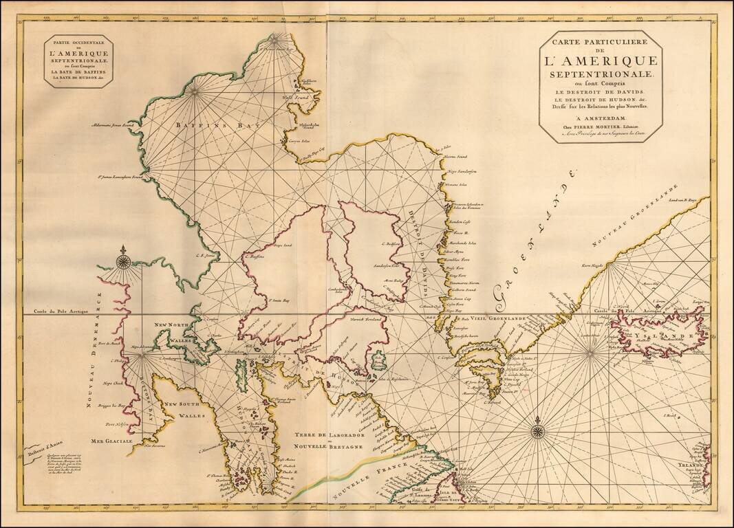
Pierre Mortier's large map of the Canadian Polar Regions, Greenland and Iceland, which appeared in his Suite de Neptune Francois. Among the more remarkable elements of the map is the depiction of "Destroit d'Anian," showing the Straits of Anian...
![[Unique Extra-Illustrated Example!] Carte Nouvelle Contenant La Partie d'Amerique La Plus Septentrionale, . . . Le Canada ou Nouvelle France, La Nouvelle Ecosse, La Nouvelle Angleterre, Les Nouveau Pais Bas, La Pensylvanie . . . Et Jle. de Terre Neuve . .](/map/small/47720.jpg)
Heavily embellished example of the eastern part of Visscher's 2-sheet map of the Northeastern part of North America, first published in 1696. Cartographically, the map extends from Nova Scotia and Acadia to Newfoundland, the St. Lawrence Gulf and St....
![The Coast of Newfoundland From Plancentia to Cape Bonavista [and] A Draught of the River Plata in South America [and] Havana, Harbour [and] the Bay of Honda](/map/small/38599.jpg)
Rare Sea Charts of North and South American Ports from an Influential Atlas This composite sea chart shows Newfoundland, Havana Harbor and the Bay of Honda, both in Cuba, and the River Plata in South America. The chart shows the coastlines and...
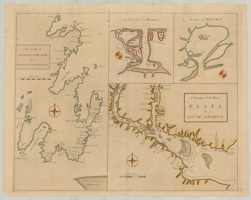
Rare Sea Charts of North and South American Ports from an Influential Atlas This composite sea chart shows Newfoundland, Havana Harbor and the Bay of Honda, both in Cuba, and the River Plata in South America. The chart shows the coastlines and...
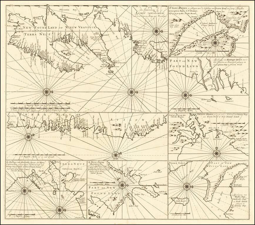
Rare sea chart of of the Coast of Newfoundland, published by Gerard Van Keulen. The chart incorporates eight insets showing various portions of Canada's Newfoundland coast. Include twelve compass roses with rhumb lines, with separate delineations of...
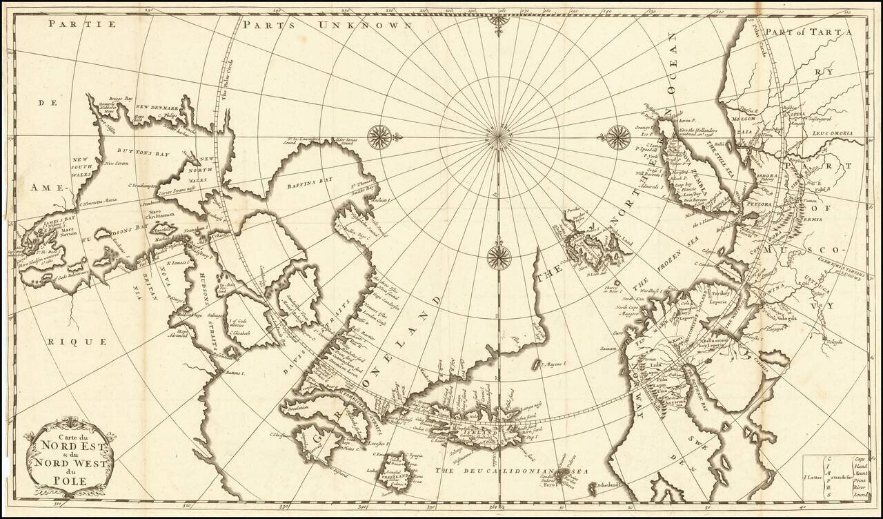
Fine Eighteenth-Century Map of the Arctic Elegant and finely-wrought map of “Northeast and Northwest of the Pole,” published by Amsterdam-based French scholar and mapmaker Jean Frédéric Bernard. The map encompasses the polar region from Tartary...
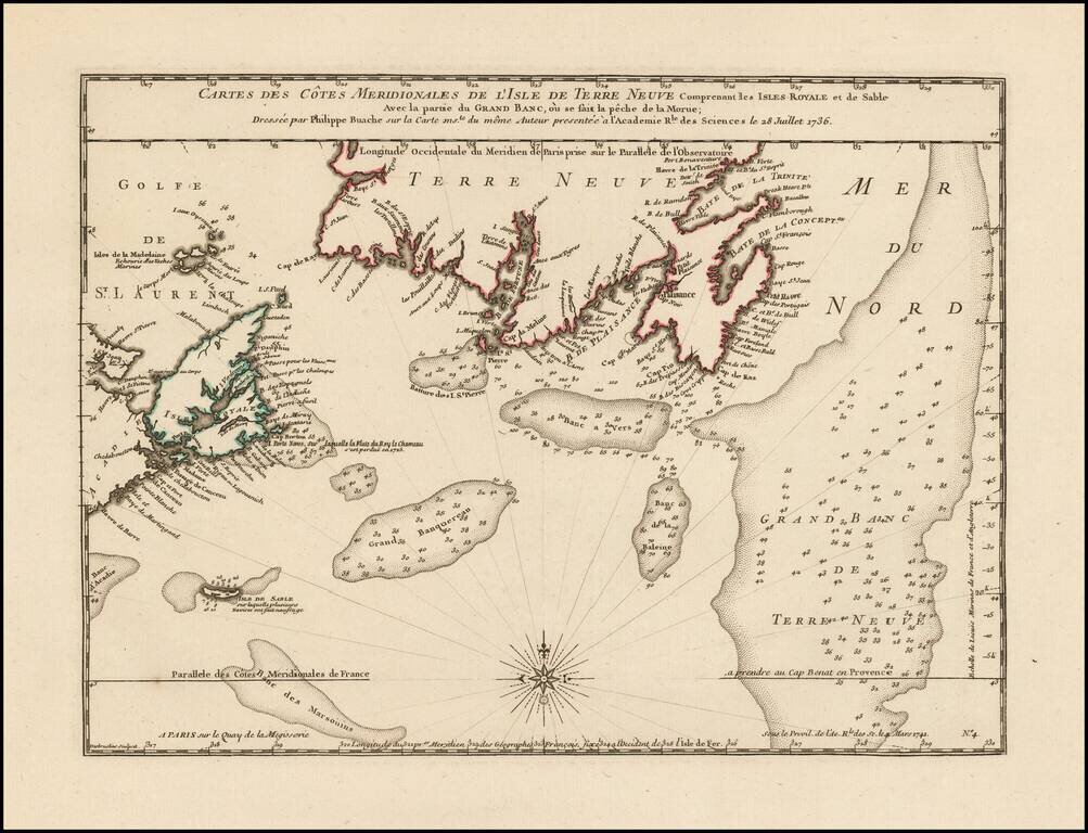
Philippe Buache Responds To Errors In Popple's Map of the British Colonies. Scarce map of the coast of Southern Newfoundland and part of Nova Scotia by Philippe Buache in 1736, as part of his critique of the accuracy of Henry Popple's map of 1733....
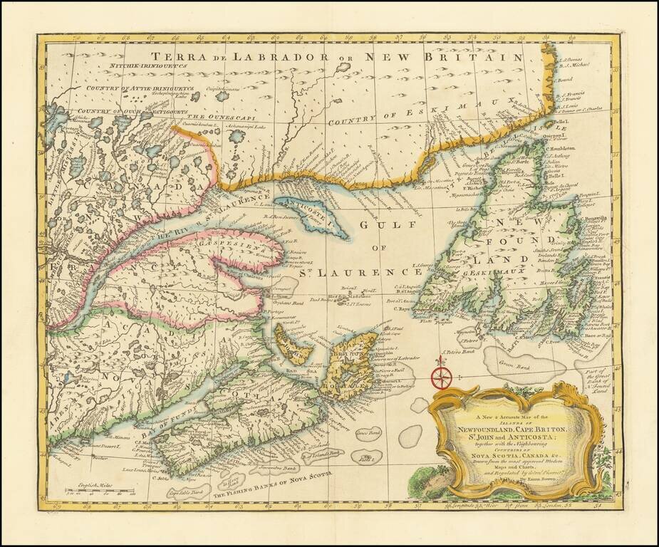
Striking and highly detailed map of Northeastern Canada, etc. published by Emanuel Bowen in London. The map covers the region bounded by Newfoundland, Nova Scotia, Acadia and Labrador. Decorative cartouche, compass rose and excellent detail...
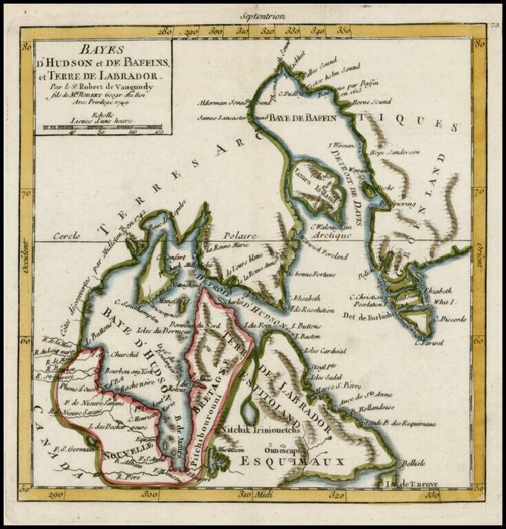
Detailed map of Hudson Bay, Baffin Bay Labrador and contiguous regions, from De Vaugondy's Atlas Portatif.
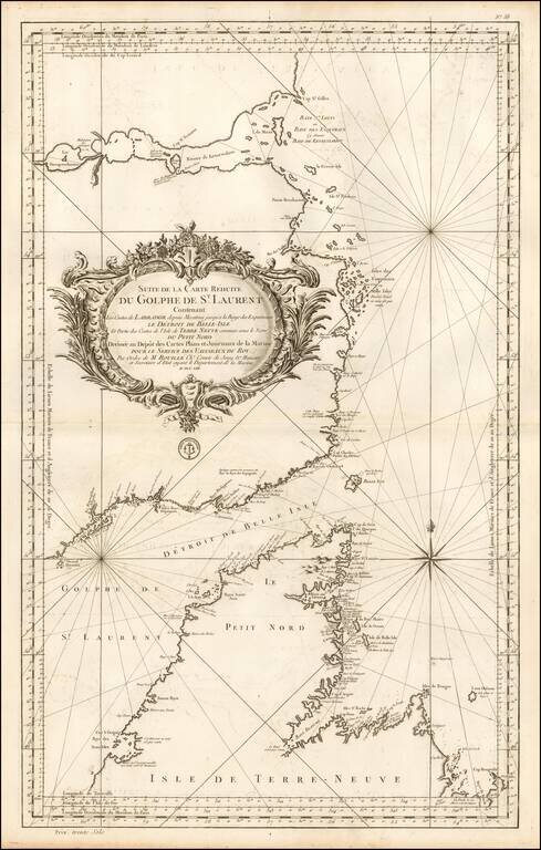
Important mid-18th Century chart of the Gulf of St. Laurence, Straits of Belle Isle and contiguous coastlines, published by Bellin, for the French Depot de la Marine. This interesting chart is one of the most significant maps of the region. The Strait...
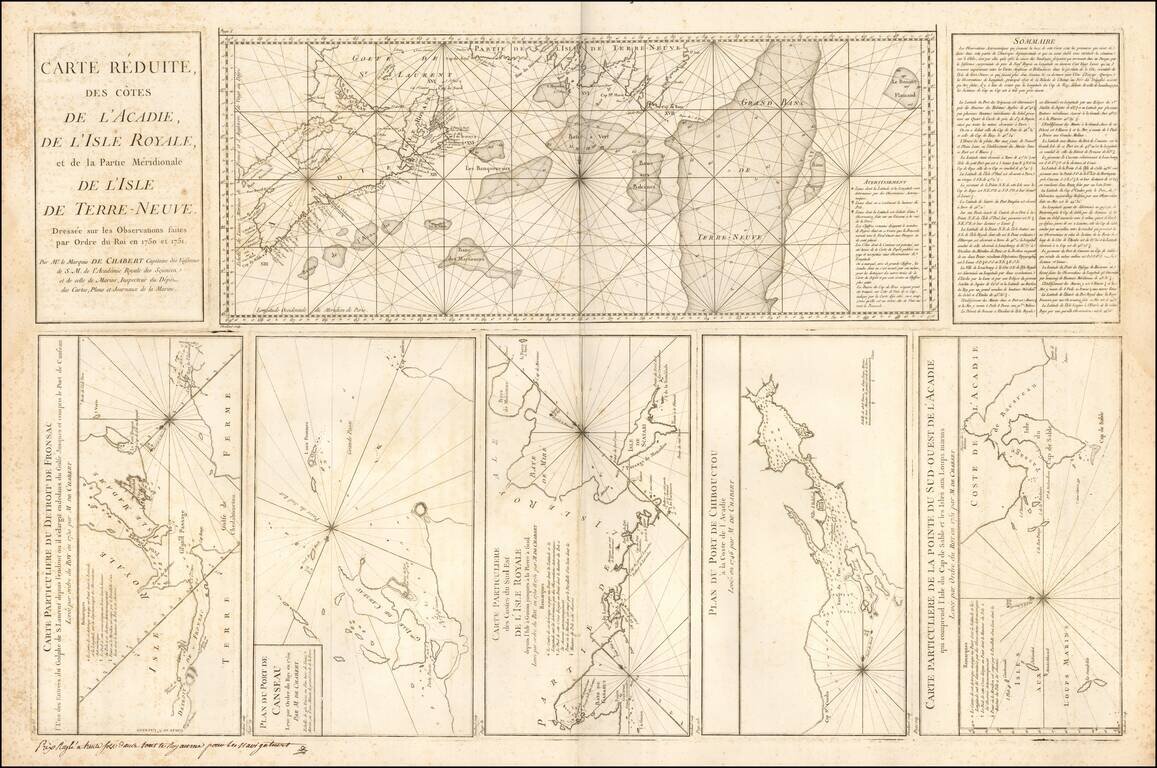
Large engraved mapsheet, comprising six inset maps related to the coast of Acadia and Ile Royale, published by Depot de la Marine in the mid-1750s. The maps are all credited to Mr. le Marquis de Chambert Capitaine des Vaisseaux.
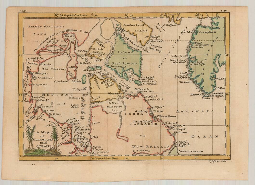
Interesting early map of Hudson Bay and vicinity, engraved by Jefferys. The map illustrates the English expeditions in search of the fabled Northwest Passage. Notes the discoveries in the vicinity of Repulse Bay and Wager River by Capt. Middleton in...