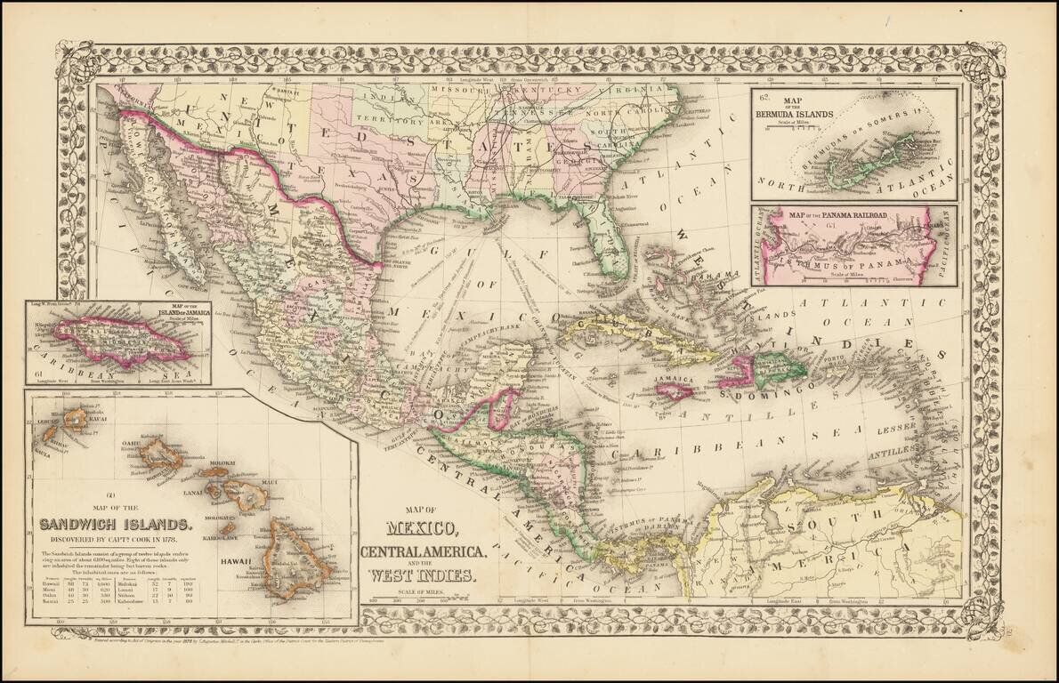
Rare and antique old maps of the North America
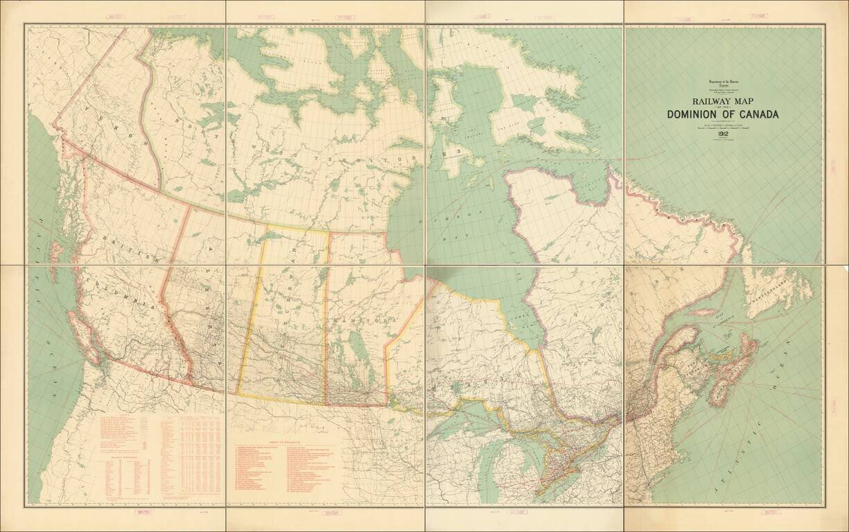
Fine example of this exceptional map of Canada, published by the Department of the Interior. The map focuses on the Railway system in Canada and related statistical information. Tables include: Legend showing Grand Trunk Railway, Canadian Pacific...
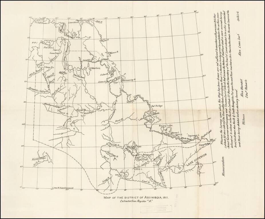
Early copy of one of the original maps delineating the Red River Colony, undertaken by Alex Lean, surveyor, in Selkirk. The name District of Assiniboia was used to describe the Red River Colony, (for official purposes), between 1812 and 1869. An...
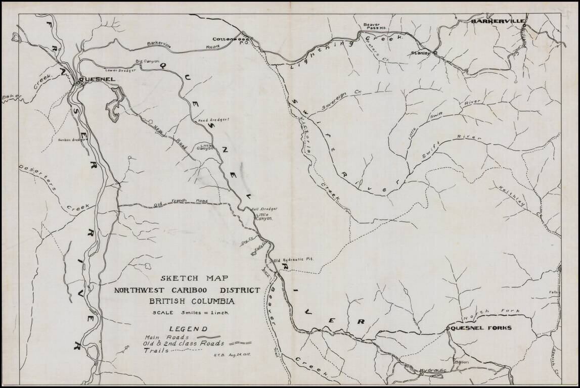
Detailed map of the Northwest Cariboo District, in British Columbia, drawn on a scale of 3 Miles = 1 inch. The legend shows main roads, old and second class roads and trails. The map focuses on the region between the Fraser River to the west and...
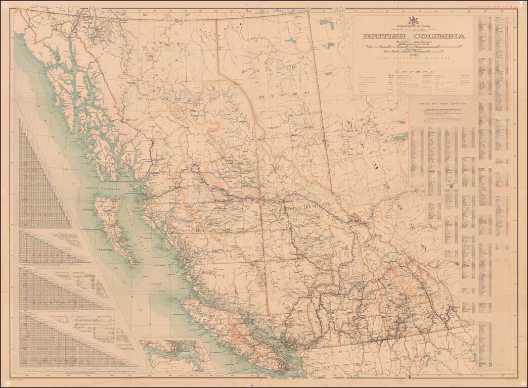
With an Index of Post Offices for British Columbia Highly detailed map of British Columbia, published by the Department of Lands, Land Records Division. An elaborate set of distance tables are shown at the left, noting distances along the coast,...
![[Route of the 1938 Westward Northwest Passage Cover] Map of the Northwest Territories 1929](/map/small/60046.jpg)
Illustrating Canadian Postal History -- A Cover's Travel Through the Northwest Passage in 1939 Fine large format map of the Northwest Territories of Canada, published by the Department of the Interior. The map identifies: Royal Canadian Mounted...
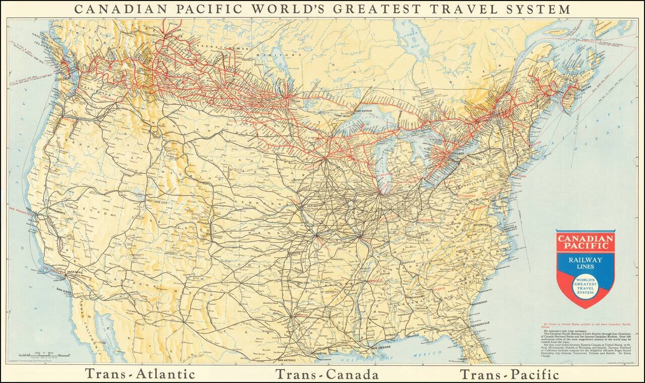
This is a map showing the railway lines of Canada and the US, with the lines operated by the Canadian Pacific Railway highlighted in red. Many different routes crisscross the map, and cities, towns rivers, and more are all named. The verso advertises...
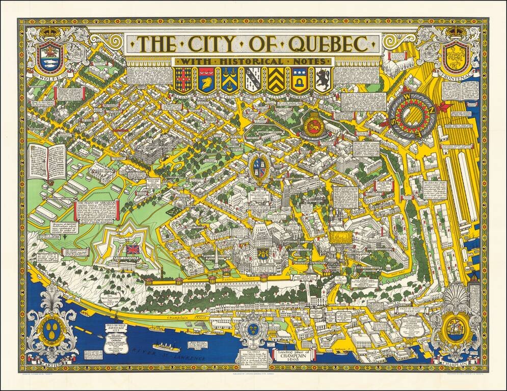
Decorative historical map of Quebec, richly adorned by coats of arms and historical facts.
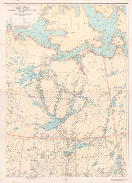
Detailed map of a portion of the Northwest Territories, published by the Department of the Interior in 1932. The map illustrates: Main, Wagon and Winter Roads Falls and Rapids Ranger Cabins Royal Candian Mounted PoliceStations Sea Plane...
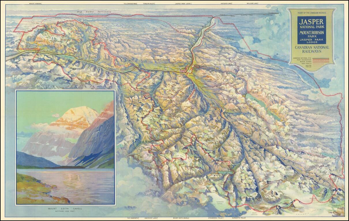
Finely illustrated vintage view-map of the Jasper National Park and environs, published by the Canadian National Railway. Color coding identifies Canadian National Railway lines, Park Boundaries, Motor Roads, Government Trails, and Indian Trails....
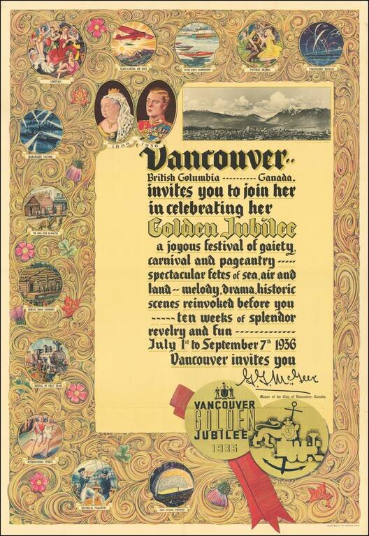
Beautiful color-printed poster commemorating the centennial of the founding of Vancouver, British Columbia, printed by Bulman Bros. in 1936. The full text of the poster reads: Vancouver.. British Columbia..... Canada. invites you to join her in...
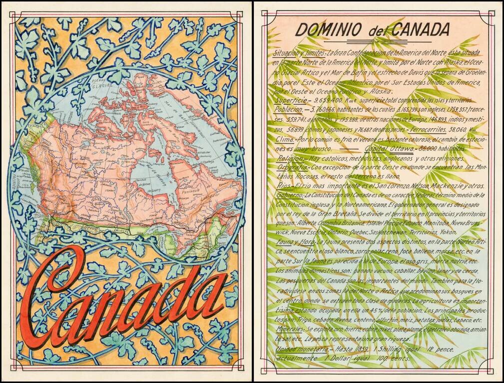
Award winning pair of manuscript cards, prepared by Antonio Raggio for the 11th Congreso de la Union Postal Universal (World Postal Congress) Exposition Filatelica Internacional, held in Buenos Aires, Argentina in 1939. The map shows a finely...
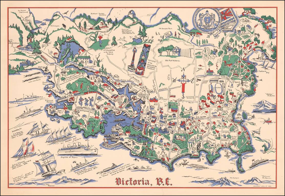
Rare pictorial map of Victoria, British Columbia, drawn by Amy Adamson. The map shows major buildings, railways, towns, major roads, landmarks, rivers, forests, recreational sites and activities. The compass is created from Cross, oriented north to...
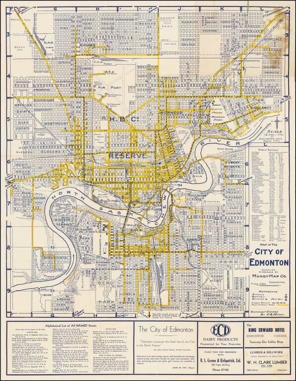
"Edmonton Possesses The Finest Site of any City in the British Empire" -- Sir John Foster Frazer Fine early plan of Edmonton, published in Edmonton by the Mundy Map Company. The center of town is dominated by a large area noted as "Hudson Bay...
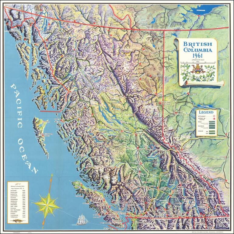
Finely executed pictorial map of British Columbia, published for the British Columbia Natural Resources Conference. The map provides a remarkable topographical presentation of British Columbia's complex terrain. The legend locates: Settlements...
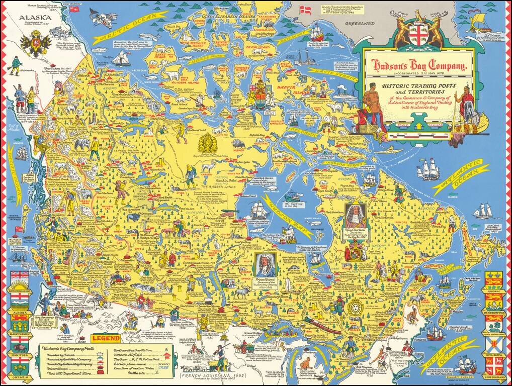
"Third Revision" of this marvelous pictorial map celebrating the history of the Hudson's Bay Company, published in Toronto. Fine large format map drawn by Toronto Artist Stanley Turner, one of the best known WWII map illustrators. The map is filled...
![[Battle of Placentia]](/map/small/70282.jpg)
Lahontan's Account of the Battle of Placentia Nice example of Baron Lahontan's illustration of the Battle of Placentia (September 1692), which was fought between the English and the French at Fort St. Louis (Castle Hill) in Placentia, Newfoundland...