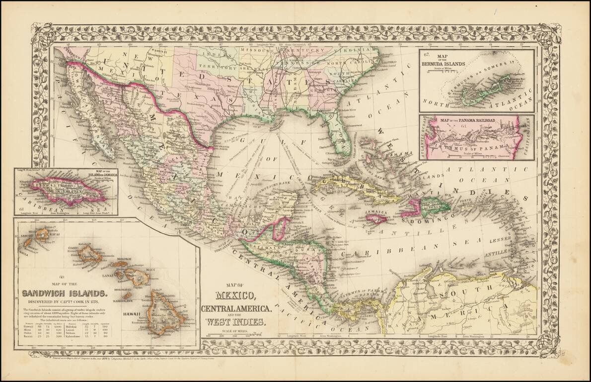
Rare and antique old maps of the North America
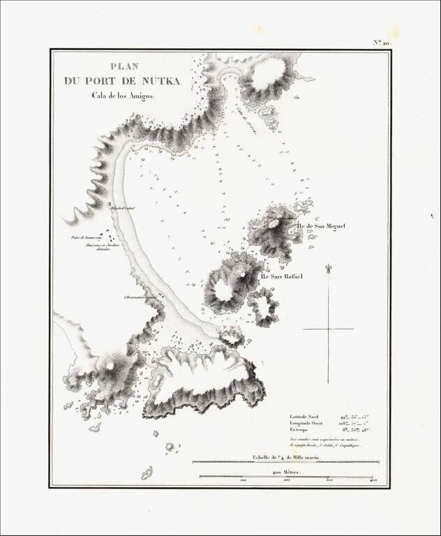
Detailed map of Nootka Bay, from Duflot de Mofras' momumental work. In 1839, Eugene Duflot de Mofras, was assigned to the embassy in Mexico City and instructed to visit the northwestern provinces of Mexico, report on potential commerce, observe U. S.,...

Rare map showing the Northwest Passage, via the Bering Straits, with a fantastic early depiction of Alaska (then Russian America) and contiguous parts of Canada. Philip's map highlights the discoveries of Franklin and Richardson in the Arctic Sea...

Rare map of the Northwest Passage, Northern Canada, part of Alaska (America Russa) and Greenland. The map is quite unusual, being one of the few maps to focus on the known islands of the Northwest Passage, including several partially known...
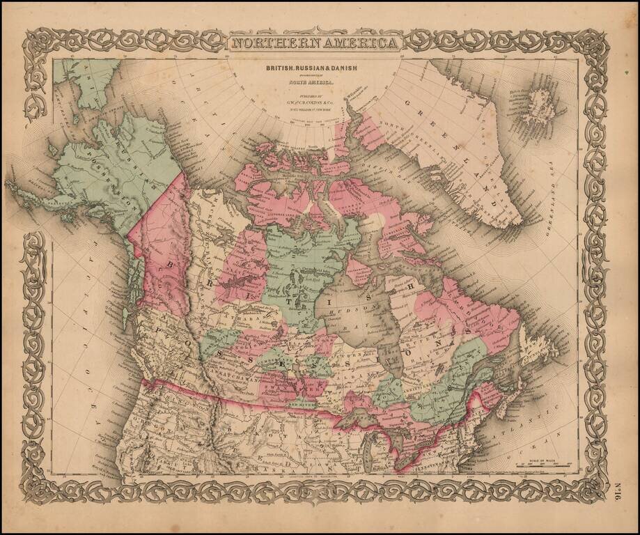
Marvelous map of Canada and Alaska, featuring a host of unusual borders. New Columbia stretches from the US Border to Russian America (Alaska). Lesser Slave Lake, Peace River, Mackenzie's River, Great Slave Lake, Churchill, Athabasca, Nelson, English...

Fine separately issued example of Adolph Lindenkohl's important early map of Alaska, the earliest printed map of lands recently acquired from Russia and the first appearance of the name Alaska on a printed map. Alaska was purchased from Russia for...
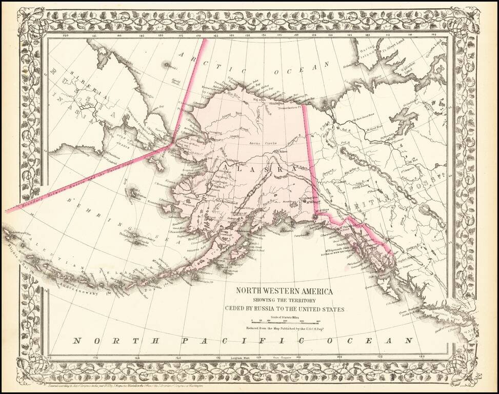
A detailed map of Alaska, showing the territory shortly after it was sold by Russia to America for $7.2 Million in 1867. The map locates towns, mountains (with elevations), rivers, bays, and other details. Cities named include Sitka and Sheshalik. The...

Rare separately issued map of Alaska and British Columbia, showing the route to Gold Regions of Alaska, among the earliest printed maps to illustrate the route to the newly discovered Gold Regions in Alaska. Lowman & Hanford of Seattle produced...
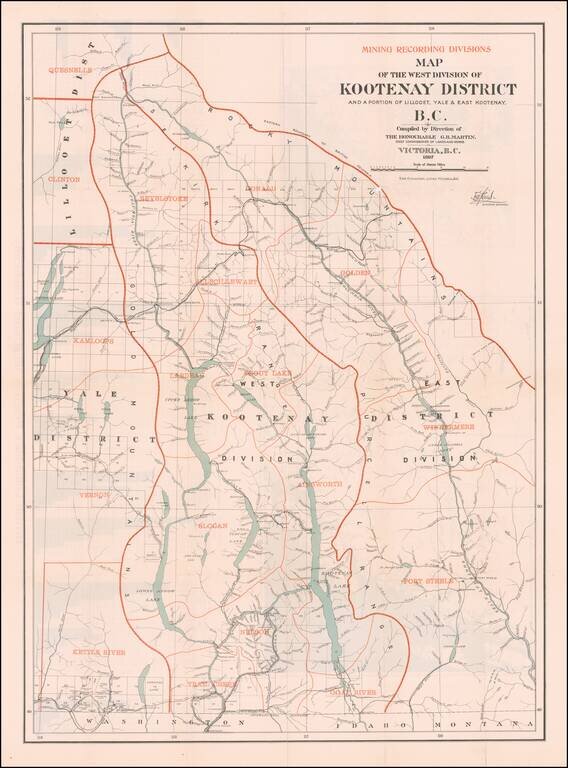
British Columbia's Progress Illustrated Graphically (and a Great Map of the West Kootenay District) Fine large Canadian government publication, illustrating the West Kootenay Mining District on the front side of the map and the Klondyke, Cassiar,...
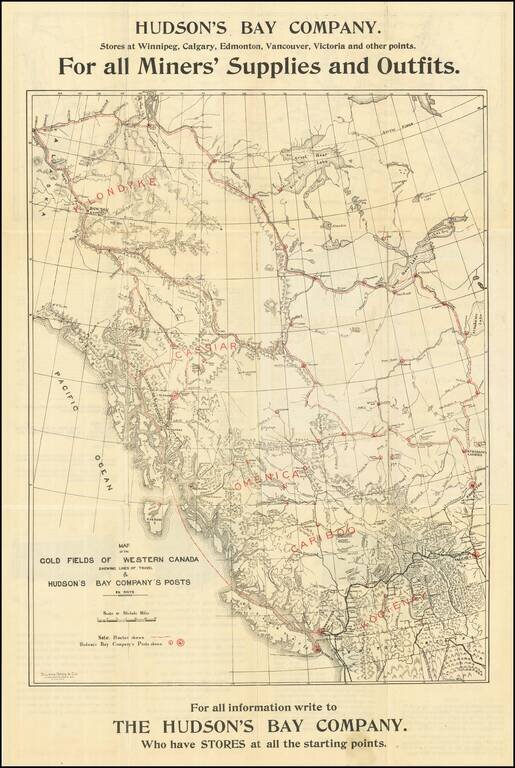
Hudson's Bay Company Guide & Map To The Klondike Gold Fields -- Rare Winnipeg Imprint Rare Hudson's Bay Trading Company map of the the Klondike and Yukon Gold Regions, illustrating the Canadian Routes to the Gold regions from Winnipeg and...

Victoria, B.C. The Key to the Klondyke and Yukon Gold Mines Rare promotional brochure and map, illustrating the routes the gold regions of Alaska and the Yukon, published by the British Columbia Board of Trade, extolling the virtues of traveling to...
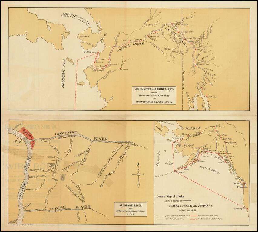
Rare promotional pamphlet showing the routes to the Klondike, published by the Alaska Commercial Company. Three maps includes: General Map of Alaska Showing Routes of Alaska Commercial Company's Ocean Steamers Klondike River and Surrounding Gold...
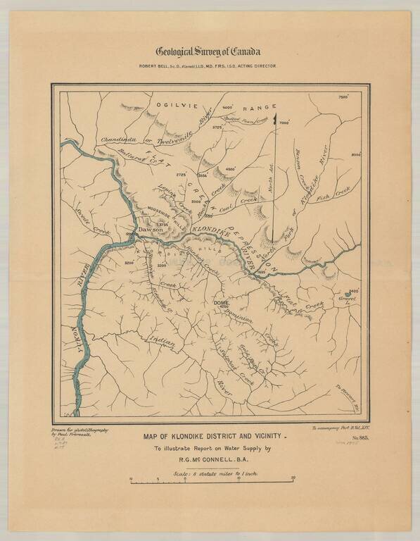
Detailed map of the Klondike Gold Region, centered on Dawson's and the Klondike River.
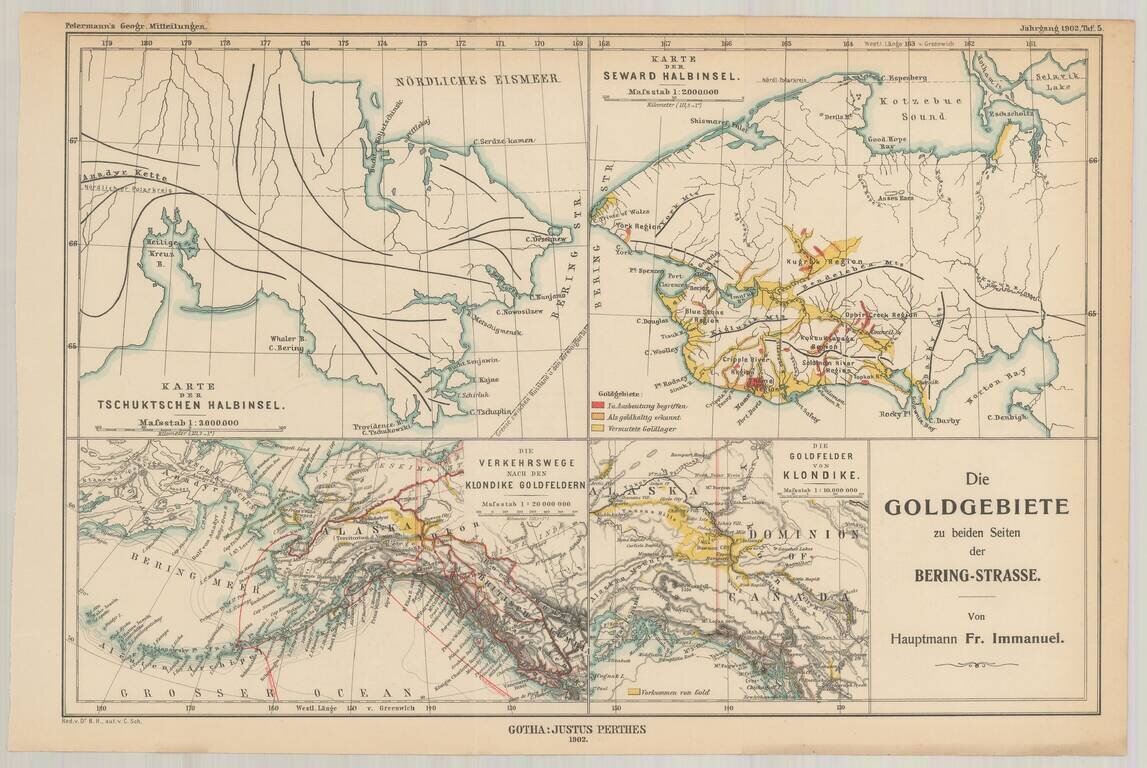
Fine set of four maps, highlighting the gold regions in Alaska and the Behring Straits, published by A.H. Petermann. The maps including the following: The Klondike Gold Region The Seward Peninsula Gold Region Routes to the Klondike Gold Fields...
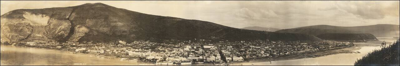
Panoramic photographic view of Dawson City in Yukon Territory, likely taken by Sheelor at the later end of the Klondike Gold Rush. Wonderful panorama of the town taken from a hill across the Yukon River. While at the time of this photo Dawson City...
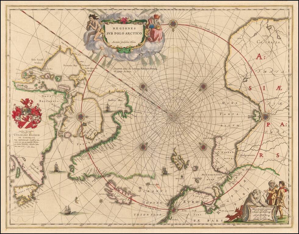
Nice example of the second edition of Blaeu's signature map of the North Polar Regions, with several wonderful cartouches and decorative coat of arms. Blaeu's decorative map of the North Pole, including Arctic North America, Scandinavia, and northern...
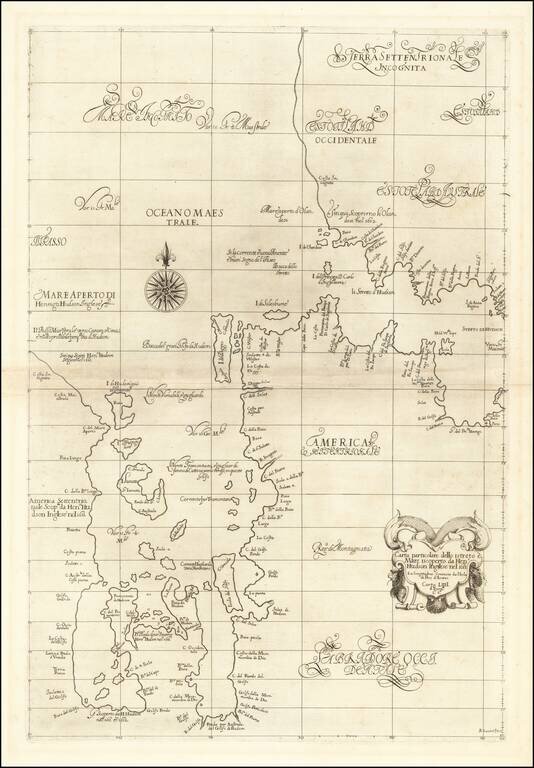
The First Sea Chart of Hudson Bay and Hudson Strait Fine example of the first edition of Robert Dudley's chart of Hudson Bay and Hudson Strait, the earliest sea chart of the region and the first printed map to focus on Hudson Bay. Dudley's chart is...