Map size in jpg-format: 16.8694MiB
Click to open in high resolution (open in new tab).
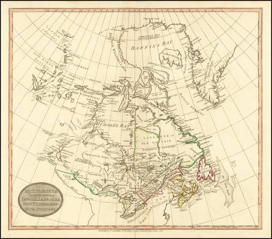
Rare Dublin edition of John Stockdale's map of British America.
The map is centered on the Great Lakes and Hudsons Bay. The course of the Mississippi River is quite fascinating, and titled "Miiskoue-sipi or Red R." and a bit further south, "Missi-sipi."
The map extends from Greenland across the continent to Great Slave Lake (here called Arathapescow Lake). The Copper, Dog Ribb'd, and Northern Indians are shown. Shows a small portion of coastline far to the north on the Beaufort Sea at the delta of the Copper River.
A later edition was issued J. Charles imprint in 1814.
If you are a student, write to us in telegram: @antiquemaps and indicate what material you need and for what work you need a map in high detail. We are ready to provide material on special terms. For students only!
![[The First Maps in a la poupée Printed Color] Cartes en Couleur des Lieux Sujets aux tremblements de Terre Dans toutes les parties du Monde Selon le Sisteme de l’impulsion Solaire](/map/small/52293op.jpg)

