
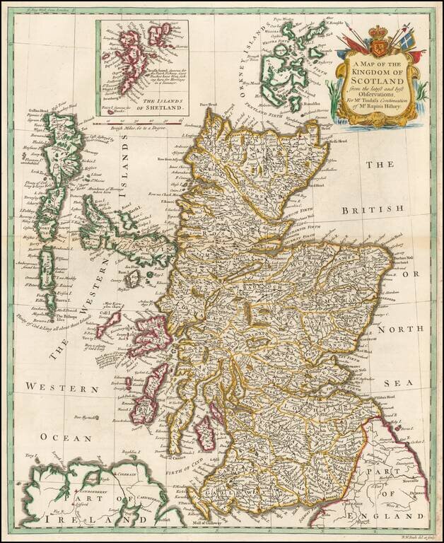
A handsome mid eighteenth century map of Scotland, on a scale of some nineteen miles to the inch, with a cartouche. Interspersed among the place names are some interesting notes and comments - "Aggat & Chrystal Marble found here", "Abundance of...
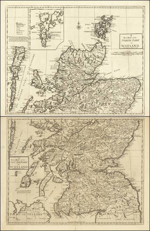
Detailed map of Scotland, showing towns, rivers, lakes, islands, bays, etc. Fine dark impression.
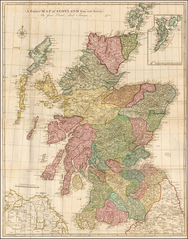
Finely executed map of Scotland, based upon James Dorret's General Map of Scotland . . . , issued in 1750. Dorret's map of Scotland was the standard depiction of Scotland for the next 40 years, used by the likes of Thomas Kitchin, Marcus Armstrong,...
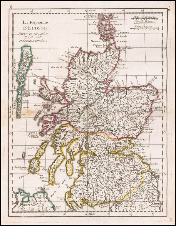
Finely engraved pair of maps comprising northern and southern Scotland, drawn and engraved by Andrew Johnston, published in the third edition of William Camden's 'Britannia' in 1753. The maps provide a meticulous accounting of the towns, rivers,...
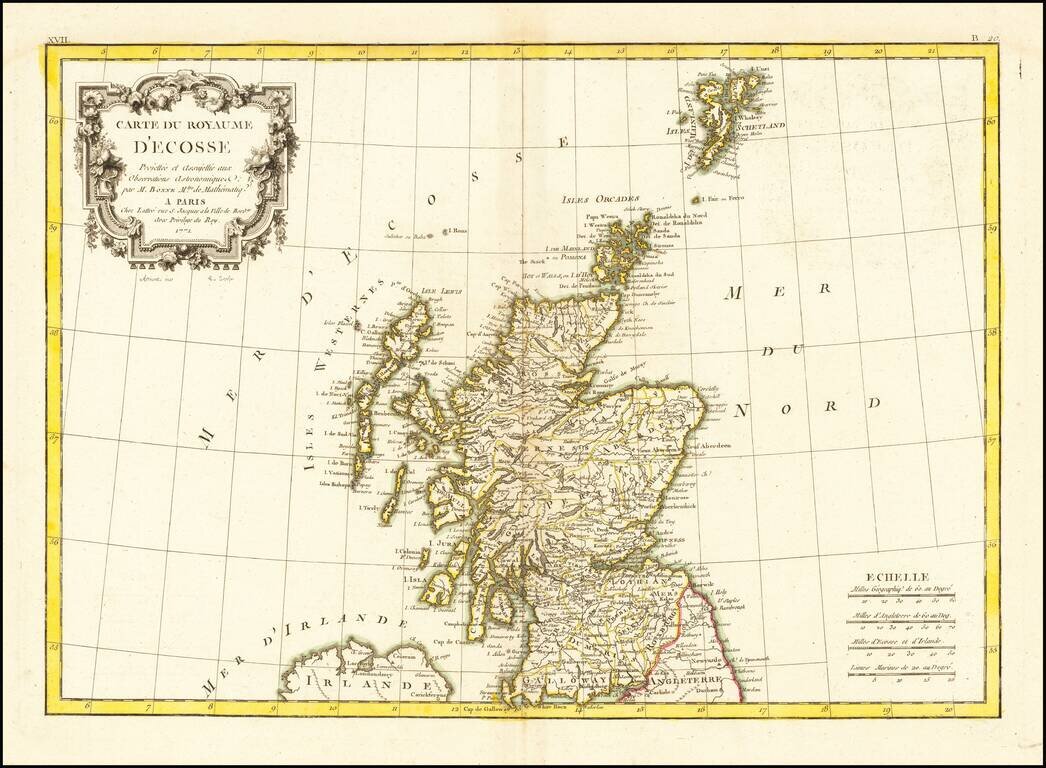
Decorative map of Scotland, with an elaborate title cartouche. From Bonne's Atlas Moderne.
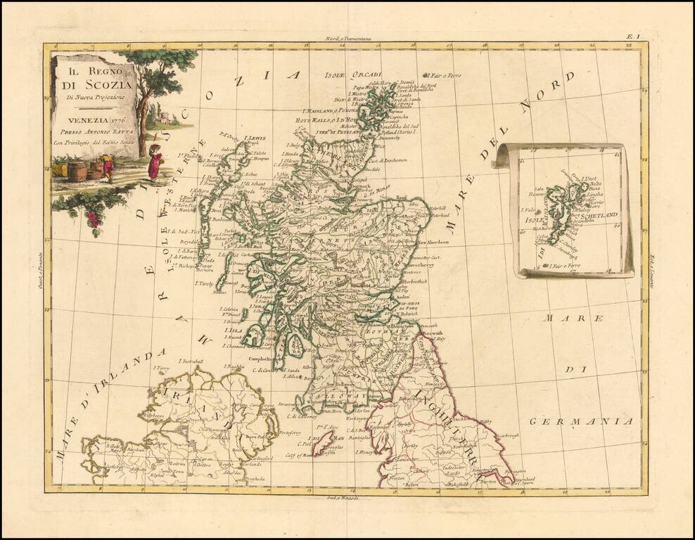
Decorative Italian map of Scotland, with an attractive inset of the Shetland Islands. The map appeared in Antonio Zatta's 4 volume 'Atlante Novissimo". Zatta was a major Italian cartographer of the time, and his works are increasingly popular with...
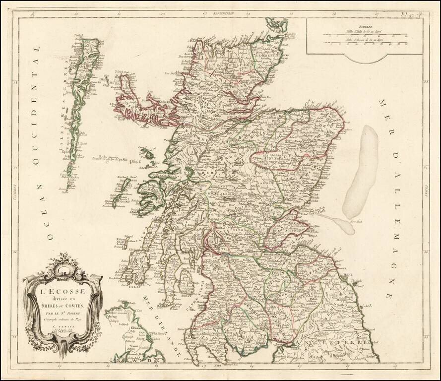
Decorative Italian map of Scotland, published by Santini in Venice and engraved by Remondini. The map includes a decorative cartouche and scale of miles in the top right corner. The map is colored by the early provinces and counties, with the...
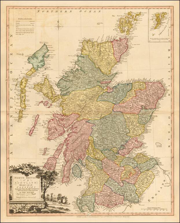
Striking map of Scotland, colored by shires, from Faden's General Atlas. One of the best late 18th Century maps of Scotland to appear in a commercial atlas.
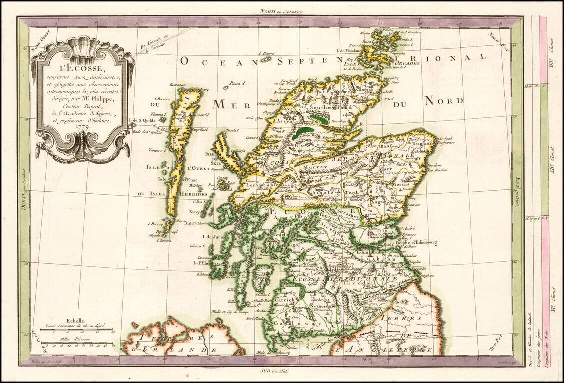
Scarce map of Scotland, published in Paris by Philippe Pretot. Includes a decorative cartouche.
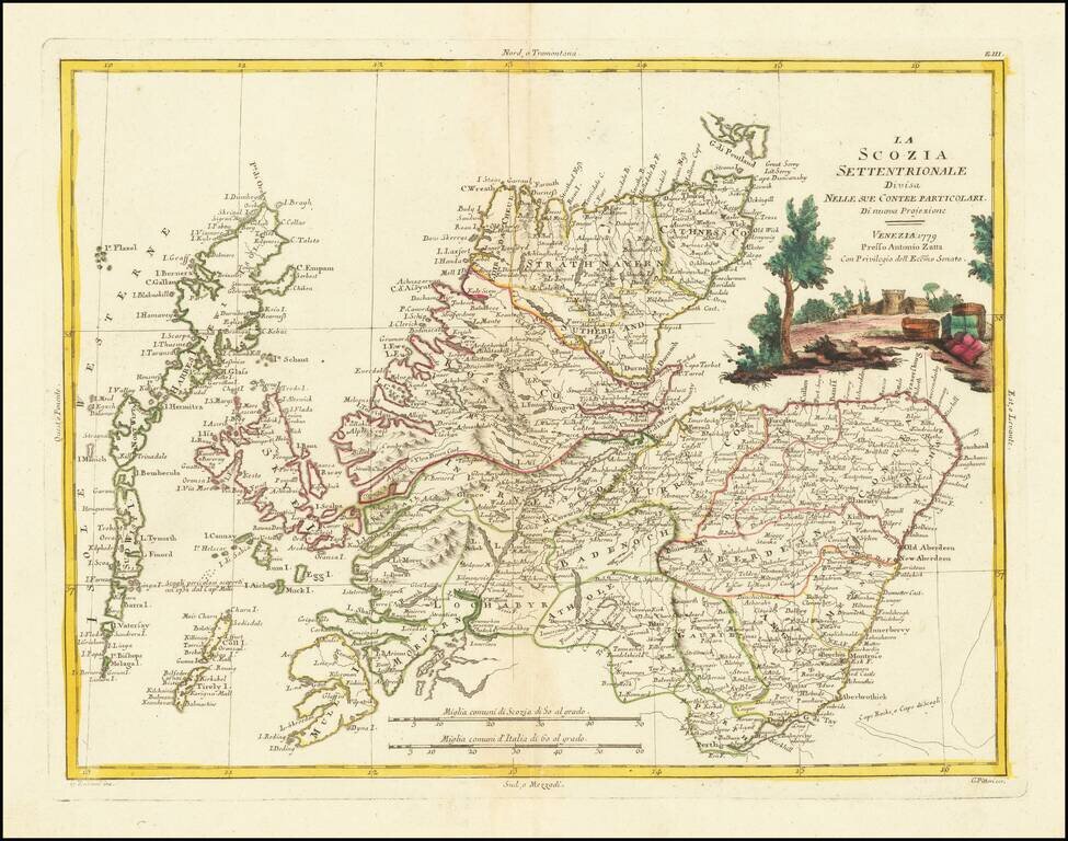
Decorative Italian map of Northern Scotland, with a large decorative vignette. The map appeared in Antonio Zatta's 4 volume 'Atlante Novissimo". Zatta was a major Italian cartographer of the time, and his works are increasingly popular with collectors.
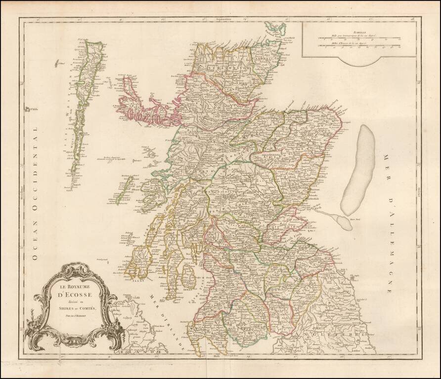
Detailed map of Scotland from a later edition of DeVaugondy's Atlas Universel. Includes towns, mountains, rivers, lakes and a host of other details.
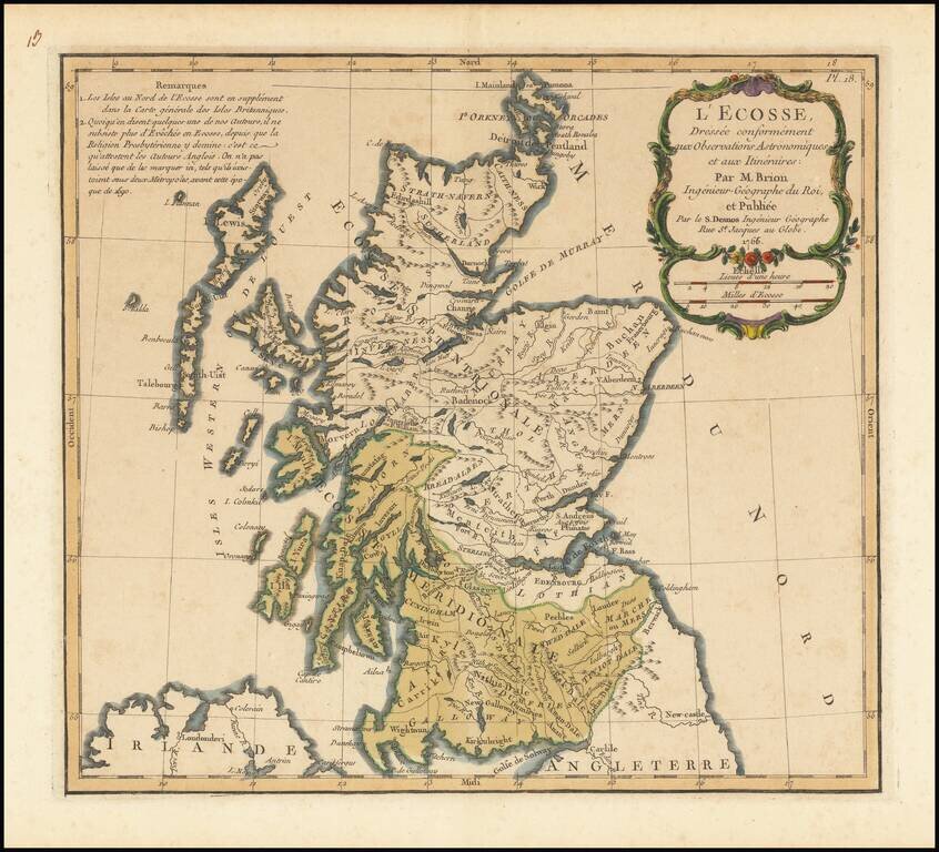
Interesting map of Scotland, published by Brion in 1766.
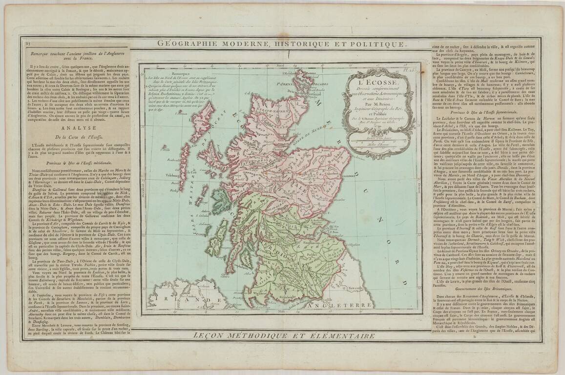
Interesting map of Scotland, with decorative cartouche and side paneled text.
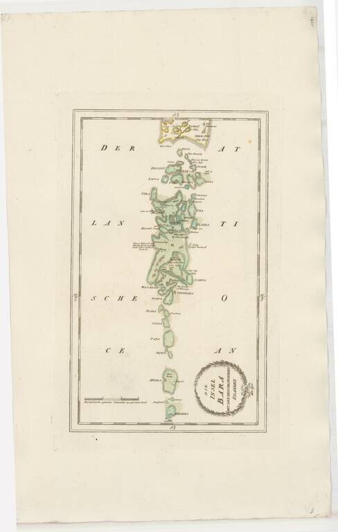
Striking map of Barra and some of the other Western Scottish Islands, from Von Reilly's remarkable atlas. The map extends as far south as Bernera (Barra Head) and Megala (Mingulay), also showing Papa (Pabbay), Linga (Lingeigh), Flada (Flodday),...
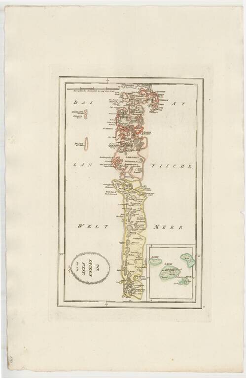
Striking map of Uist, other western Scotish Islands, from Von Reilly's remarkable atlas. Extends north to Harries (Harris) Island and south the the southernmost tip of South Uist Island.
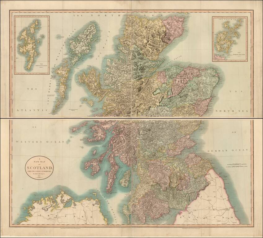
A large and detailed four sheet map of Scotland, published by John Cary. The map is hand colored by counties and includes precise topographical detail, including lakes, rivers, mountains, bays, towns, roads with milage, political divisions, and a host...