
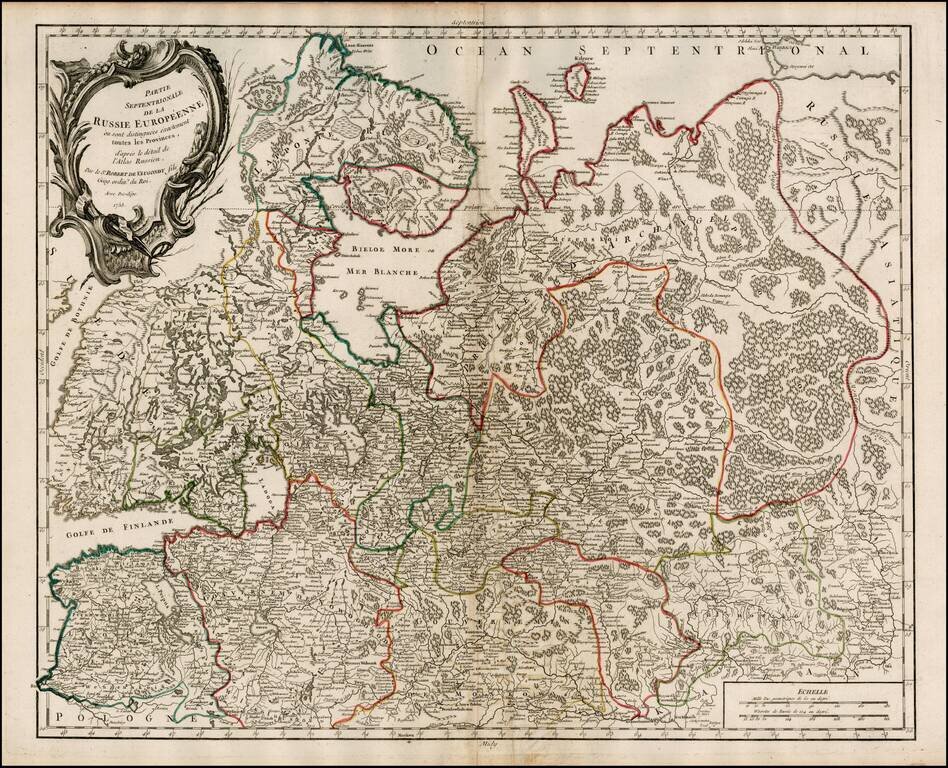
Highly detailed map of the Northwestern part of Russia, from the Gulf of Finland and Poland, to the western part of Asian Russia. Decorative cartouche.
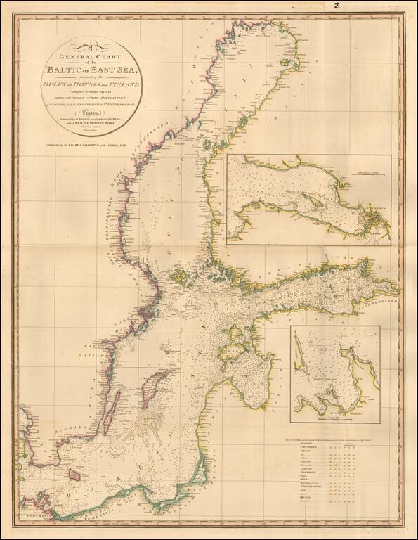
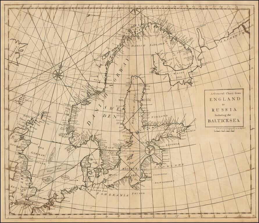
Highly detailed chart of the Baltic and contiguous coasts, from Faden's general atlas. Includes detailed insets of the areas around Revel and St. Petersburg. One of the most detailed general charts of the Baltic to appear in an English Commercial...
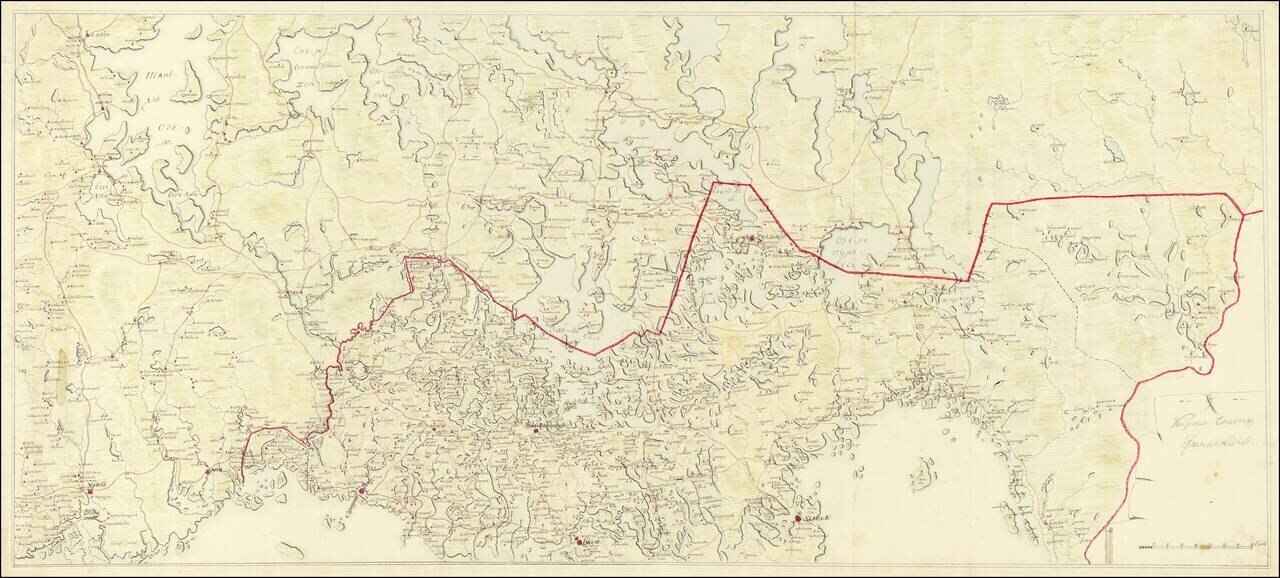
Imperial Russian Manuscript Map of the Russia-Finland Border, circa 1810. Pavlovsk Palace Library Provenance. Large Imperial Russian manuscript map of the Russia-Finland border as it existed between 1743 and 1812. The Russian side of the border...
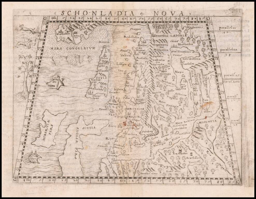
Important early modern map of Scandinavia, Iceland, and the Baltic, published in Venice by Giacomo Gastaldi. Gastaldi's modern map of Scandinavia and environs "built upon previous publications, in particular, the representation was based on the map of...
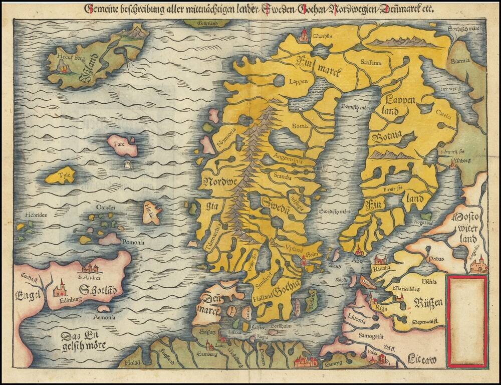
Second edition of Munster's map of Scandinavia, first issued in 1545 to replace the very rare first edition of the map, which appeared in only the first three editions of Munster's Geographia. Munster's first map relied upon the cartography of Jacob...
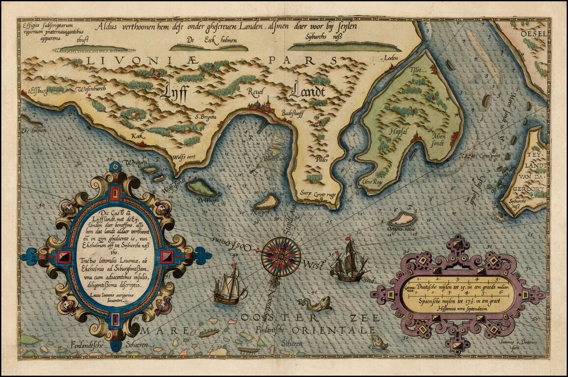
Fine early example of Waghenaer's map a portion of the Gulf of Finland showing Wyburch (Vyborg), Telsborch, Narua, Niewkerck, Reisenburg, and the region just west of St. Petersburg, from Lucas Waghenaer's Spiegel der Zeevaerdt. Includes sea monsters,...
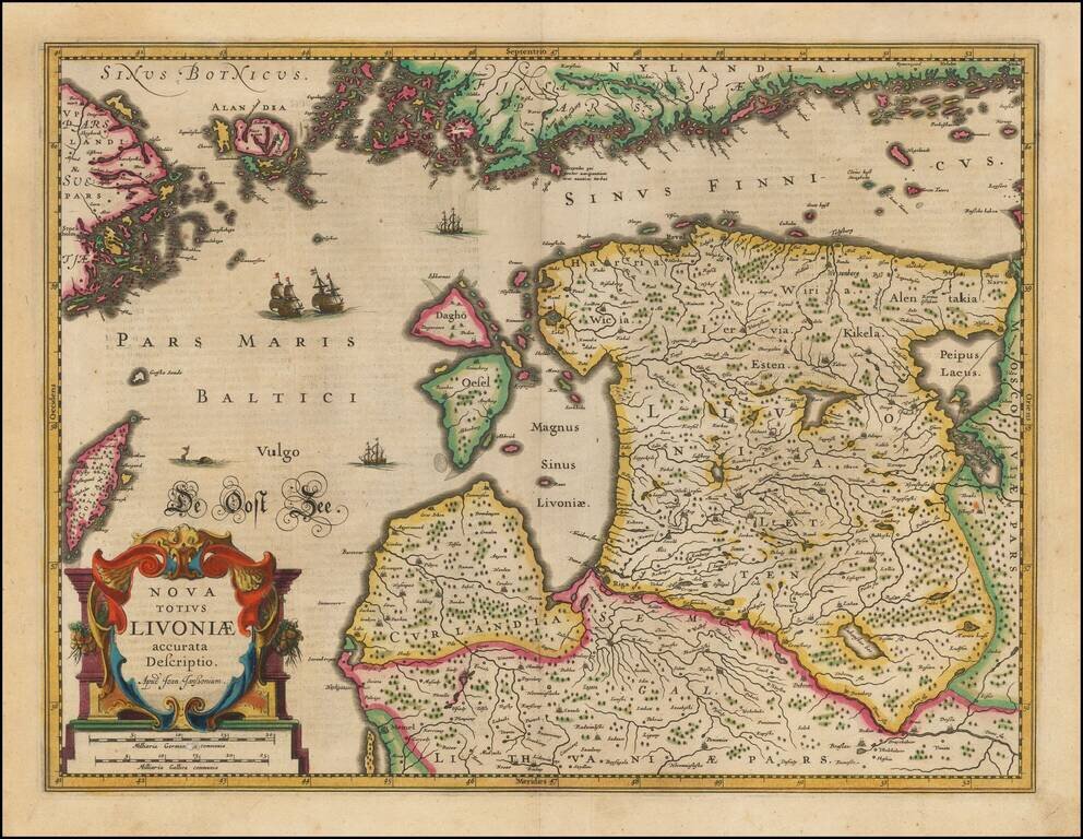
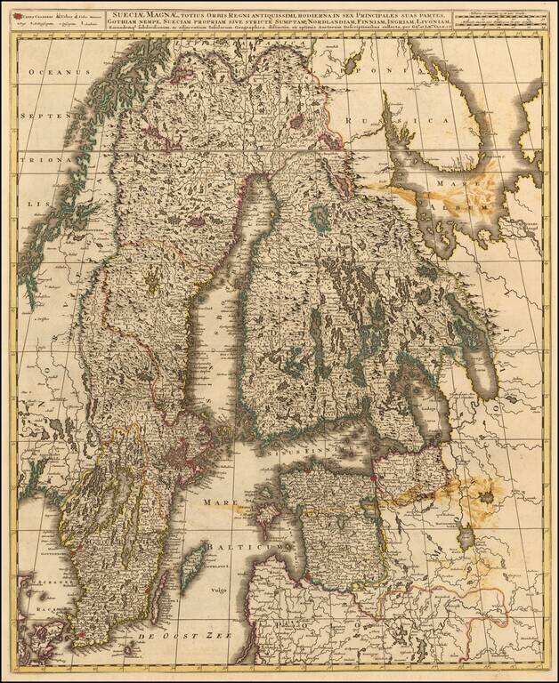
Striking full color example of Jansson's new map of the Balkans and the Sinus Finnicus. Decorative map of Estonia and Latvia. Including the southern tip of Finland and the south eastern tip of Sweden, including Stockholm. Includes a decorative...
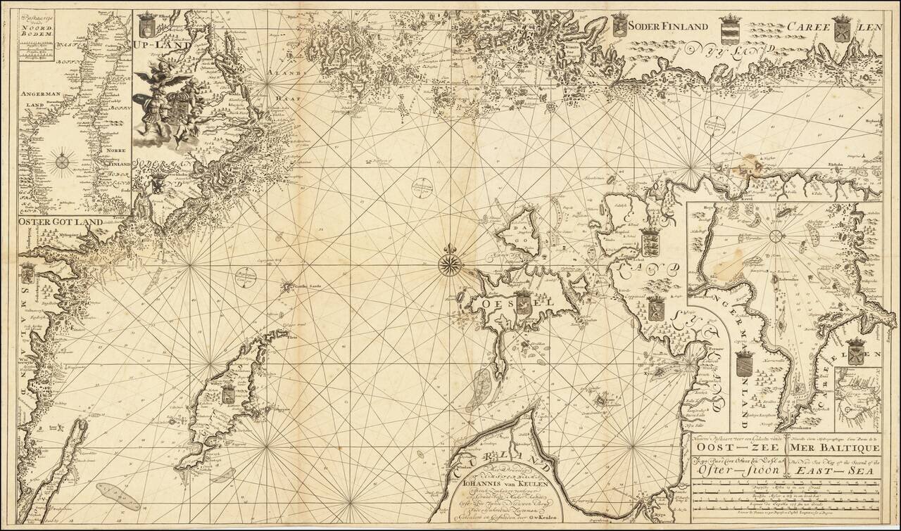
Scarce Dutch sea chart of the Baltic Sea, published by the Van Keulen firm, the leading Dutch sea chart publishers of the 18th century. The map covers much of the Baltic Sea, the Swedish coast around Stockholm, the Gulf of Riga and West Estonian...
Fine map of Scandinavia and the Baltic, published in Amsterdam by Valk. Shows Norway, Sweden, Finland, Estonia and Latvia. It depicts a significantly contracted Swedish Empire having suffered defeats against both Norway and Russia over the previous...
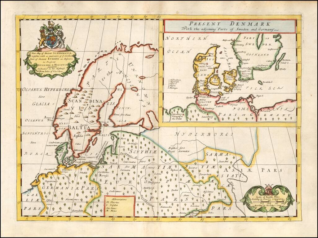
Decorative map of Scandinavia and Northern Europe, with an inset of Denmark and part of Norway and Sweden. Two decorative cartouches. Wells map is 1 of a set of 22 maps dedicated to William, Duke of Glouchester, who at the time of publication of the...
![Carte De La Partie Meridionale du Royaume de Suede avec une Table des Provinces et des Villes Principales [including Baltic Sea, Estonia, Latvia and Lithuania]](/map/small/41643.jpg)
Detailed map of the Southern part of Scandinavia, the Baltic Sea and contiguous parts of Estonia, Latvia and Lithuania. From Chatelain's monumental Atlas Historique.
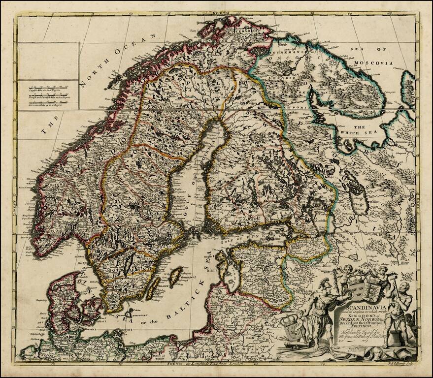
Nice example of John Senex's map of Scandinavia and the Baltic Sea, from his New General Atlas. Fine dark impression of this scarce map, including a decorative cartouche, 3 coats of arms and a dedication to the Duke of Shando.
Rare Chart of Northern Europe from an Influential Atlas Scarce engraved sea chart comprising Scandinavia, the Baltic Sea, and the North Sea (here "German Ocean"). Interestingly, Norway is separate from Danish Norway, and there is a separation drawn...
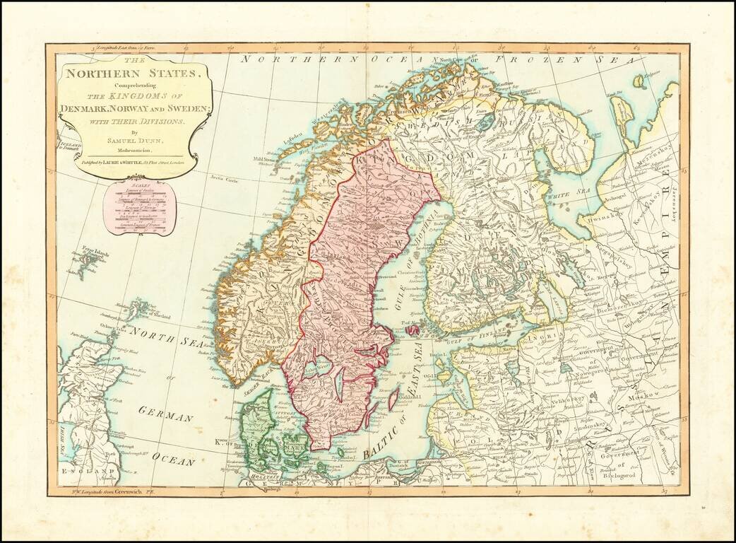
Detailed regional map of Scandinavia and the Baltic Sea, colored by Political divisions. Includes towns, mountains, rivers, lakes, islands, etc. From Dunn's New Atlas or Mundane System of Geography.
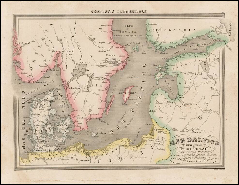
Fascinating map of the Baltic region and Scandinavia, focusing on the topographcal features, from Marmocchi's scarce Geografia Commerciale. A very unique map. The second time we have seen this map on the market.
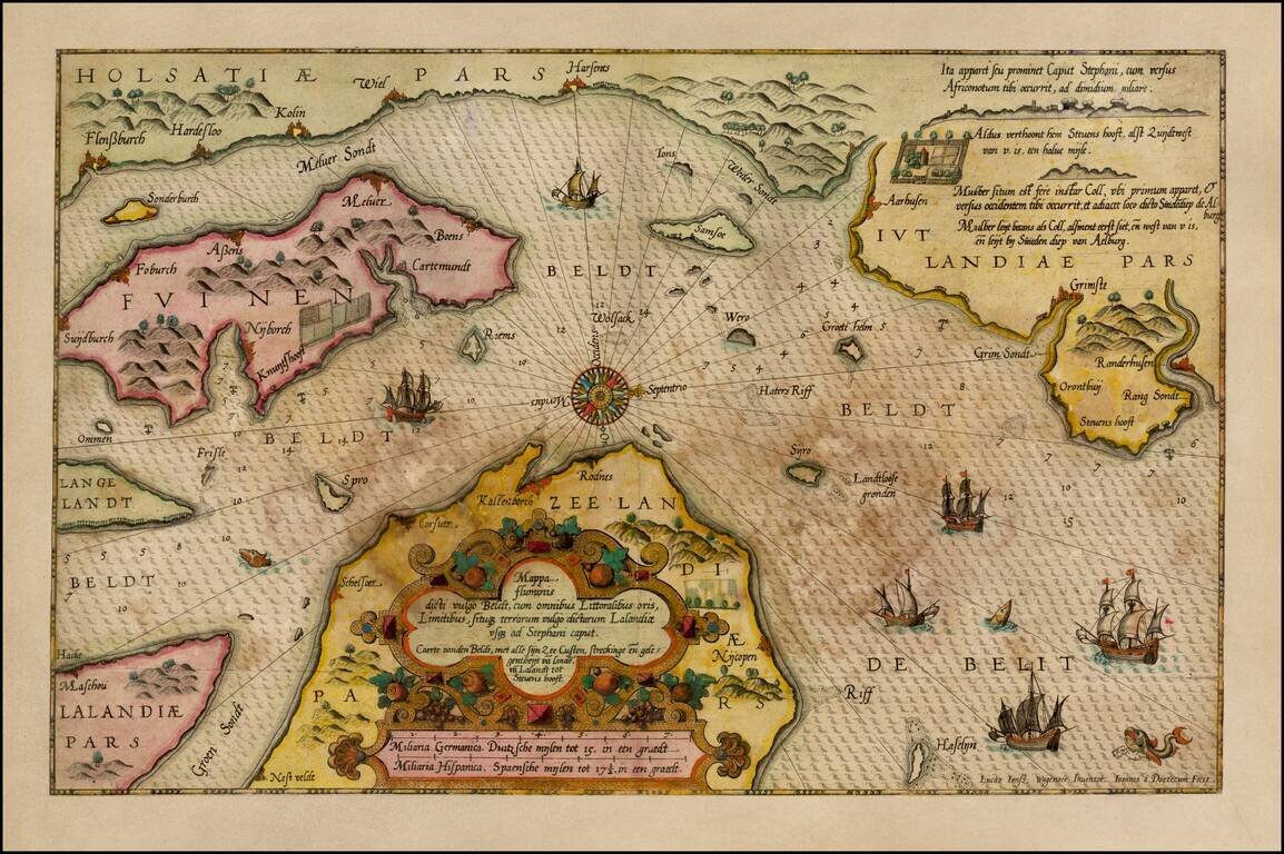
Old Color, gold heightened example of Waghenaer's sea chart showing a significant part of the coastline of Denmark. The chart includes the modern cities of Randers, Kalundborg, Korsor, Aarhus, Horsens, Vejle, Kolin, Haderslev, Sonderborg, Nordborg,...