
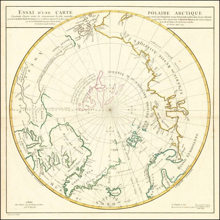
A Cartographic Landmark -- De Vaugondy's Presentation to the French Royal Academy on the Most Practicable Sailing Routes to the Pacific via the North Polar Regions Extremely rare polar map produced to illustrate a presentation made by Didier Robert...
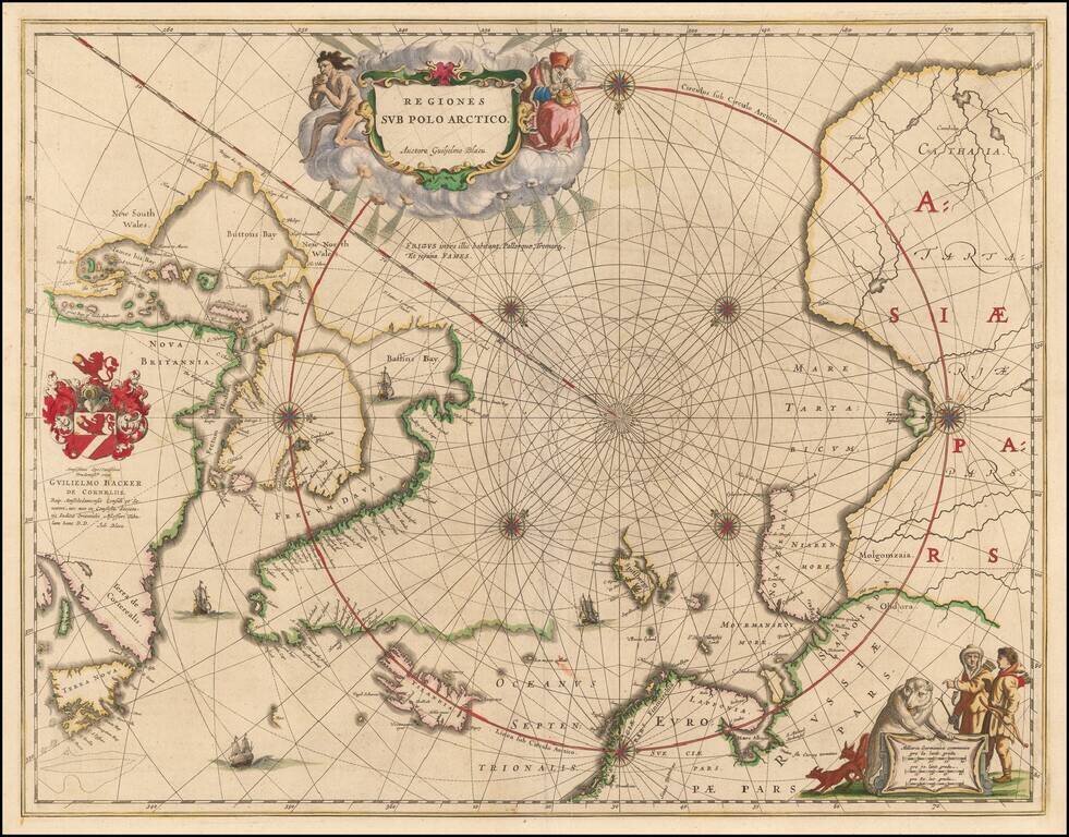
Nice example of the second edition of Blaeu's signature map of the North Polar Regions, with several wonderful cartouches and decorative coat of arms. Blaeu's decorative map of the North Pole, including Arctic North America, Scandinavia, and northern...
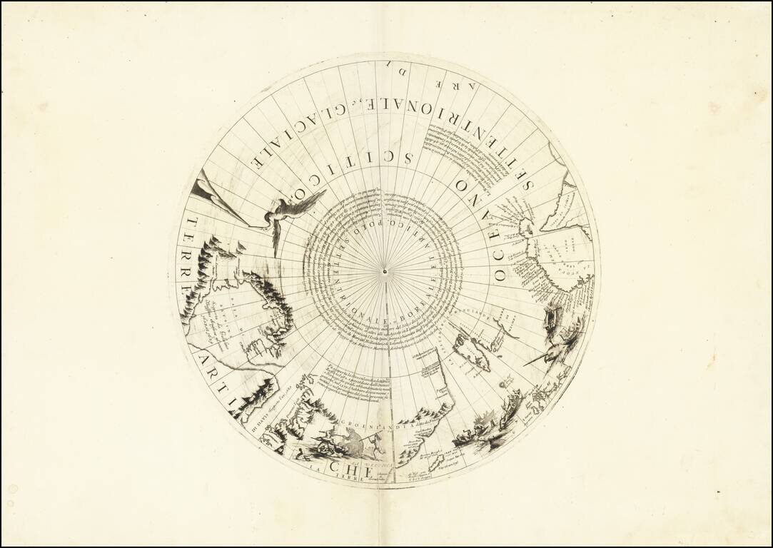
Rare north polar section of Coronelli's remarkable globe gores, first published in 1690. The present gore section is the upper calotte for Coronelli's large (110cm) globe showing the north pole and surrounding areas. The section includes extensive...
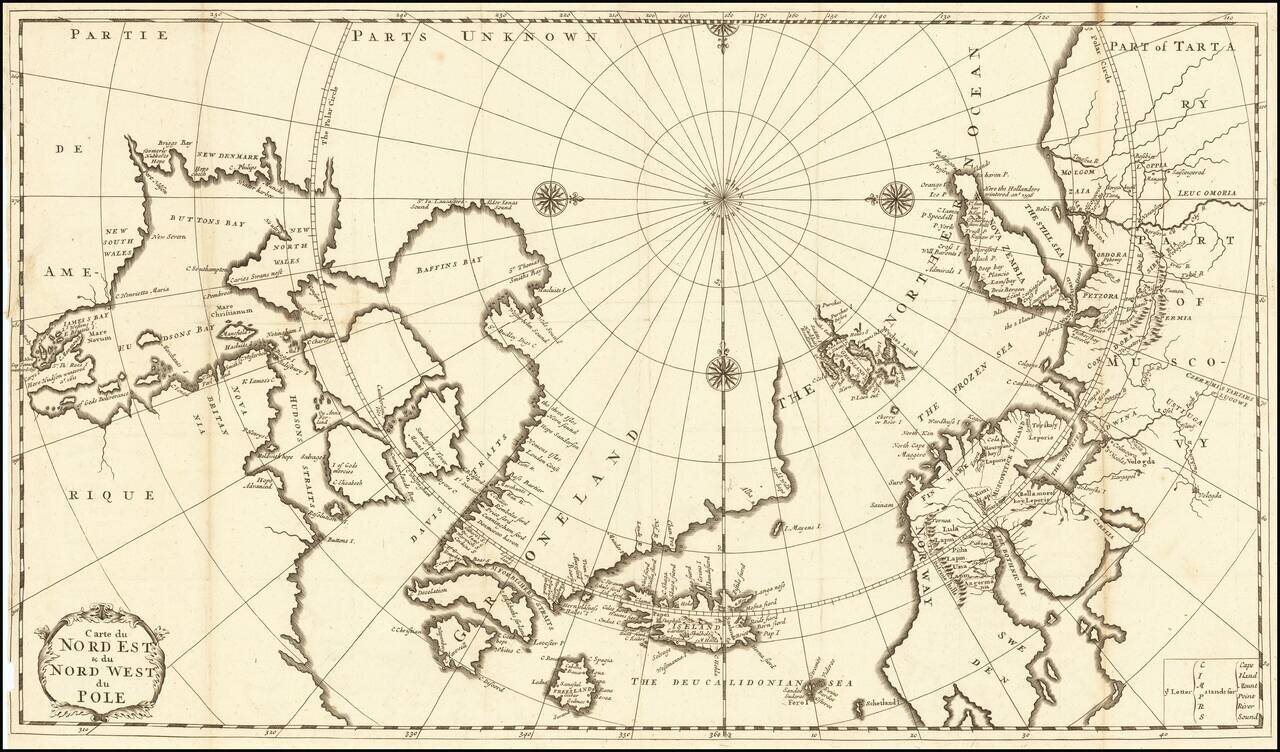
Fine Eighteenth-Century Map of the Arctic Elegant and finely-wrought map of “Northeast and Northwest of the Pole,” published by Amsterdam-based French scholar and mapmaker Jean Frédéric Bernard. The map encompasses the polar region from Tartary...
Decorative map Europe, Iceland and part of Greenland, with sea monsters and land creatures in the sea and on land. Large decorative cartouche and characters. Scherer's Atlas Novus was a 7 volume compendium which demonstrated his unique style and...
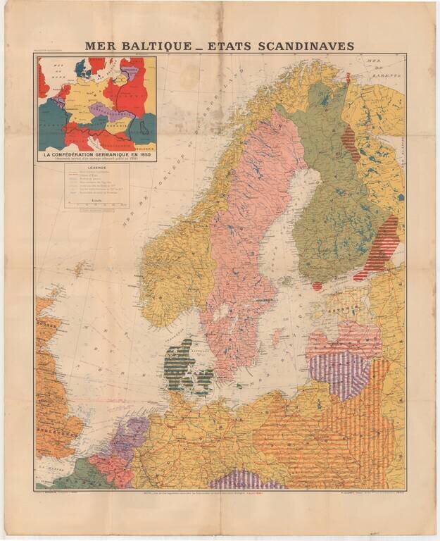
Large format map of the Theater of War in 1940, published in Paris. The inset map shows the German Confederation as it will appear in 1950, based upon a public German document from 1904. The areas identified in Striped regions have already been taken...

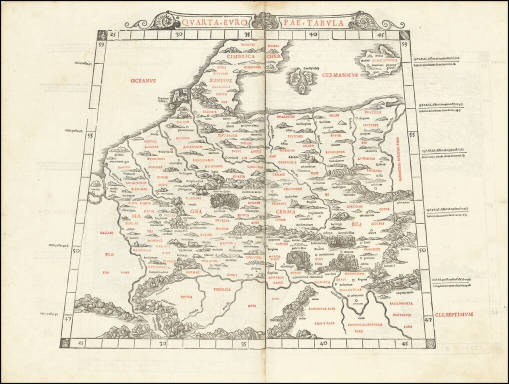
Rare Early Map of Northern Europe Important early map of Northern Europe, Scandinavia and the British Isles, which first appeared in the 1507-1508 Rome edition of Ptolemy's Geography, Claudii Ptholomei Alexandrini. Cosmographia..., created under the...
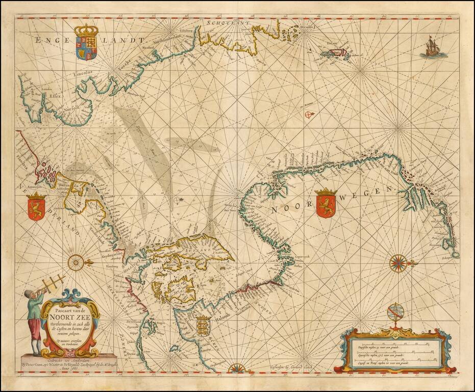
Nice example of Goos' Sea Chart of the Noort Zee, extending from the Mouth of the Thames and the English Channel and Calais and Dunkirk to Stetin and Christianopolen on the Baltic and Dronten and Schogen in Norway. The chart is oriented with north at...
Fine Chart of the Far North Atlantic from an Influential Atlas Scarce sea chart of the north Atlantic covering the British Isles, North Sea, Scandinavia, Iceland (here "Iseland"), the German coast, and the Baltic. This chart is on a Mercator...
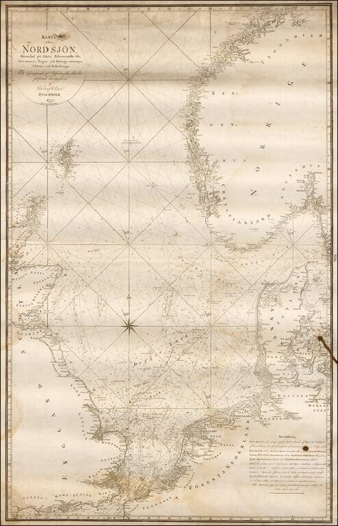
Rare Swedish chart of the region between the British Isles, Scandinavia and the Netherlands, published in Stockholm. Covers England's south coast in the south and east coast of Scotland in the west, Trondheim in the north and Wismar - Stromstad in the...
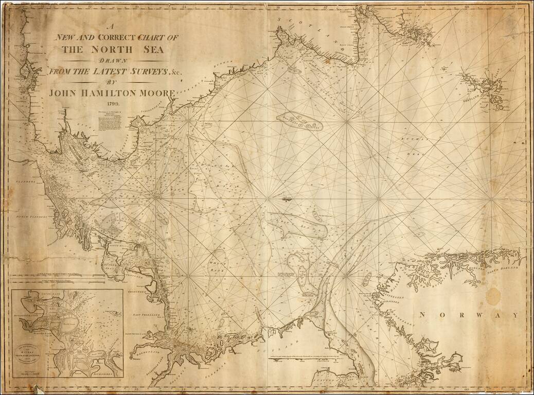
Exceedingly rare early commercial Sea Chart of the North Sea by John Hamilton Moore, published in London. Moore was one of the earliest blue back chart publishers working in London. The present chart is apparently the second edition, after an edition...
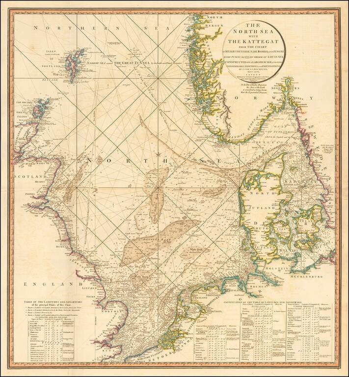
Striking and highly detailed sea chart of the North Sea from the Straits of Dover to the Shetlands and North Bergen in Norway, and east through the Kattegat to Copenhagen. Highly detailed sea chart, with extensive tables and annotations. Shows...
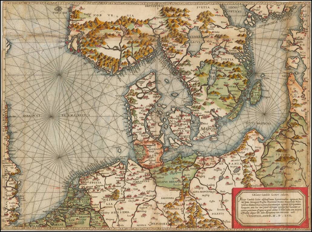
"Beyond all comparison the best map of the Southern Baltic and the North Sea." (A.E. Nordenskold) Extraordinary old color example of this rare Lafreri School Map of Scandinavia, the Baltic and contiguous parts of Poland, Germany, the Low Countries...
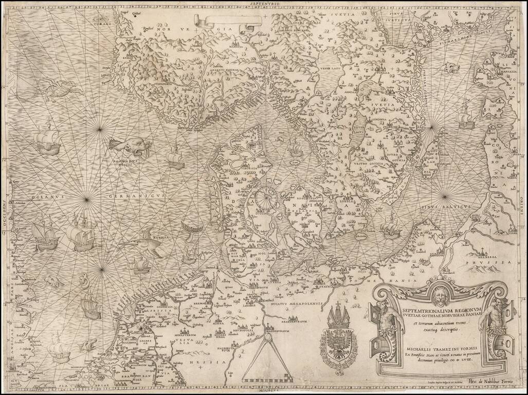
The most important modern map of Scandinavia and the Baltic Regions published in the mid-16th century. Rare and highly important early map of Scandinavia, the Baltic Sea and the North Sea by Michael Tramezini, based upon Cornelis Anthoniszoon's lost...
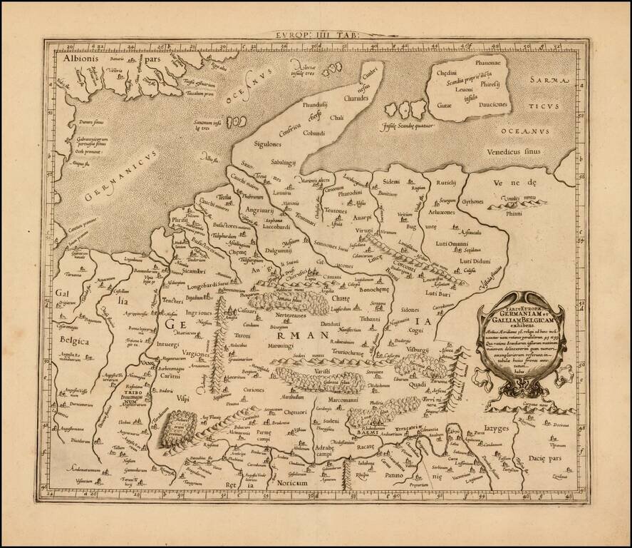
Attractive map of Denmark, Germany, Netherlands and Belgium, on the Ptolemaic model. Mercator originally published this map in his 1578 edition of Ptolemy's great Geography. The present example is the second edition of the map, first issued in 1698....
This is Sylvanus's scarce map of northern Europe, depicting the region encircled by the Rhine in the west, the Danube in the south, and the Vistula in the east. One of the earliest obtainable maps of the region, and the first printed in two colors,...