
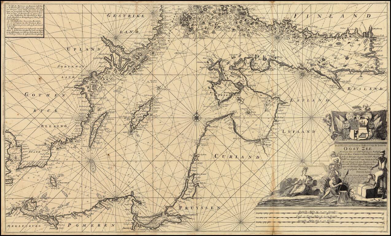
Extremely rare over-sized sea chart of the Baltic, published by Johannes Loots. Loots chart of the Baltic Sea extends from Copenhagen and Rostock in the west, to Wyborg, Narva and Ryga in the east, showing the region in exceptional detail, including...
![Europae Tabula VIII [Russia, Ukraine, Baltic, Scandinavia]](/map/small/44610.jpg)
Nice example of Gastaldi's map of the region bounded by the Baltic in the North and the Black Sea in the south, based upon Ptolemy. Giacomo Gastaldi is considered as the foremost Italian cartographer of the 16th century along with Paolo Forlani. From...
![[Russia, Sweden, Finland, Estonia Latvia and Lithuania].](/map/small/36638.jpg)
A fine wide margined example of the northern sheet of the first edition of Gastaldi's 2-sheet map covering Russia, Sweden, Finland, Lithuania, Latvia and Estonia, published in Venice in 1562. The present offering is the northern sheet only (of 2) of...
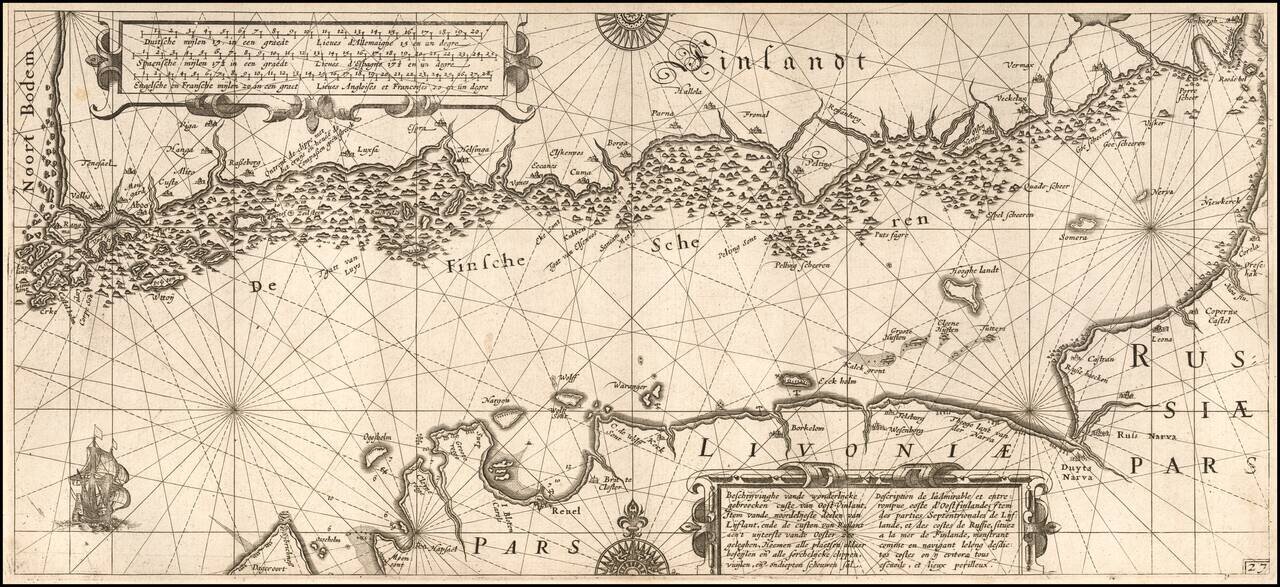
One of the Earliest Detailed Sea Charts of the Baltic Coastline Finely engraved sea chart Gulf of Finland, extending from St. Petersburg in the east to Estonia and the entire coast of Southern Finland. The chart appeared in Blaeu's Her Licht der...
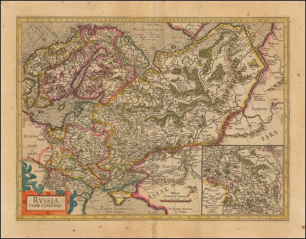
Nice outline color example of Mercator's first map of Russia. The map shows the region from Scandinavia to the Black Sea and the Oby River. Large inset of Russia Pars Amphisicata (Moscovia). Numerous Eastern European regions are shown, including:...
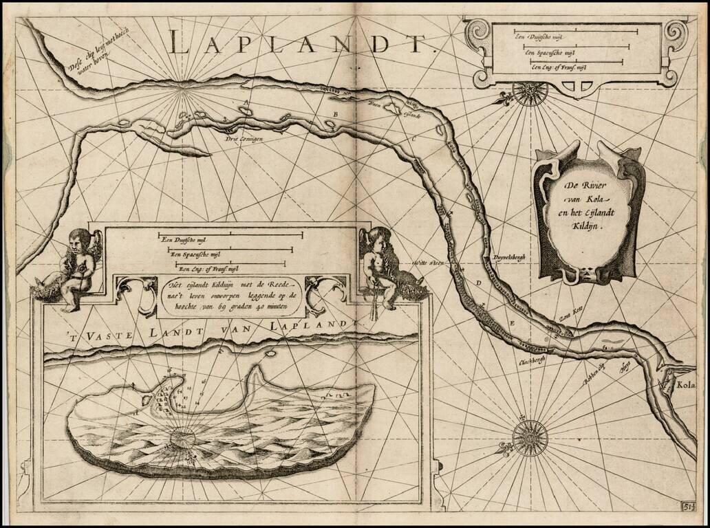
First edition of Blaeu's chart of part of Lapland, near Murmansk, from Blaeu's Zeespiegel, Inhoudende Een Karte Onderwijsinghe in de Konst de Zeevaert, en Eene beschrijvinghe der Seekusten van de Oostersche, Noordsche, en Westersche Schipvaert. The...
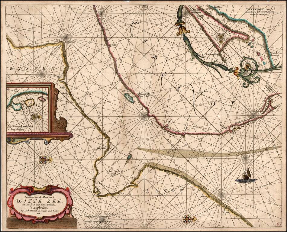
Rare sea chart of a part of the White Sea, published by Jacob Theunisz (Lootsman). At first Jacob adopted his father Anthonie's name, being known as Jacob Theunisz. Later with his brother, Caspar, in association, they added the name Lootsman to their...
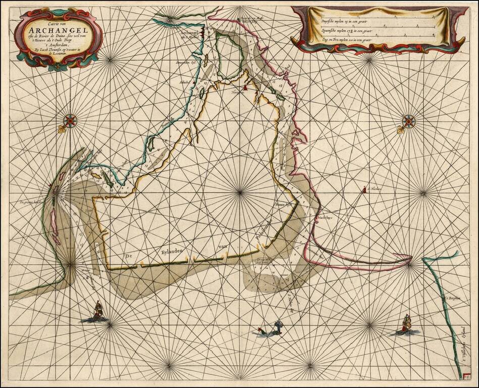
Rare sea chart of the mouth of the Duina River and the port town of Archangel, published by Jacob Theunisz (Lootsman). At first Jacob adopted his father Anthonie's name, being known as Jacob Theunisz. Later with his brother Caspar, in association,...
![De Zee Custen van Ruslant, Laplant, Finmarcken, Spitsbergen en Nova Zemla [Heightened in Gold]](/map/small/54892.jpg)
Detailed sea chart of the coasts of Russia, Finland, and Spitsbegen in old color. Includes an inset map of "De Reviere Dwina opte Reviere van Archangel". The chart includes a detailed plan of the coastlines, soundings, anchorages, coastal details,...
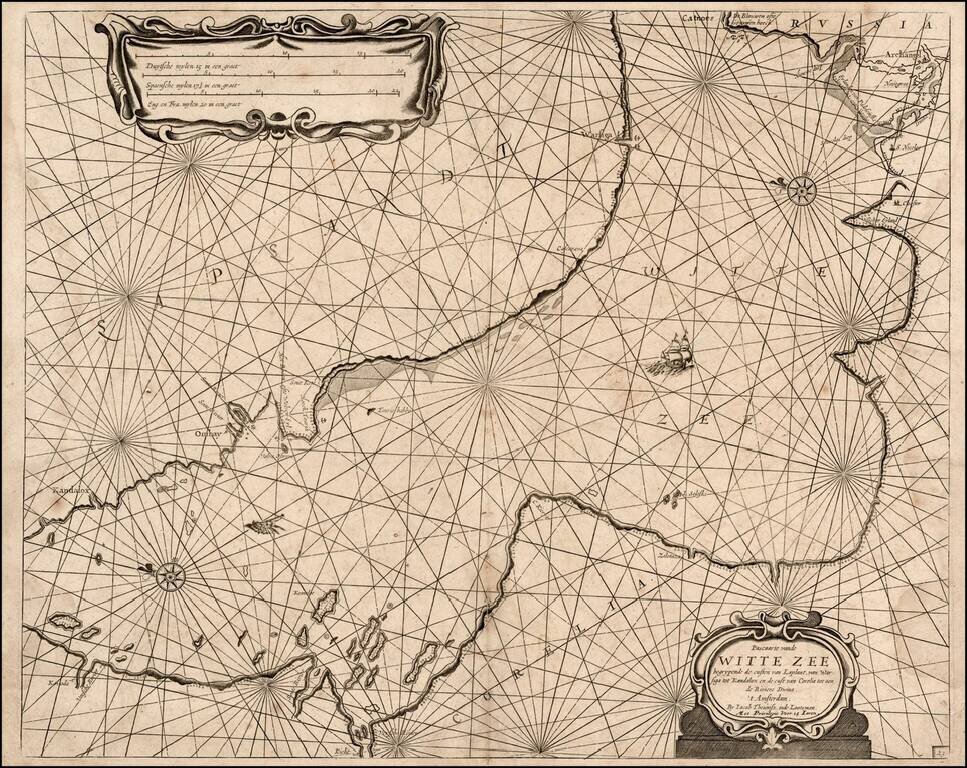
Rare sea chart of a part of the White Sea, published by Jacob Theunisz (Lootsman). At first Jacob adopted his father Anthonie's name, being known as Jacob Theunisz. Later with his brother, Caspar, in association, they added the name Lootsman to their...
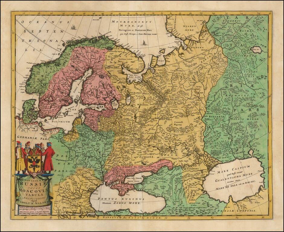
Nice example of Carol Allard's map of Russia and much of Northern Europe. Embellished with a decorative cartouche and coat of arms, plus sailing ships and sea monsters. Based on the cartography of Isaac Massa. The map is an updated version of Hugo...
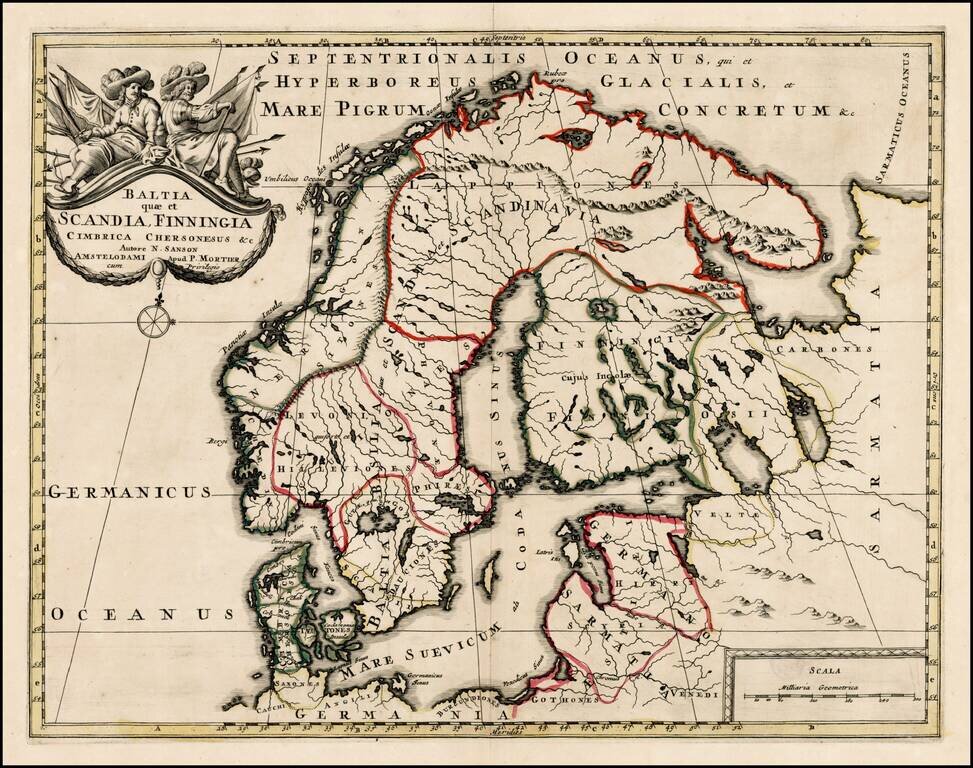
Scarce map of Scandinavia, the Baltic Region and contiguous parts of Finland and Russia. The map appeared in Mortier's Atlas Antiquus, based upon the work of Nicolas Sanson.
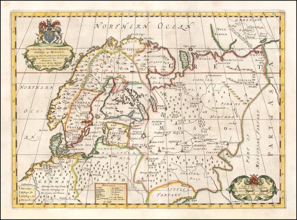
Decorative map of Scandinavia and Russia at the beginning of the 18th Century. This map was part of an atlas dedicated to the Duke of Glocester, who was then attending school in Oxford. English coat of arms and decorative cartouche.
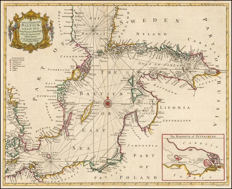
Detailed coastal chart of the Baltic Sea, Bay of Bothnia, Gulf of Finland and contiguous coastlines, with a large inst map o the Harbour at St. Petersburg. Includes a compass rose and rhumblines, with a decorative title cartouche.
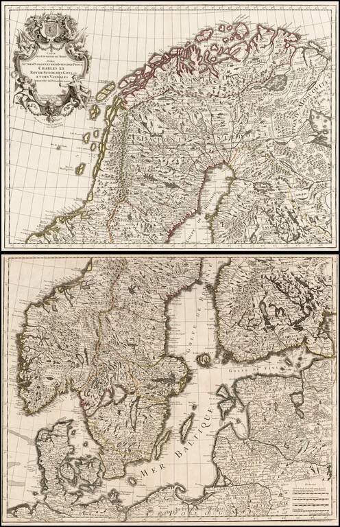
Large format 2-sheet map of the region from Scandinavia to the Baltic and part of Poland, originally issued by De L'Isle in 1708.
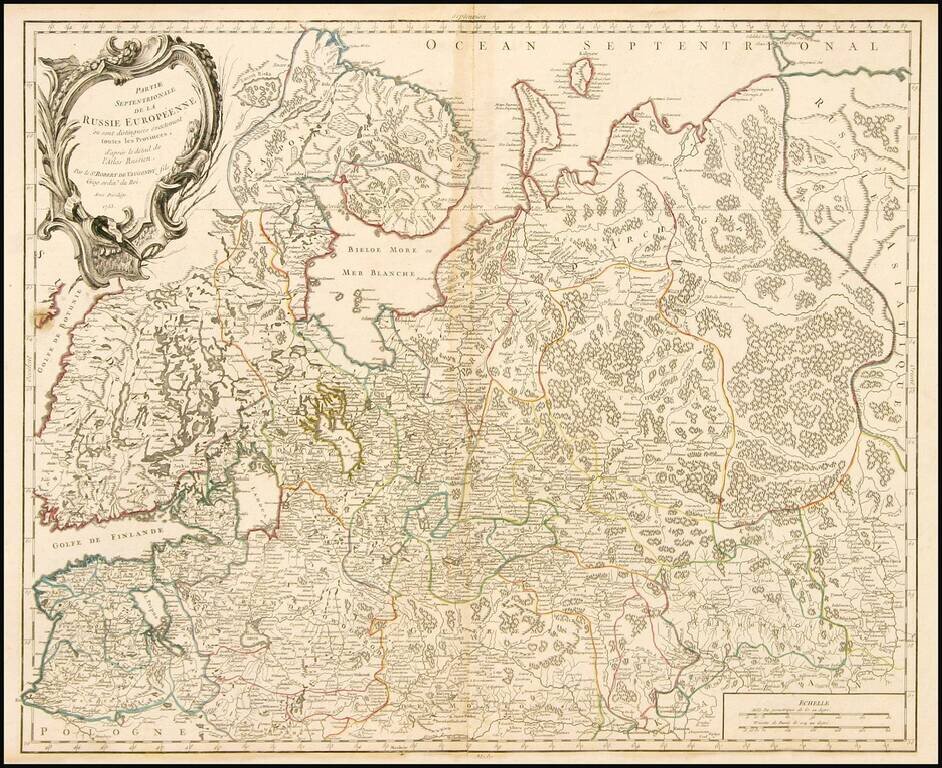
Highly detailed map of the Northwestern part of Russia, from the Gulf of Finland and Poland, to the western part of Asian Russia. Decorative cartouche.