Map size in jpg-format: 41.0351MiB
Click to open in high resolution (open in new tab).
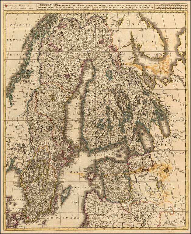
Fine map of Scandinavia and the Baltic, published in Amsterdam by Valk.
Shows Norway, Sweden, Finland, Estonia and Latvia.
It depicts a significantly contracted Swedish Empire having suffered defeats against both Norway and Russia over the previous century.
The most notable battle was fought against Peter the Great at Poltava in 1709 resulting in the end of Swedish dominance in the region.
If you are a student, write to us in telegram: @antiquemaps and indicate what material you need and for what work you need a map in high detail. We are ready to provide material on special terms. For students only!


