
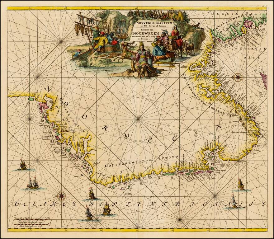
Finely colored map of Louis Renard's sea chart of Norway, with east oriented at the top. Striking sea chart, with detailed treatment of the coastal regions, rhumb lines, compass roses, elaborate cartouches and sailing ships.
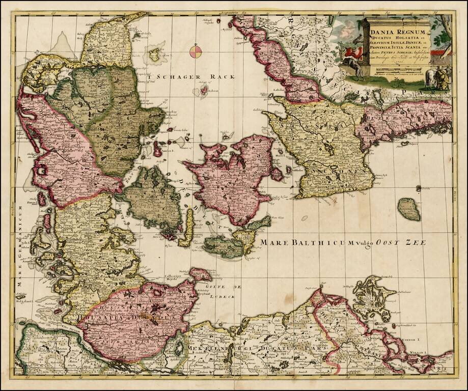
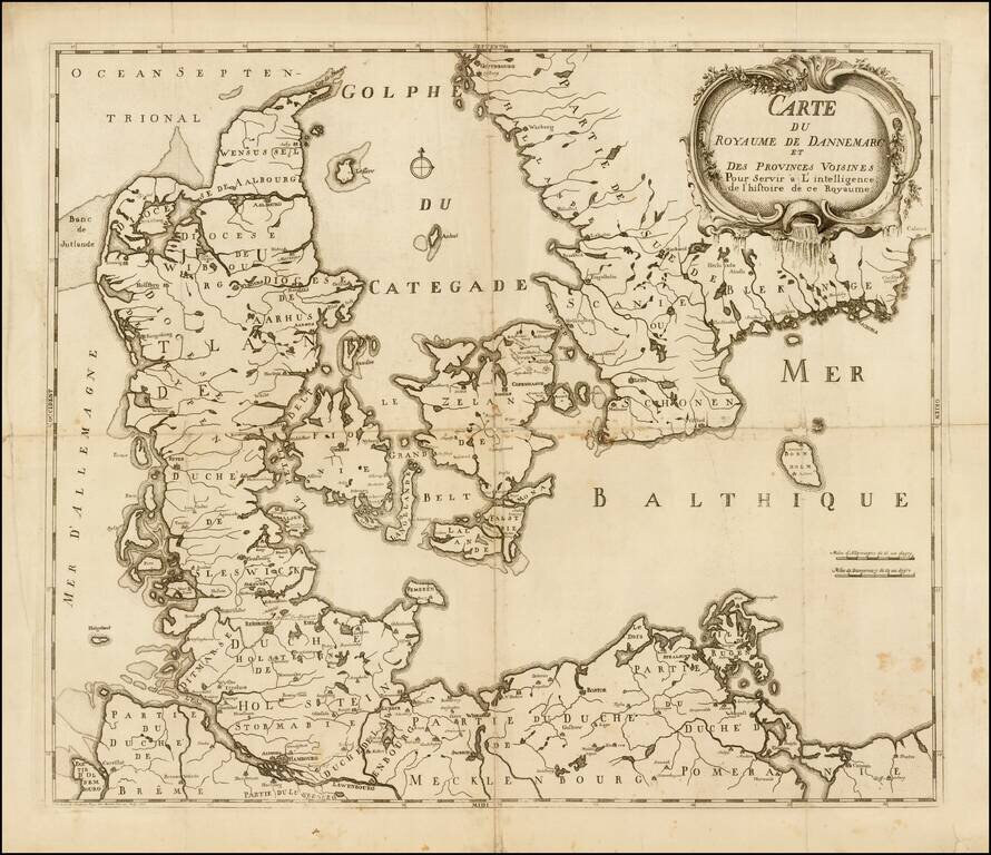
Nice old color example of Pieter Schenk's map of Denmark and surrounding regions, from an early 18th Century composite atlas.
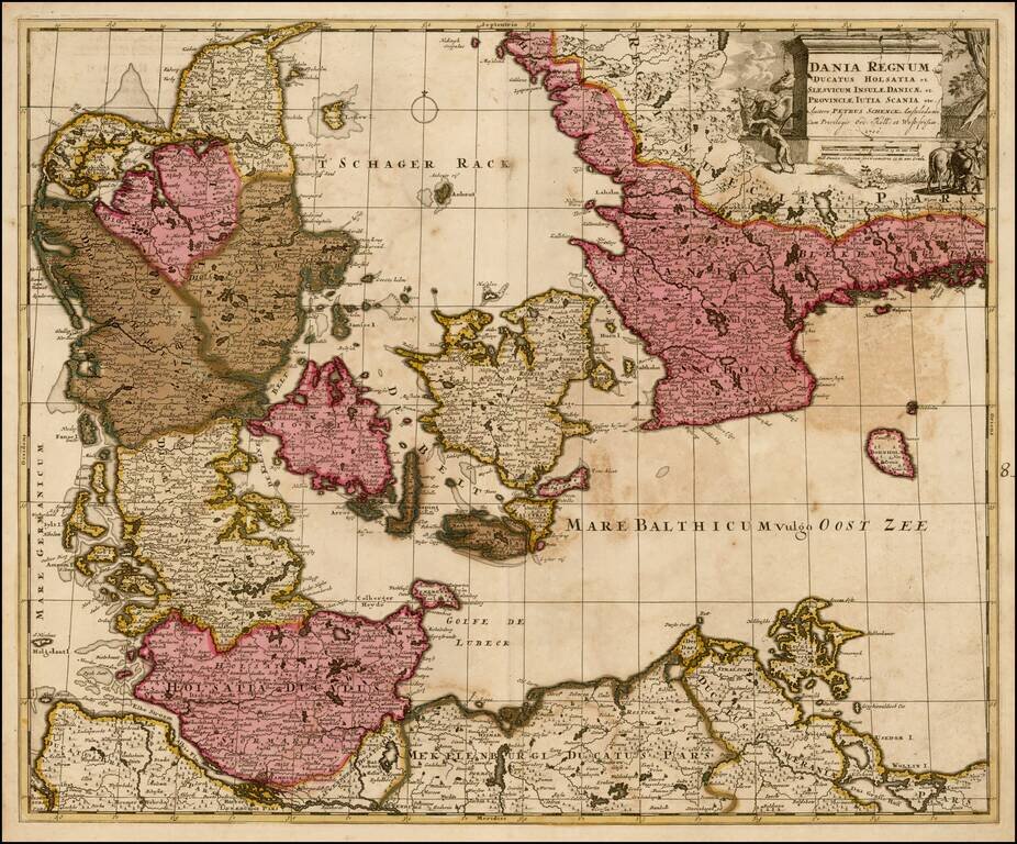
Nice old color example of Pieter Schenk's map of Denmark and surrounding regions, from an early 18th Century composite atlas.
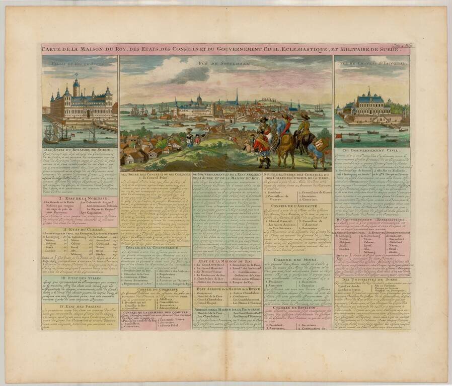
Decorative view of Stockholm, etc. from Chatelain's monumental 7 volume Atlas Historique.
Detailed map of Denmark and southwestern Sweden, published by Vander Aa, in his Le Nouveau Theatre du Monde . . . .
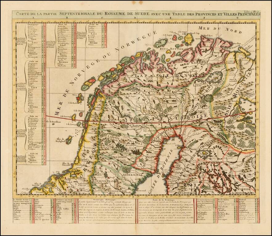
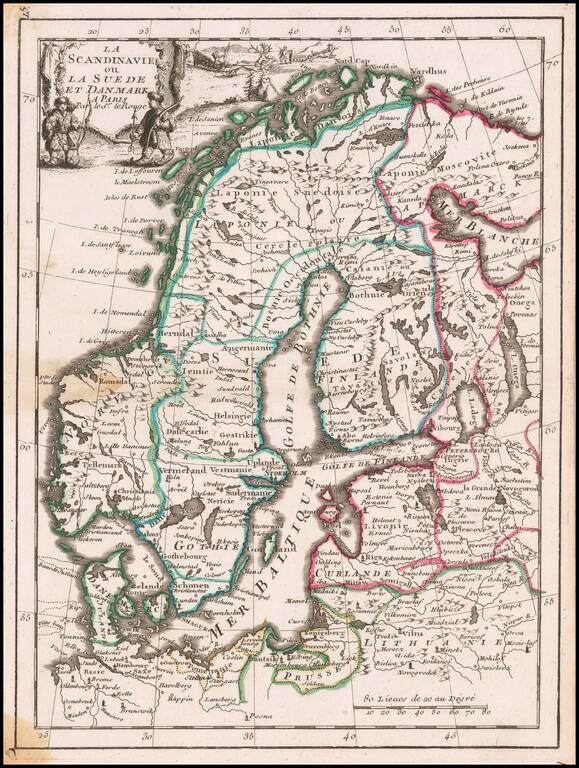
Detailed map of the Northern part of Scandinavia. From Chatelain's monumental Atlas Historique.
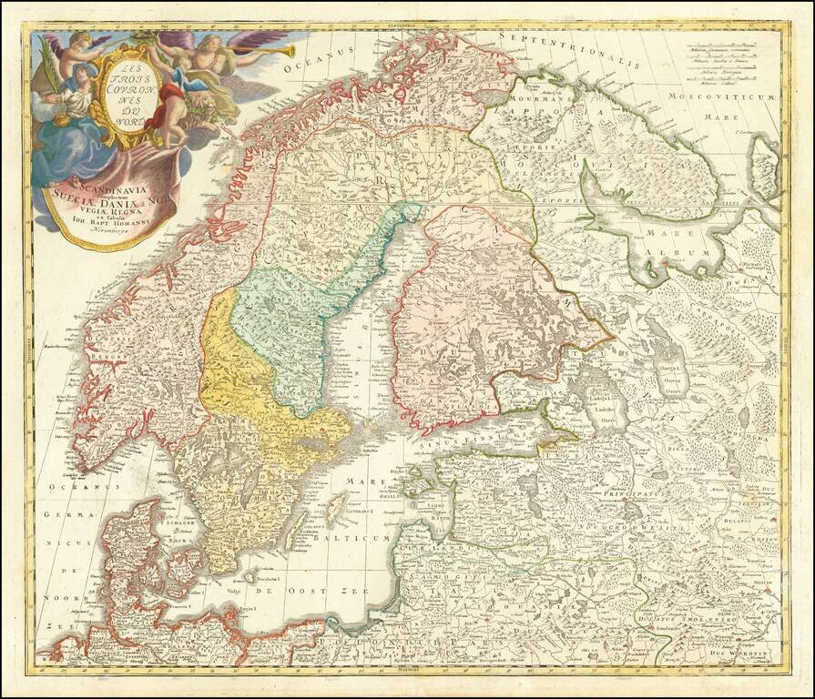
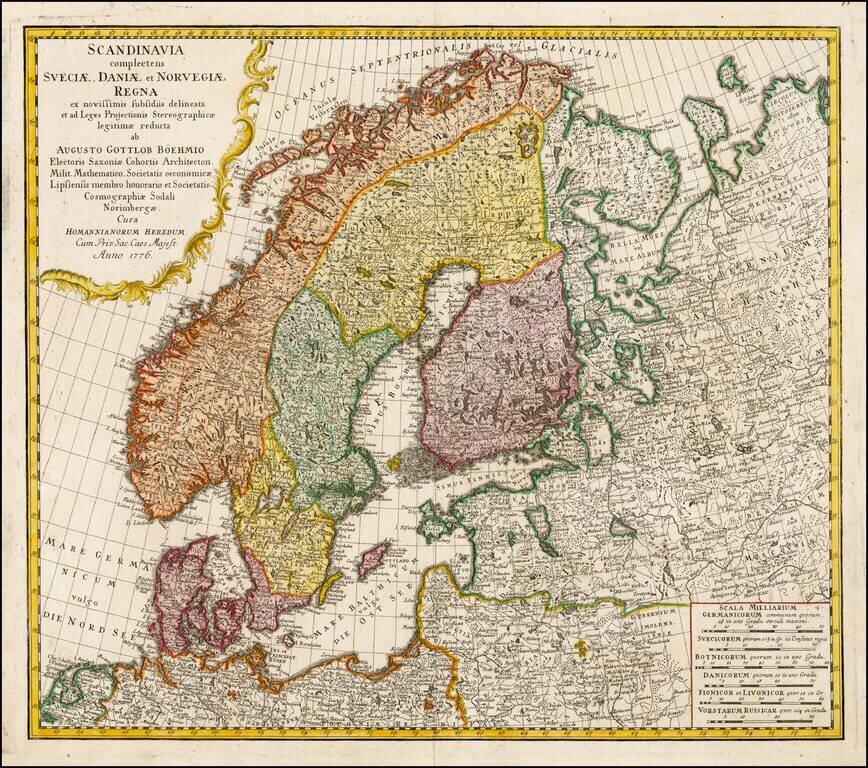
Nice example of Homann's first map of Scandinavia, pre-dating his privilege, where he reworks the map to include a different title and cartouche. Provides excellent detail throughout the region.
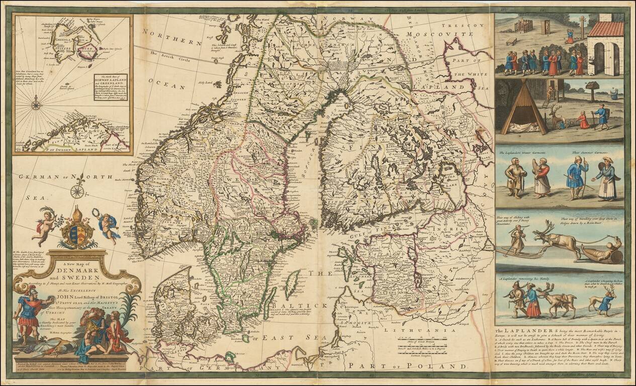
Nice example of Herman Moll's map of Scandinavia, with a large inset map and 5 wonderful vignettes, including a very early example of skiing. A very interesting note on the Laplanders below the vignettes and other notes throughout. This example of...
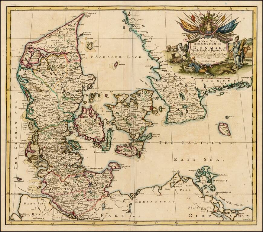
Nice example of John Senex's map of Denmark from his New General Atlas. Fine dark impression of this scarce map, including a decorative cartouche, dedication to Lord Balhaven.
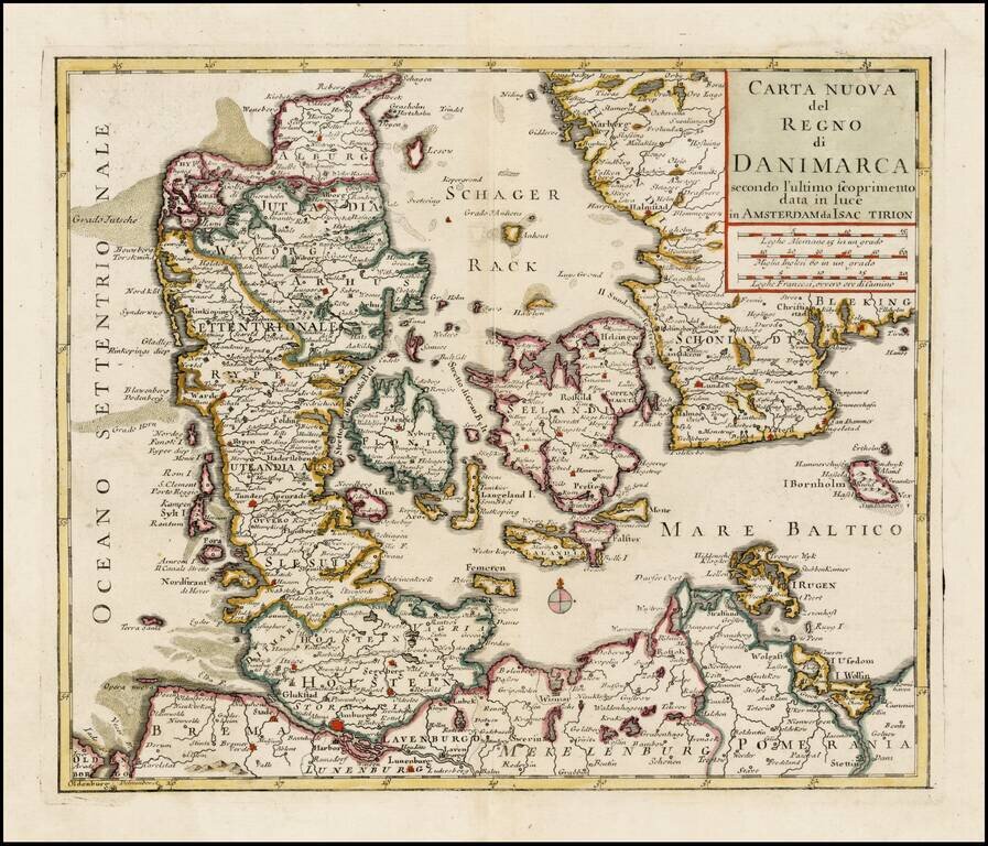
Nice example of Albrizzi's map of Denmark. While the map identifies the maker as Isaac Tirion, the maps first appeared in Albrizzi's Atlas, published in Venice.
Decorative map of Scandinavia, with a cartouche in the upper left corner.
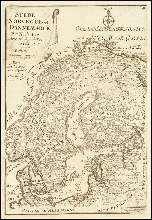
Rare late variant of De Fer's small map of Scandinavia.
Scarce map of Denmark, published by O.H. de Lode in Copenhagen.
Decorative map of Denmark, colored by Provinces. From the Deluxe edition of Brion's atlas, with elaborate decorative border.
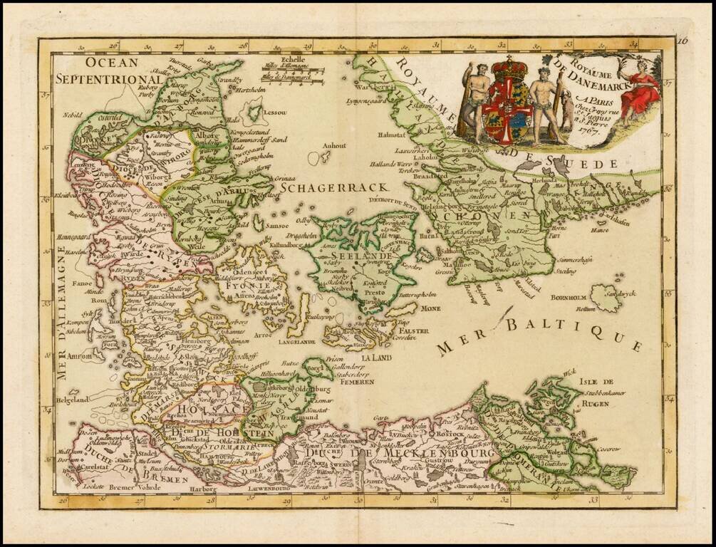
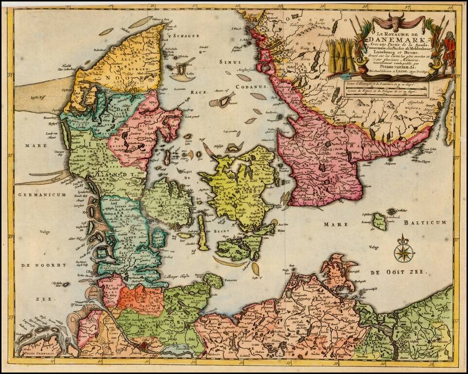
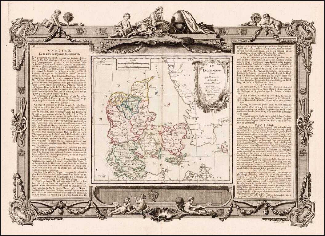
Decorative map of the Kingdom of Denmark, including contiguous parts of modern Sweden.
Nice example of Homann's map of Scandinavia. Provides excellent detail throughout the region. Includes an elaborate title cartouche, with portrait and allegorical vignette.