logo

1850. Mar Baltico sue Isole E Paesi Circostanti Suezia, Norvegia, Danimarca, Prussia, Curlandia, Livonia, Estonia, Ingria e Finlandia . . .

  • Mar Baltico sue Isole E Paesi Circostanti Suezia, Norvegia, Danimarca, Prussia, Curlandia, Livonia, Estonia, Ingria e Finlandia . . .

Mar Baltico sue Isole E Paesi Circostanti Suezia, Norvegia, Danimarca, Prussia, Curlandia, Livonia, Estonia, Ingria e Finlandia . . . information:

Year of creation: 
Resolution size (pixels): 
 3168x2465 px
Disk Size: 
 1.62021MiB
Number of pages: 
 1
Place: 
 Florence

Print information. Print size (Width x height in inches):
Printing at 72 dpi 
  44 х 34.24
Printing at 150 dpi 
 21.12 х 16.43
Printing at 300 dpi 
 10.56 х 8.22

An example of detailing the file of this map of in a printable high-resolution:

Click to open in high resolution (open in new tab).
Attention! this is just the central piece (central area 960x960 px) of the map file!
This is an example, so that you can see and study the level of detail of a given map. The entire Map will be fully available after payment!

Mar Baltico sue Isole E Paesi Circostanti Suezia, Norvegia, Danimarca, Prussia, Curlandia, Livonia, Estonia, Ingria e Finlandia . . .

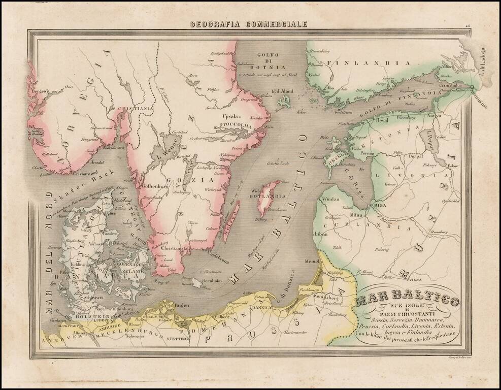
Fascinating map of the Baltic region and Scandinavia, focusing on the topographcal features, from Marmocchi's scarce Geografia Commerciale.

A very unique map. The second time we have seen this map on the market.


Special conditions for students!

If you are a student, write to us in telegram: @antiquemaps and indicate what material you need and for what work you need a map in high detail. We are ready to provide material on special terms. For students only!

Item information:

Year of creation:
Size:
3168x2465 px
Disk:
1.62021MiB
Number of pages:
1
Place:
Florence
Author:
Francesco Costantino Marmocchi.
$14.99

Related item