
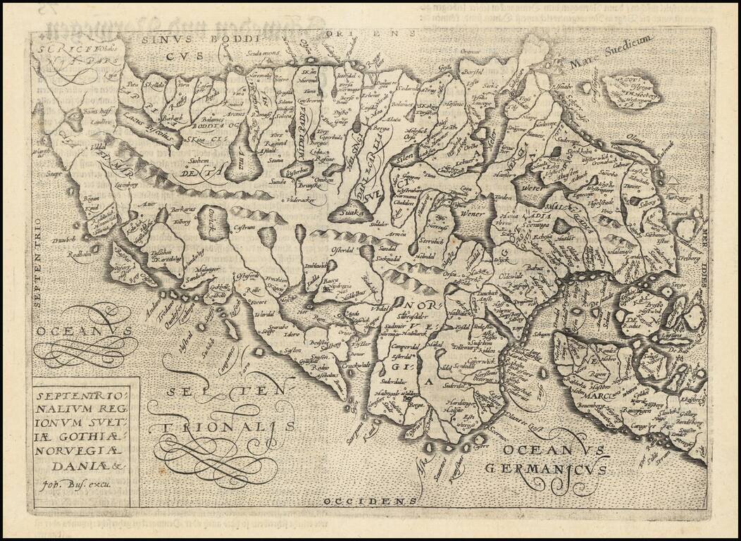
Nice example of this scarce map of Scandinavia, published in Cologne. The map is oriented with east at the top. The present map was produced by one of the primary Cologne School mapmakers, Johann Bussemacher. The Cologne School of cartography was...
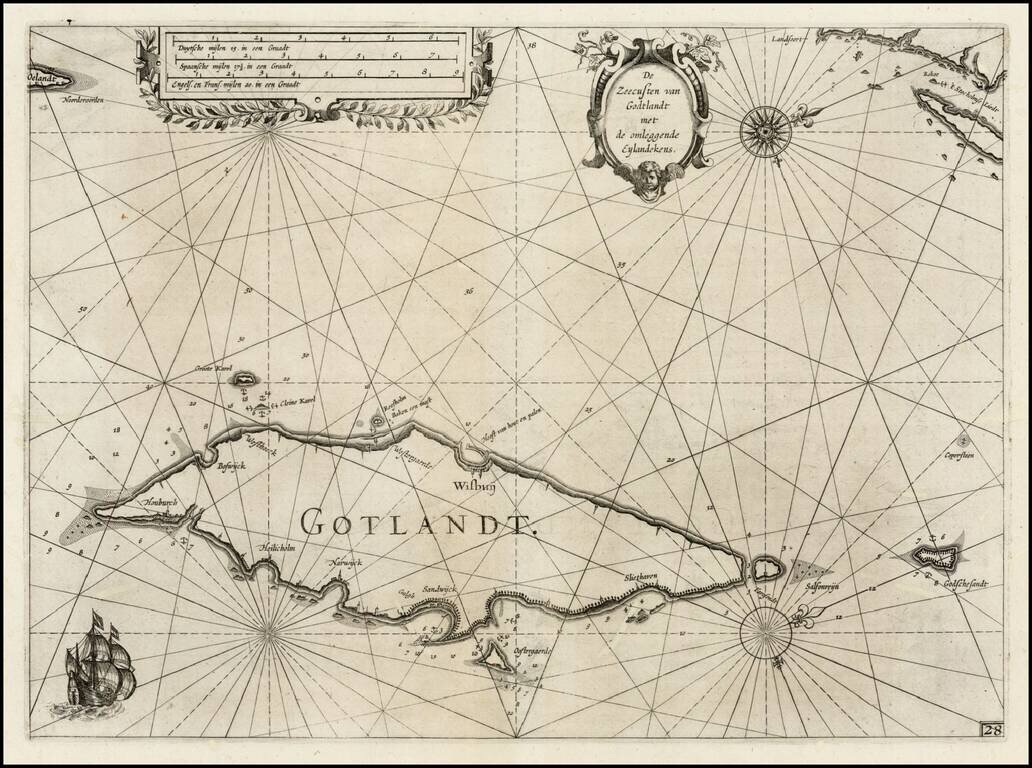
First edition of Blaeu's chart of part of Gotland, from Blaeu's Zeespiegel, Inhoudende Een Karte Onderwijsinghe in de Konst de Zeevaert, en Eene beschrijvinghe der Seekusten van de Oostersche, Noordsche, en Westersche Schipvaert. The map includes...
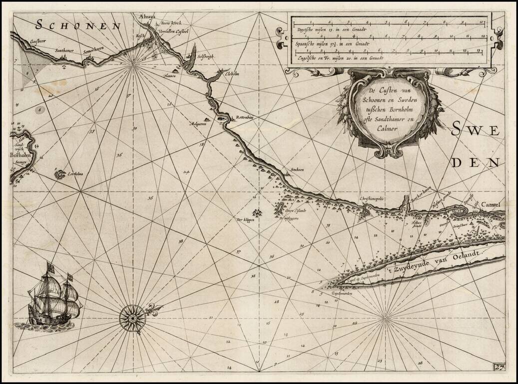
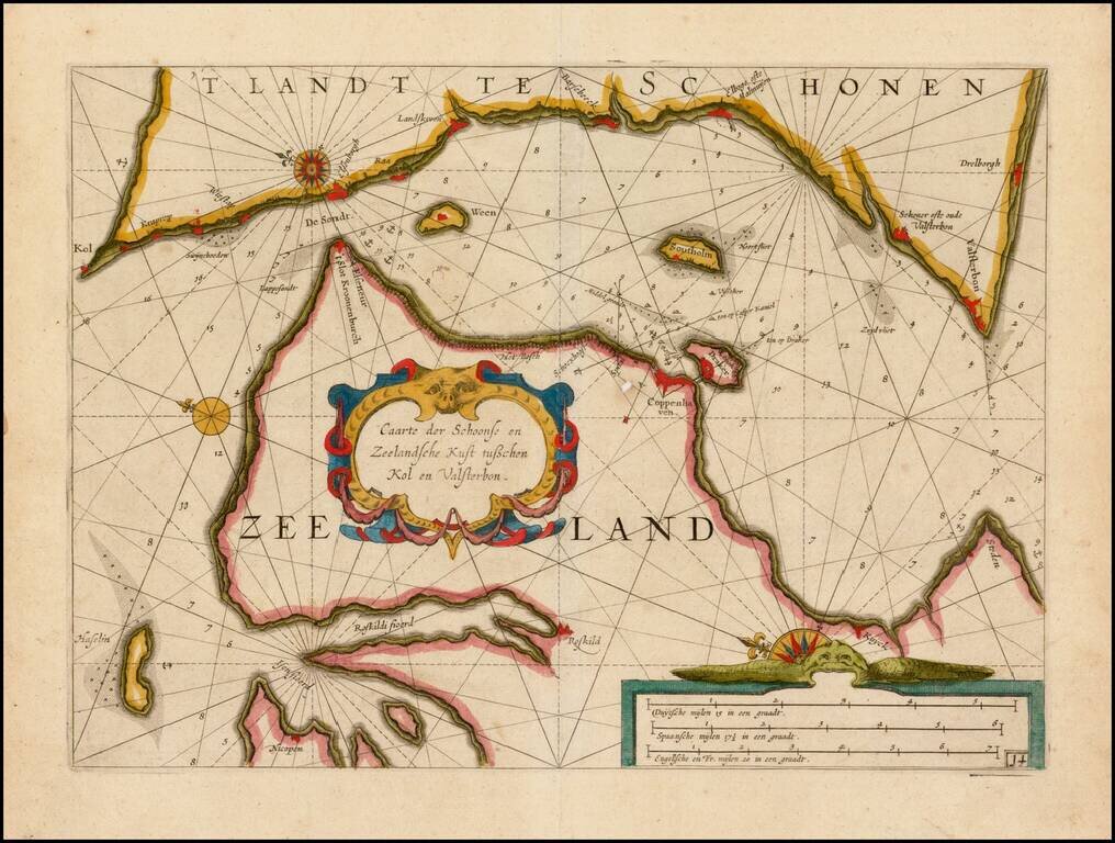
First edition of Blaeu's chart of the southeastern coast of Sweden and part of the Danish Island of Bornholm, from Blaeu's Zeespiegel, Inhoudende Een Karte Onderwijsinghe in de Konst de Zeevaert, en Eene beschrijvinghe der Seekusten van de Oostersche,...
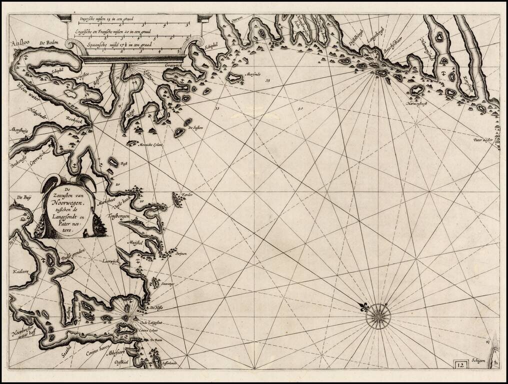
First edition of Blaeu's chart of part of southwestern Norway, from Blaeu's Zeespiegel, Inhoudende Een Karte Onderwijsinghe in de Konst de Zeevaert, en Eene beschrijvinghe der Seekusten van de Oostersche, Noordsche, en Westersche Schipvaert. The map...
First edition of Blaeu's chart of part of Denmark and Norway, from Blaeu's Zeespiegel, Inhoudende Een Karte Onderwijsinghe in de Konst de Zeevaert, en Eene beschrijvinghe der Seekusten van de Oostersche, Noordsche, en Westersche Schipvaert. The map is...
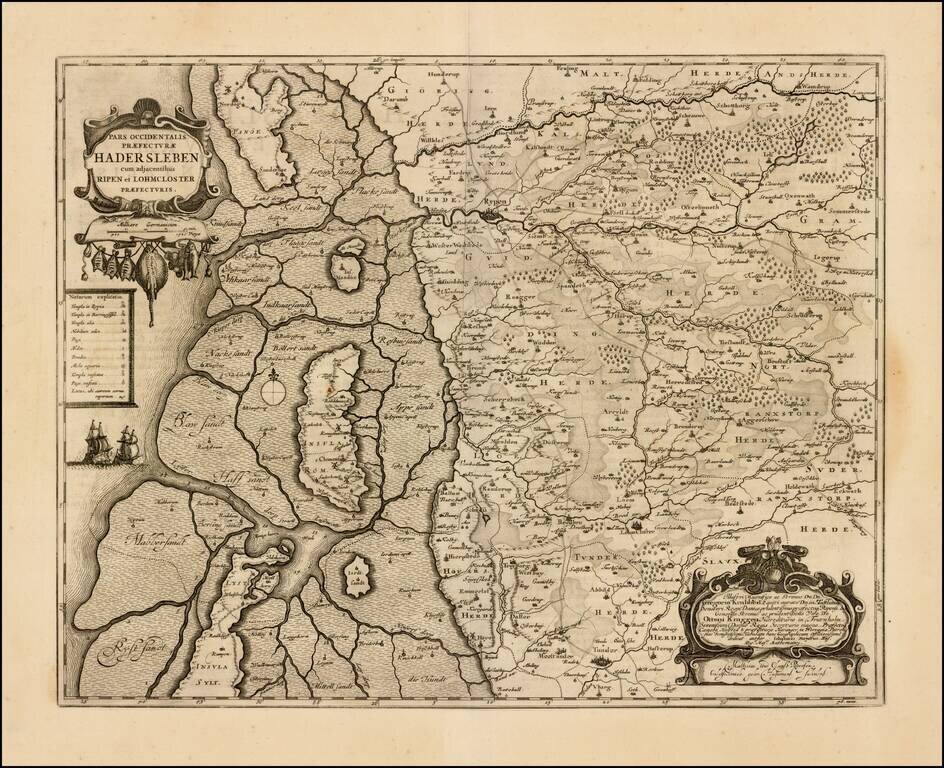
Detailed map of western Denmark, extending from Fano Island in the north, to Sylt Island in the south, showing what was then the western part of the Prefecture of Haderslev. The map includes an elaborate dedication cartouche.
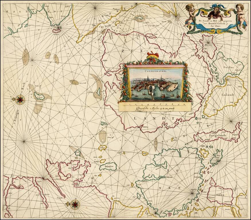
Striking sea chart of the Eastern Part of Denmark (including Copenhagen) and a part of the Swedish coastline opposite Copenhagen, published by Arnold Colom. The chart includes a fine birdseye view of Copenhagen. Arnold Colom was the son of Jacob...
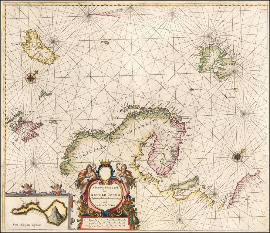
Rare sea chart of the Scandinavia, extending from Iceland to Spitzberg and Nova Zembla. Of note, this is one of, if not the earliest appearance of the reference to the sighting of land on the East Coast of Greenland by Gael Hamkes in 1654. Includes a...
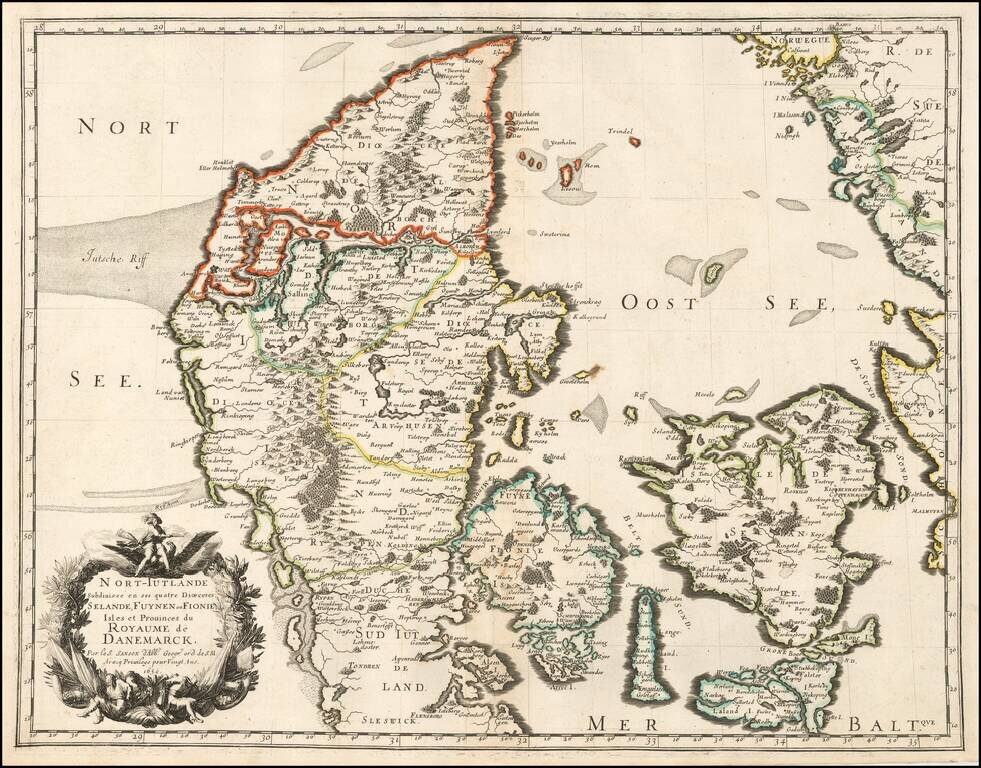
Sanson's 1659 double-page engraved map of Denmark. The map includes a very elaborate cartouche in the lower left corner and is in old outline hand color. Nicolas Sanson (1600-1667) sometimes called Nicolas Sanson d'Abbeville or Sanson d'Abbeville, was...
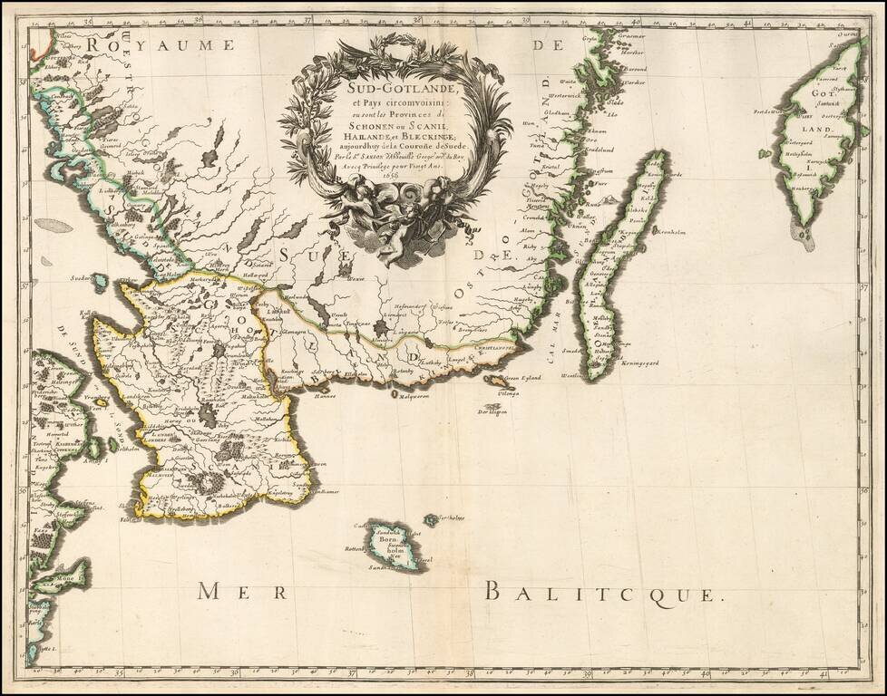
Very nice example of Sanson's 1659 double-page engraved map of southern Sweden. Nicolas Sanson (1600-1667) sometimes called Nicolas Sanson d'Abbeville or Sanson d'Abbeville, was the most important French cartographer of the 17th century. Tooley called...
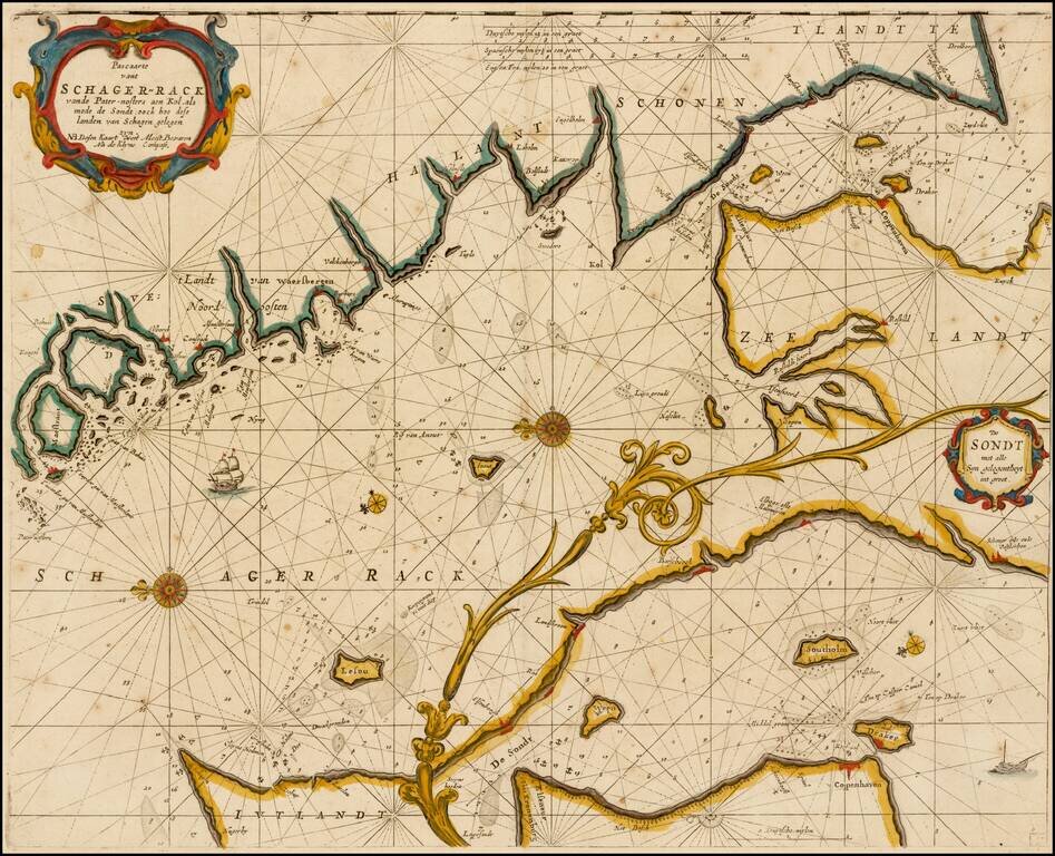
Rare variant of this striking sea chart of the strait between Sweden and Denmark, published by Goos. This east-oriented sea chart shows the waterway between Sweden and Denmark leading to the Baltic Sea. Skagerrak, Kattegat and Oere-Sund with...
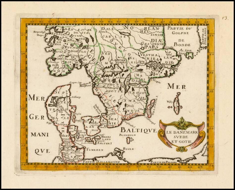
Scarce map of Denmark and Southern Scandinavia, from Briet's Theatre geographique de l'Europe, contenant la division de ses royaumes et provinces.
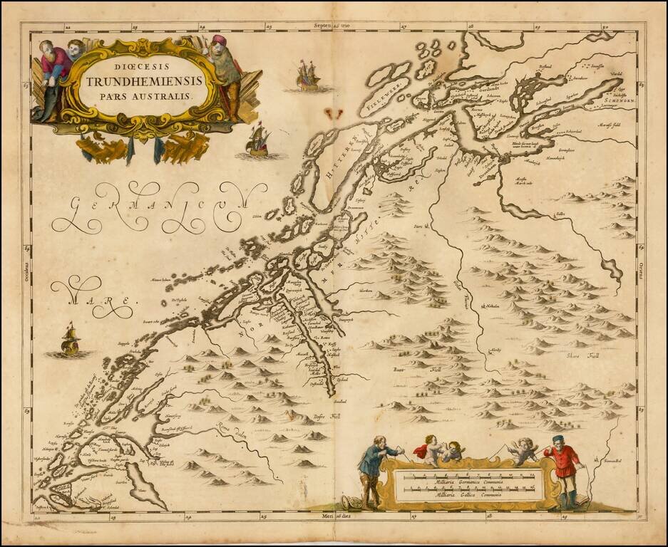
Scarce map of the Southern part of the Diocese of Trondheim in Norway, first published by Jan Jansson in Amsterdam for his Atlas Major.
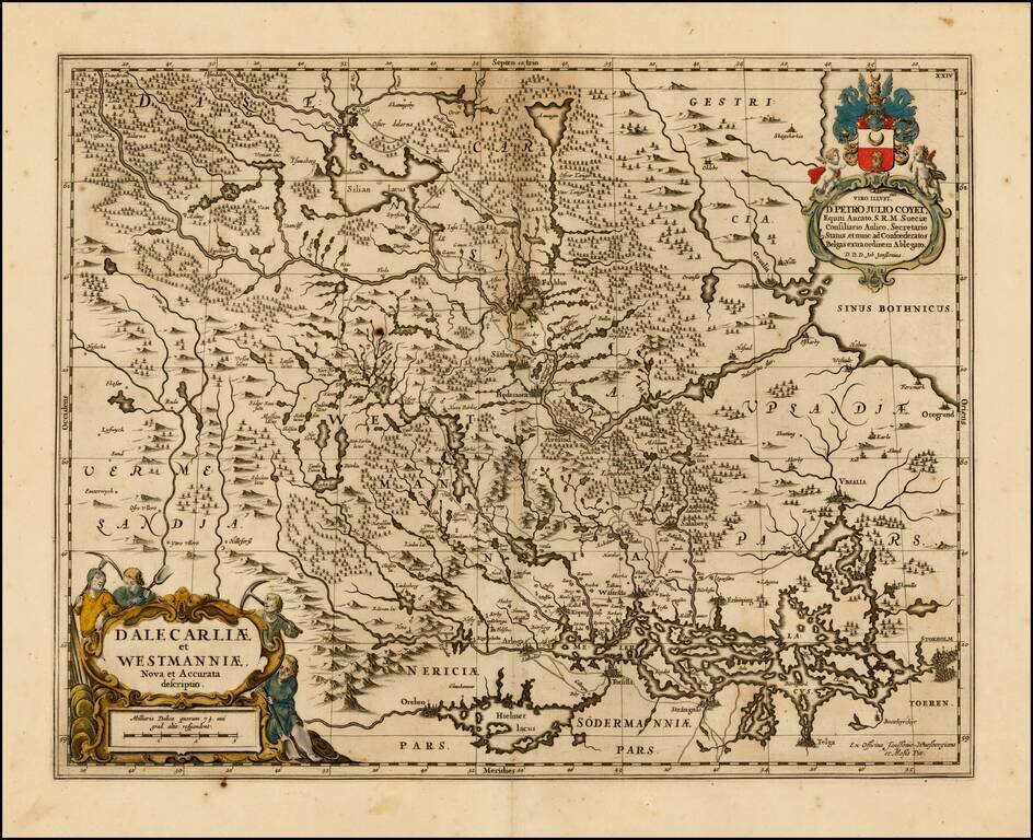
Decorative regional map of central Sweden, published by Moses Pitt. The map is richly decorated with a large figurative cartouche.

Impressive two-sheet engraved antique map of Scandinavia, published by the 17th century London mapmaker William Berry in 1684. The map covers all of Scandinavia, the Baltic Countries, and a large part of northwestern Russia. In 1684, the dominant...
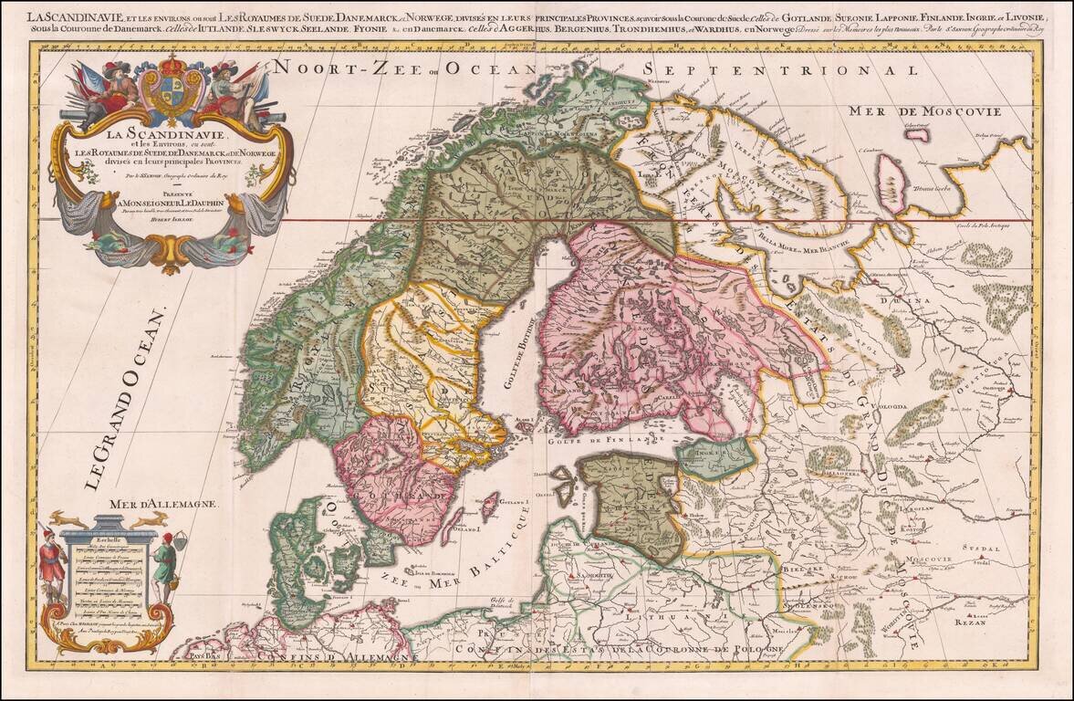
Striking large format map of Scandinavia, published by Hubert Jaillot. First issued in 1674, this two sheet map of the region, based upon the geographical compilations and work of Nicolas Sanson which remained unpublished at the time of his death....