
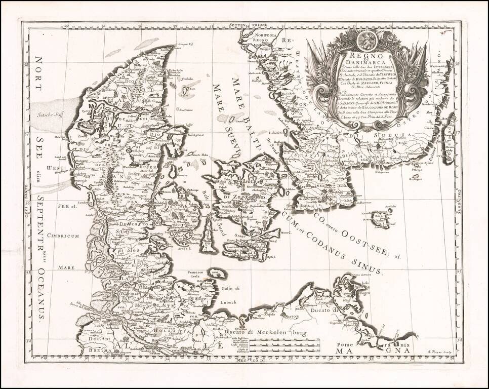
Striking map of Denmark and the southernmost part of Sweden, published in Rome by Giovanni Giacomo Rossi. The map is finely engraved, with an elaborate cartouche.
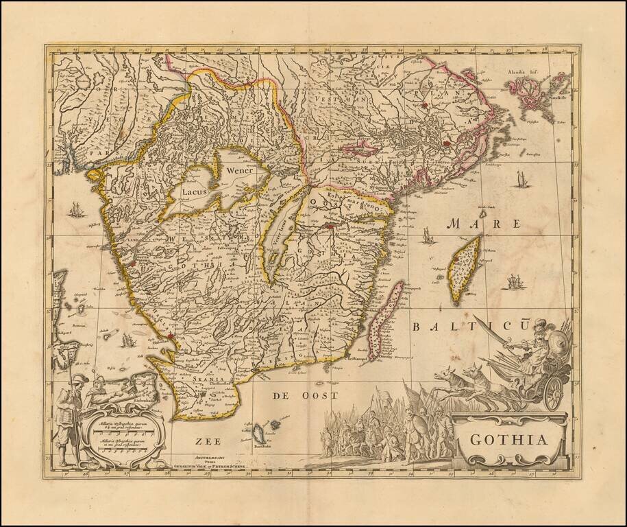
Decorative map of Gothia, published by Valk & Schenk. The map is richly decorated with a large figurative cartouche, scale of miles and sailing ships. Shows the area including Gothenburg, Malmo, Copenhagen, Lund, Helsingborg, Kristianstad,...
![[Sweden] Gothia Auctore Andrea Bareo Sueco](/map/small/0209ops.jpg)
Fine old color example of Blaeu's map of Lapland. The present example is a late state of the map, with credit to Andrea Bareo for the map and an elegant dedication carouche at the left corner, both of which are added to the map after its original...
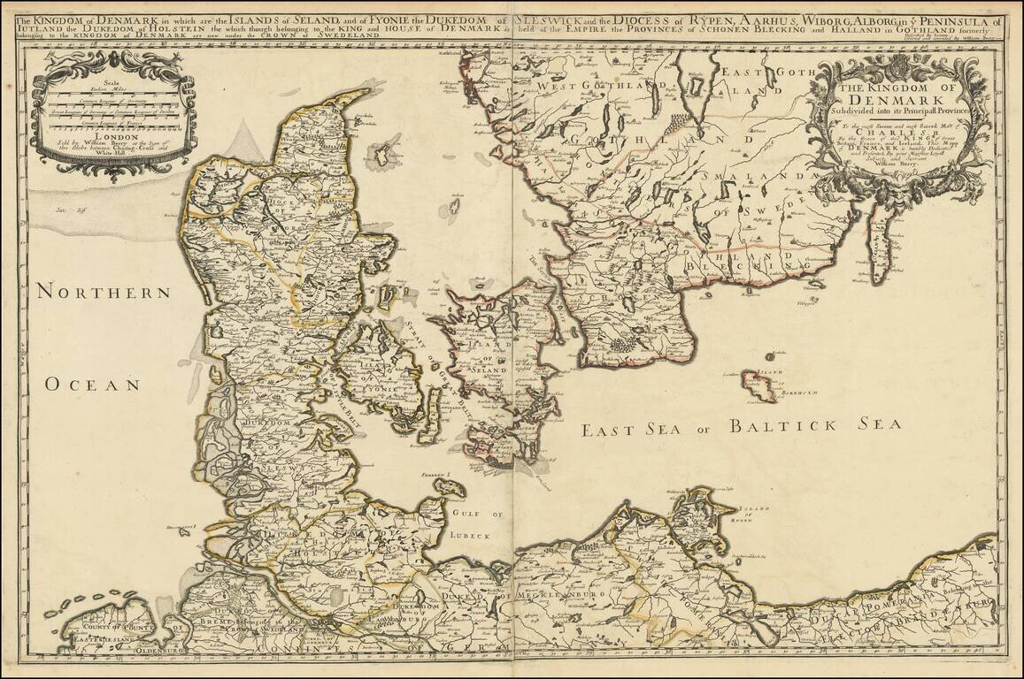
Nice example of William Berry's map of the Kingdom of Denmark, published in London. The map is drawn from Adrien Hubert Jaillot's map of 1674, which has been "corrected and amended" by Berry.
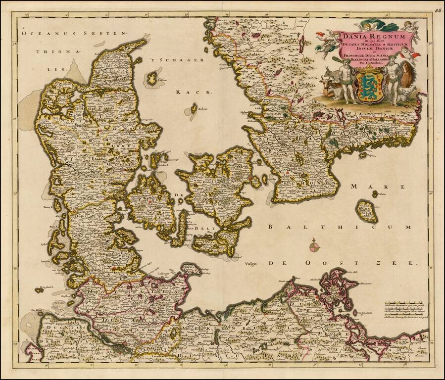
Fine old color example of Justus Danckert's map of Denmark and the southern parts of Sweden and Norway, based upon an earlier map by Frederick De Wit. Centered on Copenhagen and Lund. Extends to Hamburg, Wismar, Rostock and Wolgast. Ornate cartouche...
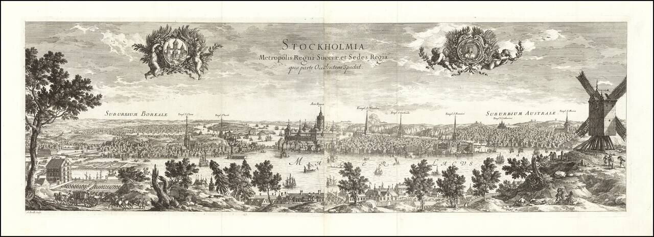
Fine early view of Stockholm, engraved in Paris in 1715 for Dahlberg's Suecia Antiqua et Hodierna. Includes two elegant cartouches decorated with cherubs. The cherub on the left has a coat of arms. The cherub on the right has the bust of a queen.
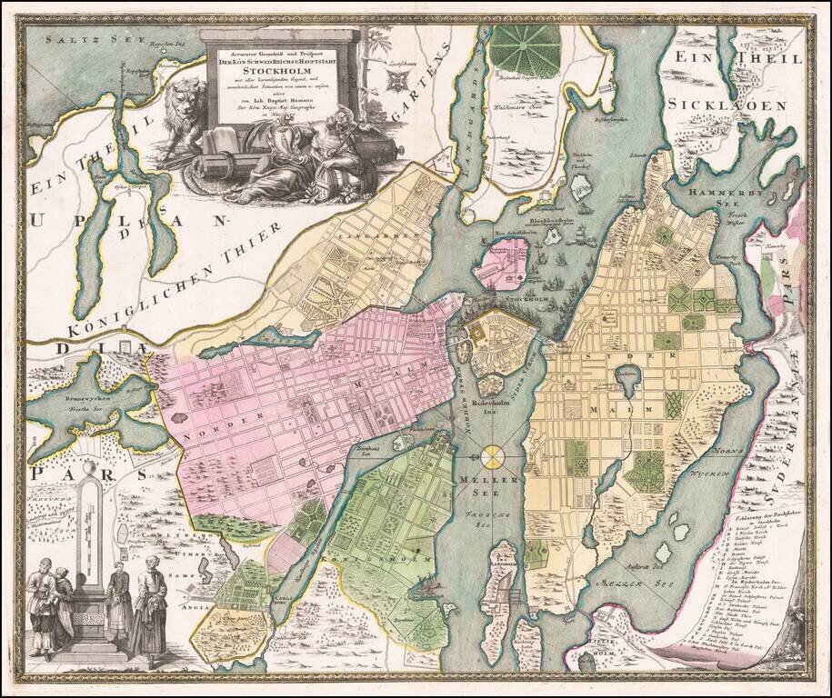
Detailed plan of Stockholm, by one of the leading German map makers of the early part of the 18th Century. Includes an elaborate plan, 2 cartouches and a key showing 28 places.
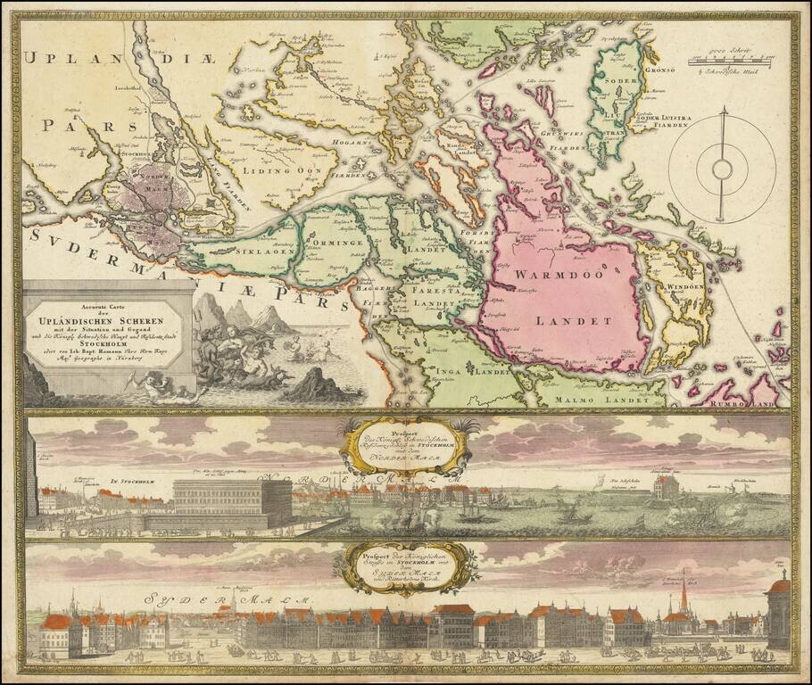
Decorative map and pair of views, focusing on Stockholm and its environs. The map shows Stockholm and the area around it, focusing on the approach from the sea. The two views below show the two major parts of Stockholm, Sydermalm and Nordermalm.
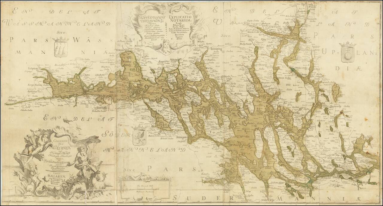
Detailed and scarce antique Swedish map of the region around Stockholm and to its north and west. The map extends from Arboga in the west to Björknäs in the east; in the southwest, the map extends to Mariefred, in the northeast, it extends to...
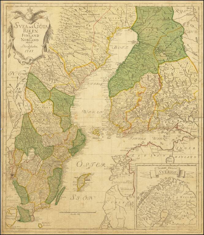
The Most Important Domestically Published Map of Sweden in the 18th Century Highly detailed map of Sweden and Finland, by leading Swedish mapmaker Georg Biurman. A nice example of this landmark map, which saw the rebirth of domestic map publication...
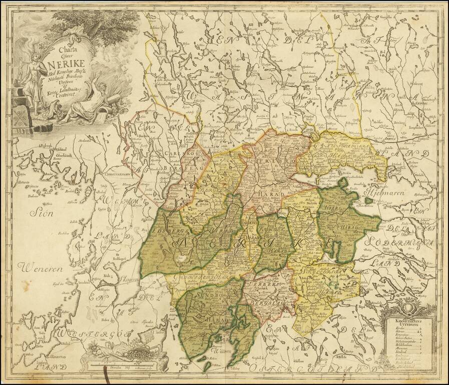
Antique engraved map of the historical Swedish province of Nerike, in central Sweden east of Lake Vanern. Wonderful allegorical cartouche featuring the arms of Nerike (or Nericia or Närke) on a rock. The internal boundaries of the province are...
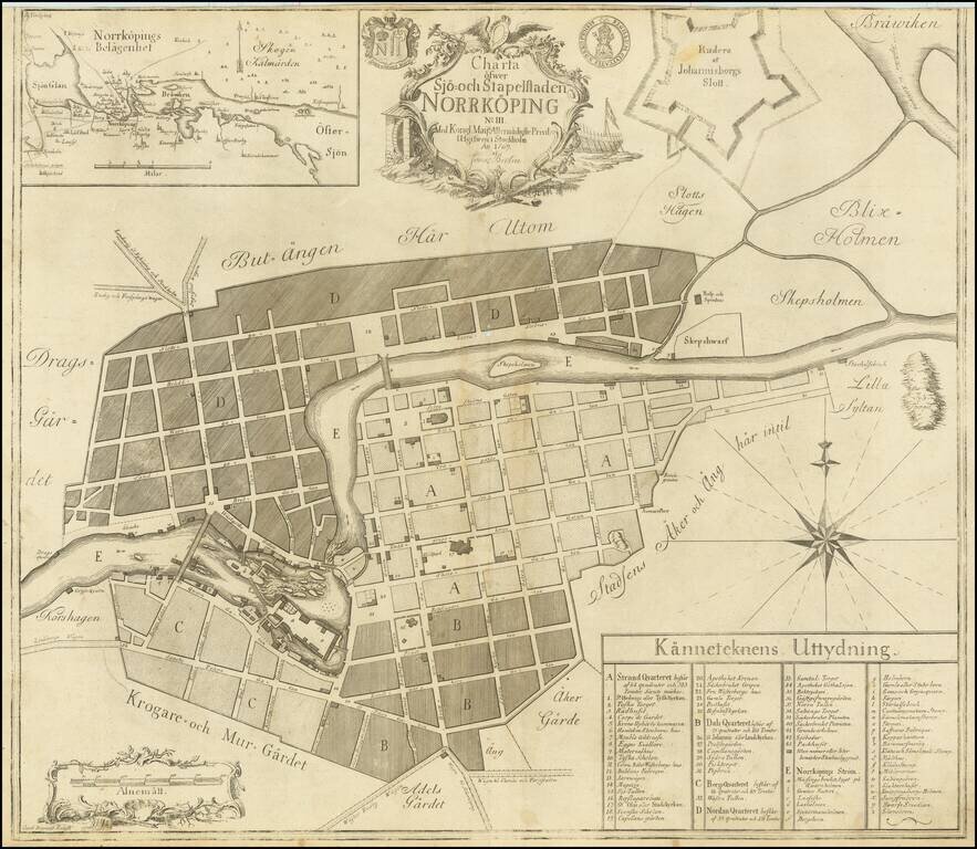
A detailed engraved plan of the Swedish city of Norrköping. This antique engraved map was produced by Jonas Brolin in Stockholm in 1769. The town is shown in remarkable detail in the city, including its street names, important buildings, gardens,...
![Charta ofwer Upstaden Wadstena No. XLVIII [with] Charta ofwer Upstaden Skeninge No. XLIX.](/map/small/70095.jpg)
A detailed collection of two plans of Swedish cities on one sheet. This antique engraved map was produced by Jonas Brolin in Stockholm in 1770. The map includes plans of Wadstena and Skeninge, as well as a regional map a the bottom. Important...
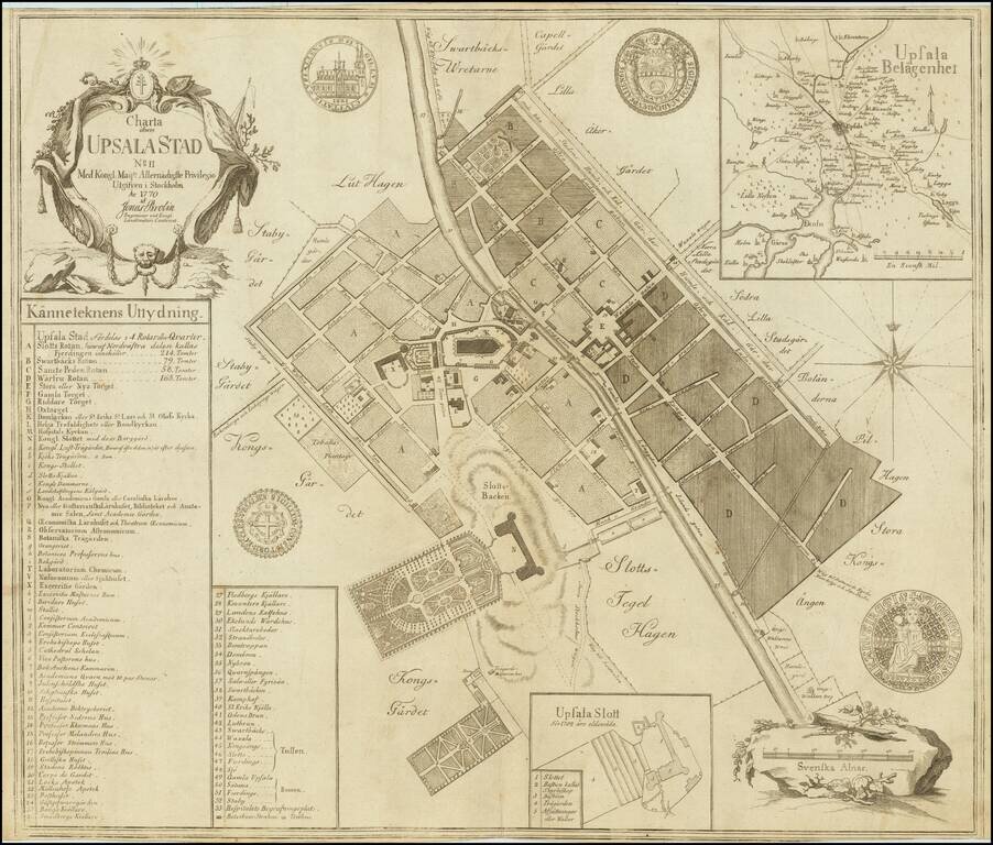
A detailed engraved plan of the Swedish city of Upsala. This antique engraved map was produced by Jonas Brolin in Stockholm in 1770. The town is shown in remarkable detail in the city, including of its street names, old fortifications, gardens, etc....
![Charta ofver Upstaden Carlstad No. XXXVII [with] Charta ofver Upstaden Christinehamn No. LXVII [with] Charta ofver Bergstaden Philipstad No. LXXIX](/map/small/70207.jpg)
A detailed collection of four plans of Swedish cities on one sheet. This antique engraved map was produced by Jonas Brolin in Stockholm in 1770. The map includes plans of Karlstad, Kristinehamn, Filipstad, and an inset of the region around Karlstad.
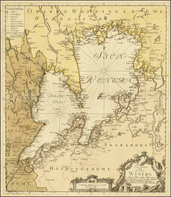
Uncommon map of the Vänern Sea region by the Swedish cartographer Nils Marelius (1707-1791). The map was published as a separate map in Stockholm, 1773, by Kongliga Lantmäteri Contoiret (Royal Institute of Surveyors) and engraved by C. Bergquist.