
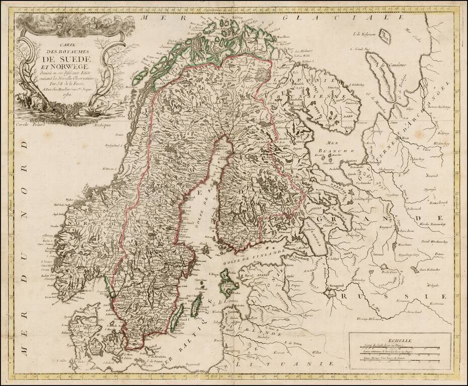
Rare map of Scandinavia by De La Fosse, one of the rarest of the late 18th Century French Mapmakers. This is only the third De La Fosse map we have seen in 20 years.
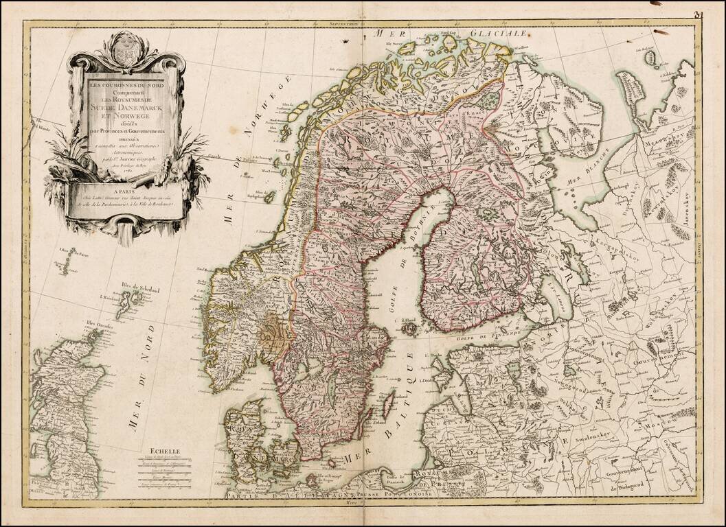
Scarce large format map of Scandinavia, by Janvier, published in Paris.
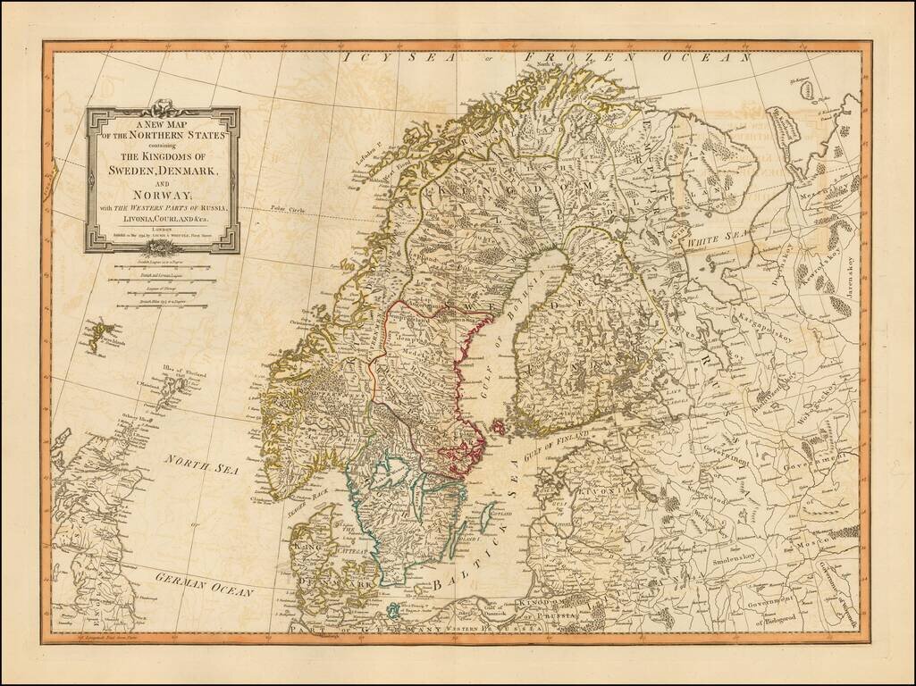
Detailed map of Scandinavia and the Baltic Region, published in London, by Laurie & Whittle. Laurie & Whittle Robert Laurie (ca. 1755-1836) and James Whittle (1757-1818) formed their Fleet Street, London-based firm upon the 1794 death of...
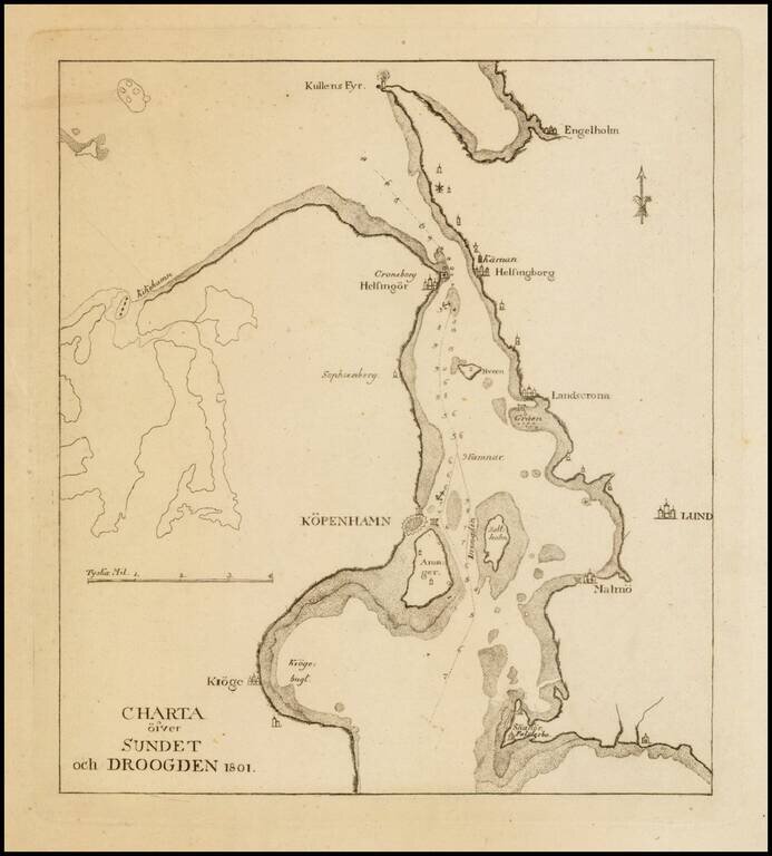
Scarce sea chart the region around Copenhagen, Lund and Malmo.
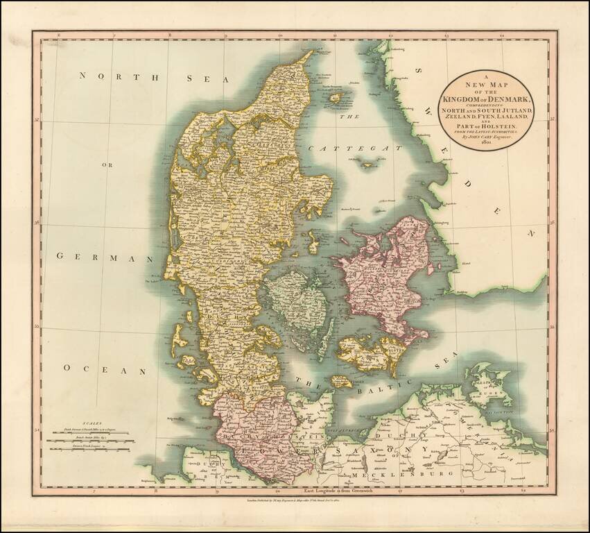
Detailed map of Denmark and neighboring regions, colored by provinces. One of the best large format English atlas maps of the period.
![Norway and Sweden with their Dependancies [Inset map of Iceland]](/map/small/70559.jpg)
Detailed map of Scandinavia, with a table listing the dependancies. Robert Wilkinson was active in London as a cartographic publisher from 1785 to 1825. He produced a number of nice works, including a General Atlas and a re-issuance of Bowen &...
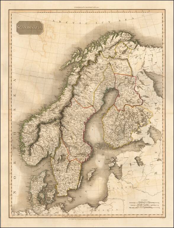
Detailed map of Scandinavia. Excellent detail. One of the best large format English atlas maps of the period. Pinkerton's maps reflect the fine copperplate engraving work being done in Britain at the beginning of the 19th Century, with remarkable...
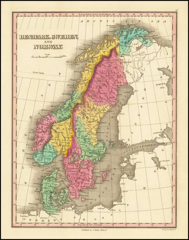
Decorative and detailed map of Scandinavia, colored by provinces, from Finley's New General Atlas. Wonderful color.
![[Map of Sweden and Norway] Карта Швеціи и Норвегіи](/map/small/66784.jpg)
Detailed and very rare Russian-language map of Scandinavia, published in Saint Petersburg in 1836. Rarity The map is very scarce. We have been unable to find any other examples in sales databases, libraries and archives, nor in general online...
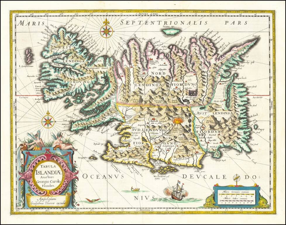
Fine old color example of Blaeu's map of Iceland. A stunning map, including an erupting volcano, sea monsters, sailing ships, decorative cartouches, compass rose and the spectacular landscape of Iceland. Carolius used Mercator's version of Bishop...
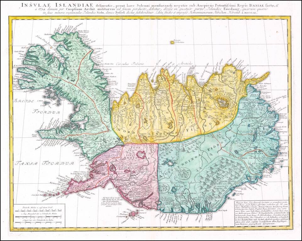
Detailed map of Iceland, published in Nuremberg by the heirs of J.B. Homann.
![Denmark [with inset of Iceland]](/map/small/67362.jpg)
A striking map of Denmark, published by John Arrowsmith. This map shows the Jutland Peninsula, Zealand [Sieland] Islands, and Iceland, as well as parts of adjacent regions including Sweden, Hanover, and Mecklenberg. Several enclaves of German...
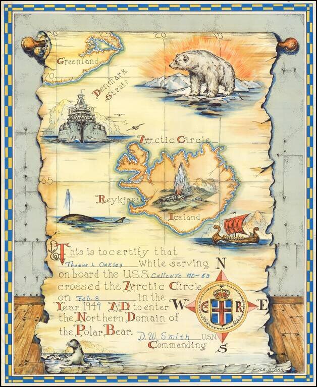
Interesting keepsake, which was given away by the U.S. Navy to sailors crossing into the Arctic Circle from at least 1943 to 1957, based upon our research. First time we have ever seen the map offered for sale.
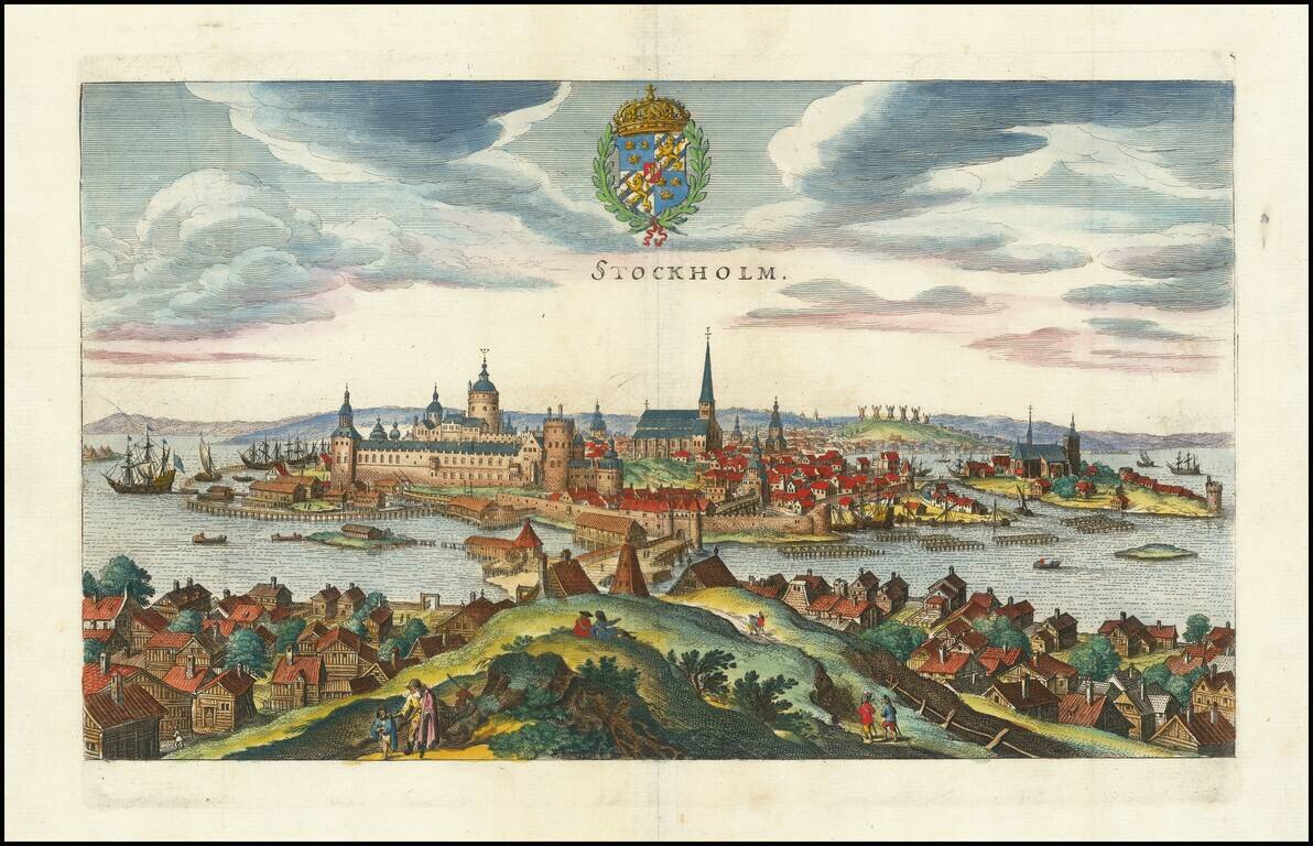
Decorative birdseye view of Stockholm from across the harbor, from Merian's Neuwe Archontologica Cosmica, published in 1638. Shows buildings, churches, bridges, ships, docks, fortified walls of the city, and the surrounding area. The coat of arms of...
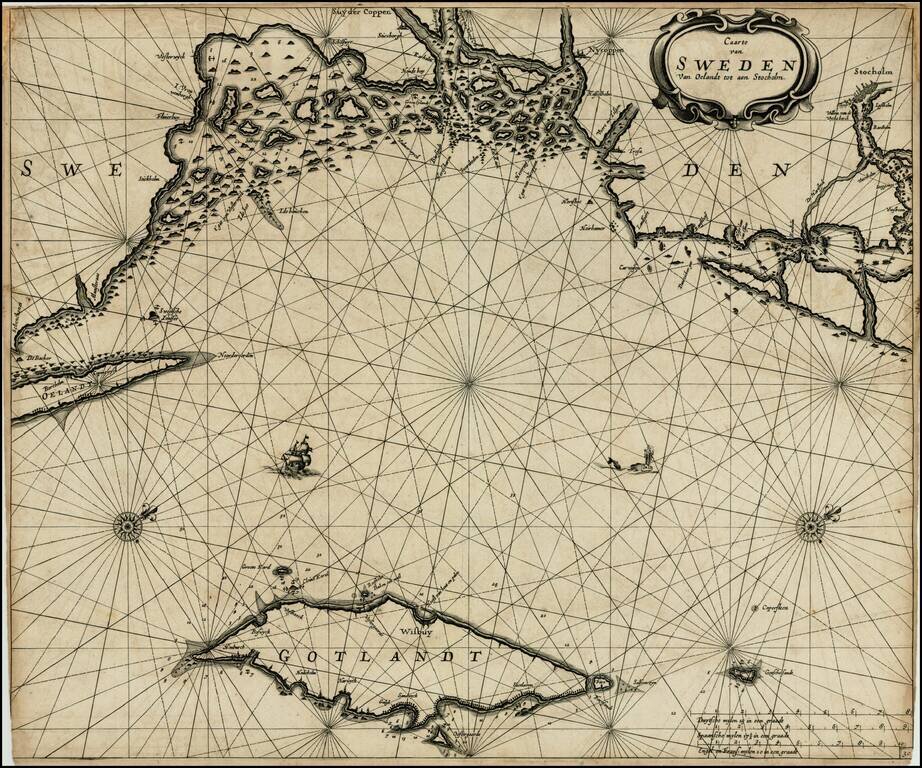
Dark impression of Goos' regional sea chart of Sweden, based upon an earlier chart by Jacobsz. The chart covers the coast of Sweden from Schenckenes and Oeland towards Stockholm, along with the island of Gotland. The chart includes the names of towns...
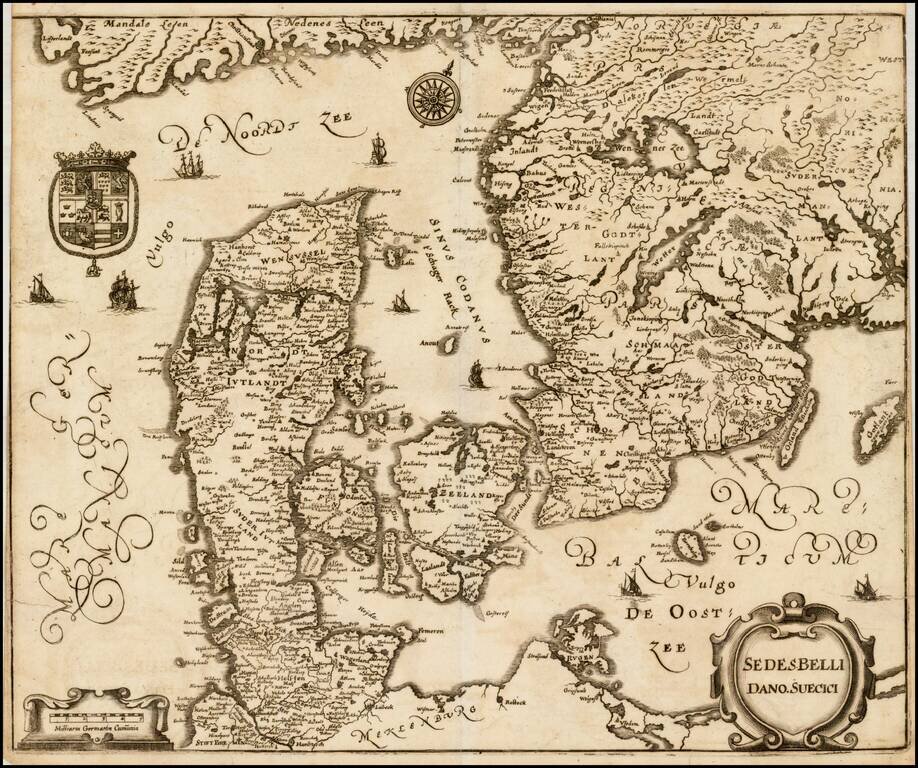
Interesting map of Scandinavia, illustrating the theater of the Second Northern War. In 1657, during the Second Northern War, Denmark launched a war of revenge against Sweden (then distracted in Poland), which turned into a complete disaster....