Map size in jpg-format: 94.8803MiB
Click to open in high resolution (open in new tab).
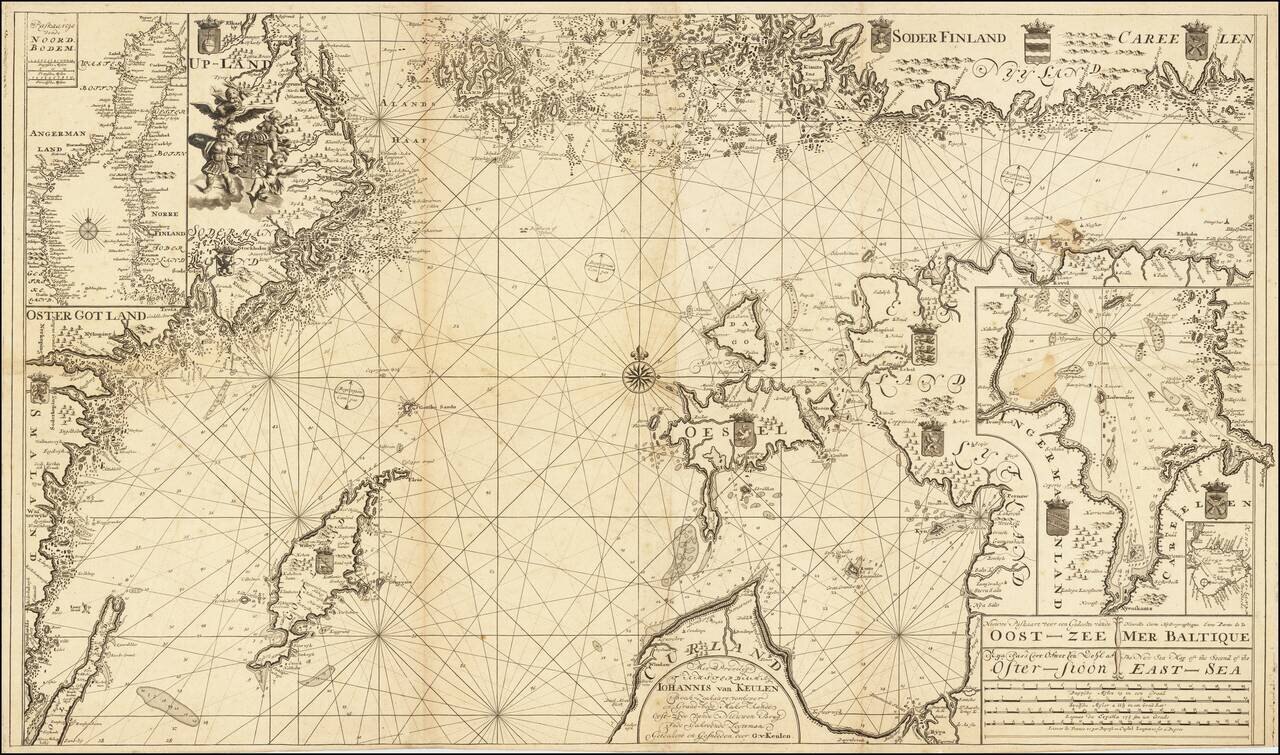
Scarce Dutch sea chart of the Baltic Sea, published by the Van Keulen firm, the leading Dutch sea chart publishers of the 18th century.
The map covers much of the Baltic Sea, the Swedish coast around Stockholm, the Gulf of Riga and West Estonian Archipelago, Gotland, the southern coast of Finland, and much of the Gulf of Finland. In the upper-left corner is an inset of the northern section of the Baltic Sea titled "Paskaartje Vande Noord Bodem." In the lower-right corner are two insets, one of the eastern section of the Gulf of Finland and one of Lake Lagoda.
The titles and scales of miles are given in Dutch, French, Swedish, and English.
The map is a companion to a Johannes Van Keulen chart of the southern part of the Baltic: Nieuwe Paskaart voor een Gedeelte van de Oost-Zee . . . The New Sea Map of the First Part of the East-Sea . . .
The Scheepvaartmuseum (B.0032_(109) 01 kaart 029) dates the map to circa 1678-1704. This is too early, as Johannes van Keulen did not take over the family business until 1726.
Rarity
The map appeared in Van Keulen chart books of the 18th century, which themselves are quite rare. The only example we were able to find online was the one previously mentioned at the Scheepvaartmuseum and one at the National Library of Finland.
If you are a student, write to us in telegram: @antiquemaps and indicate what material you need and for what work you need a map in high detail. We are ready to provide material on special terms. For students only!


