
![Daniae Regni Typus [with] Oldenburg Comit.](/map/small/49941.jpg)
A nice full-color example of Ortelius' maps of Denmark and Oldenburg, which first appeared in the 1584 edition of his Theatrum Orbis Terrarum. This is the second of Ortelius' maps of Denmark. It shows many more details within Denmark and was improved...
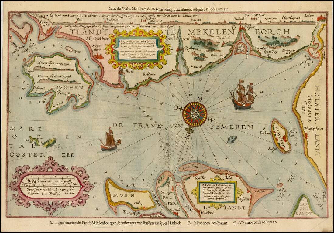
Striking example of the scarce French edition of Waghenaer's sea chart showing the coastlines of Northern Germany and Denmark. The chart includes the modern cities of Greifswald, Stalsund, the island of Rugen, Barth, Wismar, Rostock, and Lubeck and...
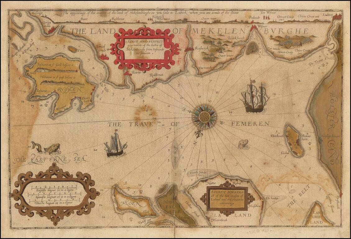
Striking example of the scarce English edition of Waghenaer's sea chart showing the coastlines of Northern Germany and Denmark. The chart includes the modern cities of Greifswald, Stalsund, the island of Rugen, Barth, Wismar, Rostock, and Lubeck and...
Rare English Waghenaer Map of Southwestern Swedish Coastline Old color example of this scarce English edition of Waghenaer's sea chart showing the coastlines of Sweden, centered on Marstrand and the coastline west of Gothenberg. The chart is oriented...
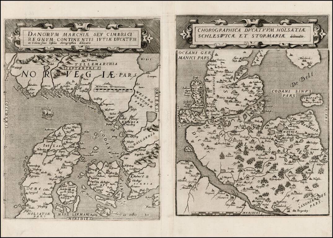
Rare pair of maps showing Norway and Denmark in one sheet and Denmark and Schleswig-Holstein in the second, from the second edition of De Jode's rare Speculum Orbis Terrae. While at first glance, the map appears somewhat similar to Ortelius's map of...
![Daniae Regni Typus [with] Cimbricae Chersonese nunc Iutiae descriptio ..](/map/small/63315.jpg)
A nice full color example of Ortelius maps of Denmark and Jutland, along with Fiona, Alsen and Langeland. This is Ortelius' third map of Denmark, first issued in 1595. It shows many more details within Denmark and was improved cartographically as...
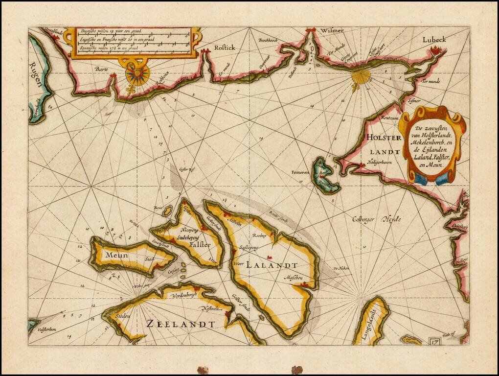
![[Mecklenburg-Vorpommern, Rugen, Bornholm, Lubeck, Sonnderborg,Svendborg, Zealand] Beschrijvinghe vant zuijder deel vande Belt, en hoemen de Custen van Mekeleborch Pomeren, met de Lande daer tegen over tusschen emeren en Bornholm geleghe besijlen en all](/map/small/61988.jpg)
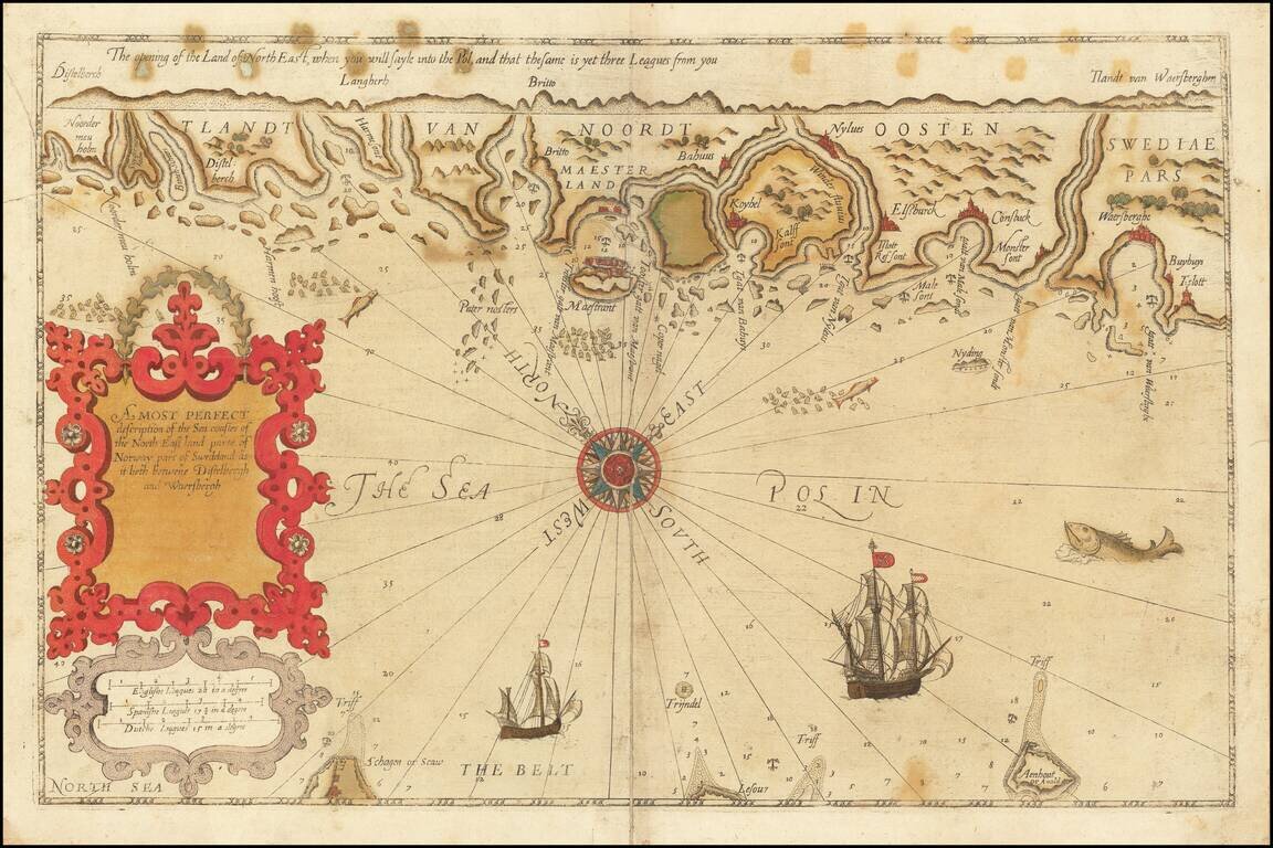
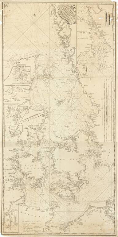
Fehmarn Belt -- An Early Sailing Chart Rare sea chart of the Fehmarn Belt, a strait connecting the north coast of Germany and the island of Lolland off south coast of Denmark, oriented with south at the top, which appeared in Blaeu's Het Licht der...
Fine example of this rare sea chart of part of the coastlines of Germany and Denmark, published by Blaeu in his Zeespiegel, first published in 1623. The present chart is oriented with South at the top and includes Lubeck, Wismer and Rostock, along the...
Decorative regional map of Northern Germany and part of Denmark (then Norway), showing Hamburg, Lubeck, etc. Decorative cartouche and a sea monster in the Baltic. From an English Edition of the Mercator-Hondius Atlas.
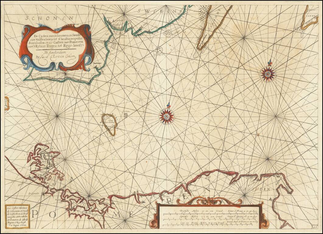
Rare early Dutch sea chart, pubished in Amsterdam by Jacob Colom. The map covers the coastlines of western Poland, Pomerania and part of southern Sweden. The chart appeared in one of the earliest Dutch Sea Atlases. The only example of the map we...
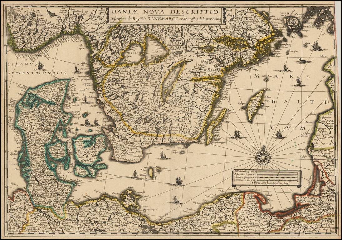
Rare separately issued map of Scandinavia and the Baltic Regions, published by Jean Boisseau. The map would later be issued by Langlois in Paris, circa 1660, with name "Mare Balticum" revised to "Mer Balticque." Not in Pastereau or Nordenskiold. We...
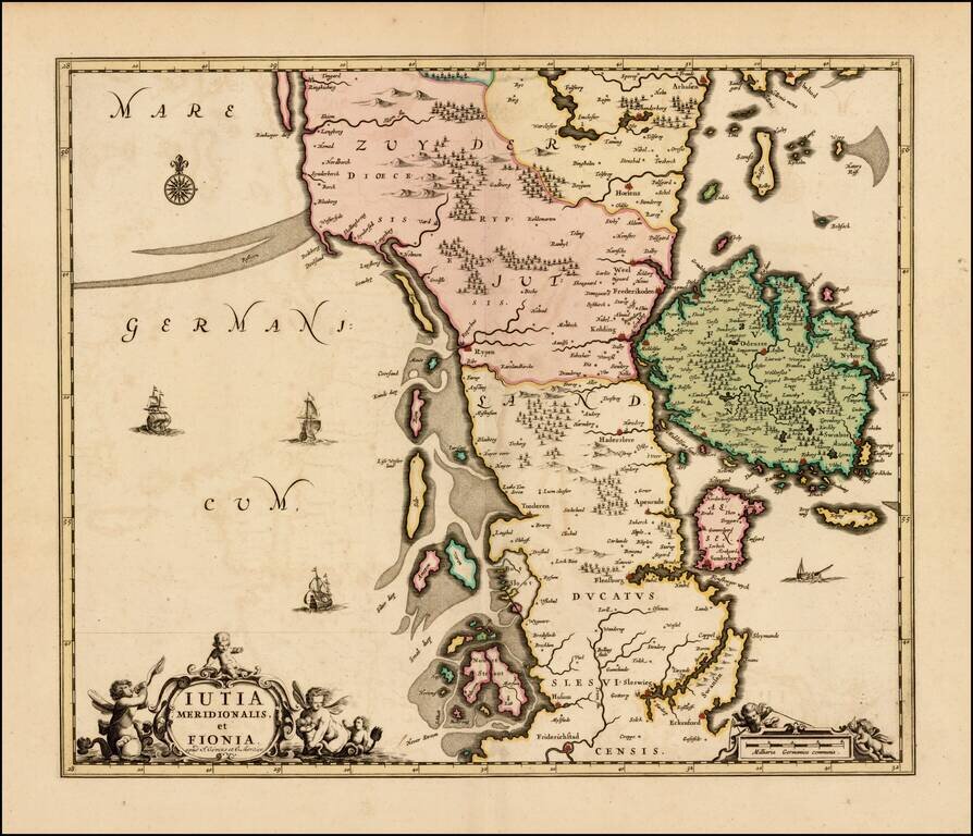
Rare map of the southern part of Jutland and the island of Fionia, published by Covens & Mortier. The map was originally issued by Hugo Allard, circa 1690. All editions are very rare on the market.
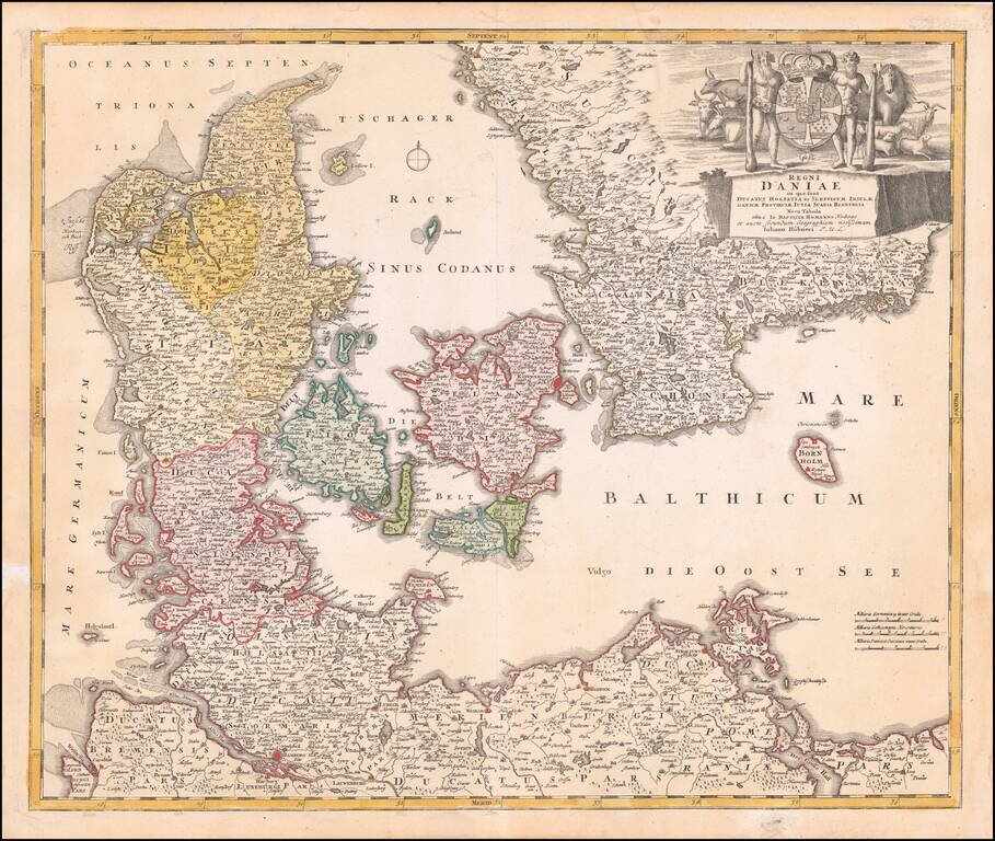
Fine dark impression of Homann's map of Denmark, Slesvig-Holstein and contiguous parts of Germany. Striking large cartouche includes elaborate coat of arms.
Signed By the Captain of the USS Congress Rare English Sea chart, published in London by John Hamilton Moore. The chart shows the region between Sweden and Denmark, extending to Rugen and the German coastline. John Hamilton Moore (1738-1807) was a...
![Octava Europe Tabula [Baltic, Scandinavia, Poland & Eastern Europe]](/map/small/54759.jpg)
Nice old color example of Waldseemuller's map of Eastern Europe, extending from the Black Sea to Scandinavia and the Baltic Regions, centered on Russia and the Ukraine. The map includes a number of written notes in a contemporary hand. The map is...
![Oost Zee door Arnold Colom . . . [Heightened with Gold!]](/map/small/26286.jpg)
Fine example of this rare sea chart of the Baltic Sea (Oost Zee), by Arnold Colom, from Colom's Zee Atlas Ofte Water-Wereldt. Colom's detailed sea chart of the Baltic Sea from Rügen and Denmark extending towards eastern Finland and Livland, is one of...