Map size in jpg-format: 605868B
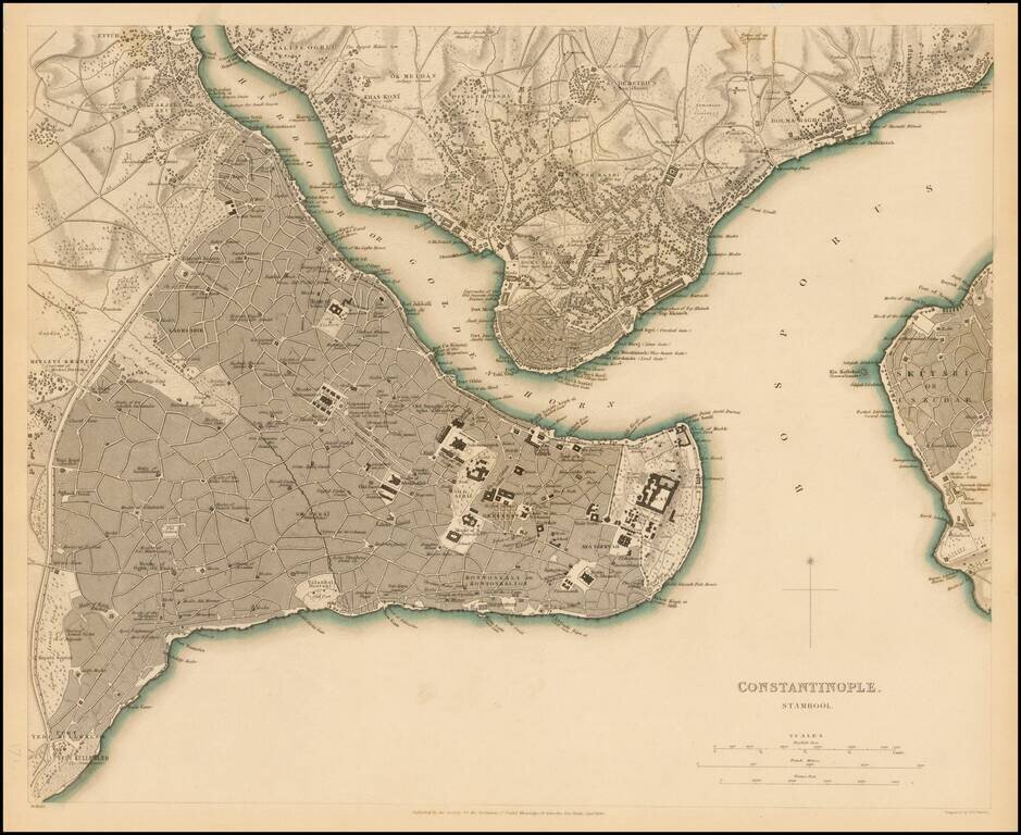
Highly detailed plan of Constantinople (Istanbul) and neighboring areas. Shows buildings, streets, ports of entry, Mosques, gates and a host of other details.
One of the best plans of the city to appear in a 19th Century Commercial Atlas.
If you are a student, write to us in telegram: @antiquemaps and indicate what material you need and for what work you need a map in high detail. We are ready to provide material on special terms. For students only!
![[Facsimile - 15th Century Portolan Sea Chart] Portolan des Iehuda ben Zara](/map/small/64285.jpg)