logo

1729. (Azores) The Western Isles . . .

  • (Azores) The Western Isles . . .

(Azores) The Western Isles . . . information:

Year of creation: 
Resolution size (pixels): 
 6355x5069 px
Disk Size: 
 7.29331MiB
Number of pages: 
 1
Place: 
 London
Author: 

Print information. Print size (Width x height in inches):
Printing at 72 dpi 
  88.26 х 70.4
Printing at 150 dpi 
 42.37 х 33.79
Printing at 300 dpi 
 21.18 х 16.9

An example of detailing the file of this map of in a printable high-resolution:

Click to open in high resolution (open in new tab).
Attention! this is just the central piece (central area 960x960 px) of the map file!
This is an example, so that you can see and study the level of detail of a given map. The entire Map will be fully available after payment!

(Azores) The Western Isles . . .

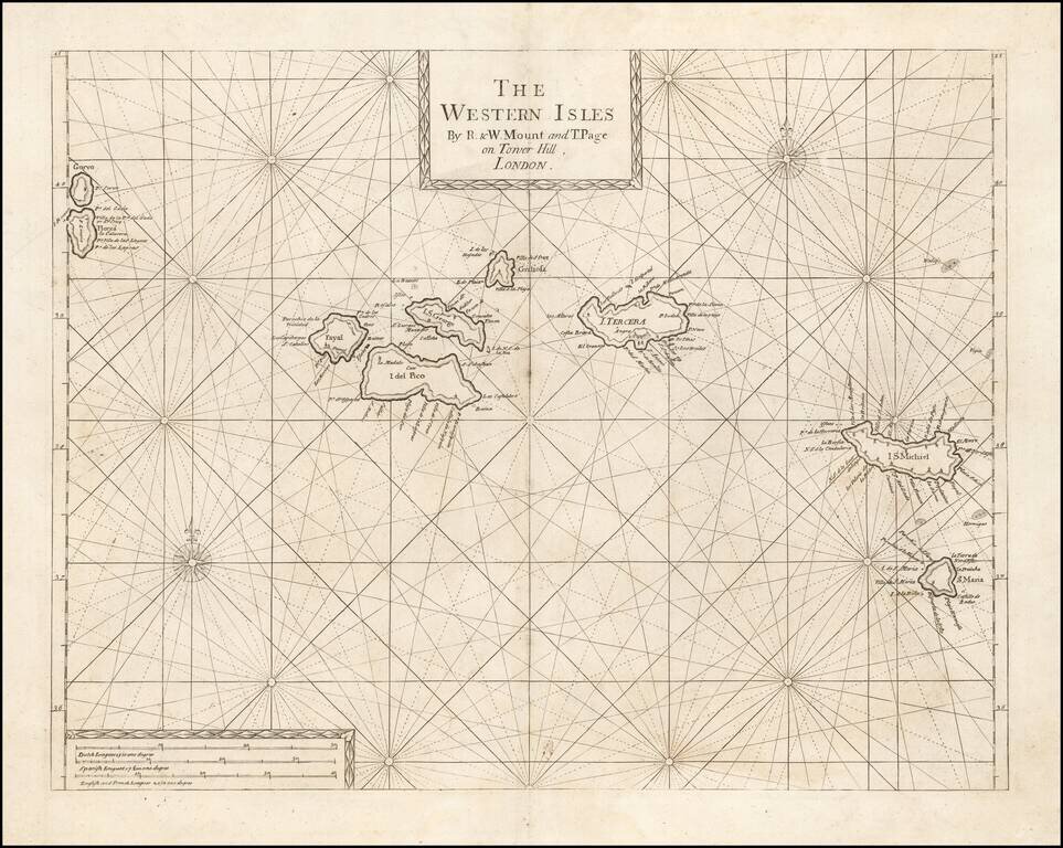
An Early Engish Sea Chart of the Azores

Fine early chart of the Azores, which appeared in the English Pilot First Part, Southern Navigation.


Special conditions for students!

If you are a student, write to us in telegram: @antiquemaps and indicate what material you need and for what work you need a map in high detail. We are ready to provide material on special terms. For students only!

Item information:

Year of creation:
Size:
6355x5069 px
Disk:
7.29331MiB
Number of pages:
1
Place:
London
Author:
Thomas Page. Richard Mount.
$14.99

Related item