Map size in jpg-format: 3.29402MiB
Click to open in high resolution (open in new tab).
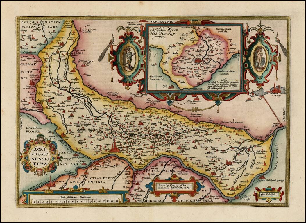
Nice full color example of Ortelius' map of the region centered on Cremona and the Padus River, with a large inset, from Oretlius's Theatrum Orbis Terrarum, the first modern atlas of the world.
Extends to Mantua and Piacenza. Several ornate cartouches. Van Den Broecke notes "Antonio Campi (1536-1591 or later) received a privilege for his map of the surroundings of Cremona in 1571. Ortelius' map is based on a manuscript version of this map, which was published in 1583. The inset of Crema goes back to an unidentified source, published by Forlani in 1570."
If you are a student, write to us in telegram: @antiquemaps and indicate what material you need and for what work you need a map in high detail. We are ready to provide material on special terms. For students only!


