logo

1619. Pedemontana regio cum Genuensium territorio & Montiserrati Marchionatu

  • Pedemontana regio cum Genuensium territorio & Montiserrati Marchionatu

Pedemontana regio cum Genuensium territorio & Montiserrati Marchionatu information:

Year of creation: 
Resolution size (pixels): 
 1977x1612 px
Disk Size: 
 1.17321MiB
Number of pages: 
 1
Place: 
 Amsterdam
Author: 

Print information. Print size (Width x height in inches):
Printing at 72 dpi 
  27.46 х 22.39
Printing at 150 dpi 
 13.18 х 10.75
Printing at 300 dpi 
 6.59 х 5.37

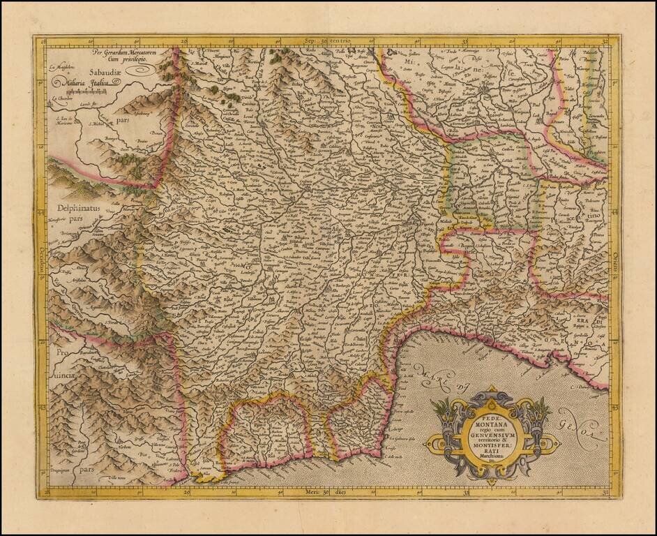
Striking regional map of Italy, centered on the Pedemont region of Italy and Genoa, published by Gerard Mercator and later by Hondius in the Atlas Sive Cosmographia.

The map extends to the Milan region in the northeast, Cinque Terre in the southeast, Nice in the South and Val d'Aosta in the north.


Special conditions for students!

If you are a student, write to us in telegram: @antiquemaps and indicate what material you need and for what work you need a map in high detail. We are ready to provide material on special terms. For students only!

Item information:

Year of creation:
Size:
1977x1612 px
Disk:
1.17321MiB
Number of pages:
1
Place:
Amsterdam
Author:
Gerhard Mercator.
$9.99

Related item