Map size in jpg-format: 1.35247MiB
Click to open in high resolution (open in new tab).
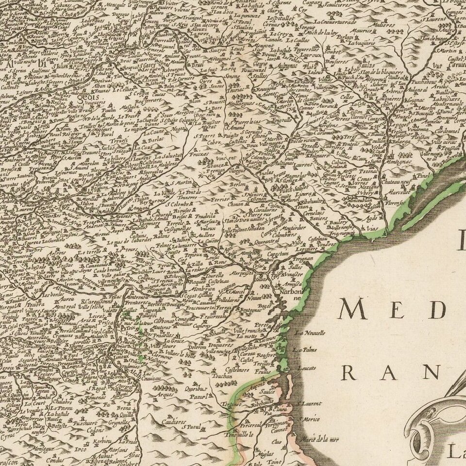
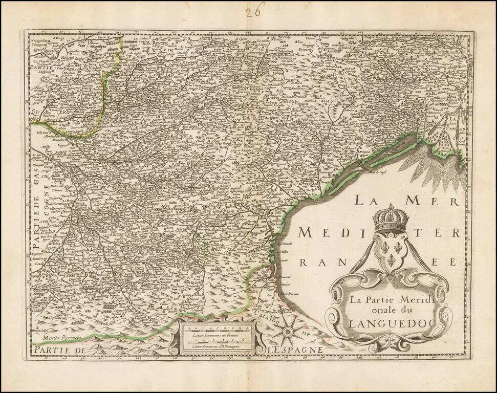
Unrecorded map of the southern part of Languedoc, based upon Henricus Hondius's map of the same region.
Our research of the map turns up no source information. The example in the National Library of France is attributed to Hondius, but this is clearly printed with a difference copper plate. It is also not the Melchior Tavernier edition of Hondius' map.
If you are a student, write to us in telegram: @antiquemaps and indicate what material you need and for what work you need a map in high detail. We are ready to provide material on special terms. For students only!
![Carte d'Etude [Study Map]](/map/small/66795.jpg)
![Orange [Vauban Style Fortress]](/map/small/62043.jpg)
