Map size in jpg-format: 22.0853MiB
Click to open in high resolution (open in new tab).
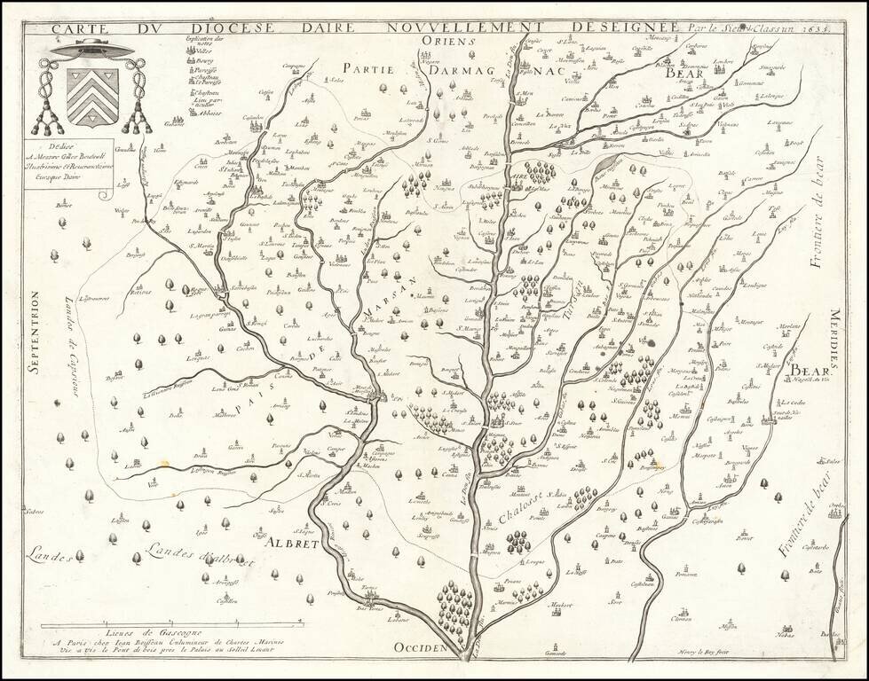
Jean Boisseau's First Map!
Rare map of the Diocese of Aire, printed in Paris in 1635.
The map is oriented with east at the top, breaking the course of the Leie River and its tributaries.
All of Boisseau's maps are rare. As noted in Mapforum.com
Jean Boisseau, a Parisian map publisher, is recorded as a 'master illuminator' in 1631 and a 'map colourist' from 1635 - "Enlumineur de cartes marines " / " Enlumineur du Roy pour les cartes geographiques ". Boisseau published his first map Diocese d'Aire in 1635, and a number of his own maps from 1636. However, Mirielle Pastoureau in "Les Atlas Francais" lists only one edition of Boisseau's atlas Theatre des Gaules, dated 1642. . . . A later 1648 edition of Boisseau's atlas has also been recorded.
The map is apparently quite rare.
If you are a student, write to us in telegram: @antiquemaps and indicate what material you need and for what work you need a map in high detail. We are ready to provide material on special terms. For students only!
![Carte d'Etude [Study Map]](/map/small/66795.jpg)
![Orange [Vauban Style Fortress]](/map/small/62043.jpg)
