logo

1633. Nova Haec Tabula Galliae . . .

  • Nova Haec Tabula Galliae . . .

Nova Haec Tabula Galliae . . . information:

Year of creation: 
Resolution size (pixels): 
 13766x11602 px
Disk Size: 
 49.2457MiB
Number of pages: 
 1
Place: 
 Amsterdam
Author: 

Print information. Print size (Width x height in inches):
Printing at 72 dpi 
  191.19 х 161.14
Printing at 150 dpi 
 91.77 х 77.35
Printing at 300 dpi 
 45.89 х 38.67

An example of detailing the file of this map of in a printable high-resolution:

Click to open in high resolution (open in new tab).
Attention! this is just the central piece (central area 960x960 px) of the map file!
This is an example, so that you can see and study the level of detail of a given map. The entire Map will be fully available after payment!

Nova Haec Tabula Galliae . . .

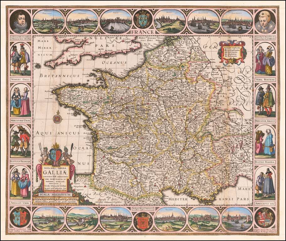
Carte-a-Figures Antique Map of France

Highly decorative map of France, surrounded by vignettes of traditional French dress from the early 17th Century, with city views at the top and bottom.

Decorative and detailed map of France by one of the best Dutch mapmakers of the early 17th Century.


Special conditions for students!

If you are a student, write to us in telegram: @antiquemaps and indicate what material you need and for what work you need a map in high detail. We are ready to provide material on special terms. For students only!

Item information:

Year of creation:
Size:
13766x11602 px
Disk:
49.2457MiB
Number of pages:
1
Place:
Amsterdam
Author:
Nicolaes Visscher I.
$14.99

Related item