Map size in jpg-format: 1.23368MiB
Click to open in high resolution (open in new tab).
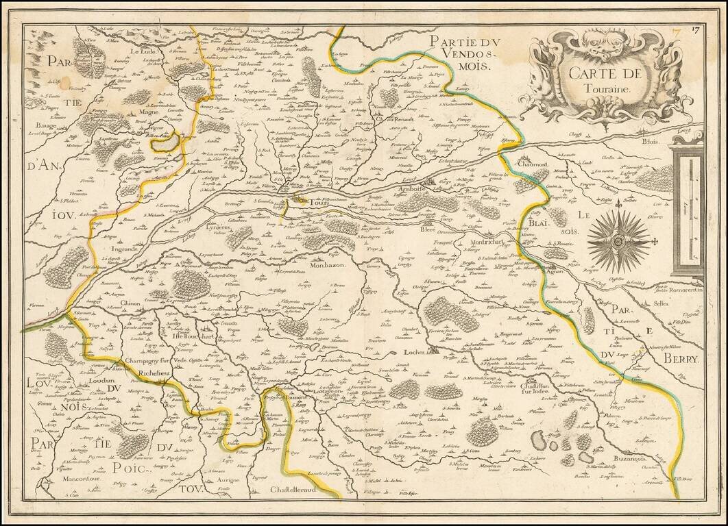
Rare map of the Province of Touraine, published in Paris by Tassin.
The map is centered on Tours and the confluence of the Cher River and the Loire River.
If you are a student, write to us in telegram: @antiquemaps and indicate what material you need and for what work you need a map in high detail. We are ready to provide material on special terms. For students only!
![Carte d'Etude [Study Map]](/map/small/66795.jpg)
![Orange [Vauban Style Fortress]](/map/small/62043.jpg)
