
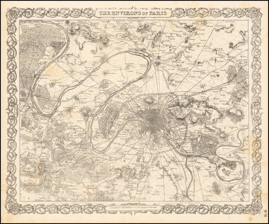
Detailed plan of Paris and surrounding towns and countryside. Decorative border. A terrific map, from JH Colton, one of the most prolific American mapmakers of the mid-19th Century.
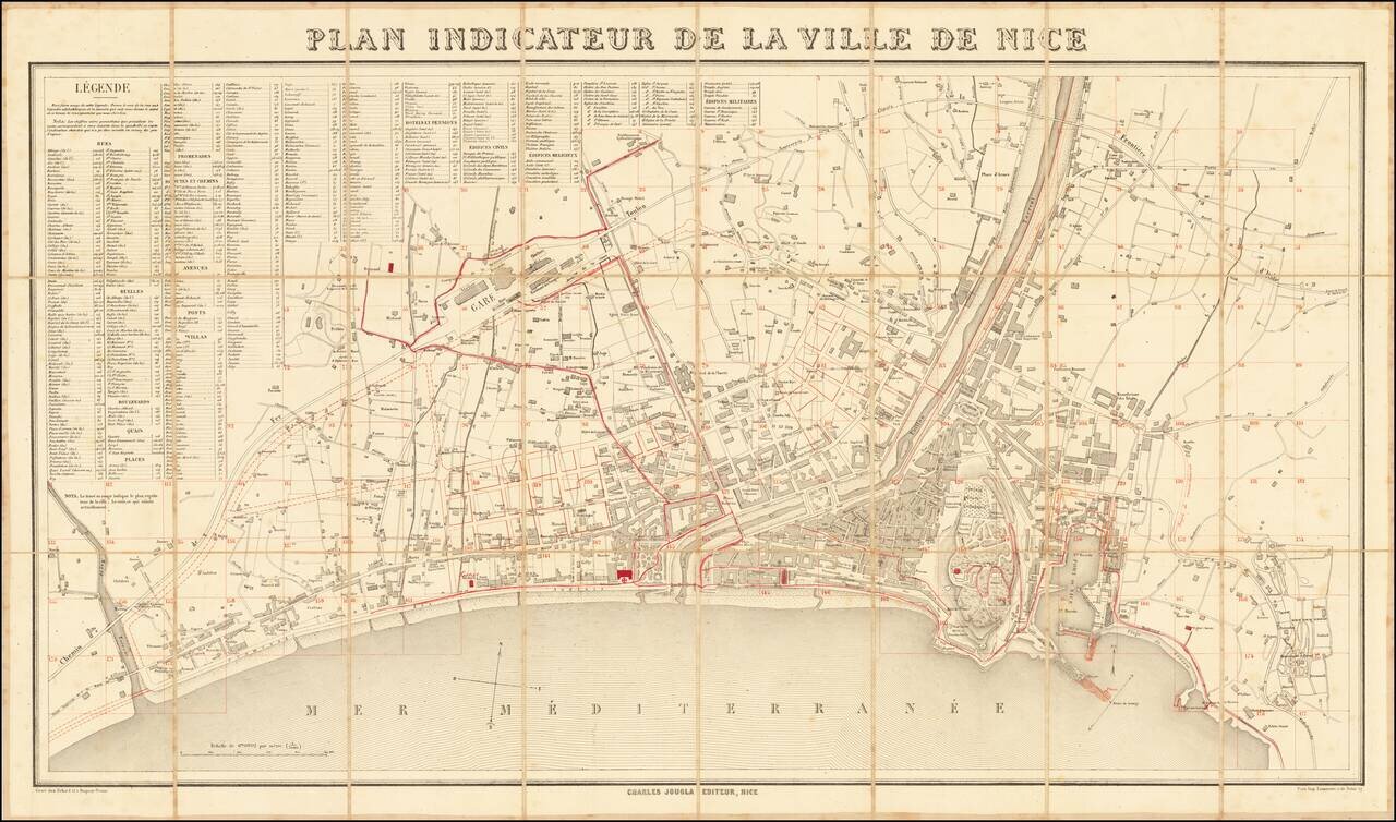
With Additions Showing Improvements in the Harbor and Other Places Fine large plan of Nice, published in Paris in about 1865. The present example has been extensively annotated in red throughout the map, but most notably in the harbor, where designs...
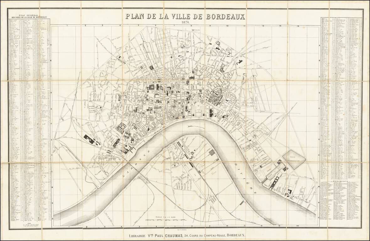
Highly detailed map of Bordeaux, published in Bordeaux in 1874. The map is oriented with east at the top, and includes a detailed index on either side of the map. The map illustrates the major buildings and squares, along with the town lay out along...
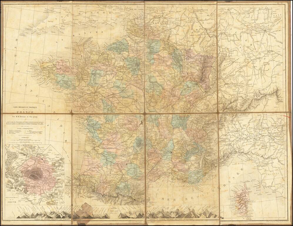
Scarce folding map of France, with large inset map of Paris.
![[Rhone River]](/map/small/70229.jpg)
Rare Lucien Boucher Pictorial map of the Rhone River region of South France. The map extends from Lyon and Lake Geneva in the north the the French Mediterranean, including caricatures of famous sites in St. Maries de la Mer, Nimes, Arles, Avignon,...
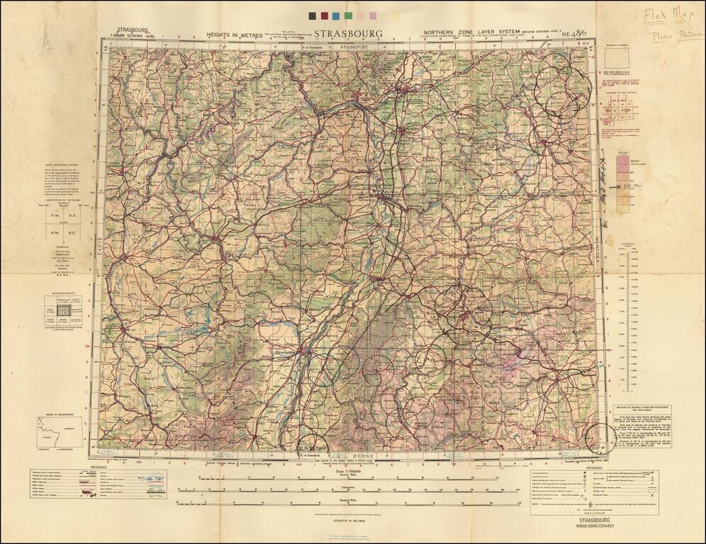
A Wall of Flak Batteries Leading into Germany. Detailed WWII air navigation map of the area around Strasbourg, published by the British War Office. The map is noteworthy for the manuscript circles highlighting the flak batteries stationed in major...
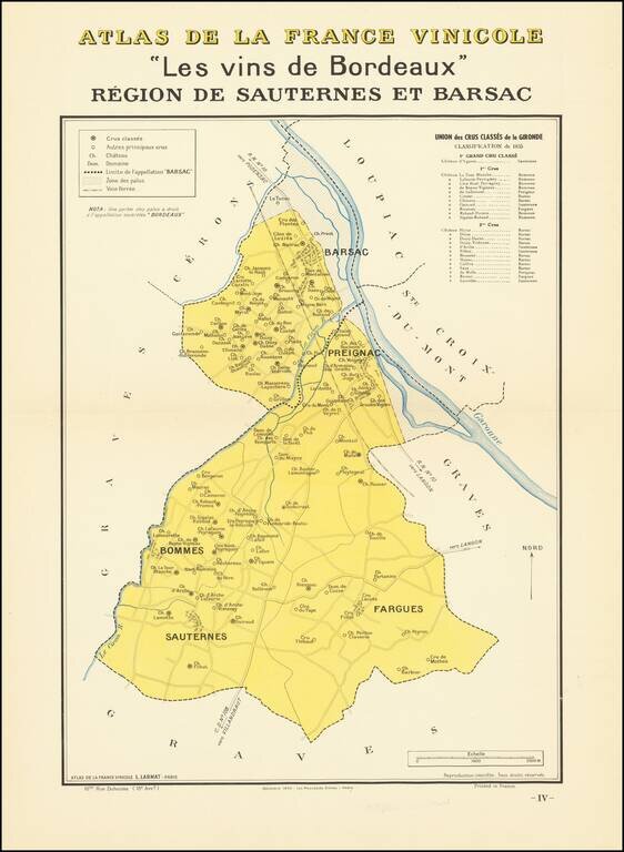
A nice example of one of the Bordeaux regional maps from Louis Larmat's important atlas of the French Wine Country Atlas De La France Vinicole -- Les Vins de Bordeaux. The map focuses on a small region around Pregnaic, twenty miles upriver from...
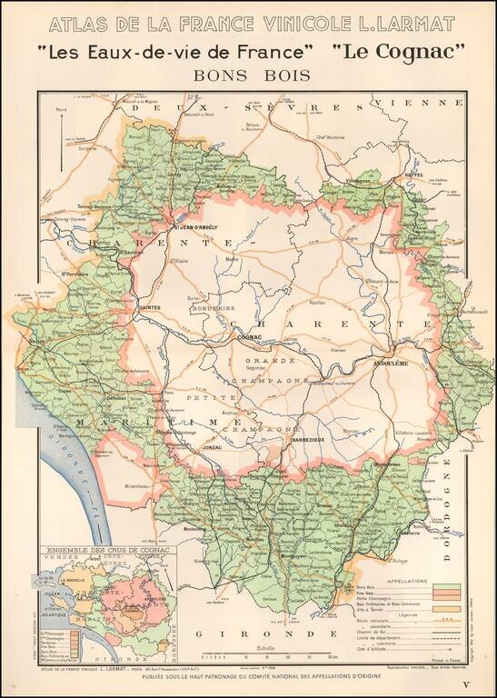
The "Water For Life" of France Nice example of one of the Cognac regional maps from Louis Larmat's important atlas of the French Wine Country Atlas De La France Vinicole -- Les Vins de Bordeaux. After the success of this first volume covering the...
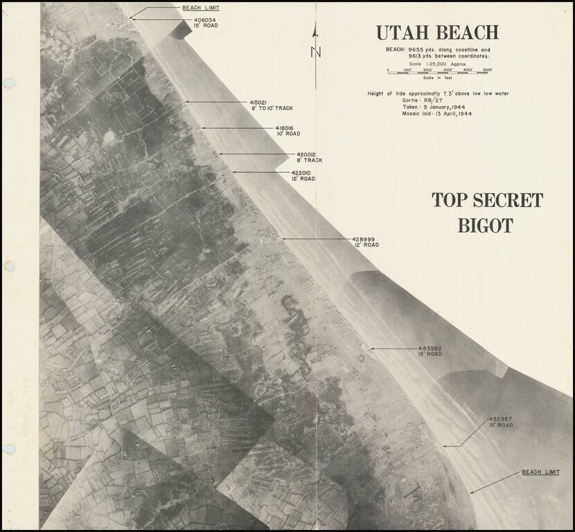
Rare “BIGOT”-rated photomosaic planning map for the D-Day landing at Utah Beach. A rare composite photographic map prepared for the D-Day landing at Utah Beach. From the Neptune Monograph, the definitive briefing book issued to senior American...
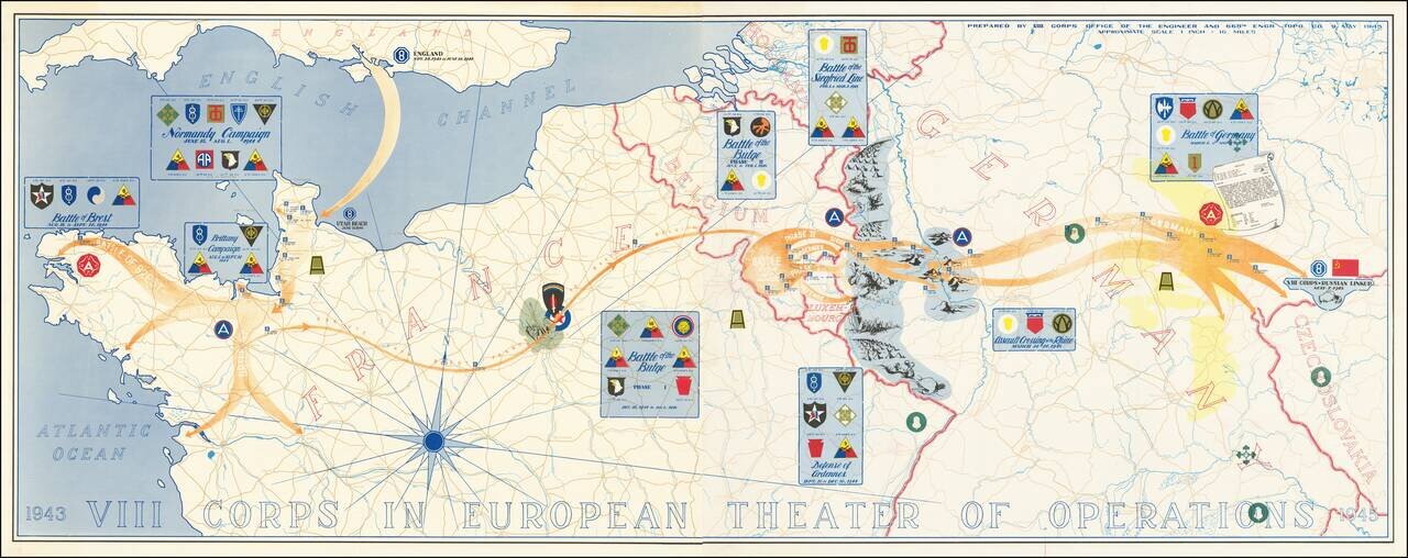
Superb map of the actions of VIII Corps, US Army, from 1943 to 1945. The map was prepared by VIII Corps Office of the Engineer and 665th Engr. Topo. Co. on the 9th of May 1945. The map, which stretches from Normandy to Czechoslovakia, lists the...

Great vintage pictorial of Cap D'Antibes in southern France published by Bonfant & Rampleberg, in Nice, in 1949. The map is by Vic (Victor?) Raymon and features the quintessential glamorous style of mid-century southern France. The point of the...
![[Unfinished Pictorial Map of France] (Oil painting)](/map/small/58393.jpg)
Unfinished Pictorial of France By Noted French Illustrator Joseph Pinchon -- Commissioned By Huguette Clark A remarkable pictorial view of France, painted by the French artist and illustrator Joseph Pinchon in 1951 for his patron New York Heiress...
A great antique map made for the 1953 Tour de France, showing the many cities and towns the race would pass through. The route starts in Strasbourg and then passes through Liege, Lille, Caen, Nantes, Bordeaux, Marseille, and Lyon before arriving in...
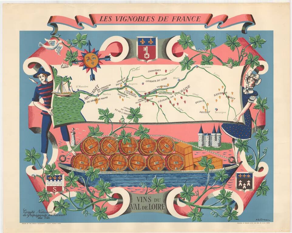
Fine promotional map of the wine regions of the Loire Valley, drawn by Remy Heteau in 1954. The map shows the major wine producing regions with cluster of grapes, using red for red wines, and yellow for white wines. The map is surrounded by a compass...
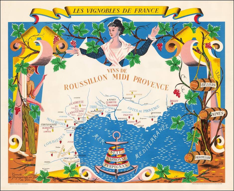
Fine promotional map of the wine regions of Roussillon and Provence, drawn by Remy Heteau in 1954. The map shows the major wine producing regions with cluster of grapes, using red for red wines, and yellow for white wines. The map is surrounded by a...
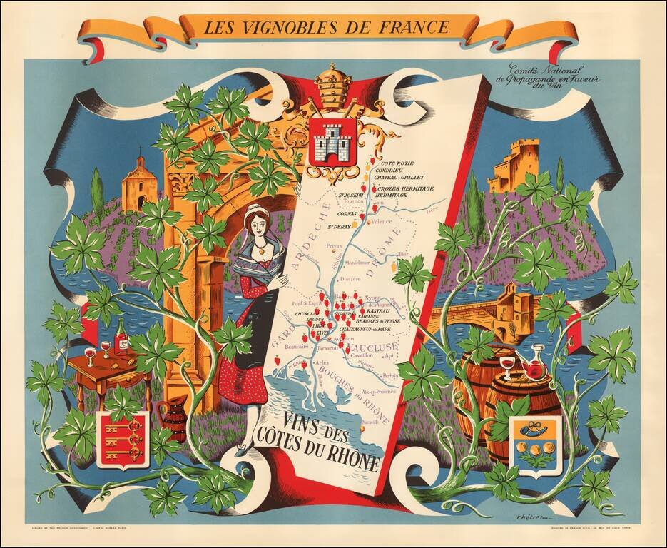
Fine promotional map of the wine regions of the Cote du Rhone, drawn by Remy Heteau in 1954. The map shows the major wine producing regions with cluster of grapes, using red for red wines, and yellow for white wines. The map is surrounded by a compass...